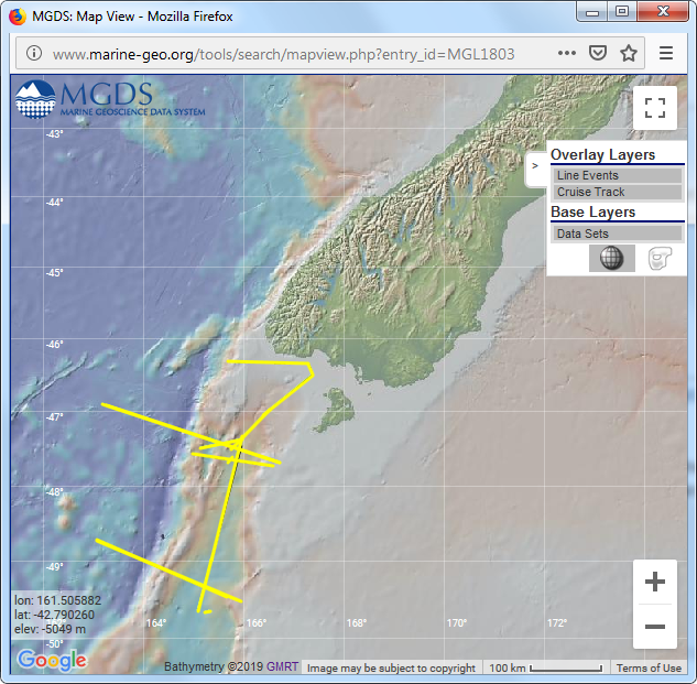
Figure 4 – Data Portal Report Spring 2019 Fig 4 Published January 13, 2020 at 633 × 621 in April 2019 | Status Report on the GeoPRISMS Data Portal ← Previous Fig.4: Seismic survey lines (bright yellow) from the 2018 SISIE survey of Gurnis et al. The background elevation map is the Global Multi-Resolution Topography (GMRT) synthesis.