The GeoPRISMS data portal was established in 2011 to provide convenient access to data and information for each primary site as well as to other relevant data resources. Since the last newsletter report, highlighted below are recent contributions of data sets and field program information of interest to the GeoPRISMS community. Most of the data sets described are also available in GeoMapApp under the Focus Site and DataLayers menus.


Click the figures to open the image gallery
East African Rift System
A new aeromagnetic total magnetic intensity grid for eastern Botswana was made available for download by Estella Atekwana, Folarin Kolawole, Tiyapo Ngwisanyi, and Elisha Shemang. The data set was used in their study of lithospheric initial rifting processes and is also accessible through GeoMapApp.
Aleutian Arc
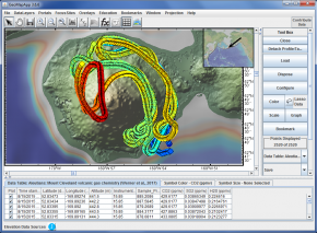
As part of an integrated geochemical-geophysical study of the Aleutian arc Unimak-Cleveland corridor, headed by Diana Roman, Erik Hauri and Terry Plank, Cindy Werner’s helicopter-derived analytical chemistry data for volcanic trace gas emissions at Mount Cleveland volcano is now available. Analyzed with a Multi-GAS system, the concentrations of CO2, SO2 and H2S are described in Werner et al., 2017 and can be explored in GeoMapApp.
Cascadia
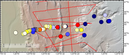
Subduction zone heat flow data sets from H. Paul Johnson, Evan Solomon, Robert Harris and Marie Salmi were contributed for surface heat flow measurements collected during an R/V Atlantis cruise in 2013. These include heat flow data acquired with a multi-core logger as well as with thermal blankets and an Alvin heat flow probe that were deployed using the Jason II remotely-operated vehicle. The investigators also contributed the Salmi et al. 2017 heat flow data derived from Bottom-Simulating Reflectors (BSR) that were imaged using active-source multi-channel seismic data from the 2012 Cascadia Open Access Seismic Transects (COAST) survey. The BSR-related fieldwork was conducted along the southern Cascadia margin on R/V Langseth expedition MGL1212.
GeoPRISMS Data Portal Tools and Other Relevant IEDA Resources
Search For Data – The GeoPRISMS search tool provides a quick way to find GeoPRISMS data using parameters such as keyword, NSF award number, publications, and geographical extent.
Data Management Plan tool – Generate a data management plan for your NSF proposal. The on-line form can be quickly filled in, printed in PDF format, and attached to a proposal. PIs can use an old plan as a template to create a new plan. We also have developed a tool to help PIs show compliance with NSF data policies.
GeoPRISMS Bibliography – With more than 1,140 citations, many tied to data sets, the references database can be searched by primary site, paper title, author, year, and journal. Submit your papers for inclusion in the bibliography – just the DOI is needed!
Contribute Data – The web submission tools support PI contributions of geophysical, geochemical, and sample data.Once registered within the IEDA systems, the data sets become available to the broader community immediately or may be placed on restricted hold. Additionally, PIs can choose to have a DOI assigned to each submitted data set, allowing it to become part of the formal, citable scientific record.
