The Eastern North American Margin (ENAM) represents the final product of continental rifting to form a passive margin, and records the full history of rift evolution and post-rift processes. The ENAM encompasses large variations in fundamental rift parameters, including the volume of magmatism, the pre-existing lithospheric template, and the duration of rifting. In particular, rifting along the southeastern United States was associated with voluminous magmatism, whereas the northernmost portion of this margin offshore of Nova Scotia and Newfoundland is distinctly magma-poor. ENAM also captures an extensive post-rift evolution of the passive margin sedimentary prism as well as the cooling and further evolution of the mantle lithosphere below. Finally, there are further compelling logistical benefits to studying ENAM, including the leveraging of considerable US infrastructure, including Earthscope (in particular, upcoming USArray deployments), and the USGS Law of the Sea survey activities.
ENAM Experiment
The goal of the Eastern North American Margin Community Seismic Experiment is to understand the breakup of ancient continents that led to the formation of the eastern edge of North America and the Atlantic Ocean and the later evolution of this continental margin by landslides and other active processes. A record of these geological events is stored in the rocks offshore North Carolina. We will collect active and passive, onshore and offshore seismic data to image geological structures at a range of scales to learn about the evolution of continental margins and their geohazards.
This project involves the following major components:
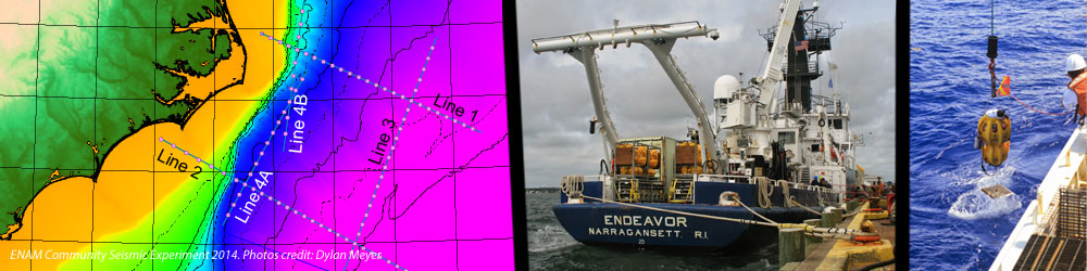
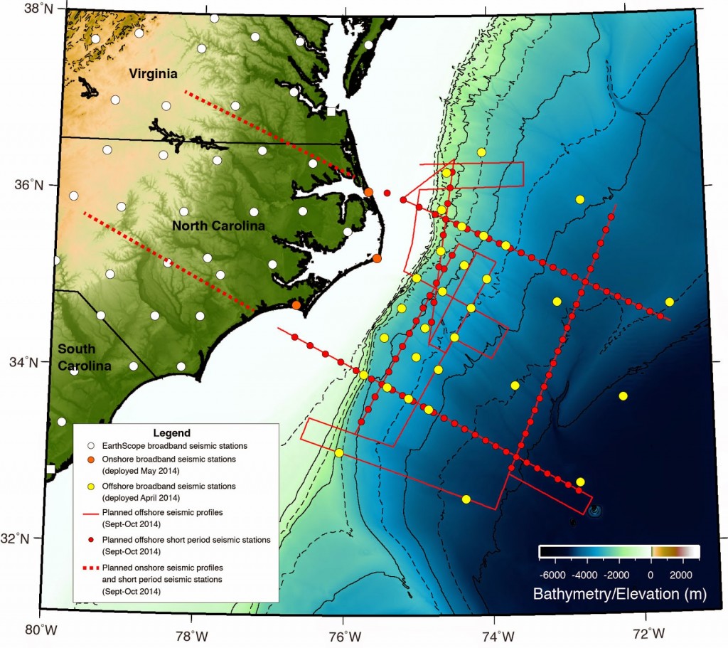
- Deploying broadband ocean bottom seismometers (OBS) across the continental margin for one year with the R/V Endeavor (April 2014)
- Deploying broadband seismometers on the Outer Banks to connect between EarthScope stations and the offshore array (May 2014)
- Acquiring marine seismic reflection data across the margin with the R/V Marcus G. Langseth (Sept-Oct 2014)
- Deploying short-period OBS across the margin with the R/V Endeavor to record the Langseth’s seismic source (Sept-Oct 2014)
- Deploying short-period seismometers onshore to record the Langseth’s seismic source (Sept-Oct 2014)
- Acquiring onshore active-source seismic data (summer 2015)
This is an academic project funded by the NSF-GeoPRISMS program. The U.S. science community has selected the margins off North Carolina and Virginia as an ideal place to gather this data set. The selection of this region and the design of the seismic study were guided by input from the US scientific community through workshops and online forums. A large group of scientists are spear-heading the effort to collect and disseminate these data. The data will be open to public immediately and will be useful for studying a large range of fundamental geological processes. The project also involves a large training and outreach component; we are bringing students and young scientists to sea and will hold short training courses and workshops after the cruise.