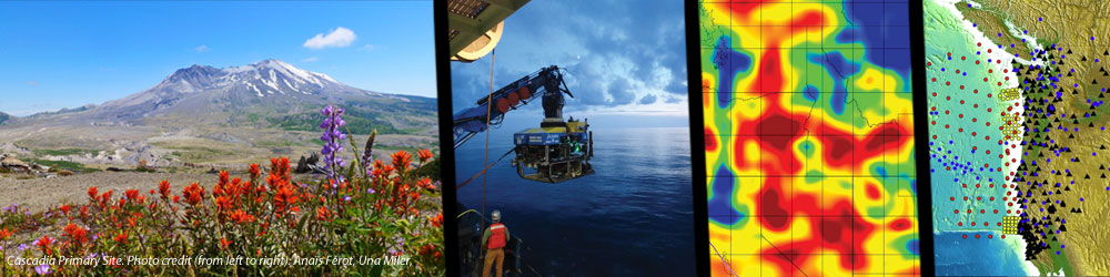
The Cascadia Subduction Zone is one of the three Primary Sites for the Subduction Cycles and Deformation (SCD) Initiative (along with Alaska/Aleutians and New Zealand). Cascadia offers outstanding short- and intermediate-term opportunities, in particular leveraging existing and growing onshore and offshore infrastructure associated with EarthScope’s Plate Boundary Observatory (PBO), and deployment of the EarthScope-MARGINS (now GeoPRISMS) Amphibious Array, all part of the ARRA-funded Cascadia Initiative. Work in this region will also build upon a broad spectrum of geological and geophyscial data collected over the past decades and can engage a range of US, Canadian, and international scientists.
Several Themes are outlined in the GeoPRISMS Science & Implementation Plans and some thematic studies and projects are now underway. If you would like to organize a group to begin developing a plan for studying one or more of the SCD themes please contact the GeoPRISMS Office.
Click on each theme below to see current projects and some remarks on that theme from the GeoPRISMS Implementation Plan.
- The Cascadia Subduction Zone offers many exciting research questions. Examples of outstanding research problems include:
- How does the balance of sediment accretion and subduction change with time and what effect does this have on the development of an accretionary wedge and a subduction channel?
- What are the relationships between slow slip, non-volcanic tremor, great earthquakes, and the geological and geophysical conditions on the plate interface?
- What causes the large compositional diversity of lavas and tephras erupted at many volcanic edifices in the Cascades and the along-strike variation in magma transport within the arc?
- The Cascadia hot-slab paradox
- What role do volatiles play in megathrust coupling/decoupling in this hot slab setting?
- How did subduction initiate beneath Cascadia, and what was the role of the Siletzia terrane?
Further information about these topics, a summary of existing datasets, and critical research efforts for GeoPRISMS studies in Cascadia can be found in Section 2.3 of the GeoPRISMS Implementation Plan.
Significant advance planning has already taken place for Cascadia Initiative operations, with onshore deployments largely in place and offshore plans written and vetted by the community; the Amphibious Array instrumentation should be fully in place by early 2012. Proposals for open-access 3-D marine seismic surveys are also in process. Thus, certain components of GeoPRISMS work in Cascadia can start immediately. Nonetheless, a broader scientific planning workshop, joint between GeoPRISMS and EarthScope, likely will take place within the year to discuss how to take scientific advantage of the new infrastructure provided through the Cascadia Initiative, and to decide what ancillary projects require immediate attention and community input.
The Implementation Plan for the Cascadia Primary Site has been updated following the outcomes of the workshop, and is available for download.
The Cascadia Initiative (CI) is a joint program between EarthScope and GeoPRISMS/MARGINS. The GeoPRISMS Website does not maintain a centralized web presence on behalf of the Cascadia Initiative, however several links to CI-related websites can be found below.
NSF Cascadia Initiative Dear Colleague Letter
NSF has released a Dear Colleague Letter: Clarification of the proposal submission process for the Cascadia Initiative (CI). This letter outlines the types of proposals that will be considered for the EarthScope-GeoPRISMS Cascadia Initiative, and their associated deadlines. The DCL is available at the NSF Website.
2012
-
GeoPRISMS/EarthScope Planning Workshop for the Cascadia Primary Site | Portland, OR, April 5-6, 2012
-
IODP Opportunities for SCD | AGU Fall Meeting – Dec 6, 2012
-
Marine Geophysics in the Cascadia Primary Site | AGU Fall Meeting – Dec 2, 2012
2011
- SCD Implementation Workshop | Bastrop, TX, January 5-7, 2011
- NSF Cascadia Initiative Workshop | Portland, OR, October 15-16, 2010
- Cascadia Amphibious Facility Planning Group | LDEO, July 2009
Cascadia
- iMUSH: Imaging Magma Under St. Helens
- Imaging Magma Under Mount St. Helens with Geophysical and Petrologic Methods
- iMUSH: Imaging Magma Under St. Helens
- Cascadia Initiative Workshop Update
- Bathymetric Surveys of the Cascadia Subduction Zone in Support of the Cascadia Initiative OBS Array Deployment
- Status of the Ocean Bottom Seismology Component of the Cascadia Initiative
- GeoPRISMS – EarthScope Science Workshop for Cascadia Report
- COAST: Cascadia Open-Access Seismic Transects
- Student Seagoing Experiences: The 2013 Cascadia Initiative Expedition Team’s Apply to Sail Program
- A Geophysical and Hydrogeochemical Survey of the Cascadia Subduction Zone
SCD
- iMUSH: Imaging Magma Under St. Helens
- E-FIRE Field Institute Alps Summer 2017 | Erro Tobbio
- E-FIRE Field Institute Alps Summer 2017 | Voltri Massif
- E-FIRE Field Institute Alps Summer 2017 | Schistes Lustrés
- E-FIRE Field Institute Alps Summer 2017 | Lago di Cignana
- HT-RESIST Hikurangi Trench Regional Electromagnetic Survey to Image the Subduction Thrust
- Putting the “Community” in the Alaska Amphibious Community Seismic Experiment (AACSE): Alaska Peninsula and Western Gulf of Alaska, Summer 2018
- SISIE: South Island Subduction Initiation Experiment
- Assessing changes in the state of a magma storage system over caldera-forming eruption cycles, a case study at Taupo Volcanic Zone, New Zealand
- Sizing up the Taniwha: Seismogenesis at Hikurangi Integrated Research Experiment (SHIRE)
- Hikurangi Ocean Bottom Investigation of Tremor and Slow Slip (HOBITSS) – Revealing the environment of shallow slow slip
- IODP tackles the Hikurangi Margin of New Zealand with two drilling expeditions to unlock the secrets of slow-slip events
- The NZ3D Experiment – Adding a new dimension for understanding slow slip events
- Volatile cycling through the Hikurangi forearc, New Zealand
- Probing the nature of the Hikurangi margin hydrogeologic system
- Slow slip and future earthquake potential in New Zealand and Cascadia
- Revealing the secrets of the New Zealand GeoPRISMS Primary Site
- ExTerra Field Institute and Research Endeavor: Western Alps, Summer 2017
- Magnetotelluric and Seismic Investigation of Arc Melt Generation, Delivery, and Storage beneath Okmok Volcano
- Imaging Magma Under Mount St. Helens with Geophysical and Petrologic Methods
- Cascadia Data Un-restricted: The Cascadia Data are now available on the OBSIP website and the IRIS DMC Metadata folder.
- Cascadia Initiative Expedition Team (CIET)