Analytical EarthChem geochemistry data tables were updated for all GeoPRISMS and MARGINS focus sites in GeoMapApp. The USGS-ANSS earthquake catalogues were also updated to include the most current events. A new United States mainland PACES gravity model of free-air and complete Bouguer anomalies covers the Cascadia and ENAM primary sites was added, along with updated geology-lithology maps of the western US.
ENAM
An updated USGS bathymetric compilation of the ENAM margin was added to GeoMapApp. Based upon 32 multibeam swath mapping surveys collected between 1990-2015, the new compilation covers 725,000 square kilometers of seafloor. Also added for this margin was basic field program information for the MGL1514 active-source magneto-telluric/electromagnetic (MT/EM) experiment designed to map the presence and extent of freshwater in ENAM shelf sediments, an effort led by PIs Kerry Key and Rob Evans.
Gulf of California
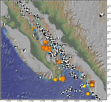
As part of the their studies on the Neogene rifting history of the Gulf of California MARGINS focus site, PIs David Kimbrough, Marty Grove and Peter Lonsdale contributed Zircon U-Pb geochronology data for submerged and terrestrial continental crust rock samples (Fig. 1).


Cascadia
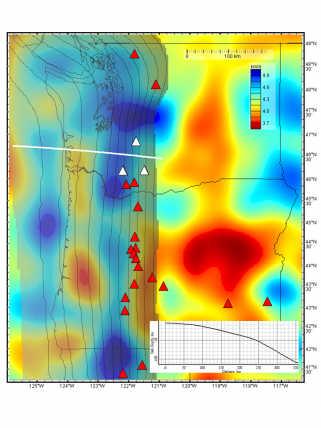
A range of seismic velocity models of the Western US has been added to GeoMapApp, under the Focus Sites menu. Based upon tomographic techniques, the models include the 2014 Gao and Shen Cascadia 3-D shear-wave velocity model, the Porritt et al. (2011) PNW10-S Pacific Northwest dVs model and the Gilbert (2012) crustal thickness model derived from receiver function analysis of EarthScope USArray data. Also incorporated were the North American DNA-13 joint inversion model of Porritt et al. (2013) and the SAWum_NA2 Vs upper mantle velocity model of Yuen and Romanowicz (2011). Complementing these seismic tomography models is the McCrory et al. 2006 model of depth to the subducting Juan De Fuca slab beneath the Cascadia margin (Fig. 2).
GMRT base map
The Global Multi-Resolution Topography (GMRT) synthesis is the base map used in GeoMapApp, in the GMRT MapTool, and in other IEDA tools. The GMRT now includes processed multibeam swath bathymetry data from more than 270 cruises within GeoPRISMS primary sites.
GeoPRISMS Data Portal Tools and Other Relevant IEDA Resources
Search For Data The GeoPRISMS search tool provides a quick way to find GeoPRISMS data using parameters such as keyword, NSF award number, publications, and geographical extent.
Data Management Plan tool Generate a data management plan for your NSF proposal. The on-line form can be quickly filled in, printed in PDF format, and attached to a proposal. PIs can use an old plan as a template to create a new plan. We also have developed a tool to help PIs show compliance with NSF data policies.
GeoPRISMS Bibliography With more than 1,130 citations, many tied to data sets, the references database can be searched by primary site, paper title, author, year, and journal. The citations can be exported to EndNote™. Submit your papers for inclusion in the bibliography – just the DOI is needed!
Contribute Data The web submission tools support PI contributions of geophysical, geochemical, and sample data. File formats include grids, tables, spreadsheets, and shapefiles. Once registered within the IEDA systems, the data sets become available to the broader community immediately or may be placed on restricted hold. Additionally, PIs can choose to have a DOI assigned to each submitted data set, allowing it to become part of the formal, citable scientific record.
