The GeoPRISMS data portal was established in 2011 to provide convenient access to data and information for each primary site as well as to other relevant data resources. Since the last newsletter report, highlighted below are recent contributions of data sets and field program information of interest to the GeoPRISMS community. Many of the data sets described are also available in GeoMapApp under the Focus Site and DataLayers menus.


East African Rift System
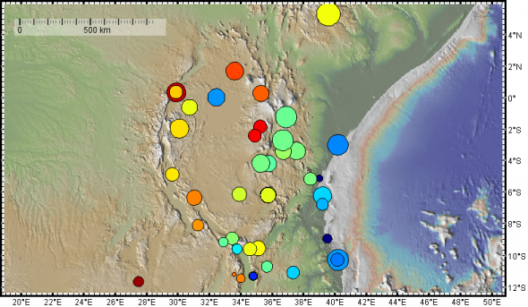
An updated East African Rift System geodetic velocity field (2016.0a compiled from continuous and survey mode GPS networks was contributed to the Data Portal by Bob King, Michael Floyd, Rob Reilinger, and Becky Bendick. Containing data obtained between 1994 and December 2015, the data set is part of a wider Africa/Arabia/Eurasia velocity field derivation.
Japan
Sabine den Hartog made available her experimental data on the friction properties of exhumed fault gouge from Japan’s Shikoku Island.
Cascadia
A GeoMapApp webinar focused upon available data sets in the Cascadia region was broadcast and is now available on YouTube.
Cascadia, Alaska-Aleutians and Hikurangi margins
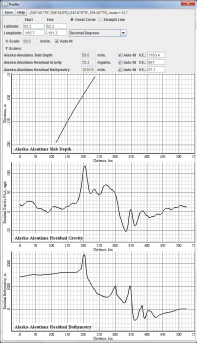
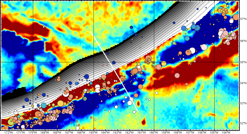
Subduction zone residual gravity and residual bathymetry data sets from Dan Bassett and Tony Watts from their 2015 G-Cubed papers were contributed for the Alaska-Aleutians (Fig. 2), Cascadia and Hikurangi margins (http://www.marine-geo.org/tools/search/DataSets.php?data_set_uids=24025,24026,24027,24028,24029). Also added was a suite of geodetic plate velocity solutions including EarthScope PBO and MIDAS solutions that cover the three GeoPRISMS primary sites in North America.
GeoPRISMS Data Portal Tools and Other Relevant IEDA Resources
Search For Data – The GeoPRISMS search tool provides a quick way to find GeoPRISMS data using parameters such as keyword, NSF award number, publications, and geographical extent.
Data Management Plan tool – Generate a data management plan for your NSF proposal. The on-line form can be quickly filled in, printed in PDF format, and attached to a proposal. PIs can use an old plan as a template to create a new plan. We also have developed a tool to help PIs show compliance with NSF data policies.
GeoPRISMS Bibliography – With more than 1,140 citations, many tied to data sets, the references database can be searched by primary site, paper title, author, year, and journal. The citations can be exported to EndNote™. Submit your papers for inclusion in the bibliography – just the DOI is needed!
Contribute Data – The web submission tools support PI contributions of geophysical, geochemical, and sample data. File formats include grids, tables, spreadsheets, and shapefiles. Once registered within the IEDA systems, the data sets become available to the broader community immediately or may be placed on restricted hold. Additionally, PIs can choose to have a DOI assigned to each submitted data set, allowing it to become part of the formal, citable scientific record.
