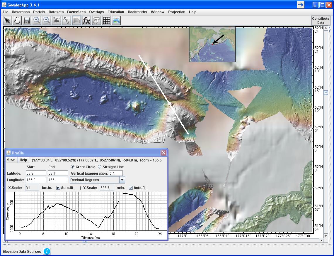
Figure 1. To the west and north of Aleutian island Kiska (lower right), highly-detailed bathymetry data from the Thompson cruise TN182 reveal myriad seafloor features not present in the surrounding base map. The white line shows the location of the elevation profile displayed in the lower left. The grids can be downloaded here: http://www.marine-geo.org/tools/search/entry.php?id=TN182. Image produced with GeoMapApp.