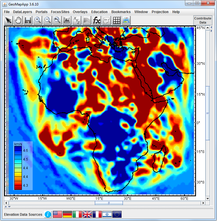
Figure 1. Shear-wave velocity structure at 123 km depth from Emry et al. (2018). This, and similar grids for depths between 105-424 km are provided in GeoMapApp. They reveal segmented, low‐velocity upper mantle underlying the magmatic northern and eastern sections of the East African Rift System. Shallow parts of the southern and western sections are dominated by high‐velocity upper mantle which transitions at depth to low velocities. The image is made with GeoMapApp.