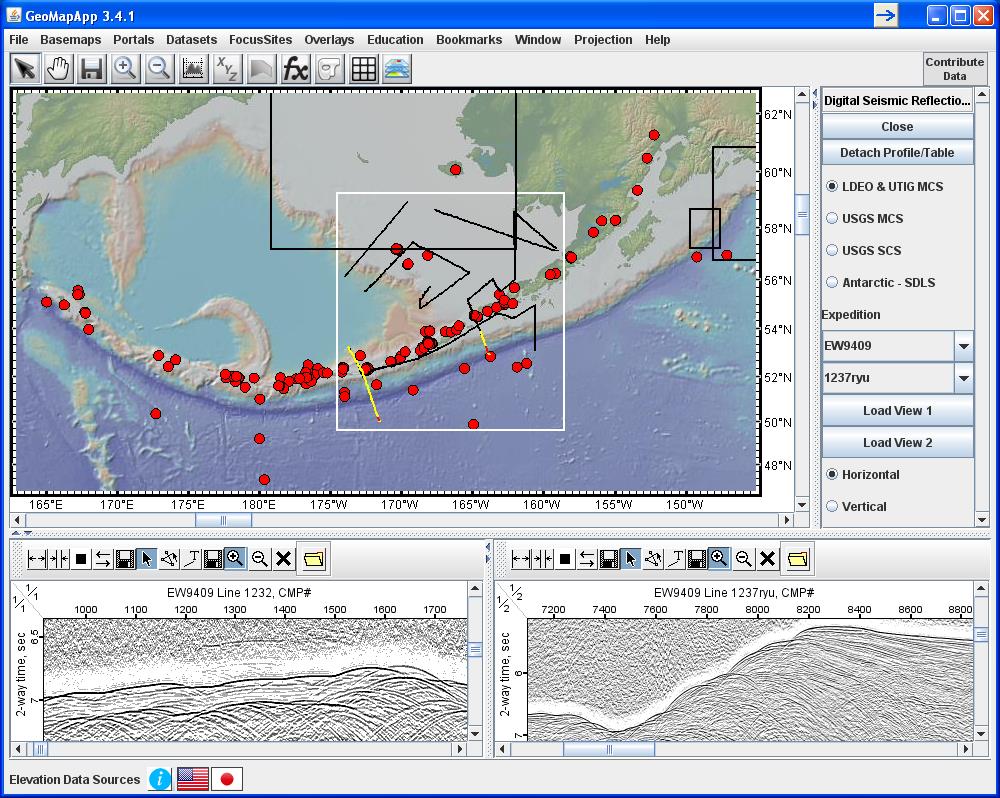
Figure 1A. Recently added to the EarthChem-PetDB database are geochemical data sets along the length of the Aleutian arc. (Left) GeoMapApp screenshot showing the geographical extent of the newly-available geochemistry data (red dots). Black rectangles outline areas of multi-channel seismic reflection data, with the white rectangle showing the bounds of MCS profile lines from the 1994 cruise EW9409 led by Susan McGeary and John Diebold. Yellow lines are the locations of MCS profile EW9409-1232 (west) and EW9409-1237ryu (east) shown in the lower panel.