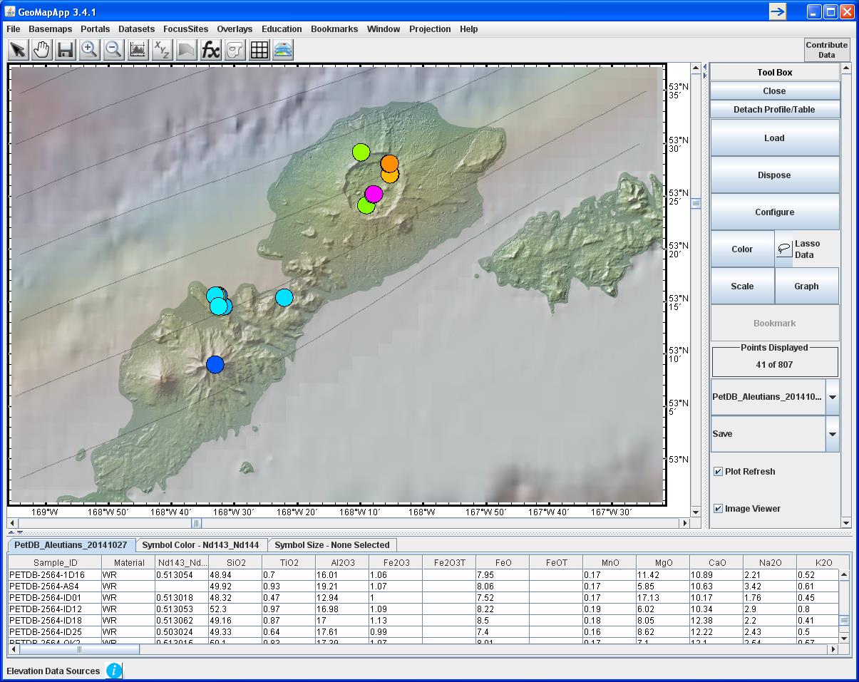
Figure 1B. On the Aleutian island of Unmak, Okmok caldera dominates the island’s northeastern landscape and is one of the most active volcanoes in the Aleutian chain. Here, a second GeoMapApp screenshot shows Nd143/Nd144 ratios that were recently added to the PetDB database and are color-coded with warmer colors indicating higher values. Faint black lines trending NE-SW represent depth contours to the top of the subducting slab from Syracuse and Abers (2006). Contours are at 10 km intervals with the 60 km contour passing through Okmok caldera. Land elevations, in shades of green, are from the USGS-NED and ASTER elevations models.