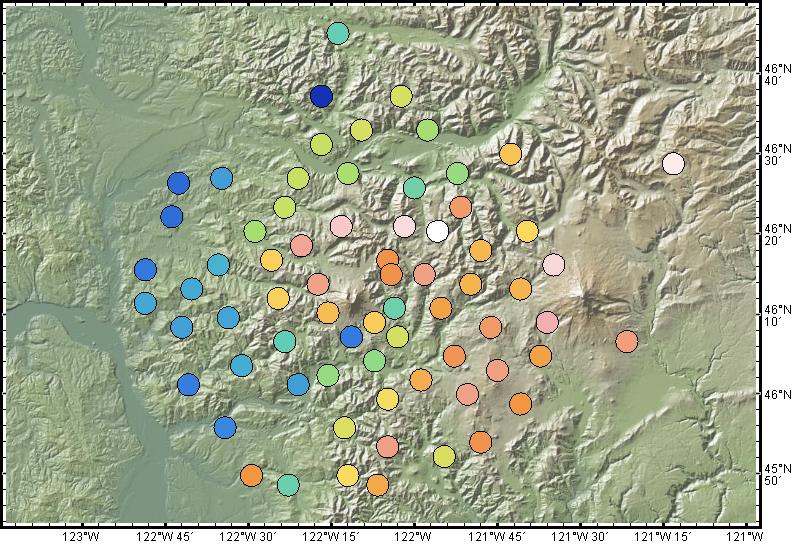
Figure 2. Seismometer station locations for the two-year passive array deployment of the Cascadia iMUSH multi-institution program (lead PI Ken Creager). Stations are plotted in GeoMapApp on a 10-meter GMRT base map and shaded according to station elevation, with warmer colors indicating higher elevations. The array comprises 71 stations centered upon Mount St. Helens and links in GeoMapApp point to detailed station and network information at IRIS.