Category: New Zealand

HOBITSS Hikurangi Ocean Bottom Investigation of Tremor and Slow Slip
Erin K. Todd (University of California Santa Cruz) on behalf of the HOBITSS experiment team
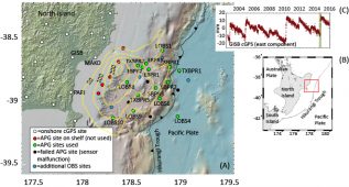
The Hikurangi Ocean Bottom Investigation of Tremor and Slow Slip (HOBITSS) experiment is a multi-national collaborative offshore seismic and geodetic research project that explores the relationship between slow slip events (SSEs), tectonic tremor, and seismicity along the shallowest part of the northern Hikurangi Margin where the Pacific Plate is subducting beneath the North Island of New Zealand. An array of 24 absolute pressure gauges (APG), fifteen ocean bottom seismometers (OBS), and three ocean bottom electromagnetometers were deployed between the shoreline and the trench for thirteen months to capture deformation, seismicity, and conductivity changes during large SSEs offshore the North Island’s east coast.
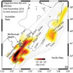
This offshore Gisborne region hosts shallow SSEs (<15 km depth) approximately every eighteen months that typically last from one to three weeks and release energy equivalent to Mw 6.5-6.8 earthquakes. However, to capture vertical deformation with the seafloor pressure sensors, the network needed to be in place during one of the larger SSEs, which only occur every four to six years. With the last very large SSE in the Gisborne region in March/April 2010, choosing the correct time for the deployment was definitely a gamble, as the timing of the large north Hikurangi SSEs is not particularly predictable! Thankfully, the anticipated SSE began in late September 2014 directly beneath the HOBITSS array (Fig. 1). The September 2014 SSE was the second-largest SSE observed on that part of the subduction zone, so we were incredibly lucky to have the seafloor instruments in place at just the right time.
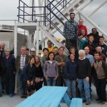
Between the deployment and recovery expeditions, the science party consisted of researchers from the United States, Japan, and New Zealand, marine geophysical instrument engineers from the United States and Japan, and ten graduate students from the United States, Japan, and New Zealand. The experiment was funded by NSF Marine Geology and Geophysics in addition to Japanese and New Zealand funding agencies. These expeditions were the first seagoing experience for many of the graduate students, myself included.
May 2014 – The Deployment
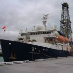
New Zealand’s Research Vessel Tangaroa was used for the deployment cruise. We set out from Wellington and began the 24-hour journey to our deployment site. Those 24 hours were very busy as the engineers began checking over every component of the instruments to ensure they were ready for deployment. As a graduate student on my first scientific cruise, I spent the first day learning my way around the ship, adjusting to ship life, and meeting all the members of the science and engineering parties. While a couple of the grad students had been on scientific cruises before, the rest of us had never been to sea before and didn’t know what would be expected of us or how we would fit in to the deployment procedure. Thankfully, everyone in the science and engineering parties was extremely helpful and, by the time we reached the deployment site, we all knew what to do.
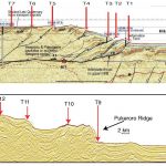
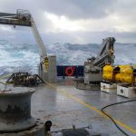
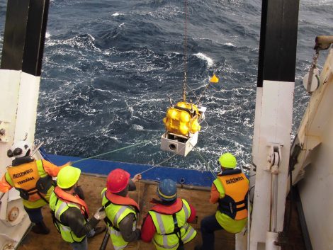
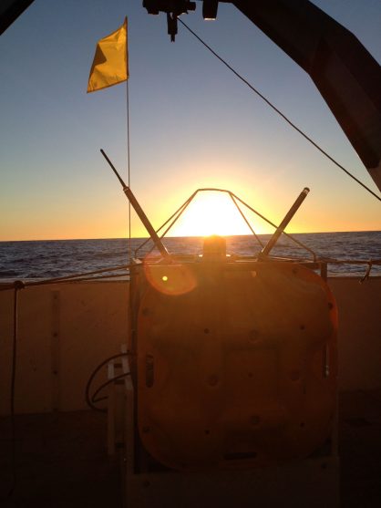
Once the deployment began, the mood on the ship changed. Everyone was focused on the task at hand. The first day of deployment was a whirlwind as we deployed fourteen instruments and recovered four that had been deployed the previous year as part of another experiment. Each step in the deployment procedure was well executed and it was fascinating to watch the exchanges between the leaders of the science party and the engineers as they worked together to determine which instrument would be ready for deployment next, how long it would take to transit to the deployment location, and how long it would take to survey the deployed instruments to pinpoint their final location (Fig. 2). So many moving pieces and steps needed to be completed in the correct order to successfully deploy the instruments with the time and resources available. Prior to the cruise, I had assumed that certain elements of the experiment like the order of station deployment had been pre-determined. I was surprised at the number of decisions that had to be made at the time of deployment based on the immediate resources and weather conditions. Once I was on the ship, I realized how quickly something could happen to change any pre-determined plans.
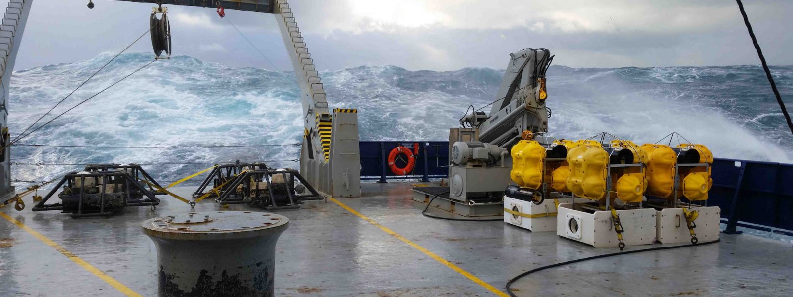
We were fortunate enough to have good weather for the first few days, but by day 4, the weather took a turn for the worse. Three days into the cruise, we had deployed 24 stations and seemed to be ahead of schedule, but our good fortune came to a swift end when a storm arrived early on the fourth day forcing us to hold position through the storm for 36 hours. With strong winds and heavy swells, deploying new instruments and surveying the locations of previously deployed instruments was out of the question. While some of the grad students had been to sea before, others of us had not and discovered if we were prone to seasickness or not. I was lucky enough to not get seasick, but for others, the storm brought some real challenges. Fortunately, everyone helped each other out to ensure that all essential tasks were covered. Calm weather returned for the last few days of the cruise and we were finally able to deploy the remaining instruments before turning back for Wellington Harbor.
“I learned that if you are going to take sea-sickness medication, it should be well before the research vessel leaves the dock. Preventative measures are key. I learned a lot on the HOBITSS deployment cruise, especially what goes into determining simple parameters that data analysts and grad students like myself take for granted, for instance, the latitude, longitude, and depth of the instrument. Ocean bottom instrument deployment can be more complicated than land deployment, and it was enlightening to see the Principal Investigators work to figure out the next deployment site and manage the experiment. It was good experience to help with the cruise report and determine locations of instruments, as well as learn how to ping the instruments as they sunk to the ocean floor. My advisor arranged a series of science talks on the deployment, so I learned a lot about the context of the experiment, which is really helpful because I will be working with the data. I appreciated the opportunity to meet and work with a variety of scientists from Lamont-Doherty Earth Observatory, the Earthquake Research Institute in Tokyo, Japan, Tohoku University, University of Texas Austin, University of California Santa Cruz, and New Zealand. We had a very international team!”
– Jenny Nakai, Graduate Student, University of Colorado Boulder
“The HOBBITS cruise was quite an unique experience for me. Unlike previous cruises I participated to learn and observe as a student, on the HOBBITS deployment cruise I worked as part of the OBS technical team. My main responsibility was to assemble and service ocean bottom seismometers and pressure gauges to get them ready for a yearlong deployment.
Working together with the OBS team on the deck on a nut and bolt level make me realize the amount of work and level of dedication that goes into deploying each OBS. For example, in order to make sure that the instrument can return to the surface following an acoustic command, two redundant release systems are put in place, both equipped with two sets of redundant wiring. Only one of the four needs to work properly for the system to function, but all four systems need to be quadruple-checked before deployment. Given the harsh environment at the sea floor, we can’t take any chances.”
– Yang Zha, former Graduate Student, LDEO, Columbia University
June 2015 – The Recovery
From the perspective of those of us who had never been on an OBS recovery cruise, the idea of successfully recovering 35 instruments that had been sitting on the ocean floor for thirteen months, accumulating sediment and marine life, seemed daunting. We knew the main Gisborne slow slip event under the array had occurred four months into the deployment and a second slow slip event had been recorded to the south of the array, so there was a lot of anticipation and the Principal Investigators were very eager to get a look at the data.
The United States’ Research Vessel Roger Revelle was used for the instrument recovery cruise. This time, the expedition began and ended in Napier, which is a famous “Art Deco” city on the New Zealand’s east coast. Most of Napier was destroyed in an earthquake in 1931 and was completely rebuilt right after that in the Art Deco style of the time. Napier is very close to the HOBITSS experiment location, so the transit to retrieve our instruments was shorter than for the deployment.
There was a lot of nervous excitement among the team as we arrived on site and prepared to recover the first instrument. What if the instrument was buried by sediment? What if the receiver on the instrument didn’t recognize the release command? What if marine life or sediment had damaged the instrument in some way and it didn’t float back to the surface? What if the battery died during the deployment? What if the pressure case leaked and the instruments were exposed to seawater? The seafloor is a harsh environment for sensitive electronics and there were many things that could have gone wrong.
After the first instrument was brought on board, the tense mood that had gripped the team relaxed and we started to recover instruments in earnest. The seas were calm and the winds were light for the first full day of recovery and nine instruments were recovered. Recovering instruments is a tricky process – even if everything works and the instrument rises to the surface, there are still challenges to getting it on board. As the ship arrives on site, we use the ship’s hull-mounted transducer to communicate with the instrument and send the correct signal for the instrument to release its weights and start rising toward the surface. Depending on the ocean depth, the ascent can take over an hour. During that hour, the ship and instrument communicate back and forth to track the progress of the ascent. Once it is clear that the instrument has reached the surface, we would send out spotters all over the ship to look for the instrument bobbing on the surface. Some of the instruments have small flags attached because when they rise off the ocean floor they would float just below the surface and it would be difficult to locate them without the small pennant flag. As the instrument is spotted, the captain would maneuver the ship alongside it. The technicians and engineers would then use long poles equipped with hooks on the end to grab the instrument and hook it up to the winch to pull it out of the water. Each step requires numerous people doing their part carefully and at exactly the right time.
We were keeping an eye on a storm that was heading our way, threatening to reach us in the middle of the cruise, so we worked quickly to recover as many instruments as possible before the seas got too rough. As the storm hit, we were forced to suspend recovery operations due to high winds and large swells. On one of my shifts, we hit a particularly large swell and everything that wasn’t strapped down went sailing across the room. Chairs toppled over, notebooks and papers went sliding, and a large telephone fell of the table. Thankfully, after one or two stormy days, we were able to resume operations and recover the rest of the instruments. We successfully recovered 34 of 35 instruments: after many attempts over a few days, one of the ocean bottom electromagnetometers was considered lost after it never acknowledged the communication from the ship.
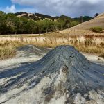
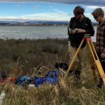
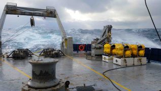
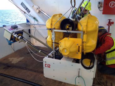
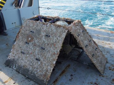
Most of our instruments were deep water (over a thousand meter depth), but five of them were on the shelf, less than one hundred meters water depth. One of the complications with having instruments at such shallow depths is that they quickly accumulate a lot of marine life (Fig. 3). In order to pass the agricultural inspection once back to port, all the instruments had to be thoroughly cleaned of any traces of mud, plant life, or animal life.
Cleaning these instruments became a large part of the graduate students’ jobs during the second half of the cruise. Soft- and hard-bodied organisms, coating every inch of the instruments, had to be removed. The task was messy and smelly but very critical, as we would not have been allowed to re-enter New Zealand with dirty instruments. As we arrived back in to port and the agricultural inspector came on board to check the instruments, they found a small patch of mud about the size of your palm deep in the inside of one of the instruments that had to be cleaned with alcohol and paper towels and placed into a quarantine bag. After cleaning the remaining mud off the instrument, we were given the all clear!
Hard won results
All the hard work to deploy and recover the instruments really paid off in the end! The Absolute Pressure Gauge data showed that the SSE in September 2014 produced a clearly observed 2-7 cm of vertical deformation of the seafloor (Wallace et al., 2016), much more than any of us ever expected. The vertical deformation shows that slow slip occurred to within at least 2 km of the seafloor, and it is possible that slip went all the way to the trench (Fig. 1). The HOBITSS results really help to demonstrate that Absolute Pressure Gauges are a valuable tool for monitoring centimeter-level offshore tectonic deformation. In addition, preliminary results from the seismic data show the existence of tectonic tremor during the slow slip and that the previously observed seismicity increase during the last large Gisborne SSE in 2010 is also present for the 2014 SSE in similar locations (Todd et al. in prep).
Future Projects – 2017 & 2018
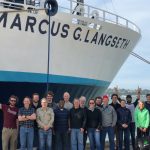
In addition to the HOBITSS experiment, there are a number of exciting future projects slated for the Hikurangi subduction margin in the coming years. The shallow nature of these slow slip events will be the target of IODP drilling in 2017 and 2018 (Expeditions 372 and 375), to better understand the physical origins of slow slip and to install borehole observatories to do near-field monitoring. In addition to the drilling experiment, the R/V Marcus Langseth will undertake an NSF-funded 3D seismic survey in early 2018 to image the shallow slow slip source area. Being able to tie the HOBITSS experiment results in with the results of co-located IODP drilling and 3D seismic imaging will be very exciting! ■
“Report from the Field” was designed to inform the community of real-time, exciting GeoPRISMS -related research. Through this report, the authors expose the excitement, trials, and opportunities to conduct fieldwork, as well as the challenges they may have experienced by deploying research activities in unique geological settings. If you would like to contribute to this series and share your experience on the field, please contact the GeoPRISMS Office at info@geoprisms.nineplanetsllc.com. This opportunity is open to anyone engaged in GeoPRISMS research, from senior researchers to undergraduate students.
We hope to hear from you!
Report: South Island, New Zealand primary site coordination mini-workshop
AGU Fall Meeting 2014, San Francisco, USA
1University of Texas; 2Caltech; 3Los Alamos National Laboratory; 4Victoria University of Wellington 5GNS Science, NZ
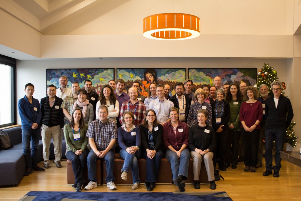
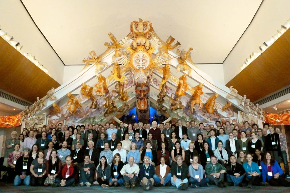
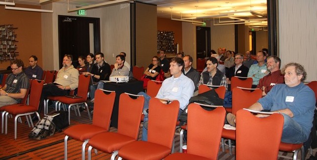
Attendees of the South Island Mini-Workshop on Sunday afternoon.
On Sunday December 14, 2014, from 1:30 to 5 pm, a diverse group of researchers met in the Grand Hyatt San Francisco before the AGU Fall Meeting to discuss coordination of work within the South Island, New Zealand GeoPRISMS primary site. The South Island of New Zealand offers extraordinary opportunities to address subduction cycles and dynamics science questions. Members of the community are gearing up for work in New Zealand and so the time was ripe to foster collaboration between US scientists and others internationally.
Following an introduction from the organizers, Sean Gulick (UT Austin) recapped the science priorities defined for Puysegur and Fiordland in the GeoPRISMS Implementation Plan. Sean described how the South Island of New Zealand offers a wealth of prospects for subduction zone research. The Puysegur Trench region – a juvenile subduction zone “caught in the act” of initiation – provides unique opportunities to investigate the geodynamics of this fundamental plate tectonic process. In Fiordland, tectonic motions have led to deep exhumation of a pristine Cretaceous arc section and offers a prime locale to investigate the root zones of an ancient arc at outcrop scale. Addressing questions on subduction initiation, exhumed terranes, and subduction thrust slip behavior in one region is an exciting opportunity and will require large geophysical field deployments, targeted geological fieldwork, sampling, geochemical analysis and geodynamic models.
The overview was followed by shorter talks describing specific targets or nascent efforts for larger activities. Joshua Schwartz (CS Northridge) described how an exhumed arc root exposed at Fiordland provides opportunities to address how volatiles, fluids, and melts are stored, transferred, and released through the subduction system. Sarah Penniston-Dorland (U Maryland) then described how Fiordland presented an outstanding locale for an ExTerra Field Institute in which a group of experienced scientists and students would spend several weeks in the field familiarizing newcomers to the area, collecting rock samples and making other detailed field observations. Jamie Howarth (GNS Science) discussed surface processes and the history of earthquakes from the sedimentary record. Jamie described his own work using sequences of turbidites to understand landslides and erosion in the Southern Alps and how the large magnitude earthquakes within Fiordland can be better understood through the study of turbidites.
Harm Van Avendonk (UT Austin) gave a talk on measuring crustal and fault structure across Puysegur with active source seismology. Harm described how the fundamental geophysical unknowns in Puysegur limit our understanding of subduction initiation. Through detailed models of seismic wave propagation through Puysegur, Harm showed how crustal structure, crustal thickness and dip of the nascent plate boundary could be determined with east-west active source seismic lines. Recent seismic work elsewhere showed that the necessary data could be acquired with an active source experiment. The field geophysical theme continued with a talk by Michal Kordy and Phil Wannamaker (U of Utah) on constraining mantle volatiles with an MT (magnetotellurics) experiment. They showed how major changes in electrical resistivity are likely associated with volatiles in the mantle and how a combined onshore and offshore MT experiment across Fiordland and Puysegur could constrain the volatile release during subduction initiation. Joann Stock (Caltech) made the case for magnetic measurements along Puysegur – the only subduction zone in which the kinematics of both over-riding and under thrusting plates are well known during the initiation phase.
Brian Jicha (U of Wisconsin) and Gene Yogodzinski (U of South Carolina) gave a talk on adakitic volcanism and subduction initiation at Solander Island. Solander is the only sampled volcanism along Puysegur and the andesites there are adakitic. Brian reviewed the other locations in which adakites are found and that melting of MORB eclogite in the subducting oceanic crust is one aspect of their formation. Most studies of subduction initiation have been made on western Pacific arcs and Puysegur provides an opportunity to study a nascent arc which has a different petrological expression. The case was made that there is a large area of submarine volcanism around Solander that has yet to be sampled and that the time is now ripe to do so.
Several talks explored work currently underway on the South Island that complements those planned for GeoPRISMS. Simon Lamb and Tim Stern (Victoria U of Wellington) gave a talk exploring the putative hyperextended margin of the conjugate to Campbell Plateau that might be the crust now below the central part of the Southern Alps. Martha Savage (Victoria U) gave an overview of several other South Island projects including seismic anisotropy over the extent of the island and drilling within the Alpine Fault.
The talks were followed by open discussion on both the science and logistics of the various plans presented. In terms of science returns, the participants discussed how the seismic experiments link the plate kinematics to the structure and evolving force balance. The MT experiment would map the first appearance of volatile release heralding the transformation of basalt to eclogite that could have provided a major jump in the force driving subduction initiation. Discussed at length was the question of optimizing the logistics of the passive MT and active seismic experiments while providing opportunities to sample volcanic rocks around Solander Island. The two geophysics experiments have different footprints: the seismic lines are more tightly aligned on the Puysegur margin while the MT experiment extends farther afield. The vessel that deploys or recovers the MT instruments might also be able to dredge for samples around Solander. The broader group discussed logistical aspects of holding an ExTerra Field Institute in the remote Fiordland location highlighting the advantages of coordination with any geophysical deployment. The group identified numerous opportunities and ways to coordinate activities through both NSF programs and international collaboration.
Go to the Mini-Workshop webpage
Reference informationGeoPRISMS Newsletter, Issue No. 34, Spring 2015. Retrieved from http://geoprisms.nineplanetsllc.com
Report: Workshop to cultivate and coordinate GeoPRISMS studies of the Hikurangi subduction margin
AGU Fall Meeting 2014, San Francisco, USA
1UTIG, Austin; 2University of Missouri; 3Scripps Institution of Oceanography, UC San Diego; 4GNS Science, NZ
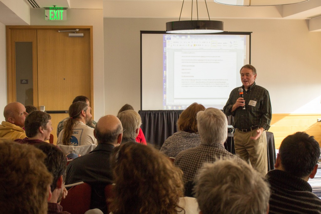
Mike Underwood, one of the conveners of the Hikurangi Mini-Workshop, leading discussion on Sunday morning
On Sunday, December 14, 2014, an enthusiastic group of more than 70 international researchers from a variety of disciplines met in San Francisco at AGU to discuss studies that should be proposed at the Hikurangi subduction margin (part of the New Zealand focus site) for the upcoming GeoPRISMS funding rounds. The meeting began with a brief overview of the GeoPRISMS program by Peter van Keken, which was followed by Mike Underwood’s review of the Hikurangi margin science priorities, which are based largely on discussions at the New Zealand Focus site workshop that was held in April 2013. The objective of the mini-workshop was to promote and coordinate new collaborations to fill critical gaps in the GeoPRISMS Implementation Plan. To that end, a series of short talks highlighted projects that are either ongoing, already proposed, or soon to be proposed. The last half of the meeting was focused on open discussion during which participants identified new research opportunities.
The community has already made major progress in advancing key science objectives identified for the Hikurangi margin. Demian Saffer overviewed the IODP drilling proposals to investigate shallow slow slip events (SSEs) at the northern Hikurangi margin; the proposal for riserless drilling has passed through panel reviews and now awaits scheduling by the JOIDES Resolution Facilities Board. A proposal for riser drilling also reviewed well and has been forwarded to the Chikyu Facilities Board. Already underway is the Hikurangi Ocean Bottom Investigation of Tremor and Slow Slip (HOBITSS) to investigate vertical deformation of the seafloor and seismicity related to the shallow SSEs, supported by funding from NSF, New Zealand, and Japanese sources. An NSF-funded heat-flow survey led by Rob Harris is scheduled for May/June 2015 to constrain the thermal regime of the subduction interface. Proposals have been submitted to NSF to (1) acquire 3-D seismic data of the shallow SSE source, (2) conduct onshore and offshore geophysical investigation of megathrust properties along-strike, and (3) to install long-term borehole observatories at the proposed IODP sites.
Numerous representatives from the New Zealand geoscience community introduced ongoing and planned geophysical, geological, and modeling initiatives that dovetail nicely with GeoPRISMS goals. In particular, there are a large number of seismological, electromagnetic (onshore), numerical modeling, and paleoseismological investigations conducted by New Zealand-based researchers. To leverage these existing and planned studies (and not duplicate efforts), it is particularly important for GeoPRISMS-funded investigators to collaborate with and communicate with their New Zealand-based counterparts. David Johnston of GNS Science informed participants about a New Zealand-based initiative called “East Coast Life at the Boundary (LAB)”, part of which is targeted at communication of research results on the Hikurangi margin to the general public and local policymakers. This offers an excellent opportunity for GeoPRISMS researchers at Hikurangi to work with the East Coast LAB to coordinate outreach activities in New Zealand. We also heard about ongoing and already funded efforts by Japanese and European researchers focused on the offshore Hikurangi margin over the next four years.
The last half of the mini workshop was dedicated to discussion of critical science gaps. The main discussion focused on:
- microseismicity, episodic slow slip, and tremor;
- the state of the incoming plate and the role of incoming sediment properties in subduction thrust behavior and margin evolution;
- past and present megathrust slip behavior and the physical controls on that behavior;
- fluid and volatile fluxes in the forearc.
From this discussion we identified some of the most critical studies that are needed to fill gaps. Paleoseismology studies will help resolve the past earthquake behavior of the subduction thrust and whether or not the modern-day geodetic locking pattern is static or varies with time. Increased efforts towards sampling and geochemical analysis of onshore and offshore fluid seeps will yield important insights into volatile cycling and hydrogeology above a shallow subduction thrust. A new idea was raised to use the seafloor drill rig MeBo for coring at numerous points on the Hikurangi Plateau (a Large Igneous Province) where the sedimentary cover is thin (<200 m). Such sampling would address the role of 3-D stratigraphic variability in modulating subduction-interface slip behavior. Controlled-source electromagnetic (CSEM) transects in the offshore forearc and incoming plate will evaluate the role of fluids in megathrust slip behavior and margin evolution. Seafloor (GPS-Acoustic) geodetic studies will help resolve the slip behavior of the shallow subduction thrust. Densification of onshore geodetic instrumentation, and addition of strain meters, tiltmeters, and borehole seismometers will lower the threshold of slow slip event detection, enabling higher-resolution investigation of SSEs and seismicity, and detection of smaller events. Modeling of Hikurangi SSEs assuming a rate-state friction framework, as well as other approaches, will help resolve the physical controls on the diversity of SSE behavior.
The conveners appreciate the participants’ contributions, and thank them for their help in achieving the goals of the mini-workshop.
Go to the Mini-Workshop webpage
Reference informationGeoPRISMS Newsletter, Issue No. 34, Spring 2015. Retrieved from http://geoprisms.nineplanetsllc.com
IODP Workshop on Using Ocean Drilling to Unlock the Secrets of Slow Slip Events
Laura Wallace, Eli Silver, Nathan Bangs, Rebecca Bell, Stuart Henrys, Joshu Mountjoy, and Ingo Pecher
Figure 1. Workshop group photo.
From August 1 to 5, 2011, 70 geoscientists and student researchers from a dozen countries gathered in Gisborne, New Zealand, to discuss how scientific ocean drilling can help to elucidate the processes behind slow slip event (SSE) occurrence. Gisborne was chosen as a venue for this workshop due to its close proximity above the source area of shallow slow slip (<5-15 km depth) that occurs at the northern Hikurangi subduction margin in New Zealand.SSEs are a new class of shear slip found at subduction margins around the globe that have revealed the broad spectrum of fault slip behaviour. SSEs are widely acknowledged as one of the most exciting discoveries of the last decade in the Earth Sciences, and have implications for plate boundary processes and the seismic hazard posed by subduction megathrusts. The relatively shallow depths of subduction thrusts exhibiting SSEs in New Zealand (north Hikurangi), central Japan (Boso Peninsula), and Costa Rica (Nicoya Peninsula) (5 – 10 km below seafloor) potentially puts them within reach of IODP drilling. The possibility for direct access to these faults suggests that scientific drilling could play an important role in revealing the physical processes behind SSEs. The main goals of the workshop were to summarize critical requirements of a drilling program to discern the physical mechanisms responsible for SSE behaviour, develop strategies to achieve the scientific goals, determine what types of data are needed to develop an effective drilling program, and identifying the expertise and technologies needed to drill a SSE source area successfully. Additional geophysical experiments in support of any IODP drilling were also addressed.
Oral presentations at the Gisborne workshop were organized into thematic sessions centered around (1) observations of and theories for slow slip event occurrence, (2) lessons learned from previous IODP drilling at subduction zones, and (3) focused talks on potential slow slip drilling targets in New Zealand, Costa Rica, and central Japan. The talks were interspersed each day with breakout discussion sessions and broader group discussions. Breakout sessions over the first 2 days focused on the measurements and experiments needed to understand the origins of SSE and how these plans might be applied to potential IODP drilling projects in New Zealand, Japan, and Costa Rica. On the final day, breakout groups sat down and developed implementation plans for each location.
A number of fundamental conclusions came from the workshop: (1) further development and site characterization is needed at each of the sites to be able to effectively examine slow-slip processes along the plate interface with drilling. At each of the sites, additional data is needed to refine the locations, magnitudes, timing, slip regions, relationship to earthquakes, and cyclicity of SSEs. We concluded that we can achieve these goals with a combination of onshore geodetic and seismic experiments combined with offshore long-term deployment of ocean bottom seismographs equipped with pressure sensors to monitor vertical seafloor deformation. (2) Also critical are complementary, collocated studies for developing regional-scale characterization and development of site locations. These include (but are not limited to): structure and tectonics, physical properties, stratigraphy and lithologies, and thermal structure, using active source 2D and 3D seismic imaging and wide-angle refraction, passive source studies, heat flow surveys, and multibeam seafloor mapping. Auxiliary data are required to both help identify drilling targets and compliment borehole data and monitoring; (3) Shallow level borehole monitoring is key to address questions related to the spatial distribution of slow slip beneath offshore subduction margins, and to reveal the possible relationship between SSEs and normal seismicity, as well as discerning changes in fluid flow and geochemistry within the upper plate during the SSE cycle. Monitoring will be supported with coring and logging for ground truth and detailed characterization of lithology, stratigraphy, structure, fluids, and physical properties above the SSE source regions; (4) Drilling, logging and sampling of the SSE source area will provide the most direct information on the physical conditions (frictional properties, mineralogical composition, fluid pressure conditions, temperature, among others) that lead to and control slow slip event behaviour. Participants agreed that deep drilling of an SSE source area is within reach and is the ultimate way to solve the mystery of why SSEs occur.
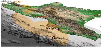
Figure 2. Oblique view of the Hikurangi subduction margin, including locations of slow slip (orange shaded), the location of the workshop and fieldtrip route, and the proposed slow slip event drilling targets offshore Gisborne.
One of the interesting discoveries during the workshop was the realization by participants that the world’s best-documented areas of shallow (<20 km depth) slow slip events in Costa Rica, central Japan and New Zealand have some striking similarities. Specifically the 3 margins include: relatively cold temperatures on the interface in the SSE source regions, similar slow slip event durations (generally ~2-3 weeks), and comparable equivalent moment magnitudes per event (Mw ~6.5). Costa Rica and north Hikurangi have further similarities in that both margins are characterized by subduction erosion, and each exhibit a regular two-year SSE recurrence interval. We expect that continued comparison and contrasting of these 3 subduction zones and their shallow slow slip event behavior begun at the workshop will lead to new insights into the mechanisms behind shallow SSEs.
The main 3-day workshop was followed by a 2-day field trip, from Gisborne to Wellington. The fieldtrip was designed to expose participants to the onshore, uplifted components of the Hikurangi forearc and provide a complete transect of Hikurangi margin active tectonics. The fieldtrip also tracked above the slow slip event source areas of the Hikurangi subduction zone, and gave participants insights into the geological and tectonic context of slow slip in the North Island.
Just after the fieldtrip, on 6-7 Aug approximately 45 of the Gisborne workshop participants met to develop the full proposals and implementation plans for a proposed project to use IODP drilling to understand slow slip event processes offshore Gisborne, at the northern Hikurangi margin. We expect that these efforts will be of interest to the GeoPRISMS community, as New Zealand has been recently selected as one of the primary focus sites for the Subduction Cycles and Deformation (SCD) program. The evolving effort towards IODP drilling at north Hikurangi may provide an important focal point for SCD research in the New Zealand region in the coming years.
The workshop was supported by funding from IODP-MI, the New Zealand Ministry of Science and Innovation, the Consortium for Ocean Leadership, and GeoPRISMS. A full report on the workshop outcomes will be developed for IODP over the next few months, and will be publicly available once it is completed.
GeoPRISMS Newsletter, Issue No. 27, Fall 2011. Retrieved from http://geoprisms.nineplanetsllc.com
The New Zealand Primary Site Implementation Planning Workshop Report
Wellington, New Zealand, April 14-16 2012
1University of Texas, Austin; 2GNS Science, New Zealand; 3Oregon State University; 4California State University at Northridge; 5Cal Poly Pomona; 6Pennsylvania State University; 7University of California, Santa Cruz; 8NIWA, New Zealand
An implementation planning workshop was held for the New Zealand Primary Site on 14-16 April, at Te Papa Museum in Wellington, New Zealand. There were ~170 participants from ten different countries, demonstrating the outstanding opportunities for international collaboration at this Primary Site. The large number of participants and high-quality white papers submitted (38 white papers – more than for any of the other GeoPRISMS Primary Site Workshops) reflected the high level of enthusiasm among both the US and international subduction zone communities for future studies in New Zealand. The workshop consisted of a number of keynote and invited talks, and break-out sessions to discuss and prioritize the main scientific objectives and most suitable GeoPRISMS goals.
Workshop topics and agenda
After a welcome to the workshop from Prue Williams (New Zealand Ministry for Business, Innovation, and Employment), Kelvin Berryman (New Zealand Natural Hazards Platform), Bilal Haq (NSF) and Julia Morgan (GeoPRISMS Program), the science program kicked off with a keynote presentation from Nick Mortimer (GNS Science) on the history of subduction in New Zealand since the Paleozoic. For much of the remainder of the first day, we heard from keynote speakers on the four main topics to be addressed at the New Zealand Primary Site. These include:
- What are the geological, geochemical and geophysical responses to subduction initiation and early arc evolution and how do they affect subduction zone formation?
- What are the pathways and sources of magmas and volatiles emerging in the arc and forearc, and how do these processes interact with upper plate extension?
- What controls subduction thrust fault slip behavior and its spatial variability?
- What are the feedbacks between climate, sedimentation, and forearc deformation?
The keynote talks provided background on how these questions could be addressed in New Zealand, as well as global perspectives on the important outstanding questions. Keynote talks on the first day helped to set the stage for discussions held during the rest of the workshop. On the afternoon of Day 1, we held our first set of breakout sessions. The sessions were organized around the four key topics above, and were focused on identifying the most exciting science that can be done in New Zealand to address these topics.
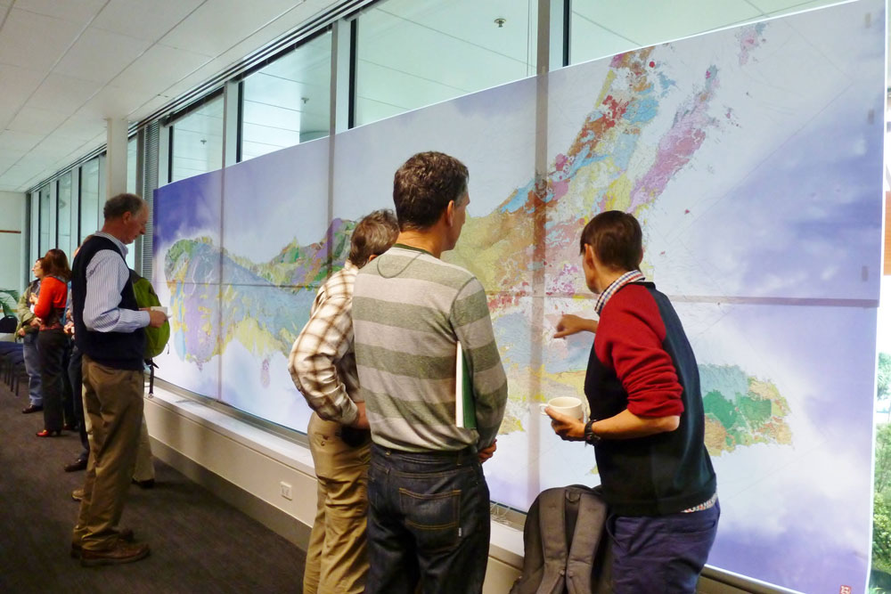
At the beginning of the second day, the breakout session leaders reported back to the rest of the workshop on the outcomes of their breakout session discussions. Following the breakout leader reports, we heard a series of talks on existing infrastructure and datasets in New Zealand that could be brought to bear on any future GeoPRISMS studies at the New Zealand Primary Site. The range of datasets and available infrastructure at the New Zealand Primary Site is particularly impressive. Among these are comprehensive cGPS and seismic networks (www.geonet.org.nz), extensive, high-quality marine geophysical data that is publicly available, recent geological mapping of the entire country at a 1:250,000 scale, and a world-class database of active faults. Participants also heard about IODP projects and proposals that are in the works for the New Zealand region that have strong relevance to the SCD topics.
- Drilling at the offshore Hikurangi subduction margin to understand slow slip events,
- Drilling in the Lord Howe Rise area between New Zealand and Australia to investigate the consequences of Tonga-Kermadec-Hikurangi subduction initiation, and
- Drilling at Brother’s Volcano in the Kermadec Arc to understand submarine volcano hydrothermal processes.
After lunch on Day 2, we were also reminded of the potentially important societal implications of future GeoPRISMS SCD research in New Zealand by a series of talks on the role of science in the understanding of seismic (Russ Van Dissen, GNS Science), volcanic (Gill Jolly, GNS Science), and tsunami hazards (David Johnston, Massey University) in the New Zealand region. These talks were followed by a series of short, topical science talks on a variety of studies being undertaken in New Zealand and elsewhere to address questions relevant to the GeoPRISMS SCD. For the rest of the afternoon on Day 2, participants divided into four breakout sessions that represented the four main geographical areas of the New Zealand Primary Site:
- Hikurangi Margin,
- Fiordland,
- Kermadec Arc, Havre Trough, and vicinity,
- The Taupo Volcanic Zone.
These breakout sessions discussed the main science priorities in each of these geographic areas, and identified data gaps that need to be filled to undertake the science. Synergies that exist across the four Topics in each of these locations were also discussed.
At the beginning of Day 3, we heard reports from the Day 2 breakout leaders, and had a plenary discussion on the Day 2 outcomes. Following the reports, we heard a series of talks from potential international partners in Japan (Shuichi Kodaira, JAMSTEC), Germany (Achim Kopf, Bremen), the UK (Lisa McNeil, Southhampton), and Canada (Kelin Wang, Pacific Geoscience Center) about their countries’ ongoing research interests in subduction and the potential infrastructure that they could bring to bear on studies at the New Zealand Primary Site. Bilal Haq also gave an overview on the structure of GeoPRISMS, and potential NSF infrastructure, such as marine geophysical vessels, that could be utilized for NSF-funded studies in New Zealand. One of the most exciting aspects of the New Zealand Primary Site is the huge potential for US collaboration with New Zealand and other international partners which will greatly amplify the outcomes of any GeoPRISMS-funded studies conducted in New Zealand.
The remainder of the final day was spent in Breakout sessions and plenary discussions to refine the plans for future GeoPRISMS-funded studies within the main geographic focus areas. For the final set of breakout sessions, the conveners decided to stray from the original plan and organized the breakouts into geographic regions (rather than topically), so that the participants could focus in on planning for the main experiments to be conducted at the New Zealand Primary Site. One very controversial decision by the conveners was to put the Hikurangi and Taupo Volcanic Zone participants together in a single breakout session to discuss potential corridors across from the subduction thrust through to the arc to consider the Hikurangi subduction zone as a complete system. Although forcing these two groups together was a challenge, we hope that it initiated some discussions that will lead to more thinking about the Hikurangi subduction zone as a complete system in the future.
Identification of geographic corridors and priorities within those corridors
Four geographic regions emerged as focus areas where several of these topics could be well addressed.
The Puysegur Trench
The Puysegur Trench elicited significant enthusiasm at the workshop, as it is arguably the best-expressed example on Earth of a subduction zone being “caught in the act” of initiating, providing a globally unique opportunity to define the geodynamic boundary conditions to test models for subduction intiation. Key questions include: How does the new slab first enter the mantle? What is the fluid expression and thermal structure of subduction initiation? Focused geophysical surveys can tackle fundamental questions about the onset of convergence and associated vertical motions, offshore thermal and crustal structure, newly developing arc volcanism, as well as the geometry of subduction initiation. These new datasets will be underpinned by the uniquely well-constrained plate kinematic history during subduction development and a complete Miocene rock uplift history onshore Fiordland that records the vertical deformation response to subduction intiation.
The Hikurangi subduction margin
The Hikurangi subduction margin offers an outstanding opportunity to address the controls on variability in megathrust slip behavior, due to strong along-strike variations in interseismic coupling and slow slip event behavior observed there. Participants also recognized the outstanding opportunities to assess feedbacks between climate, sedimentation and forearc deformation, which can build upon previous MARGINS S2S studies in the Waipaoa catchment. Other questions to be addressed at Hikurangi include: How do topography, thermal structure, and material properties of incoming plate control fault zone structure, slip behavior, accretionary wedge evolution, and uplift and erosion of the forearc? What are the pathways and timescales of sediment input? What is the slip behavior and rheology of the near-trench portion of subduction fault?
Discussions for future work emphasized integrated geophysical, geological, and geochemical studies of the onshore and offshore forearc and incoming plate to discern the major controls on variations in subduction interface behavior and overall margin evolution. Moreover, a series of IODP proposals are currently in the system to investigate the mechanisms behind shallow slow slip event occurrence at North Hikurangi, and these provided an important focal point for discussions on future studies. Future studies at Hikurangi will leverage on existing datasets and scientific infrastructure such as a comprehensive geodetic and seismic network (www.geonet.org.nz), as well as significant ongoing and planned efforts by international partners in NZ, Japan, and Europe.
The Taupo Volcanic Zone
The Taupo Volcanic Zone elicited significant excitement as the most productive rhyolitic system on Earth, which also coincides with an extensional fault system. Some of the major questions to be addressed there include: How does the mafic flux from the mantle translate to voluminous rhyolitic magma production? How does arc volcanism interact with upper plate extension? World-class datasets bearing on the distributions, age, geochemistry, physical volcanology and petrology of many rocks from the Taupo and adjacent arc volcanoes have already been acquired by New Zealand-based researchers. As a result, substantial scope exists to supplement and synthesize these data and combine them with integrative geophysical and geochemical investigations. Moreover, comparison of the Kermadec Arc corridors with outcomes from the TVZ affords an opportunity to assess the influence of the continental/oceanic crust transition in the overlying plate on arc development, as well as changes in the nature of the subducting plate. An opportunity to link with the Hikurangi margin group also exists, and a targeted geochemical, geophysical, and geological corridor would enable assessment of controls on magmatism and volatile cycling for the entire subduction system, from the incoming plate and forearc through to the arc.
The Kermadec Arc
The Kermadec Arc offers a prime setting for addressing questions relating to magmatic and volatile fluxes at a well-developed volcanic arc from the forearc through to the backarc. The Havre-Lau backarc system, which progresses from oceanic spreading in the north to rifting and disorganised spreading in the south, also offers insights into backarc extension dynamics and the reorientation of arc systems. The effect of Hikurangi Plateau subduction on the magmatic products of the arc is also a topic of interest, requiring some along-strike comparisons. Moreover, it was also recognized that an outstanding record of Eocene subduction initiation at the Tonga-Kermadec-Hikurangi Trenches exists in the region west of the Kermadec Trench. The Kermadec Arc working group recognized that a key initial part of the project will be to identify corridors across the arc in which to target their field programs. Targeted field programs would include shipboard geophysics (passive and active seismic, electromagnetic, among others), rock sampling for geochemistry, petrology, and chronology, and hydrothermal fluid sampling. Results from an upcoming GeoMar/Sonne cruise in the Kermadec Arc will provide results to help define which corridor(s) should be focused on. The marine-based science plan developed by a Kermadec working group would complement ongoing and planned efforts by New Zealand, Japanese and German colleagues, and these international collaborations will amplify outcomes of GeoPRISMS goals in the Kermadec Arc.
In addition to these geographically-focused efforts, there was strong support for GeoPRISMS studies of exhumed terranes in New Zealand, which provide unique exposures of Mesozoic subduction in the Fiordland and Otago regions of the South Island, as well as parts of the eastern North Island. It was recognized that the only pristine Cretaceous arc section in the Circum-Pacific exists in Fiordland in the South Island, offering a prime locale to investigate the root zones of an ancient arc, at outcrop scale.
International Collaborations
The New Zealand Primary Site already is the focus of significant research efforts within the international community. This affords a wide range of opportunities for linking GeoPRISMS studies with a vast body of previous work on subduction systems in NZ, leveraging existing infrastructure, and collaboration in numerous ongoing and planned investigations. These ongoing endeavors include significant investments from the NZ government and efforts within the highly productive NZ geosciences community, as well as active research programs led by Japanese and European- based investigator groups. Any GeoPRISMS studies in New Zealand should build on these substantial existing and ongoing studies. We were pleased to see concrete plans for future experiments develop between the international partners and US investigators during the workshop. Although the science priorities identified at the New Zealand Primary Site are many and varied, we expect that most of these can be realistically accomplished due to the additional resources of the broader, international community that can be brought to bear on these topics.
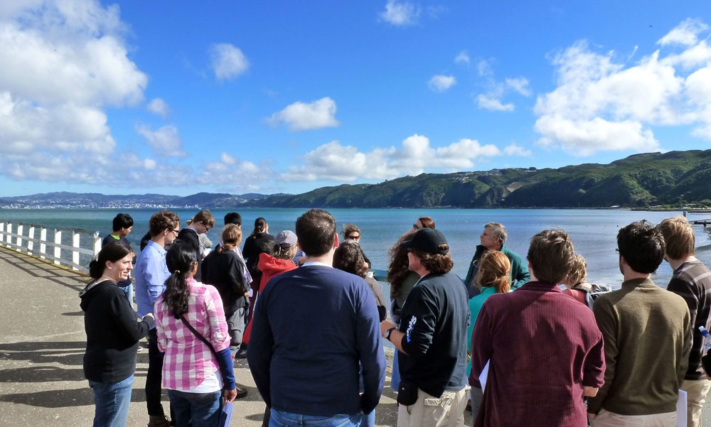
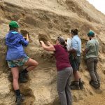
Figure 4. Students gathered around Nicola Litchfield and Tim Little at Petone Wharf – Upper Hutt. Major uplift of the Wellington Basin occured after the 1855 Wairarapa Earthquake.
Student Participation
20 students from the US, New Zealand, and the United Kingdom participated in the workshop. A student symposium was held the day before the workshop, on the campus of Victoria University in Wellington. A series of talks were given by some of the conveners and other invited scientists to introduce the students to the New Zealand subduction setting and outline the GeoPRISMS scientific goals. The students brought posters on their research which they each presented to the group in two minutes pop-up talks. The student presentations were extremely informative and polished. On the last day of the main workshop awards for poster presentation were given to 6 students (Best Overall Poster & Presentation: Katie Jacobs, Besim Dragovic, Melissa Rotella; Honorable Mention for Verbal Presentation: Laurel Childress; Honorable Mention for Poster Layout & Visual Aesthetics: James Muirhead, Simon Barker). After the student symposium, Tim Little (Victoria University) and Nicola Litchfield (GNS Science) led an outstanding fieldtrip to see the Wellington Fault (an active dextral strike-slip fault) at various locations throughout the Wellington region.
Overall, the extremely high level of engagement and input at the workshop by the students was impressive. On the final day, the students presented a well-organized implementation plan for the New Zealand Primary Site, which was a valuable guide in the crafting of the final implementation plan.
Concluding Remarks
We would like to thank the meeting attendees for their enthusiastic participation, which made the workshop a great success. We would also like to thank the speakers for the stimulating and informative talks, and the breakout leaders for their key role in steering discussions. The white paper authors made major contributions by sharing their ideas for future work, which have also provided an important resource for development of the draft implementation plan. The enthusiastic participation of the graduate students and post-docs was extremely impressive, and bodes well for the future of subduction studies in the New Zealand region. The draft implementation plan has been released for public comment, and should be finalized by the end of the year, if not sooner, well in time for the upcoming GeoPRISMS NSF deadline of July 1, 2014. Finally, a successful workshop would not have been possible without generous financial support from NSF/GeoPRISMS, the New Zealand Ministry for Business, Innovation and Employment, the Consortium for Ocean Leadership, GNS Science, and the New Zealand Earthquake Commission.
Report: Kermadec Arc-Havre Trough Planning Mini-Workshop
AGU Fall Meeting 2013, San Francisco, USA
1Oregon State University; 2University of Iowa; 3University of Maryland; 4GEOMAR, Germany
On Sunday December 8, 2013 a diverse group of international researchers gathered at the Grand Hyatt, San Francisco for a GeoPRISMS-sponsored Mini-Workshop aimed at advancing collaborative science within the Kermadec-Havre Trough system (KAHT), part of the SCD New Zealand Focus Site. This followed from the successful New Zealand Planning Workshop held in Wellington in April 2013. The primary goal of this Mini-Workshop was to bring representatives of international groups together to discuss recent results, review ongoing science plans, and to identify area for future work under the aegis of GeoPRISMS.
Following an introduction from the organizers and short presentations by NSF and GeoPRISMS representatives, a keynote presentation by Ian Smith, University of Auckland, provided background on the KAHT system as a classic intra-oceanic arc, and emphasized some of the key science opportunities such as progressive changes in convergence rate and continental contributions along strike from North to South, the significant proportion of felsic rocks that are present, and the possibility for studies of arc initiation in older preserved arc remnants.
These opportunities were also discussed and expanded on by reports from a number of international groups that are either already working in the region or that have well advanced plans. Most of these groups are actively seeking collaborators, reinforcing the potential of the KAHT system for driving multidisciplinary collaborative research. Kaj Hoernle (GEOMAR, Germany) discussed results for upcoming cruises aimed at understanding the inception and evolution of the Vitiaz Arc that was subsequently split into the Tonga-Kermadec and Lau-Colville Ridges. These ridges offer important targets for understanding the timing of initiation and evolution of the KAHT system – particularly in comparison with recent results from the Izu-Bonin-Mariana Arc (IBM) to the North. This point was also emphasized by Mark Reagan (U. of Iowa), who summarized advances in understanding of arc initiation in the IBM – and there may be close parallels between the KAHT and IBM. Yoshi Tamura (JAMSTEC) outlined ambitious plans for ROV studies of arc initiation, origin of basalts, caldera volcanism, and hydrothermal fluids associated with submarine volcanism within the KAHT. This proposed project would be conducted by a Japanese-led team of international researchers. Adam Kent (Oregon State U.) presented results provided by Richard Wysoczanski (NIWA, New Zealand) of sampling cruises to a number of submarine KAHT volcanoes as well as a number of regional and focused geophysical surveys. Many of these data sets will provide valuable for future selection of targets for detailed study. Erin Todd (USGS) discussed trace element and isotopic variations in dredged lavas from the Havre Trough – focusing on the interplay between tectonic and magmatic processes. Erin emphasized the importance of the KAHT for resolving the effects of melting styles, tectonic settings, and mantle thermal conditions on magma production during the rifting phase of backarc basin evolution.
These presentations were followed by a number of “pop up” talks – short presentations detailing other opportunities presented by KAHT research. These included Fernando Martinez (U. of Hawaii) discussing the large difference in spreading rates between the Lau Basin and Havre Trough. Samer Naif (Scripps Institution of Oceanography) described the potential for use of marine EM techniques and Dan Bassett (U. of Oxford) discussed the interplay between structure, mechanics, and seismicity. Jessica Warren (Stanford) detailed a global data base of abyssal and forearc peridotite compositions and Ken Rubin (U. of Hawaii) and Osama Ishizuka (GSJ/AIST) showed results from recent cruises to the northern Lau and the Tonga Trench respectively, that provided additional information on the range of mantle compositions and magmatic processes in the Kermadec-Tonga system.
The final part of the workshop was spent discussing future plans for KAHT research, with a consensus that the system offers many exciting new opportunities for international collaborative research.
Go to the Mini-Workshop webpage
Reference informationGeoPRISMS Newsletter, Issue No. 32, Spring 2014. Retrieved from http://geoprisms.nineplanetsllc.com

