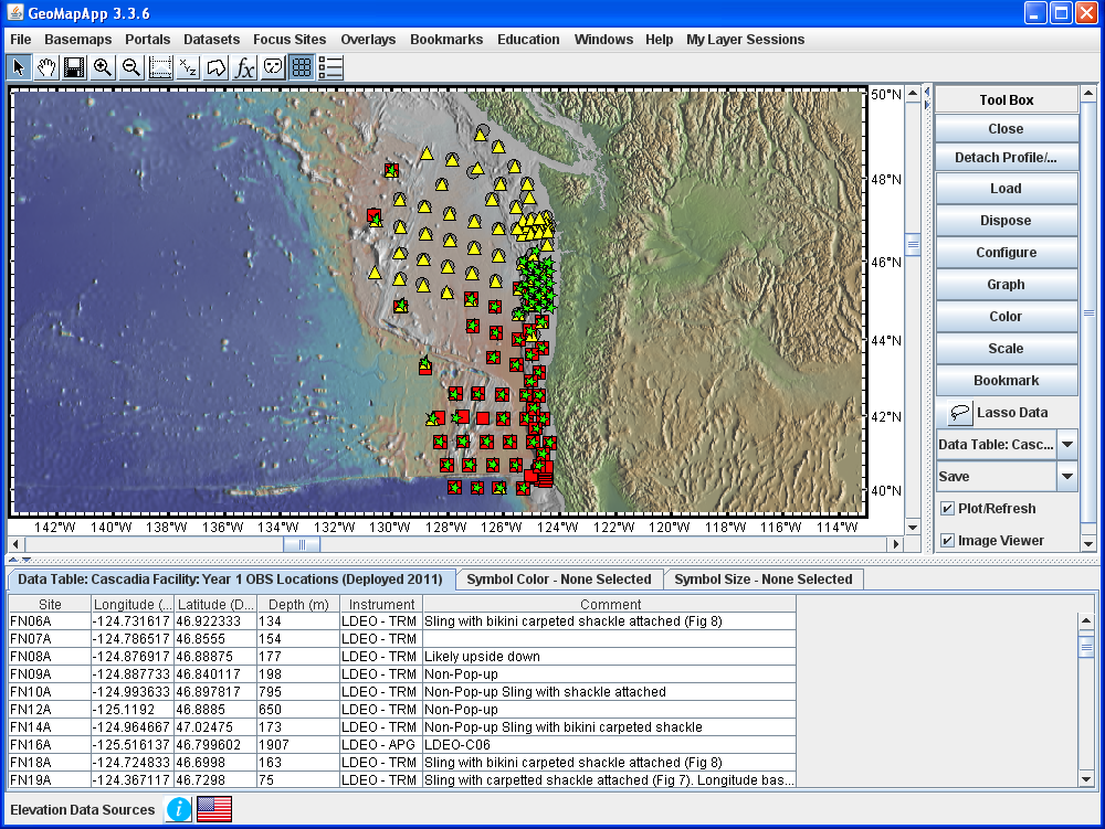
Figure 1. Four years of Cascadia Initiative OBS deployments covering much of the Juan de Fuca and Gorda plates along the Cascadia margin are plotted on the most recent bathymetry and land elevation compilation of the Global Multi-Resolution Topography synthesis. Grey circles – Year 1 surveyed-in OBS locations; red squares – year 2 best-available locations; yellow triangles and green stars – year 3 and year 4 planned OBS deployment locations, respectively.