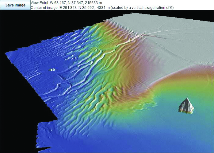
Figure 1. Centered upon a position near 68 deg W and 36 deg N and looking in a southwesterly direction, this perspective view of newly-acquired bathymetry data across the Hatteras Outer Ridge shows the fine detail of channels and wave forms on the ENAM continental rise and slope. Caryn Seamount in the lower right rises 2,000 m above the flat Atlantic seafloor. Artificial illumination is from the north and the imaged area measures about 300 km across.
Image made with GeoMapApp.