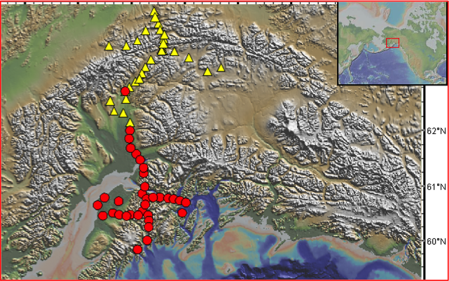
Figure 1. MOOS (red circles) and BEAAR (yellow triangles) instrument locations overlain on the GeoMapApp base map which comprises the high-resolution USGS NED land elevations model with the Global Multi-Resolution Topography synthesis of the oceans. When an instrument location is selected on the map, its record is highlighted in a table. The URL takes users to an IRIS station information web page.