Rebecca Bendick1, Mike Floyd2, Elias Lewi3, Gladys Kianji4, Robert King2, El Knappe1
1University of Montana, 2MIT, 3Addis Ababa University, 4University of Nairobi
The East African Rift System is a complicated set of extensional structures reaching from Malawi in the south to Eritrea and Djibouti in the north (Fig. 1)(e.g. Ebinger, 2005). These structures are broadly interpreted as the expression of the ongoing breakup of the African continent into a “Somali” block moving east or northeastward relative to a “Nubia” block, with perhaps additional smaller blocks (e.g. Saria et al., 2014) also involved. The details of the kinematics, the presence or importance of entrained microplates, and even the components of the force balance exciting relative block motions and extensional strains are all the subject of ongoing research and incompletely resolved scientific debates.
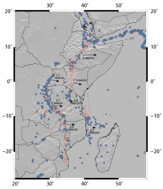
Figure 1. Overview of the EARS, with shaded topography in gray, major faults in red, recorded seismicity of Mw>5 as blue circles, and generalized kinematic velocities from Saria et al. (2014).
Several decades of geophysical and geologic research have contributed a large body of observational data related to the timing (Bosworth, 1992; Bosworth and Strecker, 1997; George et al., 1998; Wichura et al., 2010), chemistry (Aulbach et al., 2008; Bianchini et al., 2014; Chesley et al., 1999; Kaeser et al., 2009; Pik et al., 2006), mechanics (Buck, 2004; Calais et al., 2008; Corti et al., 2003; Weinstein et al., 2017), kinematics (Birhanu et al., 2015; Calais et al., 2008; Modisi et al., 2000; Saria et al., 2014), mantle involvement (Adams et al., 2012; Bastow et al., 2005; Bastow et al., 2008; Chang and Van der Lee, 2011; Fishwick, 2010; Hansen and Nyblade, 2013), magmatism (Bastow et al., 2010; Kendall et al., 2005) and natural hazards (Ayele, 2017) of continental extension in Africa. However, most of these studies are focused on a single “segment” of the larger rift system, hence on a distinct structural unit. Some work has been done to compare segments as a means of exploring the relative importance of contributing factors, such as the availability of fluids in magma-rich and magma-poor segments (Bialas et al., 2010; Hayward and Ebinger, 1996; Roecker et al., 2017; Rooney et al., 2011), the influence of total finite strain (Ebinger, 2005) on rift morphology, or the importance of sublithospheric plume impingement on the force balance (Ebinger and Sleep, 1998; Lin et al., 2005; Nyblade and Robinson, 1994). However, fully synoptic studies for the whole East African Rift System (EARS) are few in number.
A GeoPRISMS-supported collaboration between MIT and the University of Montana targeted the development of a comprehensive, consistent geodetic surface velocity solution for the entire EARS focus area (Fig. 2). This effort included several components:
- Collection of all publically available raw GPS observations from East Africa from 1992 to 2015;
- Negotiation for the release and inclusion of several additional restricted GPS observation data sets from European and African sources;
- Compilation and verification of all related metadata;
- Systematic assessment and quality control on all available data sets; and
- Processing of the merged data sets with a consistent processing strategy and reference frame.
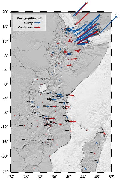
Figure 2. The most recent community geodetic solution, using all available raw data from the EARS region, processed using GAMIT/GLOBK with a consistent quality standard and editing approach, in a single common reference frame. This solution, data sources, and relevant metadata are available from the GeoPRISMS data portal at http://www.marine-geo.org with doi:10.1594/IEDA/321764
The supported work addresses the GeoPRISMS Rift Initiation and Evolution (RIE) goal of synthesis, especially in the context of multiscale mechanics and controls on deformation and localization of strain.
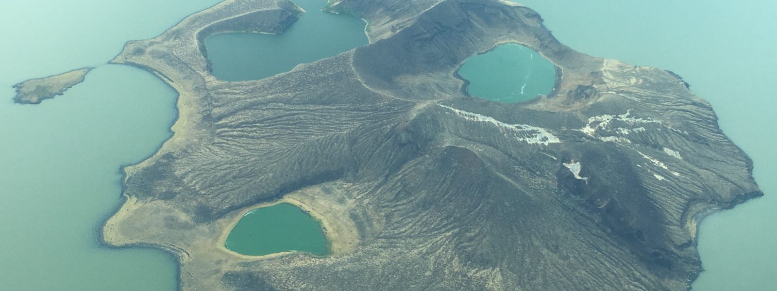
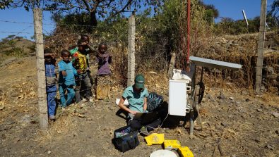
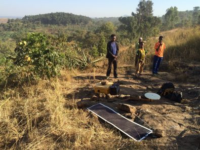
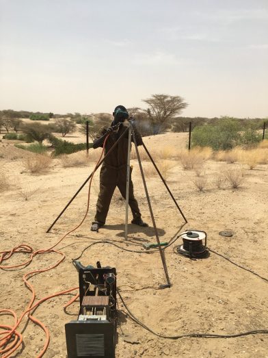
During the period of support for this experiment, we also leveraged the NSF funding to invest in permanent geodetic instrumentation in Ethiopia and add new observations in the Turkana Depression of Ethiopia and Kenya, the part of the EARS with the fewest prior geodetic observations. In the first case, we extended operations of a previously-funded Ethiopian Highlands continuous GPS network for an additional year. That year allowed Addis Ababa University and the University of Montana to negotiate with several different stakeholders in the U.S. and Africa, with the end result that the Institute of Geophysics, Space Science, and Astronomy of Addis Ababa University adopted a fully operational, scientific-grade geodetic network of ten sites for permanent ongoing observations (Fig. 3). The network became the largest entirely African owned and operated geophysical system, and maintains operations and a fully open data policy to the present. In the second case, we added an additional epoch of campaign observations on six campaign GPS sites (Fig. 4) and added two continuous GPS systems in the Turkana Depression (Fig. 5). The continuous sites are located on either side of Lake Turkana and are hosted by the Turkana Basin Institute, a nonprofit entity supporting research through the region.
The primary purposes of the project were scientific and infrastructural capacity-building. The synoptic geodetic velocity field is intended for use by a wide range of researchers in many different disciplines within the rifting initiative and the EARS focus area. Many users will likely leverage the kinematic framework as boundary conditions, a priori constraints, or tectonic context for more focused studies without having to address data collection, standardization, quality control, metadata management, or processing strategies. We hope that the solution will inform other work and serve as an example of the value of a community commitment to open sharing of high-quality observations. In addition, the successful adoption of the instrumental array by African scientists sets a precedent for negotiated transfers of other instruments and capabilities throughout the region. African researchers and institutions can and should use such combinations of infrastructure and technical skills to pursue their own novel scientific targets and build indigenous training capabilities. Finally, the new Turkana Basin continuous sites are approaching a full year of operation, and will begin to yield usable scientific constraints on the most enigmatic part of the EARS very soon. ■
Reference information

