AGU Fall Meeting 2015, San Francisco, USA
1University of Montana, 2Imperial College London, 3Michigan State University, 4Univ. Texas Institute for Geophysics, UT-Austin, 5New Mexico Tech
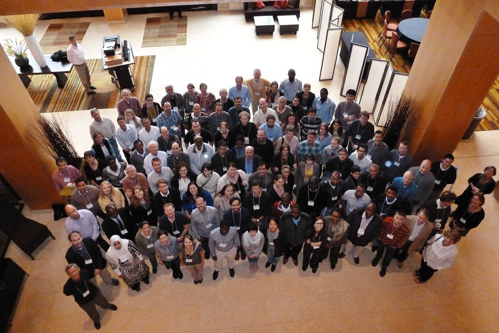
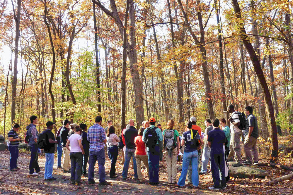
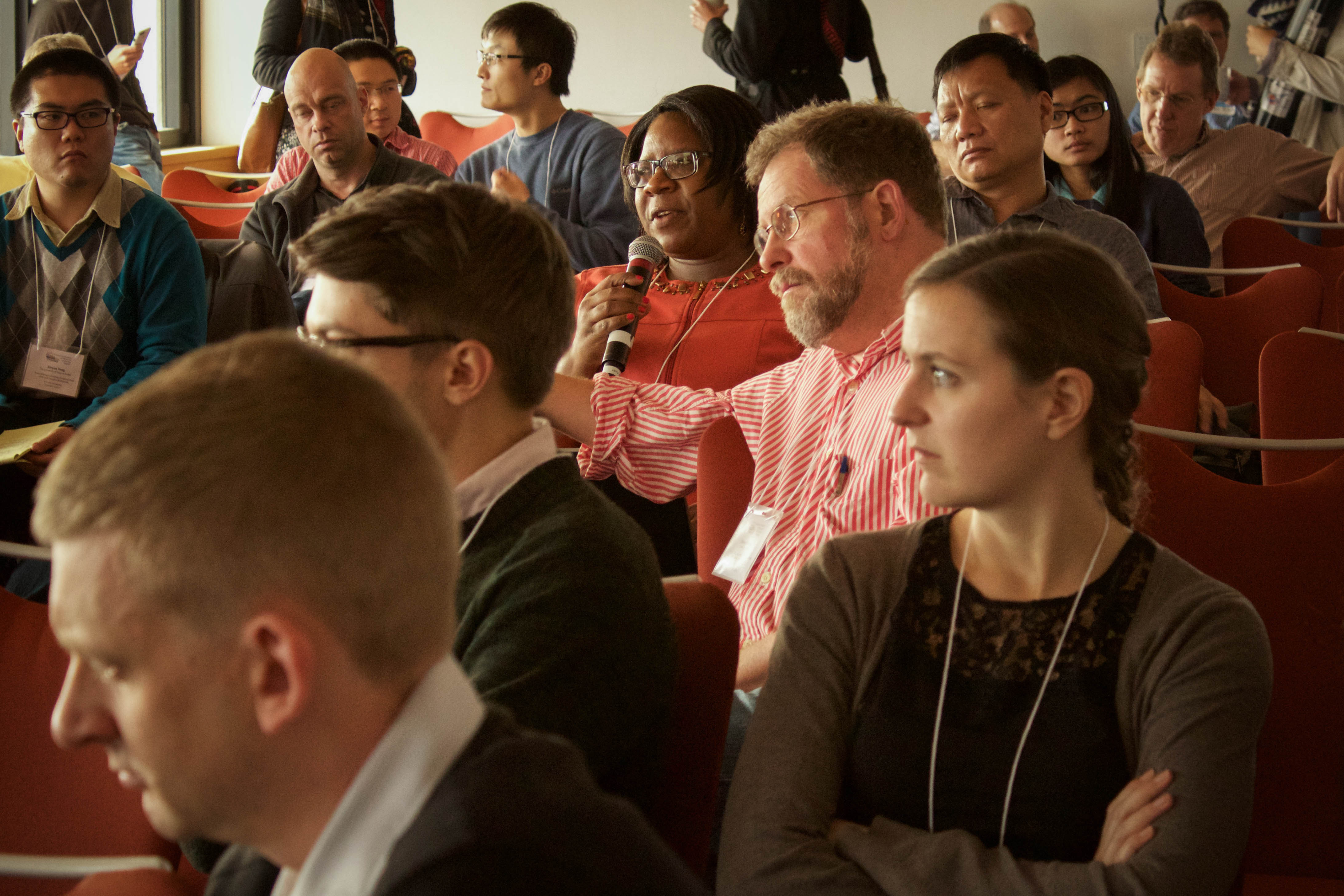
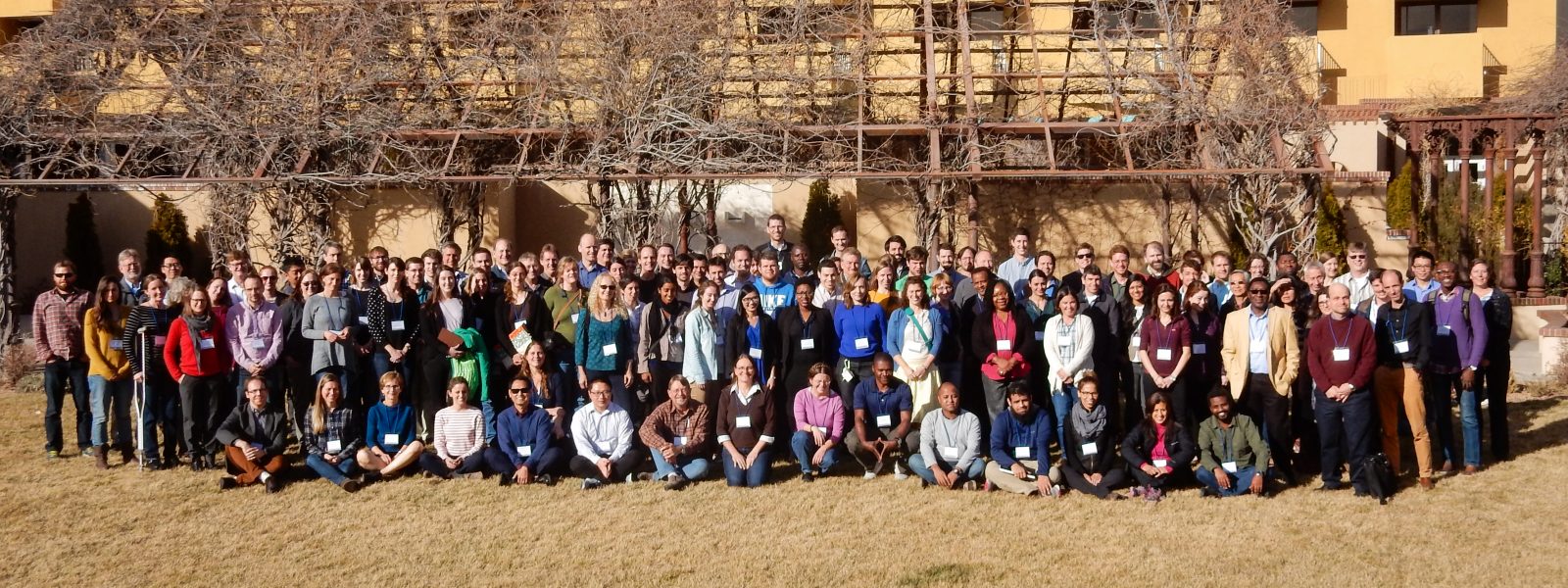
On Sunday December 13, 2015, from 8am to 1:30pm, a representative cross section of researchers interested in rifting met in the Grand Hyatt San Francisco before the AGU Fall Meeting. Our primary focus was to facilitate discussion on the current state of research into continental extension. Our aim was to be broadly inclusive by bringing an audience with widely varying backgrounds to a common understanding of the state of the art in this field. Our ultimate goal was to initiate a discussion on future research challenges for the community and how these challenges align with the existing science plans for the GeoPRISMS Eastern North America and East African Rift Focus Sites. To facilitate community building and cross disciplinary linkages, the meeting was coordinated with the STEPPE consortium (Sedimentary Geology, Time, Environment, Paleontology, Paleoclimatology, Energy) workshop investigating source-to-sink processes of the Lake Tanganyika rift (East Africa), which took place directly following the GeoPRISMS workshop from 2 to 8pm.
The meeting was structured to allow for discussion under four broad subheadings:
Topic 1: Melt Generation in Extensional Environments
A 30 minute introduction to this topic was presented by Tyrone Rooney. The talk covered the historical context of rifting studies and then focused on the relationship between magma and lithospheric strength. The concept of magma within the lithosphere facilitating rifting was introduced. The presentation examined how magmas provide an important temporal record of mantle processes during extension. It was shown how thermochemical constraints of the upper mantle source region of rift magmas could be probed with erupted lavas. In particular, the dual challenges of mantle potential temperature and pyroxenites in the upper mantle were highlighted as important frontiers in our understanding of mantle melting processes. The role of volatiles in some rifting environments (Rio Grande Rift) was introduced. The role of magmas in influencing seismic images of the upper mantle and also acting as a mechanism of strain accommodation during late stage rifting was also discussed. Finally, an examination of the continental lithospheric mantle as a possible magma source was also presented.
The discussion, moderated by Harm van Avendonk, first explored the issue of the role of water in magma generation processes. In particular, there were questions asked about the storage of water in water-bearing phases but also the ability of olivine to store volatiles. Further discussions continued on the role of hydrous phases on lithospheric rheology. The first key question arising from these discussion was – where could volatiles reside and how much in the source of rift magmas (especially water and carbon dioxide). Suggestions on approaching this question through studies of xenoliths and reconstructing lithospheric architecture were made. The second key question focused on the role of structural inheritance. It was acknowledged that crustal heterogeneity and mantle lithosphere heterogeneity may not necessarily correspond. Finally the third key question related to the amount of melt generation with the timing and magnitude of stretching.
From rifting to drifting: evidence from rifts and margins worldwide | December 13 AGU 2015
Topic 2: Magma-lithosphere interaction
A 30 minute introduction to this topic was presented by Chris Havlin. This presentation first delivered an overview of the physics and thermodynamics of melt transport. This was further subdivided on the basis of porous flow within the mantle and lithosphere and in terms of crustal fractures and channels and how lithospheric inheritance influenced melt transport. The porous flow concept was expanded to examine the dependence on pressure gradients, buoyancy and dynamic pressure. The concept of a ‘freezing boundary’ was raised in terms of a melt focusing mechanism, which if dipping, could redistribute melt. Within the lithosphere the concept of lithospheric and crustal fabrics was raised. It was acknowledged that grain size may affect porosity and surface tension. As a result, melt is preferentially directed into smaller grain size domains. The presentation also examined end-member models of strain i.e. whole lithospheric heating, and basal heating and impact of the porosity front shallowing over time creating an effective thinning of the lithosphere. Finally, it was shown that there could be a growing zone of modified lithosphere whereby mechanically it behaves as does the asthenosphere but chemically it may still resemble the lithospheric mantle.
The discussion, moderated by Ian Bastow, first examined the concept of the background state of stress in rifting environments and how stress may change with changes in viscosity. It was noted that thinning does not require large extensional stresses. A point was raised on the competing grain size effects on porosity and surface area in relation to bulk permeability. Questions were raised by the group as what happens in relation to thinning and melt alteration of the lithosphere in seemingly amagmatic rift segments. It was acknowledged, however, that segments defined as amagmatic due to a lack of surface volcanism may still possess significant melt at depth within the lithosphere. As a result of these discussions, two key questions arose: (1) What is the role of melt in magmatic and amagmatic (in terms of surface volcanism) rift segments? and (2) What are the feedbacks between melt transport and lithospheric thinning and what are the mechanisms?
Topic 3: Stretching the lithosphere
A 30+ minute introduction to this topic was presented by Suzon Jammes. The presentation first examined the concept of mechanical stretching and the genetic relationship of stretching as an important factor in the Wilson Cycle. The factors controlling this mechanical stretching focused on exhumation, tectonic inheritance, and the control of rift and margin architecture. The topic of depth-dependant stretching was examined and how vertical decoupling was incompatible with pure and simple shear endmembers. An introduction to time-dependant stretching mechanisms followed with some idealized cross section of basinward migration of deformation. Dr. Jammes presented an evolutionary model whereby mechanical stretching was followed by the creation of a ‘necking zone’ for major crustal thinning and finally an exhumation phase. The discussion continued into a discussion of how rifting processes are determined by rheological layering of the lithosphere and the impact of structural inheritance and sensitivity to this vertical layering.
The discussion, moderated by Rebecca Bendick, was more limited due to time constraints but did establish a key question of how the feedbacks with melting might vary in terms of the recognized global variety of architectures of rifts and rifted margins.
Topic 4: Melt delivery and focusing
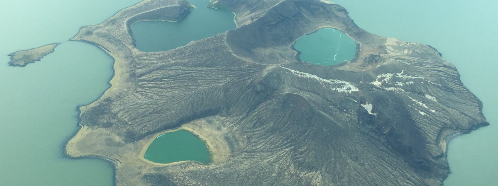
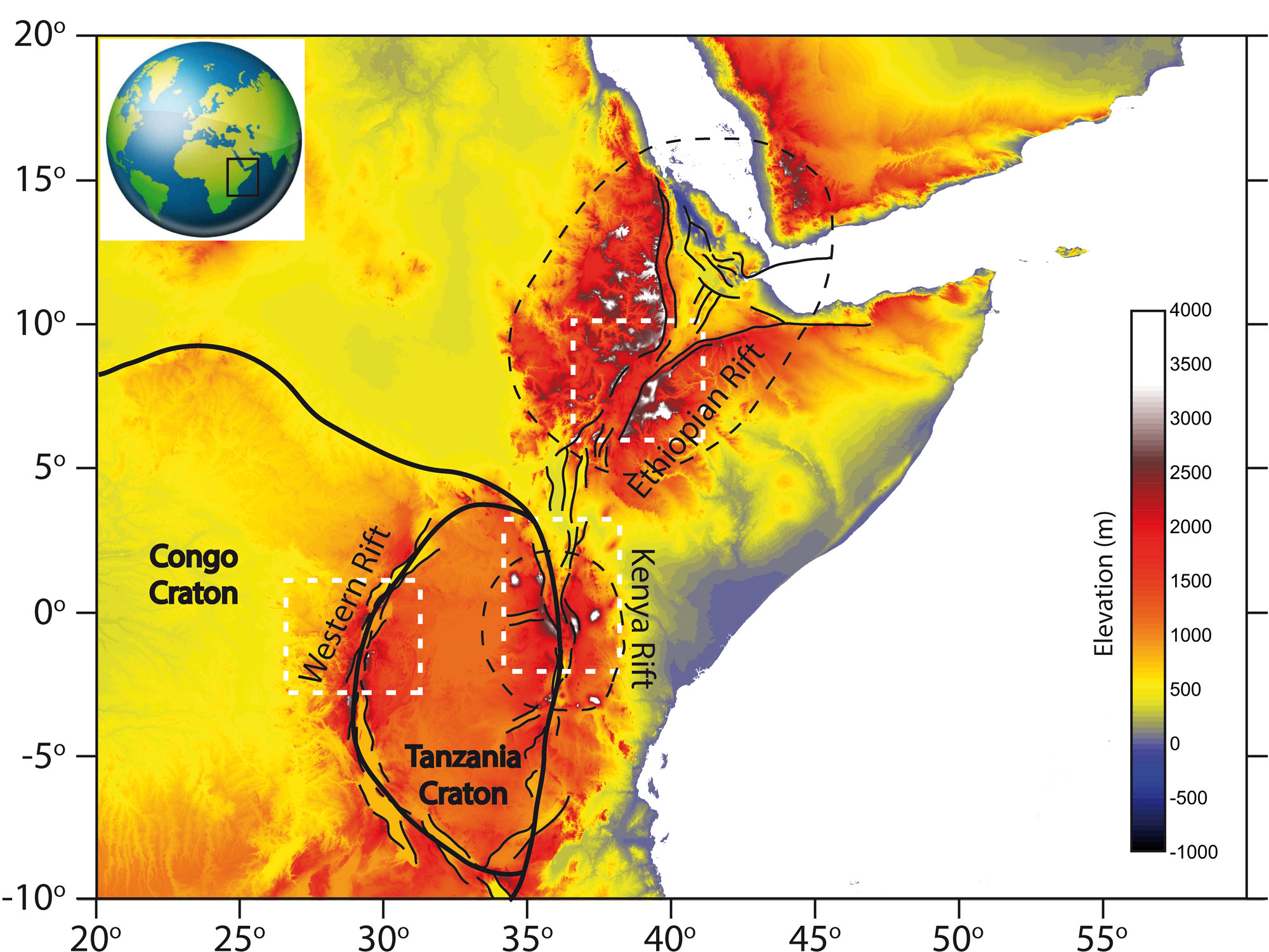
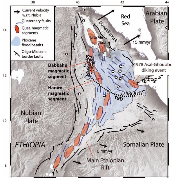
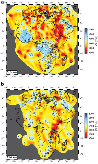
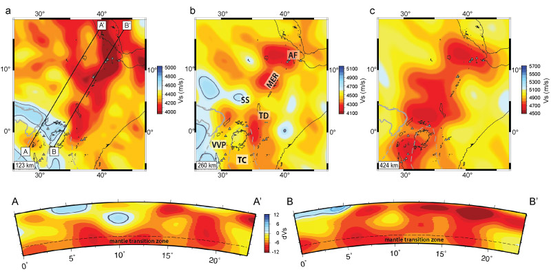
A 30 minute introduction to this topic was presented by Derek Keir. Dr. Keir showed how within the East African Rift changes in mantle potential temperature are probable first order controls on magma supply. It was also shown how variations in magmatism are multi-scalar with lateral variation at several scales both in the presence and absence of melt and melt chemistry. There was a view that melt pathways and focusing might represent the best mechanism for generating smaller scale variability and examples from the Black Sea and Afar were shown. Afar provided a particularly interesting case as in this region it was show that volcanism responded to increasing subsidence. That is, the more the thinning, the more melt and thus more melt focusing. Dr. Keir showed how a mantle potential temperature anomaly of at least 100 degrees could help explain observed seismic velocities and also the presence of melt throughout the region. A comparison was made between Afar and slow spreading ridges and also to Krafla (Iceland) between 1975 and 1984. The discussion continued as to the impact of melt focusing in time and space and how it is influenced by the temporal accumulations of tectonic stresses. The result of this was described as a general migration of volcanism from the rift flanks towards the rift axis with the competing tectonic and gravitational stresses.
The discussion, moderated by Jolante van Wijk, examined comparisons between the Havlin models discussed in topic 2 and those presented by Keir in topic 4. Some discussion centered on the concept of focusing at the lithosphere-asthenosphere boundary and then subsequent defocusing within the crust. It was acknowledged that geochemical data were critical to address these issues. It was noted that magmatic sources clearly differ along strike within the rift and thus are inconsistent with a single centralized source.
From rifting to drifting: evidence from rifts and margins worldwide | December 13 AGU 2015
Broad discussion
Following a break, the group reconvened to try and systematize some of the key concepts raised. The issues can be summarized as follows:
1. Rift Initiation
What is the role of mantle plumes?
How can mechanical heterogeneity facilitate initial rifting?
What role does chemical heterogeneity in the lithospheric mantle control initial extension?
What is the initial thermo-chemical structure of the lithosphere and asthenosphere in a nascent rift?
What does incipient rifting look like? Okavango suggests preexisting structure critical.
Is this a top down or bottom up process? How does extension propagate?
2. Evolution of rifting in time and space
Why do rifts ultimately fail?
What is the role of nonlinear feedbacks?
How can datasets from igneous petrology and the sedimentary record provide a temporal insight into rift evolution?
What is the time evolution of strain?
3. Rift Architecture
How do non-uniqueness issues create difficulties in creating global models of rift evolution?
How can real constrains be linked with ever more innovative and detailed simulations?
What variables control the strength of the lithosphere?
What is the role of far-field vs. local controls on strain and rift evolution?
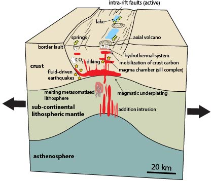
4. Volatiles in extensional environments
What are the volatile pathways from depth to the surface?
How deep are the volatiles derived from?
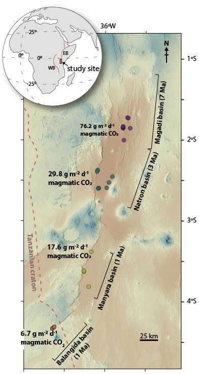
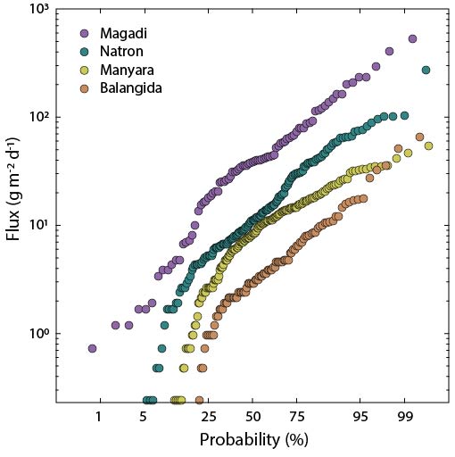
What is the role of rift valley volcanoes in global production of volatiles (e.g., CO2, SO2)?
How can lithospheric heterogeneity and inheritance influence the volatile budget?
In summary the basic concepts on which the group agreed that were critical for GeoPRISMS were:
- What is the history of melt? Where is it formed, when is it formed, why is it formed, how is it focused, and what pathways does it take through the lithosphere?
- What is the material (thermal and chemical) heterogeneity in the rift lithosphere? How does inheritance play a role, is there spatial organization at play, and how can we assess the importance of these heterogeneities to rifting?
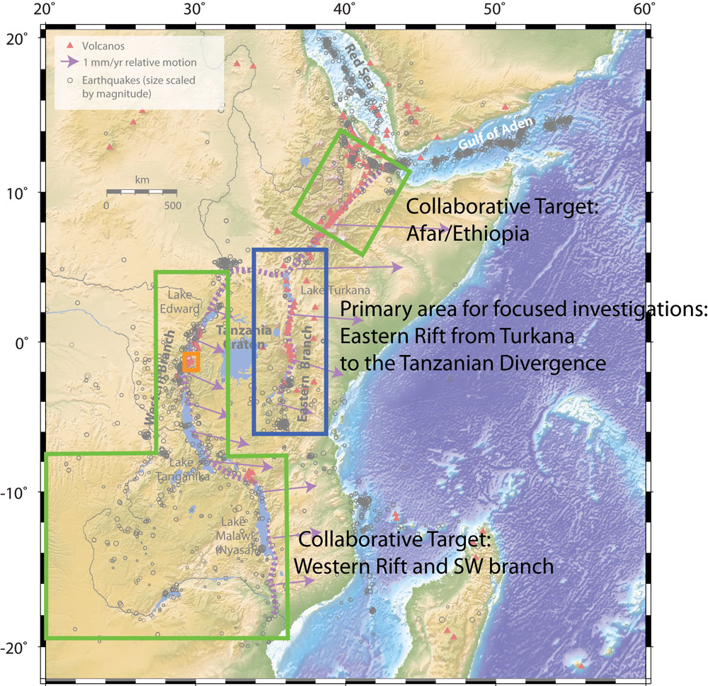
- Comparison of focus areas is needed. How do ENAM and the EAR differ and how are they similar? What can be learned from focused studies at both sites?
Go to the Mini-Workshop webpage
Reference information
GeoPRISMS Newsletter, Issue No. 36, Spring 2016. Retrieved from http://geoprisms.nineplanetsllc.com


")