Data, Science, and Education & Outreach Legacy Products


  Grand Hyatt Union Square, San Francisco
2nd Floor, Belvedere Room

 icon-calendar 
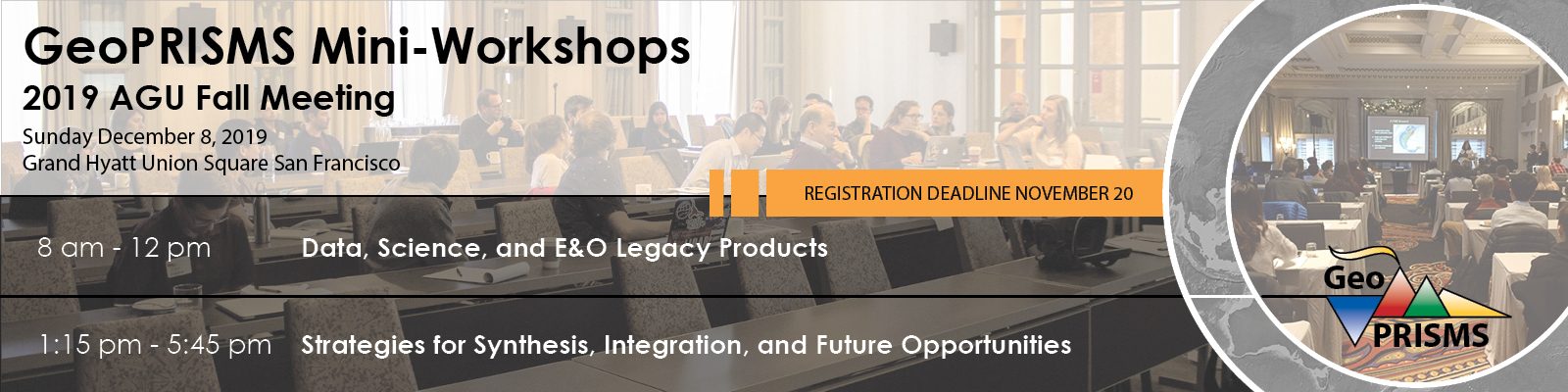
Sunday December 8, 2019, 8 AM – 12:00 PM

Conveners: Andrew Goodwillie, Anaïs Férot, Rebecca Bendick, Jessica Warren, Demian Saffer

 icon-file-text-o Participant list

 icon-file-text-o Meeting agenda

AgendaMeeting objectives

7:45 AM | Breakfast served in the Belvedere foyer, 2nd floor

8:00 AM | Welcome from GeoPRISMS Office and news from NSF (Anaïs Ferot, Jenn Wade)

8:15 – 8:45 | Presentations

  • Data Legacy: Geochemistry and physical samples (Kerstin Lehnert)
  • Data Legacy: Geophysical facility data (Dave Phillips)
  • Data Legacy: GeoPRISMS Data Portal (Andrew Goodwillie)

8:45 – 9:00 | Introduction & Charge to Discussion Groups

The overarching goal is to prepare the community to make plans for the 2020 NSF-funded Data Legacy Workshop, write proposals to develop E&O and science legacy products.

9:00 – 10:15  | Breakout Discussions

  1. Data Legacy (Sarah Stamps, Kelly Olsen)
  2. Science and Education & Outreach Legacy Products (Madison Myers, Helen Janiszewski)

10:15 – 10:30 | Coffee Break

10:30 – 12:00 PM  | Breakout report-outs & plenary discussion

12:00 PM | Lunch to be provided (OneUP Lounge, Mezzanine Level)

Goal

This GeoPRISMS-sponsored, pre-AGU mini-workshop is designed to encourage participants to identify and prioritize the challenges and opportunities associated with establishing a lasting GeoPRISMS data legacy. The outcomes from this mini-workshop will help to inform a larger NSF-funded workshop to be held at Lamont-Doherty Earth Observatory in springtime 2020 with the goal of developing a consensus and best practices for building a lasting legacy for all GeoPRISMS data.

Introduction

The NSF-funded GeoPRISMS program is nearing the end of its decadal lifespan. Funded through more than 120 proposals and focused upon five primary shoreline-crossing field areas around the globe, GeoPRISMS researchers have collected and generated a plethora of diverse data, from the field, from the lab, and from numerical models. The data sets cover a remarkably wide range of data types reflecting the interdisciplinary nature of the GeoPRISMS projects and community.

Issues

Whilst published journal articles are widely-recognized as a permanent, formal record of GeoPRISMS-funded research, the state of a comprehensive GeoPRISMS data legacy is not so clear. This must be solved because individual data sets are often unique due to the expensive facilities and instruments used to acquire them, to the remote and sometimes very challenging conditions of many of the study areas, and, in some cases, to the non-repeatable nature of the data efforts.

Although some data sets are already well-positioned in NSF-approved domain-specific data repositories, there are questions and challenges that must be addressed to ensure a lasting, robust, well-documented and easily accessible legacy for all GeoPRISMS data. For example, what is to happen to the many physical samples that have been collected, often in harsh environments, since there currently exists no central community repository or curatorial structure? What about data sets not yet in repositories, or multiple versions of data sets, or processed data sets? Or data sets from GeoPRISMS projects that may be available only as a data supplement to a journal article that is hidden behind a publisher’s paywall? And, how stable are data links on the GeoPRISMS website, and what is the best long-term hosting solution for the website.

Strategies for Synthesis, Integration, and Future Opportunities


  Grand Hyatt Union Square, San Francisco
2nd Floor, Belvedere Room

 icon-calendar Sunday December 8, 2019, 1:15 PM – 5:45 PM

Conveners: The GeoPRISMS Steering and Oversight Committee – Becky Bell, Rebecca Bendick, Daniel Brothers, Mark Caddick, Char Deering, Katie Keranen, Luc Lavier, Rob Harris, Emily Roland, Kyle Straub, Jessica Warren, Demian Saffer

 icon-file-text-o Participant list

 icon-file-text-o Meeting agenda

AgendaMeeting objectives

12:00 – 1:15PM | Lunch to be provided (OneUP Lounge, Mezzanine Level)

1:15 – 1:30 | Welcome from GeoPRISMS Office and news from NSF (Demian Saffer, Jenn Wade)

1:30 – 1:45 | Welcome, Introduction & Charge to Discussion Groups (Demian Saffer)

Overarching goal is to prepare community to write proposals for longer term workshops/studies, and for future opportunities in research and E&O.

1:45-2:00 | Example of recent synthesis workshop – strategies & outcomes (Terry Plank)

2:00 – 3:30 | Breakout Discussions

  1. Strain localization and evolution of plate boundaries (Sarah Jaye Oliva; Erin Hightower)
  2. Linking geophysical imaging to active composition/state/properties (Andrew Gase; Cailey Condit)
  3. Fluids/metamorphism/rheology & exhumed records of plate margins (Andy Smye; Kayleigh Harvey)
  4. Fluid and volatile migration (James Muirhead; Suzanne Birner)
  5. Feedbacks between tectonic deformation and magmatism (John Green; Luc Lavier)
  6. The pace and mechanics of magma supply (Dan Rasmussen; Chad Deering)
  7. From slow slip to mega-earthquakes (Hiroko Kitajima; Connor Drooff)
  8. Coupling geodynamics and surface processes; geohazards on passive-aggressive margins (Tina Dura)

3:30 – 4:00 | Coffee Break

4:00-5:30 | Breakout report-outs & plenary discussion

  • Identify common themes and needs
  • Discuss strategy and timeline for implementing next steps: workshop proposal “packages”, products to be developed, etc…

5:45 | Adjourn for Evening Celebration, light catering & Cash Bar (Bayview Room, 36th Floor)

The goal of the workshop is to harness momentum from the large synthesis & integration workshop that took place in San Antonio in February 2019, and in particular to develop strategies for engaging the community in fundamental science that builds upon the last two decades of the GeoPRISMS and MARGINS programs. Unlike many of the previous GeoPRISMS workshop events, this gathering is planned as a “working meeting”, from which we hope to emerge with a clear set of planned activities and/or proposals for future small, focused workshops; science proposals that can/should be pursued; key needs for synthesis and integration and plans to implement these; and synthesis or integration products that tie together science in thematic areas.

ExTerra: Evolution of arc crust


  Kimpton Hotel Monaco
700 F Street NW, Washington, DC 20004
Athens Room
 icon-calendar Sunday December 9, 2018, 8:00 AM – 12:15 PM

Conveners: Stacia Gordon and Alicia Cruz-Uribe

 icon-file-text-o Participant list

 icon-file-text-o Agenda

AgendaMeeting objectivesMeeting report

8-8:45 | Social Hour (Coffee, pastries, registration)

8:45-9 | Welcome & Introduction (GeoPRISMS Office Chair Demian Saffer and Mini-Workshop Conveners Stacia Gordon and Alicia Cruz-Uribe)

9-9:45 | Keynote (Oliver Jagoutz)

9:45-10:45 | Breakout discussions (4 groups)

  • What are the outstanding questions that can be addressed?
  • How can we better integrate field studies with experimental and modeling approaches?
  • What data and meta-data do we need to collect and store?
  • How can we make data and samples accessible to all?

10:45-11 | Coffee break

11-12 | Group reports/group discussion

12-12:15 | Wrap Up

Inspired by the success of convergent margin research funded through GeoPRISMS and discussions generated at ExTerra meetings, this workshop will gather together researchers with expertise in all aspects of the arc system on the Sunday preceding the AGU Fall Meeting in Washington, DC. The goal is to gather a broad group of geoscientists that use a variety of different approaches (field, experimental, petrological, geochemical, geochronological, seismic, numerical modeling) applied to different parts of the arc (the subducting plate, mantle, magma plumbing system, supracrustal rocks). The group will discuss what the major questions are that still surround the evolution of arc crust and what tools and methods will best answer these questions. The meeting will also serve to provide a space where early career researchers can network with more senior personnel, and where scientists from a variety of subdisciplines who work on different arc sections around the world can compare and contrast observations. In addition, this gathering of the  arc crust community will make a plan for future convergent margin research, specifically on arc crust. It is important to establish new goals and questions concerning arc crust before GeoPRISMS has fully ended to keep the momentum that this program established.

The format of the workshop will include a keynote lecture given by Oliver Jagoutz (MIT), followed by breakout groups on different areas of scientific interest within the broader arc system: 1) subduction/mantle influences, 2) plutonic plumbing system/magma storage, 3) volcanic components, and 4) supracrustal (metamorphic) components. One proposed outcome of the workshop will be for multiple groups to develop collaborative proposals to NSF EAR programs for research and field forums/institutes, which could then be leveraged for the submission of a larger proposal.

ExTerra: Evolution of Arc Crust
Sunday December 9th, 2018, AGU Fall Meeting, Washington D.C.

Workshop Leaders: Stacia Gordon (University of Nevada-Reno), Alicia Cruz-Uribe (University of Maine)

On Sunday, December 9th, 34 scientists from a variety of institutions from the US and abroad gathered in Washington, D.C. prior to the start of the fall AGU Meeting to discuss arc systems and, in particular, the major questions that still surround the evolution of arc crust and the tools and methods that will best answer these questions. With the nearing end of GeoPRISMS, the workshop built upon the energy of this program and the discussions and questions that it has opened. In addition to GeoPRISMS, the workshop was also motivated by ExTerra, a group within the Geoscience community that studies Exhumed Terranes. The ExTerra community has had multiple workshops on exhumed terranes in general, and scientific questions concerning what can be learned from exhumed crustal arc sections have been included within the overall ExTerra framework. In addition, a 2016 ExTerra White Paper laid out a broad array of research themes linked to exhumed terranes. This GeoPRIMS workshop was intended to take the ExTerra White Paper one-step further by having a focused workshop for the part of the ExTerra community particularly interested in arc systems.
To start the workshop, GeoPRISMS Chair Demian Shaffer gave a brief introduction to familiarize the attendees with the GeoPRISMS program. Sarah Penniston-Dorland and Maureen Feineman, lead organizers of ExTerra and PIs on a ExTerra Field Institute and Research Endeavor grant, summarized the goals of the ExTerra program and the recent success in obtaining funding for a highly collaborative, multiple PI project through the NSF PIRE program. Subsequently, workshop leaders Stacia Gordon and Alicia Cruz-Uribe presented 1) overview ideas of all the different parts of the arc system (from the subducting plate to the volcanic components) that combined provide critical details on the evolution of arc crust; and 2) some of the major questions concerning arc systems that had been included in past white papers. Finally, to stimulate ideas and lead into group discussions, Oliver Jagoutz (MIT) and his PhD student, Benjamin Klein, presented a keynote talk on their geochemical, geochronological, and structural results from mainly the Sierra Nevada batholith and the Kohistan Arc, and the knowledge that has been gained about arc crust through these exhumed terranes.

The main goal of the workshop was to create an environment in which there was significant discussion, where all participants felt comfortable sharing their opinions, and to provide a networking opportunity for junior scientists to interact with and meet many senior personnel. To do this, after the introductory activities described above, the attendees divided into four groups based on different areas of scientific interest within the broader arc system. Junior scientists were charged with leading the discussion and recording notes, including Emily Chin (UCSD) for the subduction/mantle interface group; Barbara Ratschbacher (Cal Tech) for the plutonic plumbing system; Martin Jutzeler (U. of Tasmania) for the volcanic components; and Besim Dragovic (Boise State) for the metamorphic components. The workshop leaders provided topics for the groups to discuss, including outstanding scientific questions, what data and samples are needed, etc.

Subsequently, the group leaders gave a summary to the overall group. The subduction/mantle interface group reported that there are still many questions concerning what processes and properties control the stress state of the down going slab and the role of volatiles (other than H2O) in subduction zones. The plutonic group discussed major questions about how magma transport, ascent and emplacement mechanism vary with depth and how is space created during the movement of magma. The volcanic group presented questions on how can we estimate eruption periodicity and the processes controlling eruptions as well as what are the roles of pre-existing crustal thickness and the local stress field on the style and kinds of volcanism. The metamorphic group focused on the arc crustal section and asked what is the distribution of water, and how do oxygen fugacity and the thermal structure change throughout the arc crustal section and through time.

In the larger group, two main topics were discussed after the subgroup leaders gave their summaries: 1) whether or not to have a focus site for arc crust research, and 2) the best way to move forward and promote ExTerra and the arc crust community. In general, it seemed like most were opposed to choosing one field locality, as it is difficult to choose one arc crustal terrane that would be the ‘best’ for answering the questions that the subgroups discussed. In addition, focus sites can sometimes exclude and limit the number of scientists involved in a project. To follow this workshop, the larger group discussed several possibilities of how to proceed in terms of moving forward with writing proposals and securing funding for arc crust research. Most were not in favor of a field institute for the same reasons as the focus site described above. Instead, a larger meeting targeting the arc crust community was proposed as potentially the best mechanism to show NSF and other funding agencies that the arc crust community consists of a large number of scientists that are organized and have specific questions and hypotheses that have implications for a variety of different Geoscience subdisciplines. The group discussed that this next meeting could be a CIDER-type workshop that would involve both faculty and students.

In summary, a large number of graduate students, postdocs, and early career faculty members were in attendance and were able to network with a variety of US and international scientists at all different stages of their career. Feedback from student participants indicated that the opportunity to participate in the workshop, and in many cases meet scientists whom they knew only through reading their papers, was invaluable for them. Many important questions concerning the evolution of arc crust were discussed, and many of the students, postdocs, and junior faculty expressed interest in being involved in future events surrounding arc crust. The workshop leaders will encourage these junior scientists to take the lead on developing proposals and on being part of planning for a CIDER-type workshop.

Investigating subduction processes at the Hikurangi margin, New Zealand


  Kimpton Hotel Monaco
700 F Street NW, Washington, DC 20004
Athens Room

 icon-calendar Sunday December 9, 2018, 1:15 PM – 5:30 PM

Conveners: Laura Wallace, Dan Bassett, Heather Savage, Samer Naif, Shuoshuo Han , Patrick Fulton

 icon-file-text-o Participant list

 icon-file-text-o Agenda

AgendaMeeting objectivesMeeting report

1:15pm | Welcome & Introductory Remarks – GeoPRISMS Chair Demian Saffer

Session 1 – Integrating observations from an unprecedented summer research at Hikurangi

1:20 – 1:35 | Paleoseismic constraints on past earthquake behaviour – Jamie Howarth

1:35 – 1:50 | Summary of IODP Exp 372/375 – Demian Saffer

1:50 – 2:05 | Summary of NZ3D – Nathan Bangs (MCS) and  Ryuta Arai and Becky Bell (wide-angle)

2:05 – 2:20 | Summary of SHIRE – Harm van Avendonk (offshore) and  Stuart Henrys (onshore)

2:20 – 2:35 | Parallels between Alaska and the Hikurangi margin, and synergies with activities at the Alaska Primary Site – Donna Shillington

2:35 – 3:15 | Discussion of implications for the physical controls on subduction processes

– Structure around SCD key questions, processes or domains (e.g. incoming plate, forearc, megathrust)

3:15 – 3:30 | Coffee break

Session 2 – Future plans

3:30 – 3:45 | Seafloor Observatory installation and plans for ongoing seafloor geodesy and seismology – Laura Wallace

3:45 – 4:00 | SAFFRONZ project and the interplay between hydrogeology and slow slip – Evan Solomon

4:00 – 4:15 | CSEM and MT as a window into hydrogeology – Samer Naif (offshore) and Wiebke Heise (onshore)

4:15 – 4:35 | Space for 2 minute (1 slide) pop-up talks summarizing other synergistic activities

4:35 – 5:15 | Open Discussion

– What gaps in data/knowledge remain? What additional work needs to be done?

The Hikurangi margin offers an outstanding opportunity to address many of the key topics of GeoPRISMS Subduction Cycles and Deformation. Major international experiments to investigate subduction processes at the Hikurangi margin have taken place in the last year including two IODP drilling expeditions to investigate shallow slow slip events, and two seismic experiments with the R/V Langseth and R/V Tangaroa to investigate controls on plate coupling and slow slip.  The objectives of a Hikurangi margin mini-workshop are to discuss new observations from the New Zealand focus site and their implications for an integrated understanding of subduction processes, as well as planning for upcoming experiments.

The first half of the miniworkshop will introduce the latest results from the recent GeoPRISMS-related research efforts at the Hikurangi margin (including IODP drilling and seismic experiments), and a discussion of the implications of these for GeoPRISMS SCD questions. The second half of the miniworkshop will consist of presentations on upcoming plans for field experiments and research at the Hikurangi focus site, and discussion on coordination of these efforts. We will also discuss any research gaps that might exist. In addition to a small number of overview talks on recent and future experiments, we will offer the opportunity for a limited number of short (~2 minutes) pop-up talks on synergistic activities at the Hikurangi subduction zone.

In addition to researchers focused on the Hikurangi margin, we welcome attendees interested in subduction deformation and megathrust processes in Cascadia and Alaska, to cross-fertilize ideas and research outcomes among all three of the GeoPRISMS primary sites. Student and early-career scientist participation is also encouraged.


Investigating subduction processes at the Hikurangi margin, New Zealand

2018 GeoPRISMS mini-workshop at AGU

December 9, 2018, Washington DC

Conveners: Laura Wallace1,2, Dan Bassett1, Samer Naif3, Patrick Fulton4, Heather Savage3, Shuo Shuo Han2

1GNS Science, New Zealand, 2Univ. Texas Institute for Geophysics, 3Lamont-Doherty Earth Observatory, Columbia University, 4Cornell University

A mini-workshop to discuss the latest research results from the Hikurangi subduction zone (New Zealand), was held on Sunday afternoon before Fall AGU began in Washington, D.C. The mini-workshop had a record turnout, with 116 registrants from 9 different countries, the largest number of participants of any previous GeoPRISMS mini-workshop.  A particular priority of this workshop was to get the broader community up to speed on the range of research activities and major experiments underway to better understand the Hikurangi subduction zone, and to facilitate discussion to better integrate results between these projects.

Subduction of the Pacific Plate beneath New Zealand’s North Island occurs at the Hikurangi subduction margin. The Hikurangi margin offers an outstanding opportunity to address many of the key topics of GeoPRISMS Subduction Cycles and Deformation, as outlined in the New Zealand primary site implementation plan.  In particular, the strong along-strike variations in megathrust behavior and characteristics make it an ideal location to investigate the physical controls on subduction margin deformation and slip behavior, including seismic vs. aseismic slip.

 Data acquisition and analysis at the Hikurangi margin are ongoing by scientists from New Zealand, the United States, Japan and Europe. Major experiments to investigate Hikurangi subduction processes have taken place in the last year including two IODP drilling expeditions to investigate slow slip processes (Expeditions 372 & 375), and two seismic experiments with the R/V Langseth and R/V Tangaroa to investigate controls on plate coupling and slow slip (Figure 1).  Additional NSF and New Zealand-funded experiments have just taken place in the first few months of 2019.

Figure 1. Map of the North Island and offshore Hikurangi subduction zone with a summary of some instrumentation and recent offshore and onshore experiments undertaken at the Hikurangi subduction margin over the last 3 years.

The meeting began with an overview from Jamie Howarth (Victoria University of Wellington) on paleoseismological studies to establish a record of, and evidence for, large subduction zone earthquakes at the Hikurangi margin. Ongoing efforts in this area involve both onshore proxies for paleo-earthquakes, as well as offshore (turbidite) studies. Demian Saffer (Penn State) overviewed the results of recently completed IODP drilling (Figure 2), and discussed the implications of these results for controls on slow slip event processes. A number of active source seismic imaging investigations took place in 2017/2018 (Figure 1). Nathan Bangs (UTIG), Ryuta Arai (JAMSTEC), and Rebecca Bell (Imperial College, London) presented an overview of the 3D multi-channel seismic survey (NZ3D) to image the shallow slow slip region at north Hikurangi in unprecedented detail. Nathan Bangs also presented preliminary results of the first phase of the SHIRE experiment to image along-strike variations in properties of the subduction zone. Stuart Henrys (GNS Science) overviewed plans for the final, onshore phase of SHIRE that was successfully completed in early March 2019.  The first part of the mini-workshop concluded with an overview from Donna Shillington on parallels between the Hikurangi margin megathrust and aspects of the megathrust in Alaska.  There are striking parallels between Hikurangi and Alaska, offering clear research opportunities for the future.

The second half of the mini-workshop focused on future plans at the Hikurangi margin.  Laura Wallace (GNS Science/UTIG) overviewed ongoing and upcoming seafloor geodetic experiments (Figure 1) to clarify the nature of offshore interseismic deformation and the distribution of slow slip events on the shallow megathrust. Evan Solomon (University of Washington) discussed plans for an experiment to undertake sampling of sediment and fluids from offshore seeps, acquire heat flow data, and deploy seafloor flow-rate meters (Figure 1) to evaluate the role of fluids in Hikurangi megathrust behavior (the SAFFRONZ project). The SAFFRONZ cruise was successfully completed on the R/V Revelle, in February of 2019. Samer Naif (LDEO) overviewed their recently completed HT-RESIST experiment (December 2018/March 2019; Figure 1) to deploy offshore MT instruments and undertake controlled-source electromagnetic (CSEM) surveys to map along strike variations in the fluid content and the relationship of this to megathrust behavior. All of these studies are supported by a combination of NSF/GeoPRISMS funding, and funding from international partners in New Zealand, Japan, and the U.K. Following the talks we had short pop-up talks from a number of participants to overview additional investigations at Hikurangi.

Figure 2: Seismic image (after Barker et al., 2018, GRL) showing the transect that was drilled on IODP Expeditions 372 and 375 to investigate shallow slow slip events at the offshore northern Hikurangi margin.

Large portions of the mini-workshop were devoted to discussion of using these new observations from the New Zealand focus site, to develop an integrated understanding of subduction margin processes from geophysical, geological, and geochemical field perspectives. Many of the themes discussed included (1) the state of the incoming plate and the role of incoming sediment and basement properties in subduction thrust behavior and margin evolution; (2) physical properties of the forearc and megathrust, and the influence of this on megathrust behavior; (3) fluid sources and fluxes, with emphasis on the forearc; (4) the relationship between micro-seismicity, slow slip events, and tremor.

Overall, there are close to 100 scientists from several different countries involved in GeoPRISMS-related studies on the Hikurangi subduction zone. The mini-workshop at Fall AGU offered the first opportunity for many of these scientists to get together to discuss the results of these recent major experiments at the New Zealand focus site, and their implications for deformation and earthquake cycle processes at the Hikurangi margin. It also provided an important opportunity to coordinate efforts for the additional upcoming experiments in 2019, and to explore synergies between the various research groups working there.

2019 GeoPRISMS Synthesis & Integration Theoretical and Experimental Institute


 Hotel Menger, San Antonio, Texas
 February 27-March 1, 2019
Preceded by an Early Career Symposium

Attendees of the 2019 GeoPRISMS Synthesis & Integration TEI in front of the Alamo in San Antonio, TX

icon-chevron-right Photos from the workshop

AnnouncementAgenda | Presentation archiveStudent & Postdoc SymposiumFundingMore info

The 2019 GeoPRISMS Theoretical and Experimental Institute (TEI) will represent an opportunity for our community to synthesize results from the Rift Initiation and Evolution Initiative (RIE) and the Subduction Cycles & Deformation Initiative (SCD). During this meeting we will evaluate what has been accomplished so far in all GeoPRISMS themes and primary sites, and what gaps still need to be filled in the last years of the decadal program. We will also try to identify emerging new opportunities and to develop new research directions for our community after the end of the GeoPRISMS Program. The three-day meeting will be preceded by an Early-Career Investigator symposium on Tuesday February 26.

Key objectives that the workshop will try to achieve:

  1. Set the stage for legacy of GeoPRISMS, develop concrete ideas for legacy products or activities in the coming 2-3 years. This should include both science and Education and Outreach.
  2. The meeting program should identify the outstanding process-based questions and cross-cutting themes that engage both RIE and SCD communities. These burning science questions can help guide the integration of science results from GeoPRISMS, and it can lead to future proposals and funding opportunities.
  3. The Early Career Investigator (ECI) symposium will foster cross-disciplinary collaborations among young scientists. This symposium will be led by two young scientists in our community.
  4. The synthesis workshop will help position our science community for future years. We can evaluate the role that large research infrastructure will play, how science goals of the GeoPRISMS program can be met in other initiatives such as a SZ4D, and the importance of continued NSF support for cross-disciplinary and cross-shoreline research.

Organizing Committee

Katie Kelley (University of Rhode Island)
Harm Van Avendonk (University of Texas at Austin)
Jessica Warren (University of Delaware)
Kyle Straub (Tulane)
Rob Harris (Oregon State university)
Katie Keranen (Cornell)
Joe Dufek (University of Oregon)
Christie Rowe (McGill)
Philip Skemer (Washington University, St Louis)
Ikuko Wada (University of Minnesota)

Ex officio: Demian Saffer (GeoPRISMS Office/Pennsylvania State University)

Early Career Investigator symposium leaders:

Eric Mittelstaedt (University of Idaho)
Taryn Lopez (University of Alaska, Fairbanks)

Important Dates

October 10: Applications are invited via the meeting webpage
November 12: Application deadline
December: Successful applicants are invited to confirm participation
January 7: Deadline for confirmation of attendance
Late January: Final meeting agenda is released

Morning meeting of workshop conveners (including leaders of EC symposium)

Tuesday February 26 – Early Career Symposium | Ballroom A, Leaders: Taryn Lopez & Eric Mittelstaedt

12:00-12:30 | Registration for early career symposium attendees (booth by Ballroom A)

12:30-12:45 | Welcome, Introduction and outline of symposium | Demian Saffer, GeoPRISMS Chair; Taryn Lopez and Eric Mittlestaedt, ECS conveners

12:45-13:05 | Deformation at all timescales: Background, methods & opportunities for advancing GeoPRISMS science

Presenters: Emishaw Luelseged, James Muirhead, Sarah Jaye Oliva, and Tianhaozhe Sun

13:05-13:45 | Lightning Talks in breakout groups

13:45-14:30 | Breakout session: Deformation at all timescales

14:30-14:45 | Coffee Break

14:45-15:05 | Mass fluxes: Background, methods & opportunities for advancing GeoPRISMS science

Presenters: Helen Janiszewski, Michelle Muth, and Richard Palin

15:05-15:50 | Breakout session: Mass Fluxes

15:50-16:10 | Geohazards and margin stability: Background, methods & opportunities for advancing GeoPRISMS science

Presenters: Christine Chesley, Connor Drooff, Hui Tang, and Mel Zhang

16:10 -16:55 | Breakout session: Geohazards and Margin Stability

16:55 -18:00 | Wrap-up and Synthesis

TEI attendees are invited to put up their posters on Tuesday afternoon. Please refer to your poster ID#  to find your poster board.

18:00-20:00 | TEI registration, reception and ice breaker | Minuet & Patio Rooms


Wednesday February 27 – Day 1

7:00-8:00 | Breakfast | Minuet & Patio Rooms

8:00-09:40 | Early morning session: moderated by Philip Skemer and Rob Harris

08:45-09:00 | Discussion

09:00-09:20 | Summary of SCD Initiative | Sarah Penniston-Dorland

09:20-09:40 | Summary of RIE Initiative | Donna Shillington

09:40-10:00 | Coffee break

10:00-11:45 | Late morning session

10:00-10:30 | Outcome of Early-Career symposium. Eric Mittelstaedt and Taryn Lopez

10:30-11:30| Allied organizations

11:30-11:45 | Discussion. Moderated by conveners

11:45-13:15 | Lunch provided | Minuet & Patio Rooms

13:15-15:25 | Early afternoon session

THEME 1: Deformation at all timescales

TOPIC 1a: The role of structural inheritance in plate tectonic events
TOPIC 1b: Reconciling strain budgets at different time scales

15:25-15:45 | Coffee break

15:45 – 17:35 | Late afternoon session

15:45-16:05 | IEDA data repositories for the GeoPRISMS Community – Suzanne Carbotte

Breakout session 1: Deformation at all time scales

16:05-16:20 | Instructions on first breakout session presented by Ikuko Wada-Phil Skemer
16:20-16:35 | Dividing the participants in four groups and send them to breakout rooms
16:35-17:35 | Breakout meetings

  • Where do we have gaps in our understanding? What are remaining or emerging science questions?
  • What kind of infrastructure does our community need to address current science questions? What data sets must we collect?
  • Is an amphibious research program required to accomplish our goals? How do we maintain a cohesive community that conducts research across the shoreline?
  • How do we capture the momentum of the GeoPRISMS community? Can a Research Coordination Network (RCN) serve this purpose?

17:35-19:30 | Poster session with cash bar

Dinner on your own


Thursday February 28 – Day 2

7:00-8:00 | Breakfast | Minuet & Patio Rooms

08:00-09:40 | Early morning session

08:00-08:30 | Summaries of Breakout session 1. Moderated by Harm Van Avendonk and Katie Kelley. The breakout scribes present summaries

Group 1 | Group 2 | Group 3 | Group 4

THEME 2: Mass fluxes

TOPIC 2a: Fluid and volatile fluxes at plate boundaries.
TOPIC 2b: Evolution of the volcanic arcs, and the composition of continental crust

  • 08:30-08:45 | Introduction of the science theme | Harm Van Avendonk and Katie Kelley
  • 08:45-09:05 | What are the mechanisms and consequences of fluid and volatile exchange between the Earth, oceans, and atmosphere at rifted continental margins? | Keynote 2a/RIE – Tobias Fischer
  • 09:05-09:25 | How are volatiles, fluids, and melts stored, transferred, and released through the subduction system? | Keynote 2a/SCD – Terry Plank
  • 09:25-09:40 | Questions for both speakers. Moderated by Harm Van Avendonk and Katie Kelley

09:40-10:00 | Coffee break

10:00-11:45 | Late morning session

11:45-13:15 | Lunch provided | Minuet & Patio Rooms

13:15-14:30 | Early afternoon session

Breakout session 2: Mass fluxes

13:15-13:30 | Instructions on second breakout session; Dividing the participants in four groups and send them to breakout rooms. Presented by Harm Van Avendonk and Katie Kelley
13:30-14:30 | Breakout meetings.

  • What studies are necessary for synthesis what questions will be important beyond GeoPRISMS
  • Where do we have gaps in our understanding? What are remaining or emerging science questions?
  • What kind of infrastructure does our community need to address current science questions? What data sets must we collect?
  • Is an amphibious research program required to accomplish our goals? How do we maintain a cohesive community that conducts research across the shoreline?
  • How do we capture the momentum of the GeoPRISMS community? Would a Research Coordination Network (RCN) serve this purpose?

14:30-14:50 | Coffee break

14:50-17:30 | Late afternoon session

  • 14:50-15:20 | Summaries of Breakout session 2. Moderated by Joe Dufek and Kyle Straub. The breakout scribes present summaries

Group 1 | Group 2 | Group 3 | Group 4

Theme 3: The stability of margins and geohazards

Topic 3a: Feedbacks between tectonics, surficial processes, sediment transport and deposition
Topic 3b: Geohazards

17:10-17:30 | Questions for both speakers, and Discussion. Moderated by Joe Dufek and Kyle Straub

17:30-18:30 | Poster Session with cash bar – Ballroom C

19:30-21:30 | Conference dinner | Ballroom AB


Friday March 1 – Day 3

07:00-08:00 | Breakfast | Minuet & Patio Rooms

08:00-09:45 | Early morning session

Breakout session 3

08:00-08:15 | Instructions on third breakout session; Dividing the participants in four groups and send them to breakout rooms.Presented by Joe Dufek and Kyle Straub
08:15-09:15 | Breakout meetings

09:15-09:45 | Education and Outreach – Julia Morgan

09:45-10:05 | Coffee break

10:05-11:45 | Late morning session

  • 10:05-10:35 | Summaries of Breakout session 3. Moderated by Joe Dufek and Kyle Straub. The breakout scribes present summaries.

1. Origin and evolution of plate boundaries (Presenter: Sarah Jay Oliva)
2. Linking geophysical imaging to active composition/state/properties (Presenter: Christine Chesley)
3. Fluids/metamorphism/rheology & 7. Exhumed records of plate margins at depth
4. Fluid and volatile migration (Presenter: Darin Schwartz)
6. Feedbacks between tectonic deformation and magmatism (Presenter: Brandon Chiasera)
8. The pace and mechanisms of magma supply (Presenter: Jordan Lubbers)
9. From slow slip to mega-earthquakes (Presenter: Connor Drooff)
10. Coupling geodynamics and surface processes & 11. Geohazards on passive-aggressive margins (Presenter:

  • 10:35-11:05 | Legacy of MARGINS and GeoPRISMS data
  • 11:05-11:45 | Discussion of Mid-Scale Research

11:45-13:15 | Lunch provided | Minuet & Patio Rooms

13:15-14:55 | Early afternoon session

  • 13:15-13:45 | Group discussion on outstanding research questions
  • 13:45-14:15 | Discussion on emerging science opportunities
  • 14:15-14:55 | Discussion on synthesis of the GeoPRISMS program

14:55-15:15 | Coffee break

15:15-16:45 | Late afternoon session

  • 15:15-15:45 | Discussion of strategies, themes and focus areas for future community research
  • 15:45-16:15 | Discussion on leveraging GeoPRISMS research in other science programs
  • 16:15-16:45 | Future plans for GeoPRISMS | Demian Saffer, GeoPRISMS chair, and steering committee

Dinner on your own

Meeting adjourned

Tuesday February 26 – Early Career Symposium | Ballroom A, Leaders: Taryn Lopez & Eric Mittelstaedt

12:00-12:30 | Registration for early career symposium attendees (booth by Ballroom A)

12:30-12:45 | Welcome, Introduction and outline of symposium | Demian Saffer, GeoPRISMS Chair; Taryn Lopez and Eric Mittlestaedt, ECS conveners

12:45-13:05 | Deformation at all timescales: Background, methods & opportunities for advancing GeoPRISMS science

Presenters: Emishaw Luelseged, James Muirhead, Sarah Jaye Oliva, and Tianhaozhe Sun

13:05-13:45 | Lightning Talks in breakout groups

13:45-14:30 | Breakout session: Deformation at all timescales

14:30-14:45 | Coffee Break

14:45-15:05 | Mass fluxes: Background, methods & opportunities for advancing GeoPRISMS science

Presenters: Helen Janiszewski, Michelle Muth, and Richard Palin

15:05-15:50 | Breakout session: Mass Fluxes

15:50-16:10 | Geohazards and margin stability: Background, methods & opportunities for advancing GeoPRISMS science

Presenters: Christine Chesley, Connor Drooff, Hui Tang, and Mel Zhang

16:10 -16:55 | Breakout session: Geohazards and Margin Stability

16:55 -18:00 | Wrap-up and Synthesis

The TEI is funded by the National Science Foundation through the GeoPRISMS Office at The Pennsylvania State University. There is no registration fee. We will be able to cover most on-site expenses (venue costs, hotel expenses based on multiple occupancy, and most meals) for approximately 175 participants. Partial funding for travel may also be available, with preference given to students and postdocs. Confirmed participants whose on-site expenses are covered are expected to arrive on Tuesday evening and leave on Saturday morning.

Amphibious community experiments in Alaska and related opportunities


  Westin Canal Place
100 Rue Iberville, New Orleans, LA, 70130
Crescent Ballroom – 11th Floor

Sunday December 10, 2017, 6:00 PM – 9:00 PM

Conveners (in reverse alphabetical order): Lindsay Worthington, Spahr Webb, Susan Schwartz, Emily Roland, Aubreya Adams, and Geoff Abers

icon-file-text-o Participant list

AgendaMeeting objectivesMeeting report

5:30PM | Snacks & Coffee

6:00 | Welcome and introductionGeoPRISMS Chair Demian Saffer and Aubreya Adams

6:20 | Overview of past work in the Alaska subduction zone and highlights from the similar Cascadia Initiative amphibious array – Geoff Abers

6:40 | AACSE overview and opportunities for engagement – Emily Roland

6:50 | Break

7:15 | Highlights of volcano seismology work in the regionJeff Freymueller

7:30 | Regional geodesy and other geophysical observations – Shanshan Li

7:45 | Short format presentations about complementary projects in the region

Southern Alaska Lithosphere and Mantle Observation Network (SALMON)Carl Tape

Updates from the magnetotelluric and seismic investigation of Okmok Volcano – Kerry Key

Recent Aleutian Volcano Research – Terry Plank

Seafloor Geodesy in AlaskaDave Chadwell

SZ4D – Harold Tobin

9:00 | Workshop Adjourns

Both GeoPRISMS and EarthScope have chosen the Alaska-Aleutian subduction system as a focus of their science plans, emphasizing infrastructure such as the Transportable Array. In 2018 the Alaska Amphibious Seismic Community Experiment (AACSE) will be deployed across the Alaskan subduction interface and Aleutian arc, in the Alaska Peninsula region; the project plan can be found on its webpage. All data are open and available as soon as they are recovered and processed, so abundant research opportunities exist with these data.

This mini-workshop is designed to communicate regional science goals and logistical plans for AACSE and a number of other concurrent projects in the region, with the aim of developing synergies and foster further planning among the broader community. It will highlight opportunities for participation through the apply-to-sail and other educational programs, and opportunities for a regionally targeted, multi-disciplinary set of studies that would take advantage of AACSE and other infrastructure.

 Amphibious Community Experiments in Alaska and Related Opportunities

 Sunday December 10, 2017 4 AGU Fall Meeting 2017 | New Orleans, LA

Workshop Committee: Geoff Abers (Cornell University), Aubreya Adams (Colgate University), Emily Roland (University of Washington), Susan Schwartz (UC Santa Cruz), Spahr Webb (LDEO, Columbia University), Lindsay Worthington (University of New Mexico)

On Sunday December 10, a group of 73 scientists met in New Orleans in advance of the AGU Fall Meeting to discuss the current status and plans for the Alaska Amphibious Community Seismic Experiment (AACSE). Attendees encompassed a broad spectrum of marine and onshore science backgrounds including representatives from GeoPRISMS, NSF, IRIS, the Alaska Volcano Observatory, and academic institutions across the US and abroad. Graduate students and early career scientists were particularly well represented in the audience. After a brief introduction from GeoPRISMS Chair Demian Saffer and workshop co-Chair Aubreya Adams, AACSE lead-PI Geoff Abers reviewed previous work in the Alaskan subduction zone and highlights of the preceding community amphibious array, the Cascadia Initiative.

Workshop co-Chair Emily Roland provided a history of the AACSE and plans for execution of the project. Data collection will commence in 2018 with onshore deployments in May and June, and offshore deployment in two cruise legs. Leg 1 (co-chiefs Spahr Webb and Lindsay Worthington) will sail from May 9-29 and Leg 2 (co-chiefs Anne Sheehan and Doug Wiens) will sail from July 11-25. The array footprint extends along strike from Kodiak Island to the Shumagin Islands, and from the onshore backarc to the outer rise 250 km past the trench. A total of 75 ocean-bottom seismometers will be deployed, including 20 in shallow water with trawl-resistant mounts design. Thirty broadband sensors will be deployed onshore to complement the ongoing EarthScope Transportable Array. In 2019 a high-density Nodal array will be deployed along the 50 km road system on Kodiak. All data will become open through the IRIS Data Management Center immediately upon recovery and pre-processing. Roland also highlighted opportunities for community engagement, including the opening of the Apply-to-Sail program to scientists from all career stages. By the January 2018 deadline, a total of 47 graduate students, postdocs, faculty and geoscience professionals applied for ~12 available berths. Applications will reopen in late 2018 for the 2019 recovery cruises, one of which will be reserved for undergraduate participants.

Following the introduction by members of the AACSE PI team, scientists from across the community gave updates on related studies and highlighted opportunities to leverage the AACSE. Jeff Freymueller (Alaska Volcano Observatory) gave insights into monitoring of volcanic activity and volcano seismology along the entire subduction area, and updates on upgrades to the AVO monitoring network. Shanshan Li (University of Alaska, Fairbanks) reviewed recent geodesy studies and investigations of locked and creeping sections of the subduction interface.

Members of the broader community then presented a series of lightning talks, highlighting related projects in Alaska and other regions of subduction. Carl Tape (University of Alaska, Fairbanks) gave updates following the demobilization of the SALMON network, providing insights into the unique challenges of field work in this region and into designing bear-resistant stations. Kerry Key (LDEO) showed preliminary results from a joint ocean-bottom magnetotelluric data and onshore seismic from the Okmok Volcano of the eastern Aleutian Islands. Recent geochemical studies of magma ascent and volatiles in Aleutian volcanoes were reviewed by Terry Plank (LDEO).  Dave Chadwell (SCRIPPS) discussed the use of seafloor geodesy to study locking and creeping patches of the subduction interface. The final talk of the evening was given by Harold Tobin (University of Wisconsin) on SZ4D, focusing on the status of that initiative, and how insights from the AACSE could inform subduction zone science across the globe.

Community discussion after the talks focused on encouraging feedback for improvement of the implementation plan and reinforcing the ongoing charge of how we use the AACSE to better understand subduction zones on a global scale. Steps toward this goal include a focus on instrumenting seismic gaps in order to span critical boundaries in seismic behavior, as well as linking new observations to numerical, theoretical and conceptual models. Other measurements such as heat flow, sea-floor pressure measurements and magnetotelluric surveys, will be key in addressing these aims and could motivate complementary experiments. Attendees noted the need to have a response plan in place in the case of a large volcanic eruption or earthquake during the deployment.

Early-Career Scientists/Faculty: Introduction to GeoPRISMS/MARGINS Data Resources, Mini-Lessons, and Effective Broader Impacts


  Westin Canal Place
100 Rue Iberville, New Orleans, LA, 70130
Crescent Ballroom – 11th Floor

Sunday December 10, 2017, 1:30 PM – 5:30 PM

Conveners: Juli Morgan and Andrew Goodwillie

icon-file-text-o Participant list

icon-file-text-o Meeting agenda

AgendaMeeting objectivesMeeting report

1:30PM | Welcome, introduction, goals of mini-workshop  – GeoPRISMS Chair Demian Saffer, Juli Morgan, Andrew Goodwillie

1:45 | Data resource demos

  • IRISJohn Taber
  • UNAVCOShelley Olds
  • IEDAAndrew Goodwillie

2:45 | Break

3:00 | Mini-lessons overviewJuli Morgan

3:15 | Data-rich mini-lesson examples

4:15 | Broader impacts round table

4:45 | Individual/group exploration of data resources/mini-lessons/ideas

5:15 | Discussion of possible new directions, and wrap-up

Early-career scientists often seek help in generating ideas for successful broader impacts for proposals, in finding reliable sources of material for their class exercises, and in finding effective data tools relevant for their research and teaching. The goal of this mini-workshop is to introduce several popular geoscience data resources and broader impact strategies, and to use the GeoPRISMS-hosted MARGINS mini-lessons as a vehicle to address all three aspects.

Hands-on demonstrations of useful data resources from the IEDA, IRIS and UNAVCO data facilities will be tied to science through examples chosen from the MARGINS mini-lesson collection. Ideas for broader impacts will be discussed with an emphasis on compelling ways to broaden one’s reach. Participants will also have time to explore their own questions and ideas for data-rich teaching opportunities, and gain experience with the data tools.

Mini-lesson presenters:
Juli Morgan (Rice University)
Bob Stern (UT Dallas)
Eliza Richardson (Penn State)
Jeff Marshall (Pomona)
Jeff Ryan (University of South Florida)

Data Tools and Resources Presenters:
Andrew Goodwillie (Lamont-Doherty Earth Observatory): GeoMapApp, Data Management Plan Tool, GeoPRISMS and EarthChem Portals
John Taber (IRIS): jAmaseis and other tools to access and analyze seismograms
Shelley Olds (UNAVCO): UNAVCO Velocity Viewer

Early-Career Scientists/Faculty: Introduction to GeoPRISMS/MARGINS Data Resources, Mini-Lessons, and Effective Broader Impacts

Sunday December 10, 2017 | AGU Fall Meeting 2017 | New Orleans, LA

Conveners: Andrew Goodwillie1, Julia Morgan2

1Lamont-IEDA, 2Rice University

Early-career members of the GeoPRISMS community including graduate students, post-docs and recently-appointed faculty often seek help in three areas: In generating ideas for successful broader impacts, in finding reliable sources of material for their class exercises, and in locating effective data tools relevant for their research and teaching. This workshop aimed to provide guidance and pointers on these topics, and aimed to show how the GeoPRISMS-hosted MARGINS mini-lessons could be used as a vehicle to explore each aspect.

Following an introduction by GeoPRISMS Office chair Demian Saffer, this half-day workshop proceeded with demonstrations from the NSF-funded IRIS, UNAVCO and IEDA data facilities of data tools and resources that are relevant for GeoPRISMS.

John Taber, IRIS director of education and public outreach, presented IRIS data tools including Seismic Monitor which displays near real-time earthquake information, the Earthquake Teachable Moments slide packets, IRIS Ground Motion Visualization GMV animations, the IRIS 3-D Earthquake Browser, a seismic wave propagation visualization tool, and the jAmaSeis realtime seismic data display.

UNAVCO’s Shelley Olds described the Short Courses for advancing technical expertise which cover topics including GPS and InSAR data processing, and Terrestrial Laser Scanning. The GETSI peer-reviewed teaching modules were shown. Her presentation also provided a demonstration of the GPS Velocity Viewer web interface.

Andrew Goodwillie from the IEDA facility demonstrated the NSF Data Management Plan Tool, Data Search using EarthChem and MGDS, and the GeoMapApp data discovery and visualization tool.

Former GeoPRISMS Office chair and lead PI on the MARGINS mini-lessons project Juli Morgan introduced the rationale behind the mini-lesson modules. They were designed to integrate in undergraduate geoscience curricula the critical new MARGINS observations and insights of fundamental geological processes along continental margins. Covering all four MARGINS scientific initiatives (SubFac, SEIZE, RCL, S2S), the MARGINS mini-lessons present a comprehensive and balanced suite of learning modules that highlights key results of the MARGINS program, as well as some early results of the GeoPRISMS SCD and of RIE initiatives. The mini-lessons enable data-rich learning opportunities for upper-level undergraduate students and provide a valuable resource to educators interested in continental margins research. Juli Morgan discussed the Rift Basin Morphology module as an example of bringing RCL science into the classroom. Eliza Richardson and Jeff Marshall summarized SEIZE initiative mini-lesson modules covering Slow-Slip Events. Bob Stern and Jeff Ryan described SubFac modules that tackle active tectonics and geochemical studies at the Marianas and Central America subduction systems.

The final part of the workshop was a round-table discussion of strategies to improve the impact and effectiveness of proposed Broader Impacts, with a focus on the generation of community accessible mini-lessons and data sets.

More than thirty participants from a range of fields registered for the event. The conveners thank GeoPRISMS for arranging this mini-workshop at the Fall AGU meeting.

ENAM science advances: Progress and outlook


  Westin Canal Place
100 Rue Iberville, New Orleans, LA, 70130
Crescent Ballroom – 11th Floor

Sunday December 10, 2017, 8:30 AM – 1:00 PM

Conveners: Colton Lynner and Zach Eilon

 icon-file-text-o Participant list

 icon-file-text-o Meeting agenda

AgendaMeeting objectivesMeeting report

08:30  | Welcome and Introductions  – GeoPRISMS Chair Demian Saffer and Colton Lynner

Appalachian Mountains

08:45 Keynote | The Appalachians – Lara Wagner

09:05 – 09:25 | Pop-ups by early career participants

Characterizing the Southeastern Appalachian Margin via integrated potential field and structural modeling– Patrick Duff

Insights on magmatic addition beneath the Atlantic Coastal Plain from crustal refraction seismic data – Lindsay Worthington

Localized rifting and magmatism from the crustal velocity structure of the Southeastern United States – Rachel Marzen

Correlation of three-dimensional variations of seismic Moho with tectonic terranes in eastern North America – Cong Li

09:30  Keynote | Surprising magnetotelluric results from the Eastern North American Margin – Ben Murphy

09:50 | Discussion

10:25 | Break

Offshore Margin

10:40 Keynote | Offshore ENAM margin Final stages of continental breakup and early seafloor spreading history – Anne Bécel

11:00 – 11:20 |  Pop-ups by early career participants

Offshore Margin – Brandon Shuck

Refining the formation and early evolution of the Eastern North American Margin – John Greene

How fast were the ECMA SDRs emplaced? – Joshua “Bud” Davis

Expanded mid-Atlantic deep water allostratigraphy – James Gibson

11:20 | Discussion

Margin-wide Synthesis

11:50 Keynote | Margin-wide synthesis  – Roger Buck

12:10 – 12:20 | Pop-ups by early career participants

Explore the Uplifting Mechanism of the Adirondack Mountains – Xiaotao Yang

Lithospheric structure of the Southeastern US – Erin Cunningham

12:20 | Discussion

12:45 | Conclusion – Zach Eilon

The Eastern North American Margin (ENAM) GeoPRISMS focus site is a type locale for the terminal stage in the evolution of a passive rift margin. New observations, as well as reevaluations of legacy datasets, hold promise for improving our understanding of the evolution, history, and present-day topography of the Appalachian Mountains, anomalous volcanism along the margin, crustal and lithospheric structures as determined through multiple data types, the transition from ocean to continent and possible diachronous breakup, and dynamic processes in the mantle. The particular strength of the GeoPRISMS community lies in its combination of expertise in diverse fields (e.g. seismology, magnetotellurics, geology, structure and surface processes, geochemistry, and dynamical modeling) to address large outstanding problems. A crucial aspect to this community approach is the maintenance of periodic synthesis meetings that provide a multidisciplinary forum for comparison and integration of novel research findings. This mini-workshop will be held at the Westin Canal Place (http://www.westinneworleanscanalplace.com) on Sunday, December 10th, prior to the Fall 2017 AGU meeting, and will focus on new results from investigations of the ENAM at a variety of scales, with a focus on research highlights and outstanding research questions that demand integration of multiple perspectives. We have prioritized early-career (grad student + post-doc) contributions and ample discussion time to emphasise a forward-looking approach to this community endeavour.

ENAM science advances: progress and outlook

Sunday December 10, 2017 | AGU Fall Meeting 2017 | New Orleans, LA

Organizers: Zachary Eilon1 and Colton Lynner2

1UC Santa Barbara, 2U Arizona

The Eastern North American Margin (ENAM) science advances: progress and outlook mini-workshop was held on Sunday morning immediately preceding the 2017 AGU Fall Conference. This workshop was designed to provide an opportunity for community presentation and discussion of new and future work on the Eastern North American Margin. The timing of the workshop, approximately two years following the conclusion of the ENAM Community Seismic Experiment (CSE), was ideal for showcasing mature research projects that span the entirety of the margin, from the Appalachian Mountains to the offshore region. The workshop featured products of the amphibious broadband seismic and multi-channel seismic (MCS) data as well as the integration of EarthScope Transportable Array with the ENAM-CSE.

This workshop had 34 participants in total, including 20 (59%) early-career scientists (graduate students and post-docs) – this attendance despite weather related travel difficulties for many attendees. In order to promote the integration of multiple scientific perspectives and sub-disciplines that encompass the ENAM, the mini-workshop was organized thematically by geographic region. Sessions were divided between the Appalachian Mountains and the Onshore Margin, the Offshore Margin, and Margin-Wide Synthesis, ordered sequentially for a geographic and thematic progression. The format of the workshop was split approximately evenly between keynote presentations (20 minutes each), pop-up talks (5 minutes each) and discussion time. Keynote speakers were asked to give an overview of the active research topics and outstanding questions in each region. Pop-up talks were selected from graduate-students and early career researchers who applied to speak at the mini-workshop. This format allowed 15 separate presenters to highlight their recent research products, while also building in opportunities for participants to talk through consistencies and incongruences between cutting-edge results.

Here, we summarize the main conclusions of the presentations and discussions (for speaker affiliations, see workshop schedule, below):

Appalachians and Onshore Margin: 

Lara Wagner provided a thorough tectonic and literature background for ENAM research; she emphasized that for a “passive” margin, ENAM looks surprisingly active, with ongoing seismicity, Eocene volcanics near Harrisonburg, and steep relief. Lara noted that variations in the Appalachian orogen along-strike may reflect pre-existing Grenville structure underlying the present margin. Her surface wave models reveal a localized low-velocity upper mantle anomaly precisely co-incident with the Eocene volcanics, posited as a lithospheric hole/drip. In addition, she images a slow anomaly resembling delamination beneath the Cape Fear Arch and distinct lithospheric structure across the Grenville front that indicates significant lithosphere-asthenosphere (LAB) boundary topography well inboard of the ocean-continent transition.

Patrick Duff used magnetic and gravity modeling along with legacy seismic datasets to argue for ~370km of shortening during Appalachian orogenies. He showed that lower-crustal variability was not necessarily needed in order to account for the gravity signal. His results suggest that the Carolina Terrane does not extend the entire depth of the crust and that the Grenville basement extends farther east than previously thought.

Lindsay Worthington showed new results from the on-land component of the ENAM-CSE active source experiment. Her results show a surprisingly simple lower-crustal structure beneath the onshore portion of the margin, with elevated supra-Moho velocities perhaps indicating crustal underplating related to the initial formation of the ENAM on one of the two lines. High crustal velocities seem to be only present on the southern line, suggesting high variability in crustal structure and underplating.

Rachel Marzen’s work on the SUGAR lines (South Georgia Basin) crosses Mesozoic rift basins and multiple potential suture zones between accreted terranes. They observed high Vp and Vs within the Inner Piedmont and Carolina accreted terranes that are underlain by a low velocity zone at ~5 km depth. Differences in the basin structure, lower crustal velocities, and crustal thickness between the two lines reflect varying extension and magmatism despite their extremely close proximity.

Cong Li’s P-s receiver function study (ably presented in his absence by Xiaotao Yang) indicates good correlation between Bouger gravity and Moho topography in New England, suggesting that Mesozoic terrane boundaries still control today’s Moho gradients with significant offsets in Moho topography associated with the northern Appalachians.

Ben Murphy presented magneto-telluric (MT) evidence for a deep, electrically-resistive body beneath the piedmont, spanning the region from Georgia to Virginia and extending from just east of the mountain belt to the coastline. He argued, based on extensive sensitivity testing, that this feature must be deep (up to 300 km) and so strongly resistive that it must be dry and colder than ~1200˚C; this MT signature is comparable to that of a craton. Ben also sees conductors beneath the Appalachians, and arguably beneath the Harrisburg anomaly.

Much of the discussion for this session focused on the discrepant tomographic and MT results beneath the coastal plain. Whereas tomographic images clearly delineate a thin piedmont seismic lithosphere (in contrast to thicker lithosphere inboard of the Grenville front), the MT data indicates almost the exact opposite, with thick resistors outboard of the orogen. There was also significant discussion regarding the differences between lower crustal active source lines (both on a small scale, such as the differences between the two ENAM-CSE onshore active source lines, and on a margin-wide scale, such as differences in Moho topography or variability between terranes and rifting contexts). There appear to be variation in the factors controlling Moho topography, crustal underplating, and lower-crustal structure both along strike and orthogonal to the passive margin.

This was the first of a series of discussions related to the theme of lateral heterogeneity and observational discrepancies along the ENAM. The discrepancy between MT and seismic tomographic results, along with our understanding of lithospheric structure in a passive margin, suggests there is something chemically or thermally unique about the onshore portion of the margin. We discussed a variety of mechanisms, including hydration state, thermal anomalies, seismic anisotropy, magmatic underplating, etc., that could account for both the thin seismically-inferred lithosphere and the thick lithosphere indicated by MT data. The group’s consensus was that more work is needed to settle the debate. In a similar vein, the lateral crustal heterogeneities indicated by receiver-function, active source, and modeling data require highly variable structural controls in order to account for the difference in observations over short lateral scales, and these may provide insight into a spectrum of mechanisms involved in margin formation along strike. We concluded this section (as with the entire workshop) with the questions: 1) Is there such a thing as a type locale for a magmatic (or really any type) of passive margin? 2) What is the necessary scale of an experiment to capture all of the complexities and variability of a passive margin? 3) What does the lithosphere-asthenosphere boundary look like across the ENAM?

Offshore Margin:

Anne Becel presented high quality MCS and wide-angle refraction results spanning the entire continental margin. Among the notable features were a continuously map-able Moho, erosional unconformities demarcating rift-related sedimentation, well-captured seaward-dipping reflectors (SDRs) and thick ocean-continent transitional crust in the region of the East Coast Magnetic Anomaly (EMCA). Modelling indicates that the ECMA is produced by a 10-15 km thick packet of SDRs with high magnetic susceptibility. Anne argued that rough basement topography in transitional crust, including 10-20 km tilted blocks, is an indication that early seafloor spreading was very slow. She shows that the Blake Spur Magnetic Anomaly (BSMA) coincides with thickening extrusive basalts and high-velocity lower crust, both attributable to hotter potential temperatures (Tp) at the time of formation.

Brandon Shuck’s OBS results were in strong agreement with Anne’s findings. He used petrological modelling to argue that thickened Blake Spur Magnetic Anomaly (BSMA) crust implies Tp ~ 1450˚C, positing that heterogeneity in source mantle fertility could explain along-strike crustal thickness variations. Noting that the BSMA has no African margin counterpart, Brandon suggested that this feature represents a melt pulse upon final lithospheric breakup.

John Green presented refined magnetic anomaly correlations throughout the offshore ENAM and assigned updated ages and chron numbers to M0-M25 and eight pre-M25 anomalies, identifying five correlated magnetic anomalies between the East Coast Magnetic Anomaly (ECMA) and the BSMA. His results suggest that, if the BSMA source is oceanic crust, the BSMA may have formed ~168.5 Ma and represent the initiation of oceanic crust formation. His results also suggest asymmetric crustal accretion indicating possible ridge re-orientation early in Atlantic opening, potentially involving a ridge jump.

Joshua Davis presented his modelling of ECMA SDR emplacement, seeking to explain the paradoxical observations that this feature is a single (positive) magnetic anomaly – implying extraordinary SDR emplacement rates – with no negative analogue. He argued that this feature was not produced within the span of a single magnetic reversal, but is in fact an induced anomaly (explaining the absence of similar negative anomalies) that may have formed slowly (5-20 My).

James Gibson expanded deep water allostratigraphy observations to show that bottom-current erosion rates vary along the margin. Fast erosion and large slope failures in the south contrast with well-developed fan structures to the north; deep currents may have controlled transport of slope sediments to the deep sea.

At the conclusion of the Offshore Margin session, discussions focused primarily on the location of initiation of oceanic crustal formation and on the best ways to assimilate offshore results with onshore data. Previous published studies have suggested the ECMA as the location of initial formation of oceanic material, but several pop-up talks presented results that indicate the BSMA is the site of initial crustal formation. BMSA rifting initiation seems to be a fairly robust result, coming from both seismic and magnetic data. This new conclusion alters the estimates of the extent of thinning and spreading of continental material along the margin. There may be far more highly attenuated continental material along that ENAM than previously thought. Merging offshore structural inferences to those made onshore remains a challenge facing the ENAM community, as applying uniform processing techniques to both datasets has yet to be widely achieved. Both regions show laterally variable structures and Moho topography. Connecting the site of rift initiation (either the ECMA or BSMA) to the inferred magmatic underplating and sea-ward dipping reflectors seen in both the offshore and onshore active-source data also remains an area of focus for the ENAM community. Placing the magmatic features of the margin in the context of oceanic crustal formation and highly attenuated continental crust represents an unprecedented opportunity to advance our understanding of intrusive structures in rifted margins, and may provide a tool with which to address the level of lateral variability in crustal structure across the ENAM.

Margin Overview:

Roger Buck gave an expansive overview of the large outstanding geodynamic questions in the context of rifts: Are plumes important for rift initiation? What role does pre-existing structure play? Roger discussed the rarity of a rift directly abutting a large orogenic province such as the Appalachians, and discussed implications of this juxtaposition. He focused on the chicken-egg problem of melting and rifting, as well as the possibility of using SDRs as a proxy for paleo-elastic thickness. He raised the possibility that Newark-series basins (which pre-date CAMP) represent a failed rift, emphasizing that with time, failed rifts can become stronger than the plate around them.

Xiaotao Yang showed results of his full-waveform ambient noise Vs tomography in the Adirondacks, where accreted terranes inboard of the Appalachian orogen are co-located with a Bouger gravity high. He showed localized low VS in the upper mantle in this region; when modeled, the associated density structure explains the high topography, perhaps related to edge-driven convection.

Erin Cunningham’s S-p and P-s receiver function common conversion point maps reveal crustal thickening beneath the eastern Tennessee seismic zone, after she has processed the data using a novel sediment removal filter technique.

The conclusion of the Margin Overview session served as both a discussion on the overall structures and processes associated with the ENAM and on mature passive margin formation worldwide. As one of the GeoPRISMS primary sites, inferences made at ENAM should be applied more broadly to advance our understanding of rifting processes. This lead to significant discussion as to whether such applications are justified, given all of the variability and discordant results observed along the margin. Even the most basic questions, such as: What is the Moho topography? What is the LAB structure? Where did rifting begin? Is there magmatic underplating beneath the margin? seem to have answers that strongly depend on the specific seismic lines, imaging techniques, and geophysical observables being used. Our final conclusion was that we have learned that ENAM is more complex and recently active than was previously appreciated, and that there may be no such a thing as a ‘type-locale’ for a passive margin. The ENAM community has a lot more discovery and discussion lying ahead as we reconcile the different observations and begin to unravel the controls on the variable nature of the margin.

Volcanoes in Extensional and Compressional Settings


  Grand Hyatt San Francisco
345 Stockton Street, San Francisco, CA
Union Square Room – 36th Floor

Sunday December 11, 2016, 1pm-5pm

Conveners: Cindy Ebinger, Christelle Wauthier, Cliff Thurber, Maya Tolstoy, Einat Lev, James Muirhead, Josef Dufek

 icon-file-text-o Participant list

AgendaMeeting objectivesMeeting report

1:00 | Coffee & Cookies

1:30 | Introduction by Conveners

1:40 | Invited talks: Key observations and modeling at compressional and extensional systems

  • Challenges in Volcano Research – Josef Dufek
  • Volcanoes in Compressional SettingsDiana Roman
  • Volcanoes in Extensional Settings and Triggered Eruptions – Colin Wilson

2:30-2:50 | Pop-ups by early career participants

3:00 | Break

3:10 – 4:15 | Science Cafe discussions with multi-disciplinary groups

4:20 | Wrap-up and Summary – Future Directions

5:00 | Workshop ends

Photo taken in the Afar depression where a large volume dike intrusion triggered an explosive volcanic eruption. Credit: Cynthia Ebinger

Photo taken in the Afar depression where a large volume dike intrusion triggered an explosive volcanic eruption. Credit: Cynthia Ebinger

The over-arching goal of this mini-workshop is to bridge disciplines to address critical problems of magma and volatile transfer and their role in strain localization during plate boundary deformation, as well as to consider the role of tectonic stressing on volcanic eruption cycles and magma emplacement. The planned workshop will enable cross-disciplinary research, strengthen and link the GeoPRISMS community, and feature early career scientists. It will also enable comparison and contrasts between arcs, back-arcs, and continental rift zones, and facilitate discussions with numerical modelers keen to understand the role of magmatism and volatile release in lithospheric deformation processes. This workshop will allow the community to interact and develop linkages that will utilize new and existing data products from Alaska, East Africa, Cascadia (including Juan de Fuca ridge processes), and Hikurangi margin in New Zealand to maximize the scientific impact of GeoPRISMS and to guide new research initiatives.

—-

Rationale

As GeoPRISMS focus site studies build increasingly diverse and higher resolution data bases, and as numerical modeling embraces melt generation and migration processes, the roles of magmatic fluids and magma mass transfer in plate boundary deformation at time scales of minutes to millennia are illuminated. Likewise, studies of magmatic plumbing systems at arc and rift volcanoes reveal the location and characteristics of magma reservoirs and pathways, the time-space patterns of volatile and magma fluxing in pre-eruptive and eruption processes, as well as longer-term fluxes of volatiles and magma to and from Earth’s mantle. Mid-ocean ridge magmatic processes may also play a role in, and be modified by, subduction processes, as in the Cascadia study region.

Despite these exciting new discoveries, the active and time-averaged plate boundary deformation community rarely has opportunities to interact with the volcanology community, in part owing to classical organization by discipline. Likewise, the rift and subduction communities are traditionally distinct and separate, yet there are many, and most likely more, commonalities in terms of magmatic process that could be explored and invigorated. For example, new studies in the East African rift system indicate that volatile fluxing from magmatic continental rift zones is comparable to that of much narrower mid-ocean ridges, with broad implications for crustal growth and global fluxes (e.g., Lee et al., 2016). The Juan de Fuca Studies of arc and back-arc magmatism and super-volcano eruption are informed by stress-triggering studies of tectono-magmatic interactions at mid-ocean ridges and late-stage continental rifts (e.g., Rowland et al., 2010; Allen et al., 2012), or document the role of stress triggering in volcanic eruptions (e.g., Manga and Brodsky, 2006). In a new comparative study, Gregg and Pritchard (2016) consider constraints on rhyolitic magma chamber properties in a variety of settings, and their comparison highlights discrepancies between techniques, as well as new directions. No comparable study has been undertaken with regard to basaltic systems in continental and ocean islands, however. Thus, the potential for discovery and insight from comparative studies across diverse geodynamic settings remains high.

The over-arching goal of this mini-workshop during the AGU meeting is to bridge disciplines to address critical problems of magma and volatile transfer and their role in strain localization during plate boundary deformation, as well as to consider the role of tectonic stressing on volcanic eruption cycles and magma emplacement. The planned workshop will enable cross-disciplinary research, strengthen and link the GeoPRISMS community, and feature early career scientists. It also will enable comparison and contrasts between arcs, back-arcs, and continental rift zones, and facilitate discussions with numerical modelers keen to understand the role of magmatism and volatile release in lithospheric deformation processes.

A late 2016 workshop is timely as it gives the community time to interact and develop linkages that will utilize new and existing data products from Alaska, East Africa, Cascadia (including Juan de Fuca ridge processes), and Hikurangi margin New Zealand to maximize the scientific impact of GeoPRISMS, and to guide new research initiatives.

References

Allan, A.S., Wilson, C.J., Millet, M.A. and Wysoczanski, R.J., 2012. The invisible hand: Tectonic triggering and modulation of a rhyolitic supereruption. Geology, 40(6), pp.563-566.

Lee, H., Muirhead, J.D., Fischer, T.P., Ebinger, C.J., Kattenhorn, S.A., Sharp, Z.D. and Kianji, G., 2016. Massive and prolonged deep carbon emissions associated with continental rifting. Nature Geoscience, 9, pp. 145–149.

Manga, M., & Brodsky, E., 2006. Seismic triggering of eruptions in the far field: volcanoes and geysers. Annu. Rev. Earth Planet. Sci, 34, pp. 263-291.

Rowland, J.V., Wilson, C.J. and Gravley, D.M., 2010. Spatial and temporal variations in magma-assisted rifting, Taupo Volcanic Zone, New Zealand. Journal of Volcanology and Geothermal Research, 190(1), pp.89-108.

GeoPRISMS Mini-Workshop: Magmatic Systems in Extensional and Compressional Settings

December, 11, 2017
AGU Fall Meeting 2016 San Francisco, CA

Organizers: Cindy Ebinger (Rochester), Christelle Wauthier (PSU), Cliff Thurber (Wisconsin), Maya Tolstoy and Einat Lev (LDEO), James Muirhead (Syracuse), Josef Dufek (Georgia Tech)

Overview

A diverse and enthusiastic community of scientists interested in magmatic systems in a variety of settings attended the pre-AGU GeoPRISMS workshop to discuss and plan future research initiatives in light of new studies in continental and mid-ocean rift zones, and in volcanic arc settings. The over-arching goal of this mini-workshop was to facilitate community-building, and to provide a relaxed setting for early-career scientists in particular to communicate their results, and their ideas on future directions.
Three review talks on the physics of crustal magmatic systems (Joe Dufek), and active deformation (Diana Roman) and time-averaged deformation (Colin Wilson) in rifts and arcs established context. Joe’s talk outlined the time and length scales of processes, and critical parameters controlling magma movement and eruptions: crustal state-of-stress, rheology of crust surrounding magma body, thermodynamics and heat transfer of the magma body, and magma composition and volatile content. He highlighted the need for multi-disciplinary observations at key locales, the focus-site hallmark of GeoPRISMS. Diana focused on magmatic systems in compressional settings where fluid and gas pathways tend to be closed. Seismicity may track hydraulic fracture accompanying the upward migration of magma and gasses, enabling some constraint on flux rates, and potentially, rheology of the intruded rocks. Diana’s summary demonstrated the need for long-term monitoring at volcanoes. Colin drew on precise dating and field relations to understand the ‘chicken and egg’ question of tectonic or over-pressure as the trigger for large-volume intrusion and eruption episodes in back-arcs and rift zones. He suggested that critical insights will come from quantification of extrusive to intrusive ratios as the community develops eruption forecast models, and considers the relative importance of buoyancy forces, overpressures, open or closed fault systems, and dynamic triggering from distant earthquakes.
Graduate students and post-docs introduced themselves and their research in 3-minute pop-ups. The future planning aims were achieved through small group discussions focused on specific questions, with questions and questioners changing every 15 minutes. Groups were assembled to achieve breadth and diversity of perspectives. This series of café-style discussions on a specific questions enabled scientists to share perspectives on 1) magma and volatile transfer and their role in strain localization during plate boundary deformation, and 2) the role of tectonic stressing on volcanic eruption cycles and magma emplacement. The café questions facilitated comparison and contrasts between arcs, back-arcs, and continental rift zones, and facilitate discussions with numerical modelers keen to understand the role of magmatism and volatile release in lithospheric deformation processes. As outlined below, participants shared experiences with data and models of from Alaska, East Africa, Cascadia (including Juan de Fuca ridge processes), and Hikurangi, New Zealand focus sites, and looked forward to guide new research initiatives. Summaries of feedback from each group to each of the questions are outlined below.

Question 1: What are the physics of Open Vent Systems, and their responses to external triggers?
Einat Lev, barista

Why study OVs?
• Can reveal details about conduits, which are impossible to see at other volcanoes (e.g., Are conduits cylindrical or elongated? One or several?)
• Can more readily expose response to external triggers: e.g., change in lava lake level after an earthquake locally or far away, change in gas flux or gas composition values or ratios

The bulk of the discussion included defining what OVs are. Options ranged between:
a. only active lava lakes, where the conduit is visible and magma is directly exposed to the surface
b. Continuously degassing volcanoes with or without repeating extrusion of magma as effusive or explosive. But aren’t all volcanoes emitting some gat at some level all the time? Are any volcanoes really “closed? Presumably yes: e.g., volcanoes that were considered not active, until a large eruption took place.
c. Volcanoes that emit material (gas or magma) without detectable deformation

The deformation based definition was mostly rejected, as it appears that most volcanoes that were considered to not be deforming, are actually deforming once data is more complete and available. Also, volcanoes that do have lava lakes, and are unquestionably “open” (e.g., Masaya, Kilauea), are deforming

The discussion led to moving from defining volcanoes as “open” versus “closed” to defining a range of “Openness”, and volcanoes can fall anywhere on that range, and also change places during their evolution.
• Suggested study: Global ranking of level of openness
• Suggested series of studies: Explore past eruptive history to determine level of volcano openness during volcano’s history
• Suggested study: place multi-gas sensors on all volcanoes that are open

It was noted that gas emission from a volcano doesn’t have to concentrated at a central conduit, but is often diffuse and occurs more regionally on the flanks and through other cracks. Needs to be factored in when evaluating a volcano’s openness level

Follow-on Questions :
Is a volcano like Santiaguito, which has long-term cyclic effusion of high-viscosity lava dome, with frequent gas explosion, considered open?
Is magma flux overall higher at open volcanoes, to keep them open?
Is conduit convection a requirement for an open volcano to stay open?
Is the answer different for Felsic volcanoes (new magma is presumably required) and basaltic (adding heat is presumably sufficient)?
Is the Taupo volcanic zone considered an open volcano?

A hypothesis raised early in the discussion claimed that OVs were occurring at local extensional regime, even at compressional arc settings. This was ruled out with many counter examples of OVs at compressive regions (mostly in the Aleutians). Also, obviously the volcanoes in the African Rift and in Iceland are mostly under extension, and yet only a few are OV.

Question 2. How do hot and cooled intrusions into continental and slow-spreading oceanic crust influence state of stress and rheology (e.g., underplate, foundering, along-axis propagation)?
Cindy Ebinger, barista

As many of the participants worked on extrusion and eruptive processes, some time was devoted to discussion of intrusive-extrusive ratios, and the fate of cumulates in continental crust. Magma intrusions change the density of the crust, and heat transfer to enclosing rock mass decreases strength. Volatile percolation through fractures may lead to fault zone weakening, and overpressurized zones. These combined processes could instigate crustal foundering, or strain localization at plate boundary zones. Mid-ocean ridge specialists offered insights from oceanic Layer 3.

In terms of future studies, the consensus was that quantification of intrusive (I) and extrusive (E) volumes is essential not only for mass balance and geochemical systems, but for improved models of state-of-stress and crustal rheology. Initial data sets suggest that the ratio of E:I may differ between compressional and extensional settings, with more magma stored in the crust in compressional settings. If so, then consequence would be a hotter and weaker lower crust. The E:I ratio is also important to testing models of mantle melt retention and extraction. Studies of enclaves, selvages and xenoliths within eruptive lavas will also provide insights into heating and infiltration of lower crust.

Follow on questions include:
What fraction of the magmatic system assists in crustal destabilization ?
When and where do crustal sill complexes form?
How much of the system is stimulated during eruption ?
What are the time and length scales of magma recharge, and how do they vary between extensional and compressional settings.

All agreed that permanent observatories where an arsenal of geophysical tools can be utilized to monitor subtle changes in properties over time, and coupled to gas and magma flux observations.

Question 3. (a) What are the characteristic forms of the magma transport and storage areas at various depths?
Cliff Thurber, barista

The discussions focused virtually entirely on the magma storage topic. Several common threads emerged from the discussions. Foremost among these was the need for the application of multiple techniques, both geophysical and geochemical, and the integration of the results across a suite of representative systems. Systems that could serve as test cases where significant work has already been accomplished include Santorini, Uturuncu, Taupo, Afar, Soufriere Hills, Laguna del Maule, and of course Mount St. Helens. A hypothesis testing approach can help develop models that account for the observations from all available datasets. New experimental results are needed to guide model interpretations, and new and improved modeling techniques are also required, especially in terms of distinguishing between magma versus other fluids.

A second discussion thread was the need to study exhumed systems. The examination of plutons can provide direct information on the conditions in the crust when and where a large body of magma grew, along with giving information on size and shape as well as the growth history. The degree to which plutons represent the subsurface structure of volcanic systems of different types is a subject of vigorous debate, however. Another potential target is core complexes on slow-spreading ridges.

A third, related thread is, how is the space for magma created in the crust, at different scales? Does the top move up, or the bottom move down? What is the degree of emplacement versus assimilation, and how does that differ across systems and at different depths? The critical role of crustal rheology in controlling how magma bodies form and grow was emphasized.

Regarding magma transport, comments focused mainly on seismic and geodetic techniques: long-period earthquakes and tremor, migrating seismicity, and deformation observations.

(b) What controls the magma residence time at depth and its migration toward the surface?

The discussion on this topic focused on buoyancy, volatiles, stress, rheology, and triggering. These factors must interact in complex ways. What degree of overpressure can exist in a magma reservoir, and how does that depend on size, shape, and depth, as well as the above factors? Geochemical observations can reveal time scales, but not necessarily the factors that control those time scales. The process of feeding new magma into an existing reservoir must play an important role, particularly as one form of triggering. The importance of tectonic triggering is uncertain, although tectonic-magmatic connections are clear in some cases.

Question 4. What are the feedbacks between local tectonics and magmatic/volcanic processes in triggering volcanic eruptions and unrest (nearby magma bodies, dikes, fault slip, megathrust shaking)?
Christelle Wauthier, barista

There is clear evidence that eruptions can be triggered by large magnitude earthquakes, like recently highlighted in the Southern Andes. However, the timing and exact conditions to be met are still unclear. Many participants suggested that a way to look into this problem could be to investigate magma reservoir dynamics and look for potentially specific signatures and patterns in volatile/diffusion profiles/pressure in magma reservoir. It was proposed that study changes in CO2 to track magma pressure changes would work for subduction systems but not for all setting and volcanoes.

Many participants also suggested that we need to constrain two characteristics to investigate magma-tectonic interactions in active volcanic areas further: 1/ absolute crustal stresses (local + regional ambient stress field; 2/ amount of fluid/volatiles leading to pressure conditions in magma reservoirs. The first one, absolute crustal stresses, could be estimated using multiple events and also field geology and paleo-seismology (lakes containing turbidites deposits can be a great target to investigate past tectonic and volcanic events). Mapping carefully all existing faults and magma bodies/volcanic features (i.e., cones and fissures) is also required to constrain fully the stress field. We would also need to look at potentially aseismic events/change of stress field orientation that could change the magma pressure and eruption dynamics. The second one, amount of fluid/volatiles in magma reservoirs, can be estimated through geochemistry. It has also been suggested that looking at a given volcano history from a statistical perspective could give us clues on when the magma chamber is “ready to go” if there it is affected by a small perturbation in stress.

Follow on questions:
– How sensitive are volcanoes to external factors (tectonic, climate…)?
– What are the pressure/conditions in the magma chamber?
– That are the pressure changes induced by an earthquake in magma reservoirs?
– Can we use machine learning /cross-correlation statistical algorithms to investigate multiple streams of data to understand a given system better?

All agreed that looking synergistically at datasets obtained through remote-sensing or local geophysical stations (geodetic, seismic, gravity, MT…) on volcanoes can be utilized to monitor subtle changes in properties over time, and coupled to volatiles geochemistry and magma flux observations. However, we also need to look at past event to study magma-tectonic interactions at more significant timescales and not only recent “snapshots”.

Question 5: How can we use variations in the flux and chemistry of volatiles and fluids, in combination with deformation data, to constrain different magmatic, volcanic, and tectonic processes?
James Muirhead, barista

Combined volatile/fluid and deformation data was seen as a means for constraining the geometry and interconnectivity of magma pathways, magma volumes and magma depths, as well as timescales of magma generation, recharge, and ascent in plumbing systems.

Participants inquired about the characteristics geometries of the structures that transport gas/fluids at volcanoes. Furthermore, little is known about how these pathways differ for different volcanic-tectonic settings, volcano types, and magma plumbing system geometries. Others were curious about whether gas/fluid data could provide information regarding active behavior of tectonic structures. Is fluid/volatile ascent driving deformation, or are changes in fluid flow reflecting a response to changes in stress and/or strain?

Understanding the geometry, volume, and chemistry of the hydrothermal system of a volcano was seen as critical for interpreting any fluid/gas geochemistry data and the potential for the hydrothermal system to scrub the SO2 signature. Magnetotellurics was discussed as useful tool when combined with geochemical data. Additionally, continuous monitoring of gas species (e.g., C/S ratios) and fluxes, and isotopes and compositions for magma volumes, depths, and timescales of accent. Automated Multi-GAS measurements of fumaroles and springs was favored, as were diffuse degassing surveys and permanent soil probes. Deformation data discussed included GPS, InSAR, seismicity, and borehole strain data to infer magma/fluid movement and changes in stress. Participants highlighted the need to differentiate between hydrothermal and magmatic gas to understand if deformation is related to magma and/or hydrothermal fluid movement, through measurements of isotopes in spring waters, fumaroles, volcanic lakes and eruptive plumes. It was additionally important to understand the degree of coupling between the magmatic and hydrothermal systems to understand if changes in hydrothermal activity may relate to magma recharge. Finally, the need to understand the geological, magmatic, and eruptive history of the volcano was frequently emphasized. This included diffusion modeling of crystals to look at timescales of magma ascent and recharge events, using uranium series to understand timescales of melt generation and separation, and melt inclusion studies to understand sources of fluids (e.g., mantle vs slab), initial volatile contents, and potential degassing histories.

Target volcanoes were therefore identified as ones that ideally have the following characteristics: (1) have been recently active and shown signs of deformation/unrest; (2) have well-constrained hydrothermal systems; (3) have a well constrained geological/eruptive history; (4) have known magma volatile contents from inclusion studies; and (5) have undergone previous geochemical studies investigating timescales of magma generation and ascent. Potential volcanoes identified by participants that may fulfil these categories included Popocatepetl, Colima, St Helens, Soufrier Hills, Katla, Bardabunga, Santorini, and Nyamuragira.

Question 6: What do precursory signals tell us about the physical mechanisms triggering eruptions?
Maya Tolstoy, barista

A variety of precursory signals were discussed, including seismic, geodetic and geochemical signals. Since there are likely different triggers in different settings, precursory signals are undoubtedly variable depending on the setting and the type of eruption.

Earthquakes are one well-known precursory signal, but they are stress indicators as opposed to movement indicators, though magma movement can generate changes in stress making it hard in some situations to separate the two in a volcanic environment. There was a lot of discussion of recent observations that downward propagation of earthquakes has been observed as precursory signals, and it was speculated that this may represent the downward propagation of a pressure wave. Does this imply that something other than magma (and near the surface) is triggering the eruption? Might hydrothermal processes be involved?

There was also discussion about why some volcanoes respond to the passage of surface waves and others do not, without a clear reason. It may be telling us something about the shape or other properties of the magma body and is worth further investigation.

Another point of considerable interest was the utility of precursory signals in predicting eruptions. If we better understood what is causing them, we may be able to better discriminate when a signal is truly precursory, thus reducing false alarms, which are quite common. Conversely research into why some signals appear precursory, but in the end are not, may help us address the question at hand about the physical mechanisms triggering eruptions.

It was noted that there are exciting new time series measurements coming out of CO2/SO2 ratios that can inform us about the depth the magma is coming from (the deeper the magma the more the CO2). Another up and coming area of research is EM/MT and the question was raised whether you could use these techniques to see the magma moving. It’s possible there are also other precursory signals that we aren’t usually looking for (the example of was given of well depths).

Overall, better global statistics would help address some of these questions, but there is also a need to conduct careful studies of specific volcanoes to understand the details.

Question 7. The rate of crustal production and development of crustal structure is ultimately sensitive to the degree of fractionation versus crustal melting that occurs in thermally mature systems. How can we quantify the heat budget in different levels of the crust subject to variable intrusion histories?
Joe Dufek, barista

The discussion related to this question was wide ranging, and covered topics from the geometry and thermal implications of shallow intrusions to better describing melting relationships from experimental petrology. One common theme of the discussion was developing better descriptions of the melting relations and rheology of partially molten regions of magma reservoirs that can feedback to deformation of the reservoir, and also into the stresses in the system that may influence successive intrusions. This discussion focused on the need for petrologic experiments conducted over composition and pressure ranges that are not well represented in thermodynamic databases, particularly with hydrous mineralogies. The rheological discussion focused both on how these properties could be measured experimentally, and also how they could be incorporated into numerical models that examine both crustal stresses and heat flow.

A second theme explored was the link between hydrothermal systems and magmatic systems, and the resulting heat transfer. The coupling between these systems is gaining greater interest, and has obvious heat transfer implications. However, detailed modeling of each system is usually done in isolation, and these communities have developed different perspectives, terminologies and goals.

Some discussion revolved around the implications of crustal melting versus fractionation for the long-term growth of the crust, and in particular what settings and isotopic systems can best resolve current amounts of melting. There was an emphasis on regional studies aimed at describing the end member lithologies, their melting behavior, and isotopic descriptions of these end members to better quantify relative sources in magma genesis. A major topic of discussion was the use of the crystal-scale chronometers and reconciling the different timescales in mature magmatic systems.

Developing better understanding of the link between tectonics and magmatism was discussed in almost every group. Discussion focused on tectonics role in modifying intrusion histories, and also the dual role of tectonics and magmatism on the thermal state of the crust (the discussions mostly focused on extensional environments). A common theme of these discussions was the integration of different datasets that better define the current and past rates of deformation in regions as well as measurements indicating the current state of magma bodies including pre-eruptive seismic, deformation, gas flux measurements, and geochemical measurements of erupted magmas. Models that make predictions that have implications (and can be tested) by multiple datasets were discussed as a way of integrating measurements.

Joe Dufek, Georgia Tech
Cindy Ebinger, Tulane
Einat Lev, LDEO
James Muirhead, Syracuse
Cliff Thurber, U. Wisconsin
Maya Tolstoy, LDEO
Christelle Wauthier, PSU

EarthScope-type Canadian Cordillera Seismic Array and GPS Network


  Grand Hyatt San Francisco
345 Stockton Street, San Francisco, CA
Union Square Room – 36th Floor

Sunday December 11, 2016, 8am-1pm

Conveners: Rick Aster, Pascal Audet, Katherine Boggs, Julie Elliott, Roy Hyndman, Michael Schmidt, Derek Schutt (Colorado State)

 icon-file-text-o Participant list

Related article: BOGGS, Katherine J.E. et al. EON-ROSE and the Canadian Cordillera Array – Building Bridges to Span Earth System Science in Canada. Geoscience Canada, [S.l.], 97-109, 2018. ISSN 1911-4850. doi.org/10.12789/geocanj.2018.45.136.

AgendaMeeting objectivesMeeting report

8:00 AM | Introduction to GeoPRISMS – Demian Saffer, GeoPRISMS Chair

8:20 | Introduction – Rick Aster (Colorado State University), Workshop Chair

8:35 | Principal scientific targets, geology, structure and tectonics of the western Canadian plate boundaryRoy Hyndman

8:55 | Seismological and general state of knowledge from previous and ongoing workPascal Audet

9:15 | Tectonics of the Gulf of Alaska and what understanding structures and processes in the Yukon-BC would bring to understanding of the broader region – Lindsay Worthington

9:35 | Science targets for improved geodetic coverage in western Canada – Julie Elliott

9:55 | Break

10:15 | Science targets for offshore geophysical instrumentation in western Canada – Mladen Nedimovic

10:35 | An induced seismicity program for western Canada, and past and current relevant induced seismicity workDavid Eaton

10:55 | Summary of recent Canadian workshops and a large-scale geophysical study of western CanadaKatherine Boggs

11:15 – 1:00 | All
Round Table discussion of next steps. Key topics will include further discussion of science motivation—both from a GeoPRISMS and broader set of perspectives, possible collaborations with broader scientific, resource, hazard, and other communities, funding opportunities, and possible timing and logistical alignments with USArray and PBO post-EarthScope, and marine instrumentation resources.

The purpose of this mini-workshop is to build terrestrial and marine partnerships to complement and frame the nascent EarthsCAN initiative, which seeks to fund ambitious large-scale geophysical studies in Canada across the next decade. This workshop will provide a timely and valuable US-based venue to convey and further discuss relevant results from three Canadian EarthCAN workshops being conducted in 2016, and promote future collaboration between the Canadian research community and their US and international colleagues.

Invited Speakers

  • Pascal Audet (University of Ottawa), and Katherine Boggs (Mount Royal University), will discuss the EarthsCAN initiative, potential pilot deployments in the Yukon and British Columbia, and the outcomes of the three Canadian EarthsCAN workshops.
  • Lindsay Worthington (University of New Mexico) will talk about the tectonics of the Gulf of Alaska and what understanding structures and processes in the Yukon-BC would bring to understanding of the broader region.
  • Roy Hyndman (Pacific Geoscience Centre) will discuss what is known and unknown regarding the tectonics and structures in the Yukon-B.C. region.
  • Mladen Nedimović (Dalhousie University) will discuss subduction-related water flux at the Juan de Fuca plate, and the benefits of extending work to the north of the Olympic Peninsula.

Overview

This GeoPRISMS Mini-Workshop will focus on the interaction between past and present subduction, transform faults, and the corresponding lithospheric modification of the British Columbia-Yukon region. The workshop will include a discussion on a proposed ~200 station US Array-scale broadband network and potential GPS network from the U.S. border to the Yukon and Beaufort Sea. The project would leverage ongoing USArray, EarthScope, and other U.S. and Canadian efforts in Cascadia, the Yukon, and southeastern Alaska, and tie together the increasingly well-studied south Alaska and Pacific Northwest plate margins. The proposed initiative would complete synoptic GPS, tomographic, and seismicity coverage of the plate boundary/cordilleran transition zone, when incorporated with ongoing oceanic and land-based instrumentation associated with the Transportable Array, the Plate Boundary Observatory, and field deployments in the Alaska/Yukon region.

Interest from Research Community

We are seeking to build terrestrial and marine partnerships to complement and frame the nascent EarthsCAN initiative, which seeks to fund ambitious large- scale geophysical studies in Canada across the next decade. This workshop will provide a timely and valuable US-based venue to convey and further discuss relevant results from three Canadian workshops (held in Whitehorse, Calgary, and Ottawa) being conducted this year, and promote future collaboration between the Canadian research community and their U.S. and international colleagues.

Scientific Motivation

The British Columbia-Yukon corridor includes a number of world-class science targets, including: 1) a spectrum of plate boundary styles, ranging from Cascadia subduction to transpressional convergence at the Haida Gwaii, to strike slip in the Queen Charlotte Transform fault zone; 2) a complex history of terrane collision and consequent lithospheric modification; 3) transfer of strain away from the plate boundary and its relation to intraplate strain partitioning and orogenesis (e.g., Coastal, Mackenzie, and Richardson Mountains); 4) mantle dynamics of the plate margin and transition zone, including the presence and influences of possible slab window effects, mid-lithospheric detachments, terrane, and fossil slab structures.

Connection to GeoPRISMS Goals

GeoPRISMS initiatives in Cascadia and Alaska along with other recent projects in the north Pacific region have changed our understanding of the region’s tectonics. Instead of simple plate boundaries, complex, interconnected plate boundary zones accommodate plate motion. Strain is transferred significant distances both inboard (as demonstrated by small rotating blocks and deformation zones in Alaska and the Pacific Northwest) and outboard (fragmentation of the Pacific plate in the Gulf of Alaska) of the main plate boundary faults. Reorganization of strain partitioning may occur on relatively short geologic timescales. These new insights have forced a reevaluation of seismic hazard and landscape evolution. Several studies have suggested that the effects of the Yakutat block collision with southern Alaska transfer eastward into British Columbia and the Yukon, but much less is known overall about these areas. A concentrated focus on the British Columbia-Yukon border would fill in a missing link in North Pacific tectonics and examine how the Alaska-Yukon-British Columbia-Cascadia system interconnects and influences tectonics in each region. The complex tectonic history of the region, including a long history of subduction and subduction-related magmatism, accretion and movement of exotic terranes, and potential slab windows, offers a chance to look at long term effects of subduction, and the lack thereof, on the plate margin and continental assembly. Notably, of the five Overarching Themes listed in p. 2 of the GeoPRISMS science document, this region bears on several of them, namely: “(a) Origin and Evolution of Continental Crust; (b) Fluids, Magmas and Their Interactions; and (e) Plate Boundary Deformation and Geodynamics.” Consequently, it is envisioned that the GeoPRISMS community will be interested in potential off-shore and on-shore experiments that would pair with instruments being deployed, and analyses being made, as part of the EarthsCAN initiative.

Workshop Goals

(modified from the goals of the May 31, 2016, Whitehorse EarthsCAN workshop)

  • Inform the wider community about the outcomes and findings of the three Canadian EarthsCAN workshops
  • Discuss GeoPRISMS-relevant science goals that can be addressed by augmenting existing EarthScope and Canadian networks in the area spanning from the Pacific Northwest (WA, OR, MT, ID) through British Columbia, Yukon, NWT, and Alaska
  • Outline possible pilot projects and scientific targets, including on-shore/off-shore arrays
  • Build new interdisciplinary community ties, and encourage the interest of new researchers
  • Provide a list of recommendations and summary white paper that builds on the work done in the three Canadian workshops.

GeoPRISMS AGU Mini-workshop, EarthScope-type Canadian Cordillera Seismic Array and GPS Network

December, 11, 2017 | San Francisco, CA

Organizers:  Rick Aster (Colorado State University; chair), Pascal Audet (University of Ottawa), Katherine Boggs (Mount Royal University), Julie Elliott (Purdue University), Roy Hyndman (Pacific Geoscience Centre), Michael Schmidt (University of Calgary), Derek Schutt (Colorado State University)

On Sunday, December 11, an international and interdisciplinary group of ~50 researchers met in San Francisco under GeoPRISMS support to discuss emerging interest in a Canadian Cordillera Earth Observation Network. The network is conceived to holistically image broad Earth systems along the Pacific Plate Margin and Canadian Cordillera between Alaska and the U.S. Pacific Northwest.   This initiative emerged out of four workshops and a planning meeting held in multiple locations in Canada over the last year, working with a broad range of U.S. and international collaborators. The San Francisco workshop pulled together interested researchers from across the U.S. and Canada, including representatives associated with from GeoPRISMS, IRIS, UNAVCO, NSF, industry, academic institutions, and a wide range of Canadian institutions.

After brief introductions by GeoPRISMS chair Demian Saffer (Penn State U.) and workshop chair, Rick Aster (Colorado State U.), Roy Hyndman (Pacific Geoscience Centre) began a sequence of overview talks, by outlining the fundamental tectonic questions ranging from ridge subduction at the north end of the Cascadian forearc, to the Yakutat mini-Himalaya collision along the Gulf of Alaska, to the Canning-Mackenzie overthrust in the Beaufort Sea. Hyndman noted the mainly dextral slip along the Queen Charlotte Fault has a recently revealed partitioned thrust component, as was recently illustrated by the 2012 Mw 7.8 Haida Gwaii earthquake which created a notable (but very sparsely observed) tsunami.

Evolution of BB seismic networks (Pascal Audet)

Pascal Audet (U. of Ottawa) presented an overview of existing seismic and other geophysical studies within the Canadian Cordillera, and pointed out the very significant geographic gaps in coverage.    Broadly speaking, the proposed project can build on the exceptional legacy of LITHOPROBE across Canada. However, resolution of crustal and mantle structure across the region, and the understanding of seismicity and deformation, is comparable at best in many subregions to that of the western U.S. prior to the deployment USArray.

Talks by Lindsey Worthington (U. of New Mexico) and Julie Elliott (Purdue U), described the complex tectonic collisional and transpressional setting of the Gulf of Alaska plate margin. The eastern edge of the Yakutat Block is currently poorly defined, and seems to be driving deformation well into the interior of northern Canada, resulting in a (presently very poorly imaged) Canning-Mackenzie overthrust in the Beaufort Sea, and the arcuate thrust belt of the Mackenzie Mountains, 700 to 1000 km from the plate boundary. Additionally, Julie Elliott pointed out the wide range of scientific and societal contributions that could be made by a larger permanent GNSS network in the region, including examining the deep earth, hydrosphere, cryosphere, atmosphere, industry, surveying/land use, agriculture, and natural hazards.

Mladen Ndemovic (Dalhousie U.) presented on the need for marine seismic surveys and instrumentation from the north end of the Cascadia forearc to the Alaskan Panhandle, as well as in the Beaufort Sea.

David Eaton (U. of Calgary) described induced seismicity in the Western Canadian Sedimentary Basin (WCSB) along the eastern margin of the Canadian Cordillera and its link with hydraulic fracturing. The importance of elastic stress changes in contributing to induced seismicity in the WCSB and improved understanding of induced seismicity could lead towards improving our general understanding of earthquakes, and to the conditions under which fracking can create appreciable earthquakes.

Kristin Morell (U. of Victoria) outlined the need for LIDAR, paleo-trenching, and detailed fieldwork to define active faults on Vancouver Island.    Nicole West (Central Michigan University) provided an overview of the critical zone, and the need for critical zone monitoring in a range of tectonic and environmental regimes not covered in the US NSF-funded Critical Zone Observatories. It was noted that the critical zone is also the near-surface “geotechnical zone” which defines many aspects of seismic hazard, as well as a general zone of high-frequency seismic wave propagation complexity.

Frank Vernon (U. California, San Diego) and Eric Donovan (U. of Calgary) discussed motivations and benefits of a full geophysical suite of instrumentation at some sites, including for atmospheric sciences and ionosphere/magnetosphere/space physics. Donovan suggested opportunities for collaboration with the Canadian and European Space Agencies through the SWARM program as an example of a multi-national non-traditional research network that could be emulated within the proposed array.

Community discussion after the talks focused on possible next steps for international coordination to move potential projects forward. These details include timely exploration of partnerships that can strongly leverage funding, logistical, and potentially available equipment partnerships in step with the planned sunsetting of current EarthScope USArray and other efforts in Alaska and far northwestern Canada.

[put_wpgm id=5]