Workshop Report: EarthScope – GeoPRISMS Science Workshop for Eastern North America (ENAM)


Frank Pazzaglia1, Dan Lizarralde2, Vadim Levin3, Martha Withjack3, Peter Flemings4, Lori Summa5, Basil Tikoff6, Maggie Benoit7

1Lehigh University; 2WHOI; 3Rutgers University; 4University of Texas, Austin; 5ExxonMobil; 6University of Wisconsin; 7The College of New Jersey

Background and Motivations

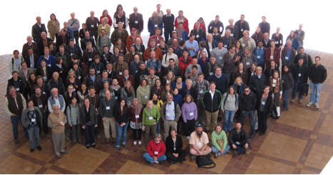
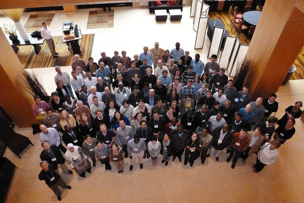
The joint EarthScope-GeoPRISMS Eastern North America (ENAM) workshop held at Lehigh University from 26-29 October, 2011, with an attendance of ≈100 participants (Figure 1). EarthScope and GeoPRISMS represent research communities of geoscientists who study the processes that build continents, open oceans, and erode, transport and deposit sediments, along with the associated natural hazards of earthquakes, tsunamis, sea level rise, and landslides, both on land and under water. EarthScope science is undertaken primarily, but not exclusively on land and involves a facility of transportable and flexible arrays of seismometers with the primary goal of imaging the lithospheric and sub-lithospheric foundation of the United States. GeoPRISMS conducts shoreline-crossing interdisciplinary research to probe the processes that form and modify continental margins. Collectively, EarthScope and GeoPRISMS research provides an integrated framework for understanding the breadth of processes that govern continental formation, break-up, and evolution in the unique ENAM setting, and for assessing associated natural hazards and natural resources, in the US and Canada.

Further motivations for the convergence of interests in ENAM include the arrival of the EarthScope transportable array (TA) in 2012-13, while GeoPRISMS has identified ENAM as a primary site for research focused on rift initiation and evolution (RIE). The USGS also has been contracted to conduct a marine seismic survey of the US Extended Continental Shelf (ECS), tentatively in 2013. Concurrently, energy companies are showing a growing interest in the evolution of deep-sea margins, such as those along the eastern margin of North America. These activities offer distinct opportunities to leverage planned and potential onshore (e.g., USArray, FlexArray) and offshore (USGS or industry marine seismic surveys) programs. Therefore the timing is now ideal to organize the two communities and to identify the crucial science targets, and to develop or modify the strategies needed for science implementation for ENAM.

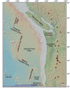
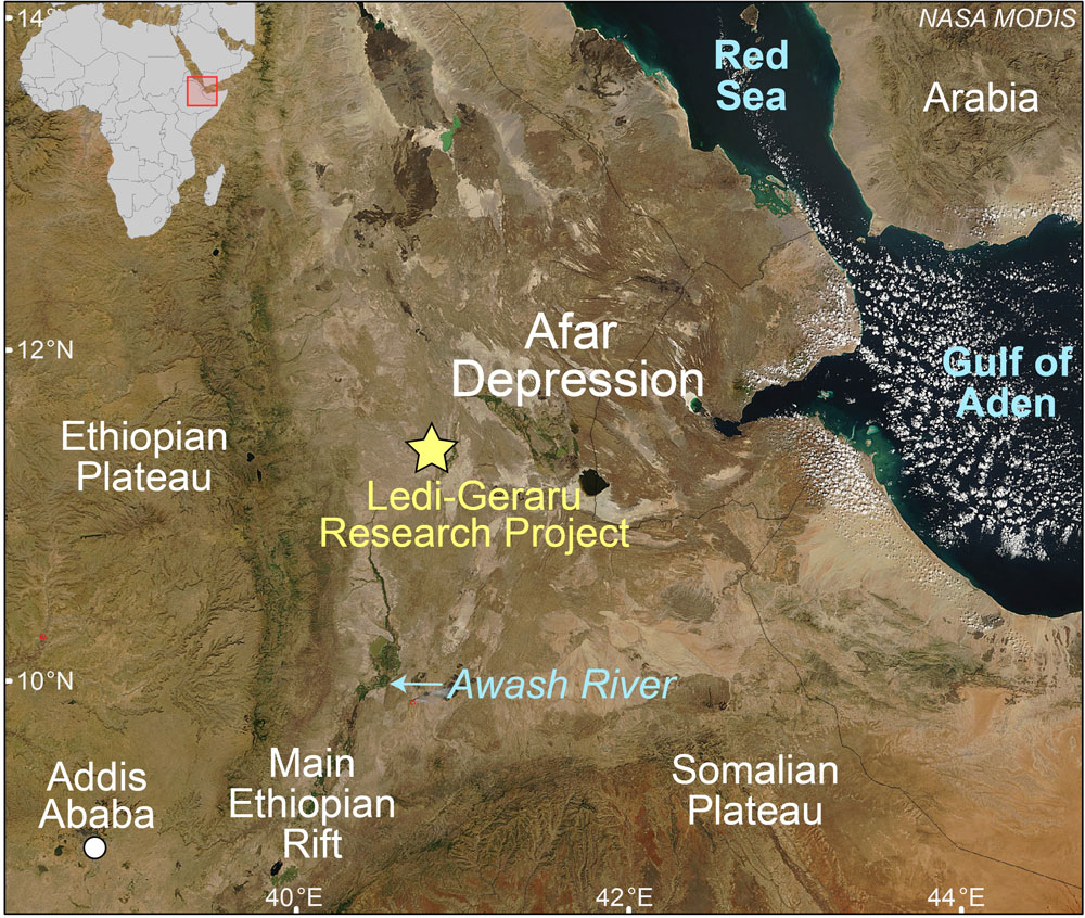
The GeoPRISMS community identified ENAM as a primary site to investigate rift initiation and evolution, in part because of the wide range of opportunities the geologic and geophysical setting provides for studying rifting and post-rift processes (figure 2). These include an apparent south to north transition from magma-rich to magma-poor break-up, numerous exposed and buried rift basins, thick archives of post-rift sediments and sedimentary rocks in shelf-slope basins, and well-documented surface processes. Similarly, ENAM appeals to the EarthScope community because of a long debated north to south transition in Appalachian structure, the west to east transition from craton to continental margin, the opportunity to investigate tectonic heredity in the context of continental assembly and dispersal, the emerging appreciation that sub-lithospheric dynamic mantle flow impacts surface dynamics, and the characterization of active seismic zones in a passive-margin setting.

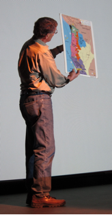
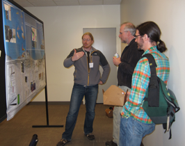
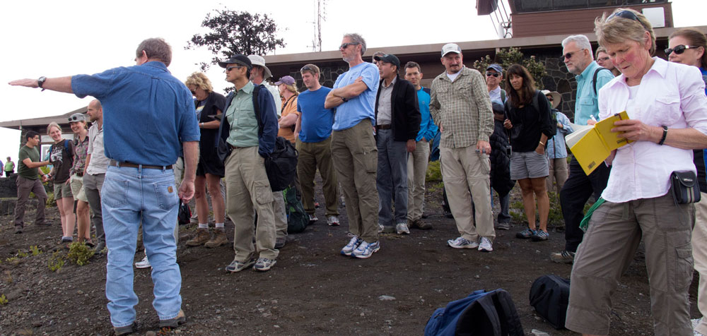
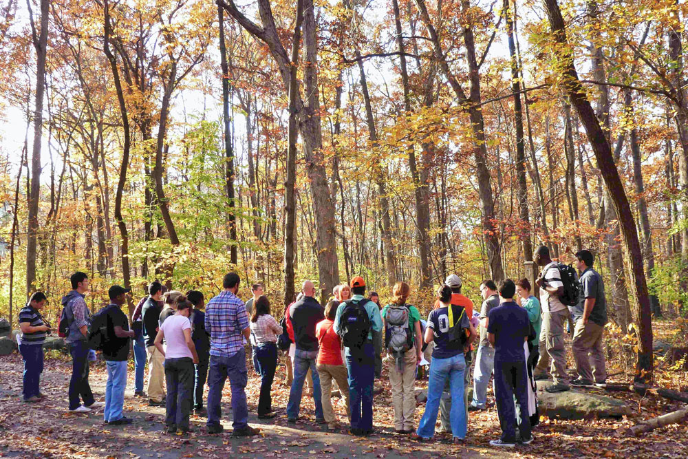
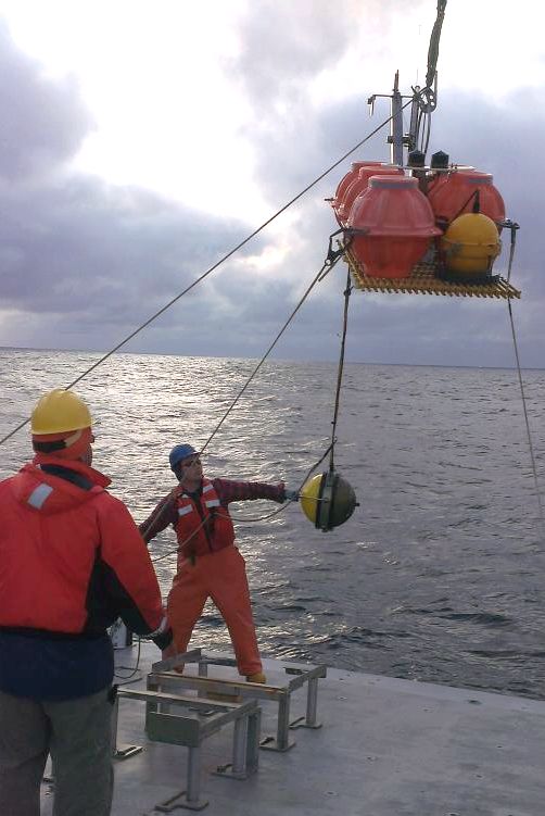
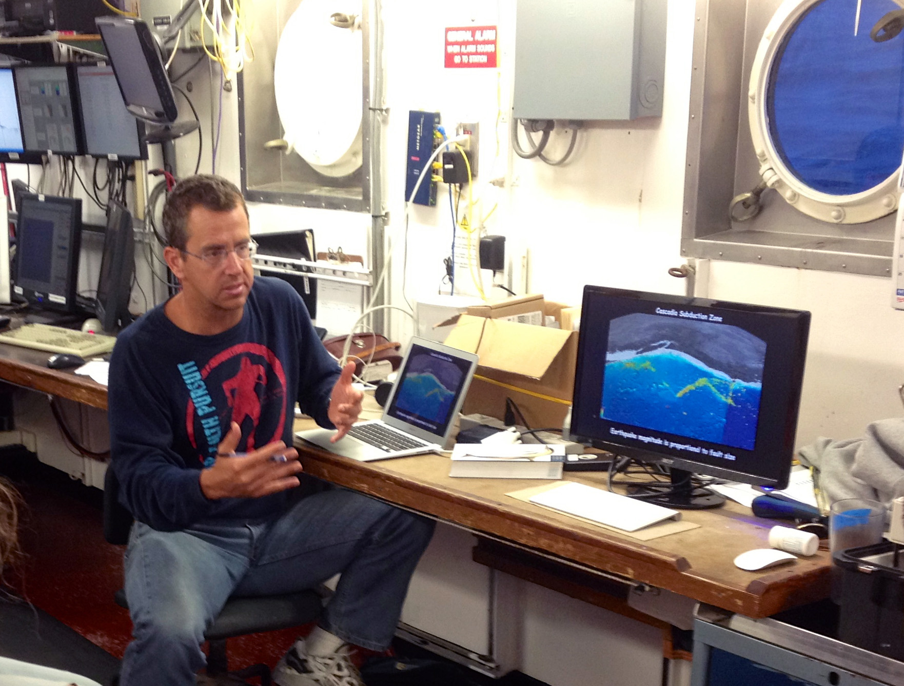
An important goal of the science workshop was to focus the broader community effort on cross-disciplinary learning and approaches to collaborative science dedicated to the aforementioned science topics embodied in the archetypal passive margin. The workshop provided a national and international forum of scientists from universities, national laboratories, federal and state agencies, and industry, and included a colloquium and field trip specifically designed for early-career researchers including masters, doctoral, and post-doctoral scientists (figure 3).

Workshop Overview and Narrative

The workshop was constructed around two and one-half days of plenary presentations, short reports on “hot topics”, break-out sessions, and plenary discussions and decision making. Presentations and break-out sessions were organized around topics presented in participant white paper reports, and included: (a) orogenic processes, (b) rifting processes, (c) post-rift processes, and (d) neotectonic and surface processes. The break-out group attendance was designed to ensure diversity of thought, geographic interest, and synergy among the GeoPRISMS and EarthScope communities. Subsequent break-out discussions were defined by evolving participant interest in the geographic regions best suited to pursue the process-oriented science relevant to their field of study. Throughout the workshop, lively discussion ensued on how to best leverage the respective approaches of the GeoPRISMS and EarthScope communities in ENAM research.

Early in the meeting, we reviewed the EarthScope and GeoPRISMS Science Plans with particular focus on their implication for the Eastern North American Margin (ENAM). The EarthScope science plan and accompanying presentations of the 2009 science plan workshop articulate the key science targets for EarthScope research. Many of these science targets have direct relevance to ENAM, and presentations at the 2011 EarthScope National Meeting highlighted a range of scientific results from the study of these targets. More specific to ENAM was a 2004 EarthScope conference that focused on research frontiers and opportunities (http://www.earthscope.org/workshops/archive).

Similarly, the GeoPRISMS science plan (http://www.geoprisms.nineplanetsllc.com/science-plan.html) identifies rift initiation and evolution (RIE) as one of its initiatives. The implementation plan identifies ENAM as one of two RIE primary sites where the processes of continental rifting and transition to a passive margin will be studied. At ENAM, GeoPRISMS asks several interrelated questions regarding the distribution of lithospheric deformation, the influence of magmatism and pre-existing structural and compositional heterogeneity, the variation of rift structure and magmatism, the mantle dynamics of the syn- and post-rift margin, the processes that accompany the transition from late-stage rifting to mature seafloor spreading, how the margin has been influenced by post-rift tectonics, the identification of the magnitudes, mechanisms and timescales of elemental fluxes between the Earth, oceans and atmospheres along a passive margin during and after rifting, and characterizing the scales and frequency of submarine landslides and related natural hazards.
The first day of the meeting was dominated by plenary and hot-topic presentations that focused on building a content- and knowledge-base for ENAM from the wide range of geoscientific perspectives present at the meeting. Afternoon breakout sessions followed with a focus on the introduction of key research ideas and consideration of research corridors where the science could best be performed. What emerged out of this exercise was the organization of ENAM into three geographic regions: (1) a Northern area encompassing Atlantic Canada and New England; (2) a Mid-Atlantic region stretching from New York City to North Carolina; and (3) a Southern area stretching south from the Carolinas and wrapping around to the Gulf Coast.

The second day opened with breakout reports that articulated the geographic organization of science topics, followed by a slate of short presentations that focused on active tectonics, geodynamic modeling, and reports from aligned facilities, government organizations, and international partners. At this point, workshop participants were fully informed of the major science topics, high-interest focus areas, and opportunities for research synergy with community and industry partners. These presentations showed that the collective interests of university scientists, the USGS, and energy companies could provide a basis for a collaborative active-source seismic study offshore of the eastern United States, perhaps in the form of a jointly funded community experiment.

In the second round of breakout sessions workshop participants were charged with self-organizing into the three break-outs defined by geographic area, based on the results of the Thursday discussions. Nearly equal numbers of scientists attended the Northern and Southern geographic area break-outs, with a slightly larger proportion of participants attending the Central break-out. GeoPRISMS and EarthScope interests were similarly well-distributed among the three break-outs. In all groups, there was synergy across the shoreline among the terrestrial-based and marine-based geologists and geophysicists.

The relative size of the three geographic regions and the composition of the break-out attendees influenced the break-out discussions and the level of science implementation detail. The Southern break-out group restricted their consideration to the Atlantic margin to allow a purposeful overlap with the EarthScope TA. Similarly the Central group explored a number of potential shoreline-spanning projects because of the relatively restricted geographic area. In contrast, the Northern group was challenged with a greater diversity of interests and possible projects given its larger size. The deliverable from this third break-out exercise were focus areas, defined by polygons drawn on copies of the GSA Geologic Map of North America for the ENAM region (Figure 4).
Breakout reports followed that defined and presented the research corridors. The Southern group settled on a swath that stretched from eastern Tennessee, through South Carolina centered on Charleston, and out onto the shelf on the Blake Plateau. The justification for this line includes a classic cross section of the southern Appalachians, .incorporation of two seismic zones, including one that generated a historic M 7 earthquake, a traverse of rift basins that may contain the oldest syn-rift and post-rift sediments, a swath of the shelf that is underlain by potentially the oldest ocean crust, alignment with a funded mid-continent EarthScope project (OINK), and alignment with the Cape Fear Slide (CFS), perhaps the largest slide complex on the U.S. Atlantic margin.

The Central group defined two northwest-to-southeast mid-Atlantic focus areas, one in the south centered on Richmond, VA and one in the north centered on Philadelphia, PA. Both focus areas provide numerous opportunities for studying Appalachian structures, including the transition in deformation style from the northern Appalachians to southern Appalachians, Mesozoic rift basins, active seismic zones, and regions of documented recent deformation indicated by offset of deformed stratigraphic and geomorphic markers. They also take advantage of the thickest, richest, and best studied shelf-slope basin (the Baltimore Canyon Trough). The Richmond focus area has the added advantage of traversing early Cenozoic intrusive rocks. Given the close spatial position of the Richmond and Philadelphia focus areas, participants discussed the possibility of orienting a focus area parallel to the coast, centered more or less on the Fall Zone in an effort to take advantage of key features spanning the coastline in both the Philadelphia and Richmond areas. A north-south-oriented marine seismic line was also proposed that would link the extensive seismic and borehole data present across the continental shelf. As the U.S. Mid-Atlantic margins encompass the densest populations centers in ENAM, understanding the array of onshore and offshore geohazards are of particular concern for this region.

The Northern group defined a focus area centered on Nova Scotia that is positioned to take advantage of the well-known south to north transition from magma-rich to magma-poor continental margin. This focus area enjoys public access to an excellent Nova Scotia government-sourced database of industry seismic and well data for the Scotian basin, crosses the well-exposed Fundy rift basin, and shares a well-studied conjugate margin with Morocco. Notably, the EarthScope TA would have to be extended into Nova Scotia to take full advantage of onshore-offshore synergy. Nova Scotia is not currently part of the planned TA deployment, and modification to that plan will take effort and leadership by those individuals interested in studying this part of ENAM. The Northern group also defined a more narrow focus area stretching from the Adirondacks through southern New England and out onto the southern Georges Bank basin. There was considerable EarthScope geologic interest for study in this region, but it was not paired with equal enthusiasm for offshore research in the GeoPRISMS community, largely because the New England seamounts may overprint rift-related structure on the margin here.

Saturday morning opened with break-out reports for science implementation for the focus areas defined and supported on the previous day. There was lively discussion regarding how best to integrate field studies and data collection with several of the numerical models that had been presented. Discussion also ensued on which focus areas were best suited to leverage available resources and synergy with industry and community partners. There was an emerging sense that all of the focus areas had merit, but that there was greater potential for EarthScope-GeoPRISMS synergy in the Charleston and Nova Scotia focus areas, although lying outside the EarthScope study area challenged the latter.

At this point, the students were asked to give their perspective on the meeting, which included an independent evaluation of the science goals and prioritization of the focus areas based on those goals, inferred likelihood of success, and best opportunities for EarthScope-GeoPRISMS collaboration. The student report provided an objective summary of the workshop prepared by a group that was fully engaged in the process. They offered a rank order of the focus areas, with the best potential for EarthScope-GeoPRISMS collaboration as follows: Charleston, Nova Scotia, Richmond, Philadelphia, New England.

The student report was followed by short presentations and a panel discussion of ENAM broader impacts led by representatives of the GeoPRISMS and EarthScope outreach offices as well as David Smith, representing the Allentown, PA-based DaVinci Science Center. Collaborative EarthScope-GeoPRISMS research along the ENAM offers important opportunities to address a range of societal issues that can impact the most densely populated part of the nation. Natural hazard catastrophes are not in the collective memory of the nation with respect to ENAM, but in recorded history there have been very large, damaging earthquakes, and there is emerging, albeit controversial evidence for tsunamis. Other, related hazards include submarine landslides, potentially catastrophic clathrate degassing, fluid venting, sedimentation and erosion, flooding, and sea level rise. Infrastructure built along the North Atlantic margin range from wind power to telecommunications, and would be affected by such catastrophic events, as well as long-term sea level change. ENAM research also will contribute to the geotechnical considerations of siting the next generation of nuclear power plants, a dozen of which are operating, under construction, or ordered as of 2009-11. The Atlantic margin is a prime target for hydrocarbon exploration, motivating an improved understanding of past and present processes of the ENAM. Onshore and offshore basins and basalt flows are actively being evaluated as targets for carbon sequestration.

Finally, focusing efforts on the North Atlantic margins, particularly in eastern North America, opens the door for extensive education and outreach to US schools and universities active in Earth Science research.

Several opportunities were identified during the workshop for carrying out ENAM-wide synoptic studies, with a focus on those that would provide regional data sets that would benefit a wide range of GeoPRISMS and EarthScope researchers, i.e., the broader community. Specifically, there was discussion of the fate of the EarthScope TA once the planned deployment ends in 2015. Three main ideas were floated and discussed: (1) Plan to leave one in four TA instruments in ENAM and have these instruments adopted by state surveys, the NRC, and universities. This would provide for a widely spaced backbone (≈250 km) of instruments that could be densified by an FA for future EarthScope projects and OBS deployment for GeoPRISMS projects; (2) leave a 70-km spaced TA in place at one of the focus areas for more detailed, long-term studies of that region; (3) remove the TA completely and reassign the instruments to the FA pool for greater access and shortened wait times for smaller, more focused studies. The majority opinion was to exercise option (1), which is already taking place. A shorter discussion noted the opportunities for a parallel extension of a PBO GPS network. One EarthScope RAPID project has subsequently been successful in installing two PBO receivers on either side of the fault that ruptured in the 2011 VA earthquake.

A similar discussion was devoted to the possibility of a regional MCS and wide-angle survey along ENAM, leveraging planned USGS operations to conduct a seismic survey of the Extended Continental Shelf along the mid-Atlantic margin (see page 9, this issue). In addition, there was discussion about the future deployment of ocean bottom sensors as part of the Amphibious Array Facility (AAF) currently deployed along the Cascadia margin. The consensus was that the GeoPRISMS community needs to act now to demonstrate the interest to have these instruments move to ENAM when the facility leaves Cascadia. In the cases of future OBS or TA redeployment in ENAM, all participants agreed that one or more “heroes” will have to take up the cause and work closely with the community, NSF, IRIS, the USGS, and others to insure that there is lasting facility infrastructure in ENAM.

R/V Marcus Langseth Cruise to the Mariana Trench: February 2-29, 2012 Large Scale Active/Passive Source Seismic Experiment


John Lundquist (WHOI), Foreword by Doug Wiens (Washington University at St. Louis)

How much water is transported deep into the Earth at subduction zones, locked away as hydrous minerals in the downgoing oceanic mantle? This question is vital for understanding the source of water erupted at island arc volcanoes as well as determining whether significant water is carried deeper to the transition zone.

A pair of cruises sailed in early 2012 near the Mariana trench to help provide answers to these questions. The project, under the direction of Doug Wiens (Washington University in Saint Louis) and Dan Lizarralde (Woods Hole Oceanographic Institution), involved deploying 85 ocean bottom seismographs (OBS) from the R/V Thompson and seismic refraction and reflection imaging work carried out using the R/V Langseth airgun array.

The active source results will constrain the seismic velocity, and thus the degree of serpentinization, of the uppermost mantle thought to be occurring at faults associated with the bending of the Pacific plate near the trench. 25 OBSs remain deployed and will provide constraints on the maximum depth of serpentinization and catalog microearthquake activity on the bending faults. These OBSs will be recovered by the R/V Oceanus in January, 2013.

Seven graduate students participated in the two cruises. What is it like to go to sea on a seismic cruise for the first time? John Lundquist’s blog, from the Langseth cruise, provides some insight.

Figure 1. The two ships used for the Mariana seismic experiement:  (left) R/V Thomas G. Thompson, operated by the University of Washington; (above) R/V Marcus Langseth, operated by Columbia University.

Figure 1. The two ships used for the Mariana seismic experiement: (left) R/V Thomas G. Thompson, operated by the University of Washington; (above) R/V Marcus Langseth, operated by Columbia University.

Life at Sea: 8,653 miles, 4 airports, 3 inflight meals, and 34 hours later, I’m standing in the Hagåtña, Guam Airport. In my post trans world flight delirium “What the hell have I gotten myself into this time?” pops into my mind. I collect myself and step outside into the warm Pacific night air. A stark contrast from the artic chill I left in Maine. I arrive at the hotel…sweet, sweet sleep.

I wake up suddenly, unaware of where I am. A few hours of fitful rest hasn’t revived my senses or my mind. I look out the window and see surf breaking and the world starts to come back into focus. I’m John Lundquist….I know this….my next thought……go find someone in your group. I’m slightly anxious, as I’m about to rendezvous with a group of highly intellectual geophysicists, Ph.D. candidates, and graduate students. Having studied geology in college I should have felt prepared to meet these great minds. I walk down stairs and arrive at the breakfast buffet. As I scan the restaurant area, my gaze immediately rests on “the science” party….not too hard to pick out of a crowd. Nathan Miller, one of the chief scientists, walks up to me, “you must be John.” Apparently I wasn’t too hard to spot either. Introductions were made and the trip was underway.

We all piled into the rented mini-van for the Naval Base, where the ship was docked. We boarded the ship, were assigned our rooms, and then set free. We headed out for a few libations and our last taste of land before the 9AM departure time. The next day, as the ship cast off its lines, we all walked out to the Observation Deck. Pulling out of the harbor was beautiful. Guam’s mountainous landscape is breathtaking from the water. As we reach the end of the channel and transition into the open ocean, I quickly realized the ship is not stationary. Five minutes later…. seasickness…this is going to be a long month.

I begin my first shift as a watchstander by making my way down to the lab. I had briefly seen this area earlier, my first thought was “you could control the space shuttle from in here.” The lab is a complete floating technology hub, with about 40 computer monitors, countless processers, and Internet. From here everything science related is controlled and monitored. I was glad to finally get down there. As I sat down that first day, it was overwhelming to say the least. I had never been in a room with so many screens, let alone been put in charge of some of them. As a watchstander, we were basically assigned to monitor several scientific instruments. Every half hour, we entered data into a thirty-minute log. The function was to insure that all the instruments were still recording and running properly.

Figure 2. Protected Species Observers watching for marine wildlife.

Figure 2. Protected Species Observers watching for marine wildlife.

Day two, I walk down to my post in the lab only to find that nobody is there. Odd, I say to myself. I see on one of the remote cameras that everyone is outside working on the deck. I make my way aft and I’m instructed to put on a life jacket and “get to work.” The task at hand is to get the seismic streamer into the water. At this point, the streamer’s technicians, watchstanders, and ship’s crew were all working together. We were in charge of the streamer length number, the spacing of weights that need to be on the streamer, the spacing of acoustics, and position of birds. On this cruise (MGL1204) the streamer length was 8000 m. Along with the OBSs (ocean bottom seismometers), the streamer was used to record data in the active source survey. Hydrophones were strategically placed along the entire streamer. Because of the precise spacing of all the elements of the streamer, and the long length, it took about 12 hours to put it all in the water. It was great to be able to work with the ship’s crew and aid in the technical aspect of the mission. As a watchstander, they pretty much let you participate as much as you want to. I was carrying birds, putting them on the streamer, coupling streamer lengths, and adding weights, all while the sun was rising. It was fun, and exciting to be part of such a technical aspect of the project. Once the streamer was fully out, the gunners began the process of putting out the guns. Once the guns were in place, they began firing and we started collecting our active source data. After each “shot” from the air guns, the acoustic echo from the ocean floor was picked up by the hydrophones on the streamer and the OBS’s on the ocean floor. The data was then used to create bathymetric profiles of the sea floor around the trench.

Once the streamer and guns were in place, it was smooth sailing in terms of the instruments; the seas, on the other hand, were the contrary. The wind increased to 30 knots and the seas grew to 4-6 meters. Large seas, as you can imagine, change life aboard a ship. Everything is in constant motion. Sleeping was another story. Imagine sleeping in a moving bed…not conducive to quality rest. The way I solved that problem was by stuffing a bunch of blankets under one side of my mattress. This in effect created a v-notch that basically held me in one spot.

Life on a ship during a research mission is a lot of work. But nobody can work 24 hours a day. There was plenty to do on the ship during down time. After a few days, everyone began to fall into their own routine. There was a full theater, complete with big screen TV, PlayStation 3, and a hard drive filled with movies and TV shows. This was a good place to go and unwind after a long shift, or if the boat was pitching too much to sleep. At any given time, there was bound to be someone there to share a laugh with.

For exercise, the ship had a nice gym. A month is a long time to go without working up a sweat, the gym was a good place to get the heart rate up. There was a treadmill, elliptical, erg, and bike. The gym was also home to some dumbbells and homemade equipment, rendered by the engineers and ship’s crew over the years. A descent swell made working out quite interesting. With any pitch or roll of the ship, you could be sent flying. After a couple minutes of practice, though, you could get the hang of it.

Figure 3 (left). The main lab.  Figure 4 (middle). A line‐up of birds for the streamer. Watchstanders Matt Hughes and Martina Coccia assisting the ship’s crew. Figure 5 (right). Guns discharging.

Figure 3 (left). The main lab. Figure 4 (middle). A line‐up of birds for the streamer. Watchstanders Matt Hughes and Martina Coccia assisting the ship’s crew. Figure 5 (right). Guns discharging.

As for meals, the ship is equipped with a full galley and mess hall. Meals were served three times a day, but there was always food available. Dinnertime was especially good to relax and chat with other people on the ship. Sometimes, if it was nice, we would take our food up to the deck and eat outside under the Pacific sky. Sunset and sunrise were two of my favorite times on the ship. Its funny how on a ship, watching the sun go down or come up becomes another part of the routine. It was like a morning and afternoon break from the fast-paced research.

One of my favorite sky-watching spots was on the PSO bridge. Every seismic ship now has a crew of PSO’s or Protected Species Observers. These people spend their day watching the water. Their job is to make sure the seismic survey does not disturb or injure any marine life. They are on the lookout for whales, dolphins, seals, and other large marine mammals. If they see one too close to the ship, we stop firing the guns until the marine life has been deemed out of the danger zone.

In the end, I was happy to be part of such an interesting experiment. I arrived with no idea what to expect. By the end of the cruise, I was comfortable with technical equipment and data analysis in the lab. I got to meet several geophysicists and the whole ship’s crew. If you have any interest in how active source reflection seismology is carried out, get on a research cruise. You will learn about geophysics as well as about yourself. Thanks to the R/V Marcus Langseth MGL 1204 crew!

“Report from the Field” was designed to inform the community of real-time, exciting GeoPRISMS -related research. Through this report, the authors expose the excitement, trials, and opportunities to conduct fieldwork, as well as the challenges they may have experienced by deploying research activities in unique geological settings. If you would like to contribute to this series and share your experience on the field, please contact the GeoPRISMS Office at info@geoprisms.nineplanetsllc.com. This opportunity is open to anyone engaged in GeoPRISMS research, from senior researchers to undergraduate students.
We hope to hear from you!

Reference information
R/V Marcus Langseth Cruise to the Mariana Trench: February 2-29, 2012 Large Scale Active/Passive Source Seismic Experiment Lundquist J., Wiens D.;

GeoPRISMS Newsletter, Issue No. 29, Fall 2012. Retrieved from http://geoprisms.nineplanetsllc.com

GeoPRISMS – EarthScope Science Workshop for Cascadia Report


Portland, Oregon, April 4-6 2012

Workshop Conveners: Geoff Abers1, Ramon Arrowsmith2, Joan Gomberg3, Andrew Goodliffe4, Adam Kent5, Katie Kelley6, Harvey Kelsey7, Julia Morgan8, Josh Roering9, Anne Trehu10, Kelin Wang11

1Lamont-Doherty Earth Observatory; 2Arizona State University; 3US Geological Survey; 4University of Alabama; 5Oregon State University; 6University of Rhode Island; 7Humboldt State University; 8Rice University; 9University of Oregon; 10Oregon State University; 11Pacific Geoscience Center

Figure 1. Bathymetry & topography of the Cascadia margin and associated tectonic elements.  Significant arc volcanoes indicated by orange triangles.  Map generated using GeoMapApp.

Figure 1. Bathymetry & topography of the Cascadia margin and associated tectonic elements. Significant arc volcanoes indicated by orange triangles. Map generated using GeoMapApp.

Background and Motivations

GeoPRISMS and EarthScope co-sponsored this science workshop on Cascadia, held April 4-6, 2012 at the World Trade Center in Portland, OR, as a joint effort to foster communication and collaboration among researchers with diverse interests in Cascadia. The broader goal was to inform and revise guiding documents for both communities. The following is a synopsis of the workshop, which is summarized more completely in a workshop report which can be found on-line at http://www.geoprisms.nineplanetsllc.com/past-meetings/207-cascadia-apr2012.html.

The Cascadia subduction zone, which cuts through three US states and western Canada (Figure 1), is the only region of the lower 48 states that is capable of producing a Mw 9 earthquake and has the greatest potential for volcanic eruptions in the conterminous US. A trove of new geological, geodynamic, and geophysical data has recently been collected and more will be forthcoming in the next several years, thanks in part to NSF investments in EarthScope and the onshore/offshore ARRA-funded Amphibious Array Facility (AAF) of the Cascadia Initiative (CI) [See GeoPRISMS Newsletter, Issue 27 for more information]. The Cascadia margin was also chosen as a Primary Site of the NSF GeoPRISMS program during the Subduction Cycles and Deformation (SCD) Initiative Implementation Workshop in 2011, and is thus recognized as a focal point of interest to a broad base of scientific communities. With so many other onshore and offshore research efforts in process or planning stages, the time was right to hold a science workshop to build synergies among communities, disciplines, and agencies with scientific interests in the area. Ongoing/future scientific efforts in Cascadia will benefit greatly from communication and coordination among these diverse groups.

The workshop took as its starting point the Cascadia SCD portion of the GeoPRISMS Science and Implementation Plans (http://www.geoprisms.nineplanetsllc.com/science-plan.html) and the EarthScope Science Plan. The primary goals of the workshop were to: (i) to clarify common research objectives within Cascadia; (ii) to address the range of interacting tectonic, magmatic, and surficial processes acting along the convergent margin; and (iii) to update implementation plans and timelines for GeoPRISMS and EarthScope research, considering available resources and infrastructure. A key additional goal of the workshop was to tap a broad cross-section of researchers working in Cascadia, or interested in future opportunities, and to foster interaction and discussions leading to new collaborations and understanding. This specifically included entraining early-career scientists (students, postdocs, and new faculty) interested in furthering Cascadia science.

Overview

The workshop was attended by nearly 180 participants (Figure 2), including ~60 graduate students and post-docs, for two days of talks and discussion in Portland, OR. The workshop aimed to provide a platform for review and synthesis of the current state of Cascadia science, involving a wide range of topics from tectonics to geophysics/geochemistry to sedimentation and beyond, and an open forum for discussion of the future directions of scientific research in Cascadia. A student symposium took place on the day before the workshop, introducing graduate students and post-docs to the Cascadia system through a series of talks and a regional field trip. The 2-day workshop was organized into a series of broad plenary talks to provide an overview of the Cascadia subduction system, interleaved with topical break-out sessions, short presentations on hot-topic science, poster sessions, and plenary discussions.

Figure 2.  Participants at the GeoPRISMS-EarthScope Cascadia Workshop in Portland, April 2012.

Figure 2. Participants at the GeoPRISMS-EarthScope Cascadia Workshop in Portland, April 2012.

The first day opened with plenary presentations on the tectonics, volcanism, faulting, and deep structure of the Cascadia subduction system, followed by updates on the current major projects ongoing in the Cascadia region. A set of evening discussion sessions (Special Interest Groups, or SIGs), focused on these major projects, providing opportunities for informal discussions of the details of each project, and helped define pathways for future research to link in to these efforts. The second day of the workshop opened with a plenary session on sedimentary processes in Cascadia, followed by two sets of special interest group (SIG) break-out discussions targeted at communities with interests in particular scientific questions or processes relevant to Cascadia. These discussions were followed by shorter plenary presentations on the geohazards specific to the Cascadia margin, and reports by each of the breakout groups summarizing the main discussion points in each session. The workshop wrapped up with a presentation from the student participants in the workshop, and an open plenary discussion outlining a “roadmap” to the future of Cascadia science.

For the GeoPRISMS community, one of the key objectives of the Cascadia workshop was to obtain input to refine the directions of GeoPRISMS research in Cascadia. In particular, the outcomes of the breakout and plenary discussions at the workshop will be incorporated into an updated version of the GeoPRISMS Implementation Plan (IP) for the Cascadia Primary Site (e.g., /science-plan.html). This document provides guidance to principal investigators interested in submitting proposals for funding under the NSF GeoPRISMS Program. Although proposals for research in Cascadia have been accepted under the GeoPRISMS solicitation since 2010, input from the community to clarify the research priorities for GeoPRISMS in Cascadia has been limited, with a strong emphasis on projects linked to the Cascadia Initiative.

Thus, a main goal of this workshop was to open an interdisciplinary dialog that would enable an integrated view of the Cascadia subduction zone, to solicit and incorporate feedback on science implementation in Cascadia from a broad-based community, and to provide focus and guidance for subsequent GeoPRISMS proposal solicitations.

For the EarthScope community, this workshop provided an integrative scientific dialogue building on the transformative observations from its augmented geodetic, magnetotelluric, and seismological facilities in Cascadia. Numerous science targets identified in the EarthScope Science Plan were illuminated in the presentations and discussions from the workshop. Initial research results from jointly NSF-funded EarthScope and GeoPRISMS projects were presented and momentum for additional joint proposals was evident and encouraged. In addition, IRIS and UNAVCO as the respective managers of the seismological and geodetic facilities of EarthScope are currently developing proposals for 2013-2018 operations and maintenance. The community discussions about science targets, priorities, and opportunities for coordination with other programs such as GeoPRISMS provide essential fodder for these necessarily integrative proposals.

Student Symposium

An important aspect of any scientific meeting is the engagement, preparation, and inspiration of the next generation of scientists and leaders. The student symposium, held before the workshop and attended by thirty-three students and two postdocs from thirteen universities, brought together representatives from this vital demographic, coordinated by Andrew Goodliffe (University of Alabama) with help from the GeoPRISMS Office and several workshop conveners and participants. Introductions to the GeoPRISMS and EarthScope Programs were followed by overviews of the geology and geophysics of the Cascadia region. The students and postdocs then took over the stage, giving one-slide descriptions of their research. Those presenting posters had an opportunity to highlight the work that they would be presenting later in the meeting.

In the afternoon, Ray Wells (USGS) and Ian Madin (Oregon Department of Geology and Mineral Industries) led a fieldtrip through the Portland metropolitan area. Participants got to see a spectacular Columbia River Basalt outcrop, evidence of mass wasting, a panorama of the Portland Basin and rocks form the Boring volcanic field flow. The field trip ended at the Zoo station of the Portland MAX light rail system where a spectacular core (recovered during the construction of the 3-mile-long tunnel) is displayed.

In the evening, following the icebreaker for the Cascadia workshop, symposium participants participated in a lively group dinner at Kell’s Irish Pub. Several workshop scientists joined the group and shared insights about their career path and the GeoPRISMS/EarthScope programs.

Workshop Program

The workshop was structured around several key topics:
  • Cascadia Crustal Evolution and Deformation
  • Earthquakes and Other Faulting Processes
  • Large-scale and Deep Processes
  • Sediment Transport, Accretion, and Subduction
Figure 3. Ray Wells demonstrates present-day Cascadia plate motions.

Figure 3. Ray Wells demonstrates present-day Cascadia plate motions.

Each topic was provided several keynote presentations, all of which can be found on the meeting website. These presentations led to stimulating plenary and break-out discussions.
The Cascadia Crustal Evolution and Deformation session highlighted the geological evolution of the Cascadia margin (Ray Wells, Figure 3), the pre-Quaternary magmatic history of Cascadia (Anita Grunder) and the history of recent magmatism and volcanism (Kathy Cashman).

On the topic of Earthquakes and Other Faulting Processes, a primary focus of both EarthScope and GeoPRISMS research at Cascadia, three different perspectives were offered, including new observations from the recent Tohoku earthquake and ongoing and planned work in Japan (Shuichi Kodaira), paleoseismic studies of past megathrust earthquakes along the Cascadia margin (Rob Witter), and recent seismicity and tremor activity along the Cascadia margin (Ken Creager).

The session on Large-scale and Deep Processes focused on the large-scale processes that control subduction system dynamics, with an emphasis on those processes that occur deep with the subduction system, such as the thermal-petrologic-fluid flow structure and dynamics of subduction zones (Ikuko Wada), the geodynamic framework of the Pacific Northwest, in light of new data obtained from seismic tomography and other sources (Gene Humphreys), and magma generation in Cascadia, in particular, reasons for the anomalously hydrous magmas in this hot system (Tom Sisson).

A session on Sediment Transport, Accretion, and Subduction addressed the Cascadia forearc as a setting for the transport of sediment from the Coast Ranges through the estuaries offshore to the accretionary prism and the abyssal plain, with topics ranging from the driving forces for erosion initiated through wedge dynamics (Mark Brandon), to deformation of sediment in the offshore accretionary wedge (Lisa McNeill) to the mechanisms and processes of delivery of sediment to the continental slope and abyssal plain by turbidites (David Piper).

Figure 4. Attendees participated in animated conversations during poster sessions.

Figure 4. Attendees participated in animated conversations during poster sessions.

Workshop attendees also participated in stimulating poster sessions addressing a wide range of Cascadia and related research topics (Figure 4). Poster-viewing time was provided during both days of the meeting schedule, and posters were well attended during these times, as well as at other times during the meeting.

Volunteers served as judges for the excellent posters that many of the students and postdocs presented. Although all of the presentations were of high quality, three posters rose to the top. These were: Allison Koleszar (postdoc, Oregon State University); Jason Patton (Ph.D. candidate, Oregon State University); and Wanda Vargas (M.S. student, Cornell University). Each student received a copy of the book “In Search of Ancient Oregon: A Geological and Natural History”, by Ellen Morris Bishop.

Special Interest Group (SIGs) discussions during the workshop to discuss scientific topics, targets, and research approaches relating to specific processes or approaches, for example, Deep Subduction Zone Structure, Megathrust Structure and Processes, Outer Forearc Structure and Segmentation, Geodetic Processes, Magmatism and Volcanic Processes, Volatile Processes and Cycles, and Sedimentary Processes. Each session was asked to address the following questions: (a) What are the key exciting scientific questions that can be addressed in Cascadia? (b) What infrastructure exists in Cascadia research to address them? (c) What knowledge gaps remain to be filled; what are future research directions? And (d) What challenges exist, and how can they be overcome? The follow-up break-out reports guided the closing discussions on the final day of the workshop.

In addition, several Implementation Interest Groups broke-out to review the status of ongoing projects, and to brainstorm about future efforts specific to Cascadia. Topics included Cascadia Initiative & Amphibious Arrays, Volcano Imaging, Geohazards, Energy & Mineral Potential, and Education & Outreach. Similar questions were posed to these break-out groups, including: (a) What infrastructure exists for Cascadia; what are associated opportunities? (b) What major research products and data streams will be available? (c) What gaps remain to be filled; what are the future directions for research? (d) What challenges exist, and how can they be overcome? Additional presentations addressed the important and diverse topic of Cascadia Geohazards, including those related to earthquakes, tsunamis and volcanoes. They also addressed the major new direction of earthquake early warning.

Throughout the workshop, students participated in plenary and breakout sessions, enthusiastically contributing to discussions. During lunches and in the evening, when most workshop participants had long since left the convention center, the symposium participants were still found hard at work. The students and postdocs ultimately developed a consensus statement emphasizing their take on the key aspects of the Cascadia system and the important scientific breakthroughs yet to come.

Roadmap to the Future – Science Implementation at Cascadia

Throughout the meeting, several key issues emerged from the presentation and discussions. A selection of these is listed below, and collectively they constitute a roadmap for refining the Cascadia science implementation plan. In most cases these issues cut across traditional discipline boundaries, and our understanding of them is impacted by multiple datasets.

The nature of segmentation along the subduction zone. Diverse data sets (geophysics, seismicity, volcano age and distribution, geochemistry, geodesy and paleogeodesy, etc.) reveal that the subduction zone is segmented along strike. Key uncertainties remain. Is the segmentation the same for different data sets? What are the ultimate controls of segmentation evident in different data? What is the influence of the incoming plate on segmentation? What is the influence of the inherited crustal structure and composition of the upper plate?

Earthquakes and the turbidite record. Inferences have been drawn from turbidite records that earthquakes rupture only part of plate boundary (M>~8 events) have regularly occurred in southern Cascadia with the northern portion rupturing only in entire-boundary, M9 earthquakes. These suggestions warrant further study as they have important impacts on hazard estimates and our basic understanding of the earthquake cycle along the plate boundary.

The hot and dry slab paradox. Uncertainty remains in reconciling the geochemical and petrological estimates of volatile fluxes in Cascadia with thermal models that predict a hot and dry subduction system. At present, measurements of pre-eruptive water contents seem relatively normal (compared to other arcs) in Cascadia basalts, however thermal models predict early dehydration and devolatilization. This remains an enigma for Cascadia. The relationship between timing of dehydration, extent of dehydration and the role of volatile fluxes in magmatism remains unclear.

Distribution of volcanism. What are the ultimate controls on the distribution of volcanism in Cascadia? Specifically, what parameters influence the formation of large central volcanoes that occur along the arc versus the more dispersed monogenetic volcanism that characterizes the regions between the larger volcanoes? Can this distribution be linked to the slab, structures in the mantle wedge, or in the upper plate? How do the relatively localized back-arc volcanic complexes (Simcoe, Newberry, Medicine Lake) relate to the arc system? What are the roles of mantle fluxes, solid/fluid flow vectors, and crustal magma processing?

Role of surrounding regions. Cascadia did not develop in isolation, and important questions remain regarding the evolution of Cascadia in relation to surrounding geologic provinces? These include the Yakima fold and thrust belt, the Basin and Range, The High Lava Plains, Klamath/Sierra block, the Yellowstone hot spot trail and the Juan de Fuca ridge. How have the interactions between these geologic provinces changes through time to influence the formation and evolution of the North American continent?

Imaging the physical properties deep within the crust and upper mantle. Different models of subduction processes, including the transition from stick-slip to stable sliding along the megathrust and the migration of magma through the crust, are difficult to image geophysically. How can traditional techniques for imaging subsurface seismic velocity and electrical conductivity be improved to better image these processes? How can better images be integrated with other geophysical and geochemical observations?

Sediment transport. The transport of sediment from the subaerial forearc to offshore is a response to tectonic processes. Also, the sediment records of such transport provide insight to the past tectonic events. Specific questions relate to the role of subduction zone earthquakes in initiating landslides, in mobilizing sediment sources and in modulating estuaries as sediment storage compartment or conduits for offshore sediment delivery. Can records from lakes, especially landslide-dammed lakes, be archives of erosion history in the Coast Ranges? How effective are carbon and other biomarkers in tracing sediment through watersheds to the offshore and can these methods, along the sediment transport data, be applied to determine sediment mass balances for Coast Range watersheds located at different latitudes along the Cascadia margin?

These topics, arising from discussions at the Cascadia workshop, informed the implementation plan developed for the Cascadia margin, specifically to guide proposals submitted to the GeoPRISMS Program, but of broad interest to the research community. The full workshop report for the Cascadia Science Workshop and the final GeoPRISMS Implementation Plan can be accessed and downloaded from the meeting website: http://www.geoprisms.nineplanetsllc.com/past-meetings/207-cascadia-apr2012.html

 Reference information
GeoPRISMS – EarthScope Science Workshop for Cascadia Report, Abers, G., Arrowsmith, R., Gomberg, J., Goodliffe, A., Kent, A., Kelley, K., Kelsey, H., Morgan, J., Roering, J., Trehu, A. and Wang, K.;
GeoPRISMS Newsletter, Issue No. 29, Fall 2012. Retrieved from http://geoprisms.nineplanetsllc.com

COAST: Cascadia Open-Access Seismic Transects


Steve Holbrook1, Graham Kent2, Katie Keranen3, Paul Johnson4, Anne Trehu5, Harold Tobin6, Jackie Caplan-Auerbach7, Jeff Beeson5

1University of Wyoming; 2University of Nevada; 3University of Oklahoma; 4University of Washington; 5Oregon State University; 6University of Wisconsin; 7Western Washington University

The Cascadia margin, where the Juan de Fuca and Gorda plates subduct beneath North America, poses substantial (but poorly understood) earthquake and tsunami hazards to the Pacific Northwest. Several major scientific infrastructure and research initiatives are focusing effort on the Cascadia margin. These include GeoPRISMS, EarthScope, encompassing the Plate Boundary Observatory (PBO), the Cascadia Initiative of ocean-bottom seismometers (OBS) with extensive onshore seismometers and geodetic stations associated with the Amphibious Array Facility, the Ocean Observatories Initiative (OOI) and NEPTUNE/CANADA cable observatories, and the SeaJade OBS program off Vancouver Island. GeoPRISMS has selected Cascadia as a focus site, and the first deployment of the Cascadia Initiative OBSs included a concentration of instruments off Grays Harbor, Washington (see GeoPRISMS Newsletter Issue 27, 2011). Here we report on a recently completed, open-participation/open-access geophysical survey of the Cascadia margin off central Washington, which provides new opportunities to participate in Cascadia studies.

Figure 1. (A) Map of COAST track lines (labeled 1-11), plotted on multibeam bathymetric grid acquired during MGL1212. (B) Inset map showing location of COAST survey on Cascadia continental margin. Bathymetry contoured at 500 m intervals. (C) Example of post-stack time migration across deformation front on Line 4 (yellow line, Fig. 1A).

Figure 1. (A) Map of COAST track lines (labeled 1-11), plotted on multibeam bathymetric grid acquired during MGL1212. (B) Inset map showing location of COAST survey on Cascadia continental margin. Bathymetry contoured at 500 m intervals. (C) Example of post-stack time migration across deformation front on Line 4 (yellow line, Fig. 1A).

The COAST (Cascadia Open-Access Seismic Transects) survey comprised a successful, two-week cruise of the R/V Langseth in July 2012 that acquired diverse geophysical data, including multichannel seismic reflection, multibeam bathymetry, gravity, and magnetic data in a high-priority corridor of the Cascadia margin off Grays Harbor. The scientific goals of this project include (1) constraining the position of the plate boundary, which is poorly known in this region; (2) imaging downdip variations in the character of the subduction thrust across the transition from aseismic creep to seismogenic rupture; (3) quantifying pore fluid pressure, fluid budgets, and upstream inputs to the zone of episodic tremor and slip; and (4) determining the geological controls on methane distribution in the forearc. Substantial shipboard processing efforts produced seismic sections processed through post-stack migration, as well as bathymetric data that provide nearly complete coverage of the forearc region (Fig. 1). Shipboard processing of the data provides the following initial observations:

(1) The Pleistocene accretionary wedge is well imaged and shows landward-vergent thrust faulting throughout our survey area. An outboard series of ramp-and-thrust structures gives way to a region characterized by folds that separate “oases” of undeformed sediment. (2) The oceanic basement reflection is strong and clear outboard of the deformation front but becomes much weaker beneath the Pleistocene wedge. At this stage of processing it is not clear whether this reflects inaccurate processing, loss of energy by scattering off a complex surface, or (more intriguingly) a physical change in the plate boundary structure. (3) Where it is imaged beneath the margin, the top of oceanic crust appears gently dipping beneath the Pleistocene wedge, then bends into a steeper inclination beneath the Miocene wedge. (4) A widespread methane hydrate system, indicated by bottom-simulating reflections, exists in the outer wedge and upper slope of the study area. Increased amplitudes of the Bottom Simulating Reflection (BSR) in tilted sediments suggest that fluid flow along bedding planes controls methane flux.

The COAST program was the first Langseth cruise conducted as an open-participation/open-access cruise. Participants were selected by an open application process, through which seventeen members of the science party were selected from over 60 applicants. Of the twenty members of the visiting science party, eight had not previously been aboard a research vessel, and an additional five (13 total) had never participated in a marine seismic reflection survey. A robust daily shipboard education program included science lectures, scheduled tutoring on seismic processing, and informal data interpretation.

All cruise data are open-access and available immediately. Raw geophysical and seismic data can be downloaded from the LDEO website. Seismic sections processed shipboard through post-stack time migration can be downloaded from the UTIG seismic data base. The cruise report can be downloaded here. We encourage all interested parties to make use of the COAST data in any way desired, including writing proposals to process and analyze the data, integrating the data with other recent and ongoing Cascadia initiatives, and incorporating the data and images in the classroom.

 Reference information
COAST:  Cascadia Open-Access Seismic Transects, Holbrook, S., Kent, G., Keranen, K., Johnson, P., Trehu, A., Tobin, H., Caplan-Auerbach, J., Beeson, J.
GeoPRISMS Newsletter, Issue No. 29, Fall 2012. Retrieved from http://geoprisms.nineplanetsllc.com

Report from the Field | Welcome to a field season at Ledi-Geraru, Afar, Ethiopia!


Erin DiMaggio (Arizona State University)

Figure 1. NASA MODIS imagery of the Afar Depression highlighting the location of the Ledi-Geraru Research Project.

Figure 1. NASA MODIS imagery of the Afar Depression highlighting the location of the Ledi-Geraru Research Project.

The 2013 Ledi-Geraru Research Project field season brought together geologists, paleontologists, and archaeologists from multiple universities to study the environmental context of human evolution in the Afar Depression, Ethiopia. Our field area is located in the southern Afar Depression, near the famous early hominin sites of Hadar and Dikika. This season we focused our efforts on the eastern portion of Ledi-Geraru (ELG) because of its fossiliferous sediments, presence of stone tools, and extensive outcrops. We also targeted this location because the time period represented by the sediments at ELG is scarcely represented in the sedimentological record in Ethiopia and in East Africa in general. As a result, we lack knowledge about important events during this time period including major changes in faunal (animal) populations, and the beginning of stone tool manufacture. Furthermore, the faulting history of the Afar Depression since the late Pliocene (<3.0 Ma) is captured in the structure and geomorphology of the region, all nicely exposed along tributaries of the Awash River. Below I organized some of my field notes to provide a short preview into the daily life and culture at the Ledi-Geraru Camp. Enjoy!

“I am dirty, smelly, and have obviously not showered in three days of field work, but I had a chocolate donut for breakfast. This camp is great!” I mentioned this to my advisor, Ramón Arrowsmith one morning after finishing a freshly made donut and gearing up for another day in the field. It’s true! Aside from the constant barrage of dust that coats anything left out for more than 30 seconds, and afternoon temperatures that make me want to join the Afar hiding under the Land Cruiser for a quick shady nap, I have to admit that our camp life is pretty plush. Our cooks are pros at setting up a fully functional and clean kitchen, including a bread baking station, a deep fryer for our nightly fill of fried potatoes, and a food storage system that somehow defies the laws of spoilage and bug infestation. I can’t even manage to keep a bottle of contact solution in my tent without somehow attracting a line of ants! We are served dinners that include a range of pasta dishes, fried eggplant, and my personal favorite, goat kebobs and tomato salad, all of which are served with soup, fried potatoes, fresh bread, and veggies.

All Under One Tent (1/21/2013)

Today, Brian wanted to better understand the geologic context for some of the fossils found in a particular region earlier in the day. Brian Villmoare (George Washington University) and Dominique Garello, a geology graduate student (Arizona State University), are sporting stylish red/blue 3D glasses because I do most of my geology mapping on anaglyphs created from aerial photographs. I also use high resolution (0.5 meter) satellite imagery for mapping faults or the extent of a volcanic ash deposit, which I later check in the field. It was not until I arrived in the field and completely immersed myself in multiple research worlds that I genuinely understood interdisciplinary research. Geologists, archeologists, and paleontologists all actively collected data within one shared field area and organized, planned, and analyzed results under one central work tent. For example, our geologic mapping helps to determine which archeology sites the archaeologists will focus their efforts on, and faulting patterns that we map one day may direct where paleontologists survey or collect fossils the next day. We are continually communicating our results and changing our plan for the following day based on what we have learned.

Figure 2. (left) Cook Getachew Senbeto is preparing a great dinner for 40 in our well-organized cook tent. Figure 3. (right) Brian (left), Dominique (right), and I (center) look over the days mapping using anaglyphs (hence, the 3D glasses) to investigate the geology of a fossiliferous area.

Figure 2. (left) Cook Getachew Senbeto is preparing a great dinner for 40 in our well-organized cook tent. Figure 3. (right) Brian (left), Dominique (right), and I (center) look over the days mapping using anaglyphs (hence, the 3D glasses) to investigate the geology of a fossiliferous area.

The Wild Life (1/22/2013)

This morning we were greeted by a large group of ostriches and gazelle hanging out by the road. There is nothing wilder than an early morning race to the field against a half dozen ostriches! We are also fortunate to see baboons, warthogs, and occasionally a hyena. Later in the day, Dominique and I were taking measurements of faults along a steep cliff outcrop on the banks of the Mille River. Our Afar friend, Ali Yasin, and our representative from the National Museum of Ethiopia, Tesfaye (ARCCH), informed us not to proceed further along the water. We were confused and thought it might be due to that fact we were on loose slopes. We were wrong. Ali had been watching a crocodile slowly approach where we were working. Needless to say, the strike and dip measurement I was after will have to wait for another day!

Figure 4. Land Cruiser vs. ostriches – a morning race to our field site.

Figure 4. Land Cruiser vs. ostriches – a morning race to our field site.

Figure 5. (top) Omar Abdullah showing us stone carvings in basalt boulders. Figure 6. (bottom) Tephra deposits (white and yellow layers) faulted by a beautifully exposed normal fault.

Figure 5. (top) Omar Abdullah showing us stone carvings in basalt boulders. Figure 6. (bottom) Tephra deposits (white and yellow layers) faulted by a beautifully exposed normal fault.

Ancient Rock Art (1/26/2013)

The Afar are proud of their heritage and were very excited to take us on a trip to show us a place near the Awash River where ancient people had created rock art along the sides of one of the basalt hills. In this photo, Omar Abdullah is pointing out a particularly beautiful etched rock with numerous animals including gazelle, camels, pigs, and monkeys! It was relaxing to take a day away from work and play tourist in this beautiful land guided by our Afar friends who were proud to share their land and its history with us.

Geology at ELG (1/27/2013)

The lack of vegetation at ELG, and in the Afar in general, is a blessing and a curse. A blessing because, well, I’m a geologist and there is no shortage of exposed rock! The only hindrance to acquiring a fault plane measurement or measuring and describing a 30 meter stratigraphy section is the sometimes thick cover of eroded sediment – all remedied by good shovel and geology pick. The curse is trying to find a suitable location for lunch, when “Me’e silalo” (good shade in the Afar language) is hard to come by mid-day, often taking the shape of a few feet of shade provided by the Land Cruiser. Today after lunch we found this beautifully exposed fault that slices through two volcanic ash deposits. There is no shortage of faults in the ELG thanks to its proximity to the Afar Triple Junction. In fact, sometimes it is hard to find a complete stratigraphy section to measure that is not interrupted by a fault! Luckily, there are also abundant volcanic ash deposits (or tephras) interbedded in the sediments (see white layers in the photo). Tephras are extremely valuable to the project because they serve as marker beds across the landscape, and some contain crystals that can be dated using 40Ar/39Ar methods, or fresh glass shards that we can use to ‘fingerprint’ the tephra for possible correlation to other areas within ELG or Afar.

Figure 7. Local Afar children.

Figure 7. Local Afar children.

Afar Kids (2/1/2013)

The Afar children living and working around our camp site (most Afar children have shepherd responsibilities) love to see what we are up to. Hiding behind trees at a set distance, the kids are curious but shy and quickly warm up when approached. Today we brought out our cameras and had some fun with them taking photos. I realized during my first field season in the Afar a few years back that the Afar kids didn’t seem to smile when I took their photo. Why? Well, simply, we teach kids to smile for the camera from the time they are born, and it becomes second nature. The Afar kids had huge grins on their faces after we took their photo, when they see themselves and their friends on the digital screen. They point at themselves and their friends and giggle, giggle, giggle!

The Fossil Hunt (2/2/2012)

Today the geologists all headed out with paleontologists Kaye Reed, Brian Villmoare (right), graduate student John Rowan (left), and the best Afar fossil hunters to survey and collect fossils (left photo). I learned quite a bit from them including that some fossils are more important than others. What do I mean by that? Because of their size, elephant fossils are commonly found throughout ELG. But collecting elephant fossils is laborious (they are huge!) and are not a very diagnostic species (in contrast to, say, pig fossils). While a few elephant fossils were collected (mostly teeth), elephant and hippopotamus fossil abundance is only noted so that it can be included in later descriptions the region’s paleoecology. In this photo, John and Kaye are holding small yellow ruggedized computers called Nomads. The Nomads are used to store and catalog information (GPS coordinates, element, genus, etc.) about each fossil to a centralized digital database.

Location, Location, Location (2/3/2013)

One of my tasks this season was to complete a gazetteer of Afar place names within the eastern Ledi-Geraru (ELG), including the most ‘correct’ Afar to English spelling and the meaning of the place name. Last night I spent an entire evening with our kind Afar Regional State Representative, Mohammed Hameddin, who did an excellent job of aiding in my not-so-easy quest. Hands down, my favorite place name (and story) is a location in the southern part of ELG, referred to as Dabali Isi. Mohammed spelled out the name for me, while our two best Afar geographers, Ali Yasin and Subudo Baro, explained the meaning of the place name to Mohammed. I knew this was going to be an amusing story because all three men had a smirk on their face during the exchange. Mohammed smiled, stood up and said, “The Afar are telling me that Dabali Isi is named after a woman who was passing through that area. She was very, very beautiful and had…” Mohammed stopped speaking and proceeded to caress his sides and top of his rear end. I was brought to laughter (Mohammed is a very funny man!) and awkwardly had to try and guess the meaning of his gestures. “Does it mean rear end?” Nope. “Sides?” Nope. “Shape?” Yes. As the story goes, Dabali Isi was a very beautiful woman passing through that particular area who had a very, very, memorable womanly form. The Beyoncé of the Afar Depression!

Figure 8. (left) John, Kaye, and Brian (left to right) head out for an exciting day of fossil collecting. Figure 9. (right) Mohammed Ahameddin (sitting, center), Kadar Mohammed, Mohammed Ibrahim, and Ali Yasin (left to right) spell and explain the meaning of local place names for our project gazetteer.

Figure 8. (left) John, Kaye, and Brian (left to right) head out for an exciting day of fossil collecting. Figure 9. (right) Mohammed Ahameddin (sitting, center), Kadar Mohammed, Mohammed Ibrahim, and Ali Yasin (left to right) spell and explain the meaning of local place names for our project gazetteer.

“Lucy Dinga”, a.k.a. Archaeology (2/1/2013)

The Afar people have played an integral role in the work that is conducted in the Afar, some as fossil hunters, others as guides and geology field assistants. Many of the same men return year after year to help in our project, and know well the history that surrounds the search for early humans and stone tools in the outcrops along the Awash that began in the 1970’s. In the Afar language “Dinga” means rock, and almost all of the Afar in the Mille and Elowa region know about the famous discovery of Lucy at Hadar in 1974. As a result the Afar refer to stone tools as “Lucy Dingas”. Today, Dominique and I wanted to see the process of a site excavation and so we spent the afternoon with the archaeologists learning about excavation techniques. We also learned about how to identify “Lucy Dingas” among a wealth of stream fractured cobbles that blanket surfaces across the Ledi-Geraru. In the photo above, from left to right, archaeologists, Will Archer, Yonatan Sahle, and David Braun (U. of Cape Town), prepare for excavation of a site in the Ledi-Geraru. The site is located on the slope on the right, while the total station is located across such that each point is visible and can be accurately measured.

Figure 10. Archaeologists prepare for excavation of a site in the Ledi-Geraru

Figure 10. Archaeologists prepare for excavation of a site in the Ledi-Geraru

Overall, we had a very successful field season – we collected new fossils and artifacts, geologic observations, and hundreds of pounds rocks to be analyzed! We hope that this brief glimpse into life at camp, the culture of the Afar people, and the work conducted by Ledi-Geraru researchers opened a door to the process and excitement of conducting field work in Ethiopia.

“Report from the Field” was designed to inform the community of real-time, exciting GeoPRISMS -related research. Through this report, the authors expose the excitement, trials, and opportunities to conduct fieldwork, as well as the challenges they may have experienced by deploying research activities in unique geological settings. If you would like to contribute to this series and share your experience on the field, please contact the GeoPRISMS Office at info@geoprisms.nineplanetsllc.com. This opportunity is open to anyone engaged in GeoPRISMS research, from senior researchers to undergraduate students.
We hope to hear from you!

Reference information
Welcome to a field season at Ledi-Geraru, Afar, Ethiopia! DiMaggio E.

GeoPRISMS Newsletter, Issue No. 30, Spring 2013. Retrieved from http://geoprisms.nineplanetsllc.com

Leveraging IODP Scientific Drilling in Support of Subduction Cycles & Deformation Science Objectives: AGU Mini-Workshop 2012


AGU Fall Meeting 2012, San Francisco, USA

Workshop Conveners: Robert Stern1, John Jaeger2, Brian Jicha3, Terry Plank4, Dave Scholl5, Gene Yogodzinski6

1University of  Texas, Dallas; 2University of Florida; 3University of Wisconsin; 4Lamont-Doherty Earth Observatory; 5U.S. Geological Survey; 6University of South Carolina

About 25 scientists attending Fall AGU meeting in San Francisco took a couple hours out of their busy schedules to participate in a Thursday evening mini-workshop at the Grand Hyatt about how to best use seafloor drilling to address GeoPRISMS Subduction Cycles and Deformation (SCD) science objectives. A new decade of scientific ocean drilling will occur when the new International Ocean Discovery Project (IODP) gets underway; this is planned for 2013-2023 (For more information about IODP and GeoPRISMS, look at the GeoPRISMS Fall 2012 Newsletter). The primary goal of the AGU mini-workshop was to stimulate interested geoscientists to consider how IODP drilling in the Aleutians, Cascadia, and Hikurangi margins can attack the seven “key questions” in the SCD Initiative draft Science Plan. The two-hour brainstorming session was fueled by hors d’oeuvres, a cash bar, and six brief (5 minute presentations plus 10 minutes discussion) talks.

Figure 1. General diagram showing tectonic locations being discussed for IODP drill sites in support of GeoPRISMS science objectives. Site 1: sediment and basement inputs to subduction factory and seismogenic zone, important for Cascadia, Aleutians, and Hikurangi. Site 2: Shallow drilling to understand slow slip events, suggested for Hikurangi margin. Site 3: forearc drilling to reconstruct megathrust events and mountain growth, suggested for Aleutian and Cascadia margin. Site 4: Volcanic history (via tephra) and early arc basement, suggested for Aleutian arc. Site 5: Aleutian Basin formation and evolution.

Figure 1. General diagram showing tectonic locations being discussed for IODP drill sites in support of GeoPRISMS science objectives. Site 1: sediment and basement inputs to subduction factory and seismogenic zone, important for Cascadia, Aleutians, and Hikurangi. Site 2: Shallow drilling to understand slow slip events, suggested for Hikurangi margin. Site 3: forearc drilling to reconstruct megathrust events and mountain growth, suggested for Aleutian and Cascadia margin. Site 4: Volcanic history (via tephra) and early arc basement, suggested for Aleutian arc. Site 5: Aleutian Basin formation and evolution.

Terry Plank discussed how to use the drillship to determine subduction zone inputs. It is essential to sample the oceanic crust and sediments that are subducted at each margin, in order to understand how these inputs affect the mechanical properties of fault zone rocks, the generation of fluids in the subduction zone, and the formation of arc magmas (Fig. 1 site 1). Terry noted that for Cascadia there are already several sediment reference sites, and there are even sites in the northern Juan de Fuca plate where basement has been well-sampled and studied hydrologically. These materials need to be analyzed in order to establish the chemical composition of what is being fed into the Cascadia subduction zone. A major uncertainty is what is accreted in the fore-arc and what is swept down to ~100 km to feed the arc magmatic system. Understanding inputs to the Aleutian-Alaskan subduction factory is a bigger problem: this convergent margin is much longer than Cascadia (~3000 km vs. ~1000 km) and sedimentation on the downgoing plate changes along strike from thick, abyssal plain and trench-axis turbidite deposits in the east to thin pelagic sediments overlain by thinning trench-axis deposits in the west. For the eastern Aleutians, we have good but very incomplete DSDP sampling of the Zodiac Fan and more sediment coring in the Gulf of Alaska is expected from scheduled drilling. In contrast, not much is known about sediments on the downgoing plate feeding the intra-oceanic Aleutian arc, west of the Bering shelf break. Fracture zones (FZ) like the Amlia FZ provide additional complexity: these may mark unusual zones of thick sediments, altered oceanic crust, and serpentinized mantle. Can we recognize these inputs in the resultant arc magmas? The subducted oceanic crust appears to become ever more important to arc outputs toward the west, but less than 20 meter of basaltic basement have been recovered from the entire 3000 km Aleutian sector. We need to recover several hundred meters of oceanic crust, because we cannot constrain how much H2O and CO2 is carried down into the subduction zone unless we understand alteration of the subducting oceanic crust. For the Hikurangi margin, ODP Leg 181 sampled the upper sediments, but the lower km (related to Hikurangi Plateau volcanism) has not yet been sampled. Plans are underway, however, to drill a new section of sediment and basement input to the Hikurangi margin (see below).

Dave Scholl outlined how we could obtain a long-term history of major Aleutian seismogenic zone earthquakes by drilling into the forearc to core the deposits of landslides and turbidites that shallow earthquakes create (Fig. 1 site 3). There are two challenges here: to distinguish seismogenic deposits from those produced by other causes, such as non-seismic forearc slope collapse; and how to date these deposits – once identified – with the precision needed at the scale of the seismic cycle? It was also noted that we have a better understanding of the Cascadia seismogenic record than we know the Alaskan record, in spite of the fact that major (M>8 to 9.2) earthquakes (eight have occurred since 1899) are more frequent along the Alaskan-Aleutian margin.

John Jaeger continued on the theme of how we could interpret tectonic history from studying deep sediment cores (Figure 1, site 3). He outlined how these sedimentary records could illuminate linkages between uplift and deformation on the one hand and climate-mediated erosion of growing mountains on the other hand. He further noted how these could combine to create a high sedimentary flux that can turn off forearc deformation.
Brian Jicha explored how the drillship could be used to understand the early Aleutian subduction zone development, and how the arc magmatic system has since evolved (Figure 1, site 4). Aleutian arc subduction is thought to have begun in Eocene time – perhaps along an E-W trending fracture zone – capturing part of the Mesozoic Kula or Resurrection plates to form the Aleutian Basin (see below). We should be able to find a suitable place in the Aleutian forearc where a continuous tephra record – the products of Aleutian and Alaskan explosive eruptions – is preserved. The tephra record – which has wind-direction and compositional bias – could be supplemented by volcaniclastic sediments, which is less compositionally biased but which would preserve the magmatic record of a few upslope volcanoes. Drilling through sedimentary cover to sample forearc basement should recover magmatic products accompanying formation of the Aleutian subduction zone. It is possible that the Aleutian Basin formed by Paleogene backarc spreading, instead of being trapped Pacific/Kula/Resurrection plate. Recovery and study of Aleutian Basin crust would be a primary constraint on timing and nature of Aleutian arc subduction initiation.

Bob Stern outlined using the drillship to understand the age and origin of the Aleutian Basin, and use this information to constrain interpretations of surrounding regions (Fig. 1 site 5), such as the early history of the Aleutian Arc as well as the thermal history of the Aleutian Basin and basement-rock beveled Beringian Shelf. The issue is that there is a lot of sediment in the Aleutian Basin (km’s), but there might be regions where the sedimentary section is thinner. By drilling to basement though 1.5 km of sediments, we should recover a complete high-latitude record of Cenozoic climate history as well as direct age of Aleutian Basin crust.
After these five samplers, we heard briefly about more advanced plans for drilling in the Hikurangi SCD focus site to understand slow slip events (Figure 1, site 2) from Laura Wallace. Hikurangi slow slip events are unusually shallow and may propagate all the way to regions near the trench that are accessible to drilling. Drilling may thus give us direct access to sampling rocks and fluids formed in association with slow-slip events. A riserless drilling proposal currently in the review and ranking process has a coring transect from the subducting plate (inputs) across the overriding plate above the SSE source. There is an input site planned: 1 km of sediments followed by ~200 m penetration into basement. The input site will provide protoliths of the fault zone rock at depth in the slow slip event source area. A proposal to drill a ~5 km riser hole will be submitted in April 2013. Hikurangi drilling will collect samples related to the former MARGINS “Source to Sink” site in the nearby Waipaoa catchment.

We were also told about an interesting Brothers volcano (Kermadec Arc) IODP pre-proposal in the works, and a full IODP proposal to drill at the Lord Howe Rise and New Caledonia Basin to look at the consequences of subduction initiation along the Tonga/Kermadec/Hikurangi subduction system. These two proposals are likely to be submitted in April 2013.

Figure 2: Participants of the GeoPRISMS/IODP mini-workshop take a break between sessions.

Figure 2: Participants of the GeoPRISMS/IODP mini-workshop take a break between sessions.

Following these presentations, the floor was open to other inputs. Gene Yogodzinski led the group in broad discussions, from Cascadia sediment input, the need for coring into oceanic basement at all sites, the importance of water-rich saponite in oceanic crust, the importance of studying input material to understanding the rheology of the plate interfaces, to the opportunity presented by drilling into the Amlia fracture zone because of unusual sediments and ocean crust alteration, to the importance of biogenic silica as a fluid source, to further discussion of the significance of the tephra record, to engineering considerations for drilling in the Aleutian Trench, to the Cascadia fore-arc slope basins being obvious targets for sampling the paleoseismic record.

After the open discussion, John Jaeger outlined how to propose an IODP workshop, which is useful for moving from broad ideas to specific drilling proposals. Since the workshop, we have learned that guidelines for preliminary proposals are being revised and will be in place for the Oct. 1, 2013 deadline. Some groups interested in similar drilling objectives gathered to begin planning.

Reference information
Leveraging IODP Scientific Drilling in Support of Subduction Cycles & Deformation Science Objectives: AGU Mini-Workshop 2012, Stern, R., Jaeger, J., Jicha, B., Plank, T., Scholl, D., Yogodzinski, G.

GeoPRISMS Newsletter, Issue No. 30, Spring 2013. Retrieved from http://geoprisms.nineplanetsllc.com

Workshop Report: “Ultra-Deep Drilling Into Arc Crust: Genesis of Continental Crust in Volcanic Arcs”


Waikoloa, Hawaii, 18-21 September, 2012

Workshop Conveners: Yoshihiko Tamura1, Shuichi Kodaira1, Susan M. DeBari2, Jim Gill3

1JAMSTEC, Japan; 2Western Washington University, USA; 3University of California, Santa Cruz, USA

Compiled by Susan DeBari, Philipp Ruprecht and Susanne Straub

Figure 1. Location map of the Philippine Sea Region. Numbers show proposed drilling sites IBM-1, IBM-2, IBM-3, and IBM-4.

Figure 1. Location map of the Philippine Sea Region. Numbers show proposed drilling sites IBM-1, IBM-2, IBM-3, and IBM-4.

A workshop was held September 18-21, 2012, in Kona, Hawaii, with the goal of soliciting international support for the endeavor of understanding continental crust formation in the Izu Bonin arc in the northwest Pacific ocean. Central to this project is riser-based deep drilling into the mid-crust of the Izu Bonin arc using D/V CHIKYU. The workshop was primarily sponsored by a Grant-in-Aid for Creative Scientific Research 19GS0211 to Y. Tatsumi and JAMSTEC. Additional funds to support attendance of U.S.-based scientists were obtained from the U.S. Scientific Support Program (through the Consortium for Ocean Leadership) and the GeoPRISMS Program.

The ~3000 km long intra-oceanic Izu Bonin-Mariana arc (IBM) has been long recognized as a primary site for understanding the formation of the continental crust (Fig. 1). A long history of past multidisciplinary exploration revealed the ubiquitous presence of a conspicuous low-Vp velocity (6.0-6.5 km/s) mid-crust layer that seismically resembles continental crust. This layer is common in arc crust, and, as such, is crucial in interpreting arc crustal structure globally. In the northern part of the IBM system (the Izu Bonin arc), the low-velocity mid-crust layer is within reach of ultra-deep riser-drilling and has been a dedicated target of the International Ocean Discovery Program (IODP). The IODP Science Plan for 2013-2023 “Illuminating Earth’s Past, Present, and Future” highlights the formation of continental crust as high-priority scientific Challenge 11 “How do subduction zones initiate, cycle volatiles, and generate continental crust?” as part of the main theme “Earth Connections: Deep Processes and Their Impact on Earth’s Surface Environment”.

Deep-drilling a single hole into the Izu Bonin arc is a major commitment in time and resources. Success is reliant on three companion riserless drilling expeditions in the arc by D/V JOIDES Resolution that are scheduled for 2014. These expeditions will provide crucial new data for the overarching goal of obtaining a complete temporal and spatial petrologic cross-section of Izu Bonin arc magmatism. These expeditions provide vital support for the planned CHIKYU drilling (IODP Proposal 698-Full3 at Site IBM-4) that will be discussed as a priority project at the CHIKYU+10 workshop on 21-23 April 2013 in Tokyo, Japan. This workshop will prioritize the future activities of the CHIKYU.

Overview

The workshop was attended by 58 participants (34 from US, 13 from Japan, 4 from UK, 2 from Switzerland, and 1 each from Mexico, Canada, Taiwan, New Zealand, Australia, Figure 2).

Figure 2. All participants at the conference venue, Waikoloa Beach Marriott, on the Big Island of Hawaii.

Figure 2. All participants at the conference venue, Waikoloa Beach Marriott, on the Big Island of Hawaii.

Attendees included a wide range of geophysicists, geologists, geochemists and petrologists whose research involves the genesis of arc crust. A primary goal of the workshop was to inform the broader geologic community about the goals of drilling in the Izu Bonin arc, as well as to solicit a very broad, international base of participation in proposed IODP expeditions, to rally support for the planned CHIKYU deep-drilling, and to obtain input on objectives and corollary studies.

The first day opened with background talks and discussions aimed at providing a framework for the proposed drilling. Talks focused on the physical and geochemical evolution of the Izu Bonin Mariana arc through time, the geophysical framework (including the enigmatic seismic properties of the middle crust and comparison to the Aleutian arc), and an overview of the goals of the three scheduled IODP drilling legs (subduction initiation, arc foundations, rifted rear arc).

The second day focused specifically on the CHIKYU deep drilling proposal and potential outcomes. This theme was supported by talks on the processes of crustal growth and evolution from exposed crustal sections and from thermal modeling.

The third day provided a break from talks in the conference room and allowed more informal discussions among participants during a field trip to observe the geology of the active Kilauea Volcano eruption (Figure 3).

Figure 3. Participants looking over at the summit caldera of Kilauea and the active eruption in Halema’uma’u crater during the field trip led by Don Swanson.

Figure 3. Participants looking over at the summit caldera of Kilauea and the active eruption in Halema’uma’u crater during the field trip led by Don Swanson.

The forth and final day focused on specific scientific objectives for deep drilling in the Izu Bonin arc and what at-sea drilling strategies and shore-based studies would best support those objectives.

Workshop Program

The key question that motivates deep drilling in the Izu Bonin Mariana arc is how the middle crust evolves and how the processes of its growth relate to the growth of continental crust. Deep drilling in the IBM arc offers the opportunity to examine the critical relationships between magmatic processes and resulting geophysical structure. The linkages established here can also be used as a template to interpret active arc processes globally from geophysical surveys.

The workshop was structured around several key topics, and the key results are as follows:

(1) Geophysical overview of the Izu-Bonin-Mariana arc-back-arc system

More seismic surveys have been acquired over the IBM arc-back-arc system than any other island arc setting on Earth. Consequently, it is possible to contrast seismic velocity models across the arc representing different evolutionary histories, and to constrain them with strike lines where available. A multi-channel seismic reflection (MCS) survey was acquired in 2008 around the proposed drilling site of IBM-4 revealing a well-resolved domal basement high beneath the proposed drilling site. Comparison of MCS data with core recovered from ODP Site 792 indicates the section above the basement is comprised of Quaternary to upper Eocene volcaniclastic sediments. At the top of the basement high, andesitic lavas were sampled at 886 meters below seafloor (mbsf). A seismic refraction survey using densely deployed ocean bottom seismographs (OBSs) was also conducted along the MCS profile and clearly show a domal structure in the 6 km/s Vp iso-velocity contour. These Vp values, which are critical to identification of the middle crust, are located 3.5 km below sea floor at Site IBM-4, within reach of CHIKYU drilling.

(2) The generation of intermediate composition (andesitic) magmas and their relevance to growth of continental crust

The workshop presentations and discussions reinforced consensus that the Izu Bonin arc was the ideal place worldwide to study juvenile mid-crust formation, as there is minimal sediment recycling and minimal pre-existing continental crust. Hence, the net flux from the mantle/subduction zone to the crust is visible with the greatest possible clarity.

Specifically questions to address include the following:
  • What is the origin of the mid crust (test various hypotheses)
  • Are intrusive and extrusive rocks genetically related (i.e., does the mid crust form in a distinct manner from the extrusive rocks)?
  • Do all arc magmas stall at mid-crust levels before eruption?
  • How fast do magmas ascend from mantle to crust?
  • How are mafic magmas expressed within the crust – are they long-lived evolving bodies or rapidly solidifying small plutons?
(3) Using exposed arc sections in conjunction with IBM deep crustal drilling to understand the generation and growth of arc crust, and transferability to other active arc settings

Investigation of arc crustal sections exposed on land provide an important companion study for deep crustal drilling. The study of paleo-arcs provides a larger, more volumetrically abundant record of both the intrusive and extrusive record of the processes that generate continental crust from mantle-derived magmas. In turn, deep crustal drilling can answer many questions that remain unanswered after examination of exposed sections, the activity of which ended long before they were amassed in their current locations. For example, through the direct petrological, geochemical, and geophysical characterization of the crust at site IBM-4, a reference section of intraoceanic arc crust can be generated. The cored rocks and borehole properties can be directly linked to the seismic velocity structure of the crust, providing the first in situ test of seismic velocity models against known rock types and structures within the deep arc crust. The IBM-4 site will provide an essential reference both for active arc crust and for accreted arc crustal terranes.

(4) Other salient points related to drilling operations

  • Temperature estimates for the proposed drilling depth of 5500 mbsf at IBM-4 do not exceed 170°C
  • All coring cannot reasonably be obtained throughout the 5500 m drilling depth so borehole imaging technology will be critical. Drilling operations will also include sidewall coring (sampling from uncored intervals) and vertical seismic profiles.
  • Costs for drilling with Chikyu will be on the order of $600,000 – $700,000 per day, with an estimate of roughly 9 months to reach 5500 mbsf. The total cost is thus as much as $200 million.
(5) Scientific objectives
At the end of the workshop, participants formalized ten of the most important scientific objectives of drilling at Site IBM4. These objectives are as follows:
  • What is the tempo of constructing arc juvenile continental crust?
  • How does arc crust composition change with time?
  • Is there older (pre-51 Ma) crust that makes up significant parts of the Izu arc?
  • How do the results of ultradeep drilling into the Izu forearc fit with perspectives gained from other drill sites and from arc crustal sections?
  • What is the relationship and proportion between volcanic and plutonic rocks in ultradeep juvenile arc crust?
  • What was the role of fluids in the evolution of the rocks that we will penetrate?
  • What is the nature of the ultradeep biosphere?
  • What can we learn about convergent margin mineralization by ultradeep drilling into arc crust?
  • What is the paleomagnetic record preserved in Izu arc crust?
  • How well can we use surface geophysical measurements such as heat flow and seismic velocity to infer properties at depth?

Given the distinct core recovery rate in riser-drilling platforms (i.e. targeted sampling) compared to riserless drilling (i.e. almost continuously coring possible) the workshop discussions also revolved extensively around how to prioritize sample recovery strategies. Workshop participants made recommendations for prioritizing sample recovery, in particular around transitional zones derived from geophysics as well as extensive coring at the base of the drillhole. Further discussion is likely to occur at Chikyu+10.

For a more detailed report on the workshop see http://www.jamstec.go.jp/ud2012/

Roadmap to Future scientific drilling in the Izu Bonin arc

In 2014 three-riserless expeditions with JOIDES Resolution are scheduled in three sites (IBM-1, IBM-2, IBM-3) of the Izu-Bonin Arc. A call to participate in these expeditions has been made with application deadlines of May 1, 2013. The three legs (each about two month duration starting in April 2014) are designed to address key questions of crust generation and modification. The expeditions will be kicked off at site IBM-3 in the rear Izu arc to generate data on the missing half of the subduction factory, as most drilling efforts have focused on the IBM forearc. This leg will document across-arc variation in magma composition from Eocene to Neogene time to test models of mantle flow, intra-crustal differentiation, and magma generation during the arc evolution. The following two months are scheduled to drill into a section of pre-arc oceanic basement at site IBM-1 (695-Full2). This site is located beneath the 1-1.5 km of sediments in the Amami Sankaku Basin west of the Kyushu-Palau Ridge remnant arc. Such basement may make up an important part of the lower-arc crust, and contribute to arc magma chemistry through assimilation and partial melting. The 2014 drilling campaign in the Izu-Bonin arc will finish at Site IMB-2, close to the Bonin Ridge (696-Full3). The goal at this site is to unravel subduction initiation and test the supra-subduction zone ophiolite model.

Although each of the three scheduled JOIDES Resolution expeditions stand on their own merits, they will also deliver crucial complementary data for the ambitious ultra-deep drilling proposal (IBM-4; 698-Full3). The ultra-deep drilling project itself would provide first-ever in-situ unaltered samples from the region in the arc crust where crustal differentiation and evolution is most dramatic. The “transferability” of a direct view of the nature of the middle crust in the Izu-Bonin arc with crustal studies from exhumed sections has the potential of being mutually transformative. Ground-truthing potential exists for a large variety of techniques. How do seismic velocities and densities vary locally in the borehole and how are those parameters recovered from surface observations? How accurate are surface heat flow measurements in projecting the thermal evolution in the borehole? In addition, deep drilling provides tremendous opportunities to obtain new insights on fluid compositions and distribution in the crust, the presence of a deep biosphere, and the potential for observing in-situ mineralization processes.

The new data from all these drilling expeditions will provide for innovative cross-disciplinary research through the integration of many subdisciplines and multinational specialists. The extraordinary collaborative effort made at sea will culminate in extensive post-cruise shore-based studies (e.g., isotope geochemistry, thermo- and geochronology, geophysical experiments with core samples) that are set to transform our understanding how juvenile arc crust forms and differentiates with time.

Reference information
Workshop Report: “Ultra-Deep Drilling Into Arc Crust: Genesis of Continental Crust in Volcanic Arcs”, DeBari S., Ruprecht P, Straub S.

GeoPRISMS Newsletter, Issue No. 30, Spring 2013. Retrieved from http://geoprisms.nineplanetsllc.com

Workshop Report | GeoPRISMS Planning Workshop for East African Rift System


Morristown, NJ – October 25 – 27 2012

Workshop conveners: Ramon Arrowsmith1, Estella Atekwana2, Maggie Benoit3, Andrew Cohen4, Rob Evans5, Matthew Pritchard6, Tyrone Rooney7, Donna Shillington8

1Arizona State University; 2Oklahoma State University; 3The College of New Jersey; 4University of Arizona; 5WHOI; 6Cornell University; 7Michigan State University; 8Lamont Doherty Earth Observatory

Background and Motivation

The planning workshop for the East African Rift System (EARS) GeoPRISMS primary site was held in Morristown, NJ, on October 25-27th 2012, mere days before Hurricane Sandy made landfall. An international group of ~115 attendees took part, including a gratifyingly large number of graduate students (~40). Overall, 15 different countries were represented, with a large number of participants from several African countries, including Tanzania, Uganda, Kenya, Ethiopia, Malawi, and the Democratic Republic of Congo (figure 1).

Figure 1. Participants at the GeoPRISMS EARS Workshop in Morristown, NJ, October 2012.

Figure 1. Participants at the GeoPRISMS EARS Workshop in Morristown, NJ, October 2012.

The East African Rift System was chosen as a primary site for GeoPRISMS because it offers significant opportunities to study a wide range of questions outlined in the GeoPRISMS Science Plan for the Rift Initiation and Evolution (RIE) Initiative, as outlined in the GeoPRISMS Science Plan and the Draft Implementation Plan (http://www.geoprisms.nineplanetsllc.com/science-plan.html); these documents served as the starting point for this workshop.

The main goals of the workshop were to clarify the community research objectives in the EARS, to discuss candidate focus areas for concentrated research, to identify opportunities for international partnerships, and to develop a detailed Implementation Plan for GeoPRISMS research in EARS to guide GeoPRISMS proposers and reviewers, considering the available resources and infrastructure.

Figure 2. Students gathed around Roy Schlische and Martha Withjack, from Rutgers University, leaders of the student field trip in the Newark Basin

Figure 2. Students gathed around Roy Schlische and Martha Withjack, from Rutgers University, leaders of the student field trip in the Newark Basin

Student Symposium

Prior to the formal meeting, a student symposium was organized by Maggie Benoit (The College of New Jersey). Interested students were given an introduction to the East African Rift System and associated projects, a chance to present their own research to their peers, and an opportunity to meet some of the meeting conveners in an informal setting. More than just providing information on the existing state of knowledge in the region, this event facilitated team building and critical thinking, which allowed the student participants to produce a well-thought out plan of their own during the formal meeting. A field trip to the Newark Basin, led by Martha Withjack and Roy Schlische (both of Rutgers University), visited some local rift features (figure 2).

Figure 3. Workshop attendees participate in post-workshop field trip to the northern part of the Newark Basin.

Figure 3. Workshop attendees participate in post-workshop field trip to the northern part of the Newark Basin.

Post-workshop field trip

The day after the workshop, Paul Olsen, from LDEO, led a field trip for all interested workshop attendees, exploring the northern part of the Triassic-Jurassic Newark basin. This trip provided an overview of this ancient rift basin, analogue to the active East African Rift basins, highlighting similarities and major differences between the two systems (figure 3).

Workshop Plan

The planning workshop itself was structured around 5 key questions from the RIE component of the GeoPRISMS science plan pertinent to the East African Rift. Talks were organized around these topics to give the audience an overview of what is known of the rift system and, more critically, what remains unknown. Presentations from selected talks below are available on the GeoPRISMS website (figure 4).

Topic 1: How does the presence or absence of an upper-mantle plume influence extension?
  • Seismological imaging of plumes and associated magmatism in rifts – Gabriel Mulibo and JP O’Donnell.
  • Origin of magmas from geochemical perspective – Tyrone Rooney
  • Plume dynamics and surface uplift – D. Sarah Stamps
Topic 2: How does the mechanical heterogeneity of continental lithosphere influence rift initiation, morphology, and evolution?
  • Mechanisms for thinning the lithosphere, including thermal/chemical erosion, and interaction with large scale lithospheric structures –Ben Holtzman
  • Control of pre-existing structures on early rifting –Aubreya Adams
  • Geochemical heterogeneity of the lithosphere – Wendy Nelson
Topic 3: How is strain accommodated and partitioned throughout the lithosphere, and what are the controls on strain localization and migration?
  • Magmatism during rifting events – David Ferguson
  • Modeling and observations of faulting and magmatism during rifting – Juliet Biggs
  • Active deformation processes – Becky Bendick
Topic 4: What factors control the distribution and ponding of magmas and volatiles, and how are they related to extensional fault systems bounding the rift?
  • Geochemical studies of magmas and volatiles – Tobias Fischer
  • Geophysical imaging of magmas and fluids (MT, seismic): Derek Keir
  • Shallow dynamics of magma chambers/dikes and eruptions – Manahloh Bechalew
Topic 5: How does rift topography, on either the continental- or basin-scale, influence regional climate, and what are the associated feedback processes?
  • Climate and tectonics and feedbacks – Manfred Strecker
  • Modeling perspective – Joellen Russell
  • Tectonics and sedimentation at basin scale – Chris Scholz
Topic 6: Hazards and Resources in the EAR and Links to Rifting
  • Seismic hazard – Ataley Ayele
  • Volcanic hazard – Nicolas d’Oreye
  • Oil/gas exploration – Dozith Abeinomugisha

Topic 7: Synergies with other agencies / international projects

Topic 8: African partnerships panel

Figure 4. Juli Morgan, GeoPRISMS Chair, introduces the GeoPRISMS Program.

Figure 4. Juli Morgan, GeoPRISMS Chair, introduces the GeoPRISMS Program.

Break-out discussions were interspersed with the plenary sessions, enabling more focused discussions about potential topics of future research. Breakout sessions on Day 1 focused on identifying the most compelling science, the highest priorities for GeoPRISMS program funds, and which types of experiments or observations might be needed. Participants were also asked to identify which themes, if any, require focusing of effort with concentrated, collaborative investigations at specific sites.

Recognizing that the East African Rift offers significant broader impacts, both in terms of hazards and resources, and in terms of education and capacity building opportunities, plenary sessions were organized to cover these topics. A session at the end of Day 1 focused on seismic and volcanic hazards, as well as opportunities that might arise from oil and gas exploration activities. On Day 2, a panel of African colleagues gave valuable insights into what needs to be considered when entering into partnerships with scientists in African nations, and thoughts on how to build successful collaborations.

The conveners also recognized that work in EARS will require PIs to initiate international collaborations and, in some cases, seek funds from other programs at NSF and elsewhere, in order to accomplish their goals, and the goals of the GeoPRISMS Program. Overviews of existing programs and other opportunities for funding were given both by invited speakers and through “pop-up”, sessions in which participants were given the opportunity to express their own thoughts and interests to the meeting. Student participants were also given the opportunity to highlight their own work through brief “pop-up” presentations.

Breakout sessions on Day 2 started to focus in on identifying target areas where the key questions could best be addressed, with the aim of narrowing in on a few locations. In addition, the student participants organized an additional session in the evening (and into the early hours) distilling the information they had gained throughout the workshop, into a decision matrix which they presented on Day 3. The final breakouts attempted to gauge interests in the various sites identified as candidates for focused effort.

Workshop Outcomes

Shortly following the meeting, the conveners distilled the feedback and outcomes of all the discussions and identified the following as the potential areas for GeoPRISMS effort (figure 6).
Primary focus area: The Eastern Rift, The Eastern Branch of the EARS was identified in breakout groups and by the graduate students as a location where a focused inter-disciplinary effort could substantially impact our understanding of rift processes and effectively address the majority of the science questions that form the core of the science plan. This region would encompass the rift from the Tanzanian divergence in the south to Lake Turkana and southern Ethiopia to the north. Particular opportunities highlighted by discussion and relevant to the science plan include (but are not limited to) the role/origin of a plume in this part of this rift; the interaction of the rift and plume with major lithospheric structures; an active magmatic system; along-strike variations in the amount of cumulative extension and lithospheric thickness (from thin in the north to thick in the south); the preservation of a record of the interplay of climate and tectonics. The existing studies characterizing this region provide a rich framework upon which GeoPRISMS science will build.

The conveners also identified what they termed “Collaborative Targets of Opportunity” where we recognize that efforts have been ongoing, offering leveraging opportunities for future programs.

Target 1: The Afar and Main Ethiopian Rift. This part of the rift system is the focus of intense recent and ongoing international and US efforts. Further GeoPRISMS studies that could enhance our understanding of rifting processes include (but are not limited to) efforts that examine strain localization, and studies probing the origin and role of a plume in rifting. The recent rifting and eruption in this region allows studies of active processes.

Target 2: The Western Rift and SW branch. This site would provide the opportunity to examine the role of magmatism in rifting by comparing this comparatively less magmatic system with the highly magmatic Eastern Rift. It also contains the most weakly extended portions of the rift and thus can be used to tackle questions concerning incipient rifting. Finally, deep lakes along the Western Rift contain the longest continuous record of climate/tectonic interactions available for the EARS. New GeoPRISMS studies in this area can leverage recently funded NSF programs and other previous and ongoing tectonic and climate investigations.

Target 3: Synoptic investigations along the entire rift. As identified in many discussions at the workshop, there are questions in the science plan that are best addressed by examining the rift as a whole.  These concern rift-wide variations in the origin and timing of volcanism, the strain field along and across the rift and large scale structure and dynamics underpinning the rift system.  Thus, key components of the implementation plan should include broad and open data assimilation efforts, strategic infilling of climatic, geochemical, and geophysical observations, and modeling and experimental work, which would provide a framework for the focused investigations along the rift.

The workshop conveners are currently in the process of wrapping up the first draft of the GeoPRISMS implementation plan for the East African Rift System primary site, which then will be disseminated to the community for input. The conveners thank all participants for their attendance and input to this plan, and the GeoPRISMS Office for coordinating a successful workshop.

Figure 5. A map of the East African Rift System (EARS) highlighting the primary focus area and the Collaborative Targets of Opportunity discussed in the Implementation Plan.comes attendees and introduces the GeoPRISMS Program.

Figure 5. A map of the East African Rift System (EARS) highlighting the primary focus area and the Collaborative Targets of Opportunity discussed in the Implementation Plan.comes attendees and introduces the GeoPRISMS Program.

 Reference information
GeoPRISMS Planning Workshop for East African Rift System – Report, Arrowsmith, R., Atekwana, E., Benoit, M., Cohen, A., Evans, R., Pritchard, M., Rooney, T., Shillington, D.
GeoPRISMS Newsletter, Issue No. 30, Spring 2013. Retrieved from http://geoprisms.nineplanetsllc.com

Rupturing Continental Lithosphere in the Gulf of California & Salton Trough


Rebecca J. Dorsey1, Paul J. Umhoefer2, and Michael E. Oskin3

1University of Oregon, 2 North Arizona State University, 3University of California, Davis

Figure 1. Map of topography, bathymetry, faults, and geophysical transects (Gonzalez-Fernandez et al., 2005; Lizarralde et al., 2007) in the Gulf of California - Salton Trough region. Systematic shallowing of water depth from south to north along the plate boundary is due to voluminous input of sediment from the Colorado River (Col. R.) in the north. Bold dashed line shows area of high-velocity anomaly at a depth of 100 km that indicates the presence of a stalled fragment of the Farallon plate in the upper mantle; purple color shows areas of post-subduction high-Mg andesites (Wang et al., in press). Abbreviations: AB, Alarcón basin; BTF, Ballena transform fault; CaB, Carmen basin; CB, Consag basin; CPF, Cerro Prieto fault; DB, Delfin basin; EPR, East Pacific Rise FB, Farallon basin; GB, Guaymas basin; GF, Garlock fault; Gmp, Guadalupe microplate; IT, Isla Tiburón; Mmp, Magdalena microplate; PB, Pescadero basin; SAF, San Andreas fault; T.A.F.Z., Tosco-Abreojos fault zone; TB, Tiburón basin; WB, Wagner basin.

Figure 1. Map of topography, bathymetry, faults, and geophysical transects (Gonzalez-Fernandez et al., 2005; Lizarralde et al., 2007) in the Gulf of California – Salton Trough region. Systematic shallowing of water depth from south to north along the plate boundary is due to voluminous input of sediment from the Colorado River (Col. R.) in the north. Bold dashed line shows area of high-velocity anomaly at a depth of 100 km that indicates the presence of a stalled fragment of the Farallon plate in the upper mantle; purple color shows areas of post-subduction high-Mg andesites (Wang et al., in press). AB: Alarcón basin; BTF: Ballena transform fault; CaB: Carmen basin; CB: Consag basin; CPF: Cerro Prieto fault; DB: Delfin basin; EPR: East Pacific Rise FB: Farallon basin; GB: Guaymas basin; GF: Garlock fault; Gmp: Guadalupe microplate; IT: Isla Tiburón; Mmp: Magdalena microplate; PB: Pescadero basin; SAF: San Andreas fault; T.A.F.Z.: Tosco-Abreojos fault zone; TB: Tiburón basin; WB: Wagner basin.

How and why do continents break apart? Under what conditions does rifting progress to rupture of the lithosphere and formation of a new ocean basin? Can we identify the state parameters, physical properties, and forces that control this process? The Rupturing Continental Lithosphere (RCL) initiative of the NSF-MARGINS program was implemented to address these and related questions through integration of onshore-offshore geophysical, geological, and modeling studies. After marine investigations of the Red Sea rift became impractical due to geopolitical factors, the Gulf of California and Salton Trough became the sole focus site for the RCL initiative.

In this report, we highlight some of the key findings that have emerged from 10 years of RCL research along the Gulf of California – Salton Trough oblique divergent plate boundary (Fig. 1). A central goal of these studies was to better understand the spatial and temporal evolution of rifting and rupturing processes by linking data and observations with insights from numerical models and experiments. Researchers addressed questions regarding: forces and processes that govern rift initiation, localization, and evolution; key controls on deformation as it varies in time and space; physical and chemical evolution of the crust as rifting proceeds to sea-floor spreading; and the role of fluids and magmatism in continental extension. The following summary highlights results of recent studies, many of which have changed the way we think about continental rifting, rupture, and the underlying controls on these processes.

Upper-Mantle Structure

Complex upper-mantle structure beneath the Gulf of California – Salton Trough region reflects evolution of the plate boundary from a convergent-margin subduction zone and magmatic arc to the modern system of short spreading centers linked by long transform faults. Using Rayleigh-wave tomography, recent studies identify a fast anomaly in seismic velocity beneath the central Baja California peninsula and western Gulf (Wang et al., 2009, in press; Zhang et al., 2009). This anomaly is interpreted to be a fragment of the former Farallon plate that became stranded by slab detachment at a depth of ~100 km during failed subduction of the Farallon-Pacific spreading center. A discontinuous belt of post-subduction high-Mg andesites (bajaites) coincides with the landward edge of the stranded slab segment (Fig. 1), and is interpreted to record partial melting of ocean crust and upper mantle due to upwelling associated with opening the Gulf of California and/or replacement of detached lithosphere with hot asthenosphere at the end of the broken slab (Burkett and Billen, 2009; Wang et al., in press). Brothers et al. (2012) used seismic refraction data to identify another, shallower segment of stalled ocean crust at ~20 km depth beneath the southern peninsula. They concluded that slab detachment at ~12 Ma, and subsequent isostatic and thermal response, controlled the late Neogene history of uplift, erosion, subsidence and sedimentation on the Magdalena shelf off southern Baja California.
Receiver function studies show that continental crust of the Peninsular Ranges and Baja California microplate thins dramatically from about 40 km in the west to 15-20 km in the east, at the western margin of the Gulf Extensional Province (Lewis et al., 2000, 2001; Persaud et al., 2007). These results show that the eastern Peninsular Ranges lack an Airy crustal root, and that high topography in this area is instead supported by upper mantle buoyancy and a thinned mantle lithosphere. The geometry, distribution and post-Pliocene timing of rift-flank uplift suggest that removal or modification of mantle lithosphere is related to the modern phase of crustal extension driven by transform tectonics (Mueller et al., 2009), and is not inherited from an earlier period of Miocene extension. Mechanisms accommodating regional deformation of the lower crust and upper mantle are uncertain but may include lower crustal ductile flow, low-angle normal faulting, and convective instabilities in the lithosphere (Gonzalez-Fernandez et al., 2005; Persaud et al., 2007; Mueller et al., 2009).

Localization of Strain

One of the major questions that motivated RCL research was: how, where, and why does strain localize as rifting progresses to continental rupture (Umhoefer, 2011)? It has long been known that in some regions (such as the Basin and Range) the crust undergoes extension over large areas for 10’s of millions of years without breaking the continent. So why does strain rapidly become localized in some settings to rupture the lithosphere and form a new ocean basin? A decade of research in the Gulf of California – Salton Trough region generated new understanding of several key processes that control localization of strain in rift systems: (1) magmatism; (2) microplate coupling; (3) strike-slip faulting; and (4) sedimentation.

Figure 2. Seismic velocity models showing crustal-scale structure for 4 transects in the Gulf of California. The top, northernmost transect is from Gonzalez-Fernandez et al. (2005), and the lower 3 transects are from Lizarralde et al. (2007; PESCADOR experiment). Velocity contours in the lower 3 panels are color-coded and labelled in units of km/s. Yellow diamonds indicate instrument locations. COT is the interpreted continent/ocean transition.  See Figure 1 for location of transects.  The rift architecture seen in these transects alternates abruptly along the rift between wide-rift and narrow-rift mode. The observed variations in rift architecture likely reflect some combination of pre-rift magmatism and thickness of sediments in the basins.

Figure 2. Seismic velocity models showing crustal-scale structure for 4 transects in the Gulf of California. The top, northernmost transect is from Gonzalez-Fernandez et al. (2005), and the lower 3 transects are from Lizarralde et al. (2007; PESCADOR experiment). Velocity contours in the lower 3 panels are color-coded and labelled in units of km/s. Yellow diamonds indicate instrument locations. COT is the interpreted continent/ocean transition. See Figure 1 for location of transects. The rift architecture seen in these transects alternates abruptly along the rift between wide-rift and narrow-rift mode. The observed variations in rift architecture likely reflect some combination of pre-rift magmatism and thickness of sediments in the basins.

Magmatism

Marine-seismic studies in the northern Gulf (Gonzalez‐Fernandez et al., 2005) and central to southern Gulf (Lizarralde et al., 2007) investigated crustal-scale structure and controls on rift architecture. Four transects reveal surprisingly abrupt variations in the geometry of rift segments and the width of extended continental crust (Figs. 1, 2). The northern Gulf transect is characterized by a broad diffuse crustal geometry, intermediate seismic velocities in the mid to lower crust, and lack of well defined ocean crust that may reflect the influence of thick sediments and lower crustal flow during extension (Gonzalez‐Fernandez et al., 2005). Rift segments in the central to southern Gulf alternate between wide- and narrow-rift geometries that Lizarralde et al. (2007) proposed are controlled by the presence or lack of pre-rift magmatism. According to this hypothesis, the upper mantle became chemically depleted in areas of early to middle Miocene, pre-rift ignimbrite eruptions. Chemically depleted mantle resulted in sparse syn-rift magmatism, thin basaltic crust, and a wide-rift architecture (Alarcon segment) that reflects the paucity of magma and a relatively strong lithosphere. Conversely, areas that were not affected by Miocene ignimbrite magmatism were inferred to have retained a fertile upper mantle that enhanced production of syn-rift magma, thus weakening the lithosphere and promoting a narrow-rift architecture (Lizarralde et al., 2007).

Behn and Ito (2008) used 2-D numerical models to explore the thermal and mechanical effects of magma intrusion on fault initiation and growth at slow and intermediate spreading ridges. Faulting is influenced by competing factors of lithospheric structure, rheology, and rate of magma accretion at the ridge axis, and that faulting typically follows a predictable pattern of initiation, growth, and termination. Fault growth in these models generates a strongly asymmetric thermal structure that can stabilize slip on large-offset normal faults, and may localize hydrothermal circulation into the footwall of evolving core complexes. Through integrated modeling and experimental studies, Takei and Holtzman (2009) found that, for a solid-liquid system in which solid grains deform by grain-boundary diffusion creep, addition of a very small amount of melt (phi < 0.01) results in significant reduction of effective bulk and shear viscosities. This means that very small melt fractions in the upper mantle will lead to substantial weakening and localization of strain. Bialas et al. (2010) used a 2-D numerical model to better understand how magma-filled dikes influence the evolution of fault stresses, heat, and lithospheric weakening. They found that only a small amount of magma is needed (<4 km of cumulative dike opening) to weaken the lithosphere such that strain may become localized and continue to ocean spreading by tectonic extension without input of additional magma.

Microplate Coupling and Strike-Slip Faults

Recent GPS studies provide new constraints on modern plate motions, plate rigidity, surface velocities, and kinematic boundary conditions in the Gulf of California – Salton Trough region.  The Baja California microplate behaves as a rigid block that moves in approximately the same direction as the Pacific plate but ~10% slower than the Pacific plate (Plattner et al., 2007). Thus the microplate is incompletely coupled to the Pacific plate along the offshore Tosco-Abreojos fault zone (Fig. 1), and this “neighbor-driven” motion of the microplate drives northwest-directed rifting and seafloor spreading in the Gulf of California (Plattner et al. 2009). Mechanical coupling to the Pacific Plate is likely enhanced by the presence of shallow-dipping fragments of the former subducting Farallon plate beneath the Baja peninsula (Zhang et al., 2007; Wang et al., 2009; Brothers et al., 2012).

Existing regional seismic profiles run between and parallel to long transform faults that link short spreading centers (i.e. Gonzalez-Fernandez et al., 2005; Lizarralde et al., 2007), and therefore do not fully address questions about complex 3-D strain and regional strain partitioning in oblique rifts. A recent study by Brune et al. (2012) explored this question using a simple analytic mechanical model and advanced thermomechanical numerical techniques. They found that oblique extension is favored, and more efficient, than orthogonal rifting because it requires less force to reach the plastic yield limit of the lithosphere. This result suggests that oblique extension can exert a major control on localization of strain that evolves to lithospheric rupture, and may explain why continental extension progressed rapidly to rupture in the Gulf of California and Salton Trough (Umhoefer, 2011).

Figure 3. (A) Map of topography, bathymetry, faults and basins in the northern Gulf of California, compiled from numerous published sources. The northern Gulf contains several pull-apart basins bounded by large transform faults. Active diffuse deformation in the Delfin basin occurs on closely-spaced oblique-slip faults, and there is no evidence for existence of oceanic crust at depth. Much of the crust is sedimentary due to the high rate of input from the Colorado River. ABF, Agua Blanca fault; CDD, Canada David detachment; SPMF, San Pedro Martir fault. P, Puertecitos; SF, San Felipe. (B) Simplified tectonic model for late Miocene to modern kinematic evolution of the northern Gulf of California. Geologic relations in coastal Sonora record a period of NE-SW extension between about 10 and 6 Ma (black faults; Darin, 2010), and rapid focusing of strain into a narow zone of dextral transtensional deformation and related offshore faults at ca.7-8 Ma (red faults; Bennett et al., in press). Plate boundary motion now occurs on the Ballenas transform (blue faults).

Figure 3. (A) Map of topography, bathymetry, faults and basins in the northern Gulf of California, compiled from numerous published sources. The northern Gulf contains several pull-apart basins bounded by large transform faults. Active diffuse deformation in the Delfin basin occurs on closely-spaced oblique-slip faults, and there is no evidence for existence of oceanic crust at depth. Much of the crust is sedimentary due to the high rate of input from the Colorado River. ABF, Agua Blanca fault; CDD, Canada David detachment; SPMF, San Pedro Martir fault. P, Puertecitos; SF, San Felipe. (B) Simplified tectonic model for late Miocene to modern kinematic evolution of the northern Gulf of California. Geologic relations in coastal Sonora record a period of NE-SW extension between about 10 and 6 Ma (black faults; Darin, 2010), and rapid focusing of strain into a narow zone of dextral transtensional deformation and related offshore faults at ca.7-8 Ma (red faults; Bennett et al., in press). Plate boundary motion now occurs on the Ballenas transform (blue faults).

The prediction that oblique rifting controls strain localization is supported by recent geologic mapping and structural studies in the northern Gulf of California and coastal Sonora region (Fig. 3). Geologic mapping and fault-kinematic analysis provide evidence for large magnitude (55-60%) NE-SW extension between about 10 and 6 Ma in the Sierra Bacha, immediately northeast of a major dextral shear zone (Darin, 2011). During this time, at ~7-8 Ma, strain became focused into a narrow zone of strong transtensional deformation and related transform faulting (up to ~100% local extension) in coastal Sonora and Isla Tiburon (Bennett et al., in press). These studies highlight the important role that strike-slip faults played in localizing transtensional strain into the northern Gulf of California shortly prior to lithospheric rupture. In contrast, Busch, et al., 2011 and 2013 and Umhoefer, et al., in review showed that normal faults remain active – but at low slip rates (<1 mm/yr) – along the Gulf Margin fault system at the latitude of La Paz.

Sedimentation

Recent studies call attention to the critical role that sediments play in continental rifting, lithospheric rupture, and formation of new ocean basins. Bialas and Buck (2009) developed a two dimensional mechanical model that explores the buoyancy effects of adding a load of non-locally derived sediment to an evolving rift system. In the absence of a sediment load, the buoyancy force contrast between areas of thinned and un-thinned crust hinders rift localization and promotes a wide-rift mode of extension. Conversely, if non-locally derived sediment is added to the rift zone, this reduces the contrast in buoyancy force and allows extension to persist within the rift, causing strain to become localized and hastening the time to rupture (Bialas and Buck, 2009). It is not clear, however, how the effect of buoyancy forces compares to the thermal effect of adding sediments, which may warm and weaken the lithosphere due to thermal blanketing (e.g. Lizarralde et al., 2007) or cool and strengthen a rift by adding a large volume of cold material to the crust.

Sediments and Crustal Recycling

It is now clear that voluminous input of sediment from the Colorado River exerts a first order control on rift architecture, crustal composition, and lithospheric rupture in the northern Gulf of California and Salton Trough region. We observe a pronounced change from sediment-starved, deep-marine seafloor spreading centers with thin basaltic crust and magnetic lineations in the southern Gulf, to overfilled shallow-marine and nonmarine pull-apart basins in the north that contain thick sediments above a quasi-continental lower crust (Fig. 1; Dorsey and Umhoefer, 2012; Fuis et al., 1984; Gonzalez-Fernandez et al., 2005; Lizarralde et al. 2007). Thus the degree to which basins have completed the transition from continental rifts to ocean spreading centers changes dramatically from south to north, even though there has been roughly the same amount of extension across the plate boundary since either ca. 6 Ma (Oskin and Stock 2003) or ~12 Ma (Fletcher et al., 2007). Although pre-rift continental lithosphere has ruptured completely in the north, as it has in the south, the northern rift segments lack normal basaltic spreading centers, and deep sediment-filled basins are floored by young crust composed of Colorado River-derived sediments and mantle-derived intrusions (Fuis et al., 1984).

Recent studies have tested and appear to confirm the crustal model of Fuis et al. (1984). Using Sp receiver functions, Lekic et al. (2011) found that the lithosphere-asthenosphere boundary (LAB) beneath the Salton Trough is very shallow (40 km), and that the lateral edges of shallow LAB coincide approximately with major active faults. They proposed that the entire pre-Tertiary lithosphere beneath the Salton Trough has been replaced, and that the LAB represents the base of newly formed mantle lithosphere generated by rift-related dehydration and mantle melting. New results from the Salton Seismic Imaging Project provide additional constraints on crustal and upper mantle structure beneath the Salton Trough. Seismic velocity models reveal a ~40 km-wide basin bounded by the San Jacinto fault zone on the southwest and paleo San Andreas fault on the northeast (Han et al., 2012a,b). Crystalline “basement” at depths of ~4 to 10-12 km consists of metamorphosed Plio-Pleistocene sediment on the basis of intermediate P-wave velocities (~5.0-6.2 km/s). High heat flow results in vigorous hydrothermal circulation and emplacement of Quaternary rhyolites produced by episodic remelting of hydrothermally altered basalts (Schmitt and Vazquez, 2006; Schmitt and Hulen, 2008).

Figure 4. Diagram illustrating a conceptual model for lithospheric rupture and sedimentation in the Salton Trough and northern Gulf of California (Dorsey, 2010). Deep basins are filled with synrift sediment derived from the Colorado River to form a new generation of recycled crust along the oblique-divergent plate boundary.

Figure 4. Diagram illustrating a conceptual model for lithospheric rupture and sedimentation in the Salton Trough and northern Gulf of California (Dorsey, 2010). Deep basins are filled with synrift sediment derived from the Colorado River to form a new generation of recycled crust along the oblique-divergent plate boundary.

Crustal extension during mid to late Tertiary time led to collapse of a pre-existing orogenic plateau, reversal of regional drainages, and diversion of the Colorado River into subsiding basins along the fault-bounded tectonic lowland (Dorsey, 2010, and references therein). In this setting, continental crust is rapidly recycled by a linked chain of processes: erosion and fluvial transport of sediment off the Colorado Plateau, followed by deposition, burial, and metamorphism in deep rift basins (Fig. 4). Dorsey and Lazear (in press) found that the volume of sediment in the basins is, within error, equal to the volume of crust (ca. 310,000 km3) eroded from the Colorado Plateau over the past ~6 m.y., but only if the calculated sediment volume includes metasedimentary crust between 4-5 and 10-12 km deep in the basins. These studies challenge geologists to think about what the middle to lower crust will look like in a setting like this if the Salton Trough were uplifted and exhumed.

Recent insights from the northern Gulf of California and Salton Trough permit recognition of a new type of rifted continental margin (in addition to popular volcanic and non-volcanic end members): one where the continent-ocean transition consists of thick, largely non-volcanic crust constructed from syn-rift to post-rift sediments (Sawyer et al., 2007). This may help explain the origin of “transitional” crust at some ancient rifted margins. Recycled sedimentary crust of this type may be recognized by an overall geometry similar to that of volcanic rifted margins but with intermediate seismic velocities that are not consistent with a simple basaltic composition (e.g. Nova Scotia margin; Funck et al., 2004; Wu et al., 2006).

Conclusions

The past decade of research in the Gulf of California – Salton Trough focus site generated new insights into the processes that control continental rifting and transition to lithospheric rupture. Several key factors – upper mantle structure, magmatism, rift obliquity, and sedimentation – were found to be especially important. An unexpected result was the discovery of abrupt contrasts in rift architecture and evolution that reflect extreme variability in governing processes and conditions along the rift axis. For example, magmatism played a major role in the south, whereas sedimentation has strongly perturbed the system in the north due to voluminous input from the Colorado River. We see a change from large-scale simple shear and lower crustal flow associated with low-angle detachment faults in the north, to early localization of strain in the central Gulf (Guaymas basin) and southern Gulf (Cabo San Lucas), to protracted, pure-shear style extension and delayed continental rupture in the south. The role of upper mantle processes is one aspect that we expect will be more fully understood by tracking the complete evolution from active rifting through the thermal-subsidence phase at ancient rifted margins. ■

References
Behn, M.D., and Ito, G., 2008, Magmatic and tectonic extension at mid-ocean ridges: 1. Controls on fault characteristics. Geochemistry Geophysics Geosystems. Volume 9, Number 8, doi:10.1029/2008GC001965.

Bennett, S.E., Oskin, M.E, and Iriondo, A., in press, Transtensional rifting in the Proto-Gulf of California near Bahía Kino, Sonora, México. Geological Society of America Bulletin, accepted.
Bialas, R.W., and Buck, W.R., 2009, How sediment promotes narrow rifting: Application to the Gulf of California. Tectonics, v. 28, doi:10.1029/2008TC002394.
Bialas, R.W., Buck, W.R., and Qin, R., 2010, How much magma is required to rift a continent?  Earth and Planetary Science Letters, 292, p. 68–78.
Brothers, D., Harding, A., González-Fernández, A., Holbrook, W.S., Kent, G., Driscoll, N., Fletcher, J., Lizarralde, D., Umhoefer, P., and Axen, G., 2012, Farallon slab detachment and deformation of the Magdalena Shelf, southern Baja California. Geophysical Research Letters, v. 39, L09307, doi:10.1029/2011GL050828.
Brune, S., Popov, A.A., and Sobolev, S.V., 2012, Modeling suggests that oblique extension facilitates rifting and continental break-up. Journal of Geophysical Research, v. 117, B08402, doi:10.1029/2011JB008860.
Busch, M. M., Arrowsmith, J R., Umhoefer, P. J., Coyan, J. A., Maloney, S. J., Gutierrez, G. M., Geometry and evolution of rift-margin, normal-fault-bounded basins from gravity and geology, La Paz – Los Cabos region, Baja California Sur, MX, Lithosphere, 2011.
Busch, M., Arrowsmith J R., Umhoefer, P., Coyan, J., Kent, G., Driscoll, N., Martinez Gutierrez, G., Geometry, segmentation, and Quaternary slip behavior of the San Juan de los Planes and Saltito fault zones, Baja California Sur, Mexico: Characterization of rift-margin normal faults, Geosphere, in press, 2013.
Burkett, E. and M. I. Billen, 2009, Dynamics and implications of slab detachment due to ridge-trench interaction. Journal of Geophysical Research, v. 114, No. B12, B12402 doi://10.1029/2009JB006402.
Darin, M.H., 2011, Late Miocene extensional deformation in the Sierra Bacha, coastal Sonora, Mexico: Implications for the kinematic evolution of the proto-Gulf of California.  M.S. Thesis, University of Oregon, Eugene, 95 pp.
Dorsey, R.J., and Lazear, G., in press, A post 6-Ma sediment budget for the Colorado River. Geosphere.
Dorsey, R.J., and Umhoefer, P.J., 2012, Influence of sediment input and plate-motion obliquity on basin development along an active oblique-divergent plate boundary: Gulf of California and Salton Trough. In: Tectonics of Sedimentary Basins: Recent Advances (C. Busby and A. Azor, Editors), Blackwell Publishing, p. 209-225.
Dorsey, R.J., 2010, Sedimentation and crustal recycling along an active oblique-rift margin: Salton Trough and northern Gulf of California. Geology, v. 38, p. 443-446.
Fletcher, J.M., Grove, M., Kimbrough, D., Lovera, O. & Gehrels, G.E. (2007) Ridge-trench interactions and the Neogene tectonic evolution of the Magdalena shelf and southern Gulf of California: Insights from detrital zircon U-Pb ages from the Magdalena fan and adjacent areas. Geolgical Society of America Bulletin, v. 119, p. 1313-1336.
Fuis, G.S., Mooney, W.D., Healy, J.H., McMechan, G.A., and Lutter, W.J., 1984, A seismic refraction survey of the Imperial Valley Region, California: Journal of Geophysical Research, v. 89, p. 1165-1189.
Funck, T., Jackson, H.R., Louden, K.E., Dehler, S.A., and Wu, Y., 2004, Crustal structure of the northern Nova Scotia rifted continental margin (eastern Canada). Journal of Geophysical Research, v. 109, B09102, doi:10.1029/2004JB003008.
González-Fernandez, A., Danobeitia, J.J., Deldago-Argote, L., Michaud, F., Cordoba, D., and Bartolome, R., 2005, Mode of extension and rifting history of upper Tiburón and upper Delfin basins, northern Gulf of California: Journal of Geophysical Research, v. 110, p. 1-17.
Han, L., Hole, J. A. , Delph, J. R., Livers, A. J., White-Gaynor, A., Stock, J. M., Fuis, G., Driscoll, N.W., Kell, A.M., and Kent, G., 2012, Crustal structure during active continental rifting in central Salton Trough, California, constrained by the Salton Seismic Imaging Project (SSIP). Geological Society of America Abstracts with Programs. V. 44, No. 7, p. 305.
Han, L., Hole, J. A., Stock, J.M., Fuis, G. S., Driscoll, N.W., Kell, A.M., Kent, G., and Harding, A.J., 2012, Active rifting processes in the central Salton Trough, California, constrained by the Salton Seismic Imaging Project (SSIP). Abstract xxxx-xx, presented at the 2012 Fall Meeting, AGU, San Francisco, Calif.
Lekic, V., S. W. French, and K. M. Fischer, 2011, Lithospheric thinning beneath rifted regions of Southern California, Science, 334, 783-787.
Lewis, J. L., S. M. Day, H. Magistrale, J. Eakins, and F. Vernon (2000), Regional crustal thickness variations of the Peninsular Ranges, southern California, Geology, 28, 303 – 306.
Lewis, J. L., S. M. Day, H. Magistrale, R. R. Castro, L. Astiz, C. Rebollar, J. Eakins, F. L. Vernon, and J. N. Brune (2001), Crustal thickness of the Peninsular Ranges and Gulf extensional province in the Californias, J. Geophys. Res., 106, 13,599 – 13,611.
Lizarralde, D., Axen, G.J., Brown, H.E., Fletcher, J.M., Antonio González-Fernández, A., Harding, A.J., Holbrook, W.S., Kent, G.M., Paramo, P., Sutherland, F. & Umhoefer, P.J. (2007) Variation in styles of rifting in the Gulf of California. Nature, 448, 466-469.
Mueller, K., Kier, G., Rockwell, T.,  and Jones, C.H., 2009, Quaternary rift flank uplift of the Peninsular Ranges in Baja and southern California by removal of mantle lithosphere. Tectonics, v. 28, TC5003, doi:10.1029/2007TC002227.
Oskin, M., and Stock, J.M., 2003, Pacific-North America plate motion and opening of the Upper Delfín basin, northern Gulf of California: Geological Society of America Bulletin, v. 115, p. 1173–1190.
Persaud, P., Perez-Campos, X., and Clayton, R.W., 2007, Crustal thickness variations in the margins of the Gulf of California from receiver functions. Geophys. J. Int. v. 170, p. 687–699.
Plattner, C., Malservisi, R., Dixon, T.H., LaFemina, P., Sella, G.F., Fletcher, J., and Suarez-Vidal, F., 2007, New constraints on relative motion between the Pacific Plate and Baja California microplate (Mexico) from GPS measurements. Geophys. J. Int. v. 170, p. 1373–1380, doi:10.1111/j.1365-246X.2007.03494.x.
Plattner, C., Malservisi, R., and Govers, R., 2009, On the plate boundary forces that drive and resist Baja California motion. Geology, v. 37, p. 359–362.
Sawyer, D.S., Coffin, M.F., Reston, T.J., Stock, J.M., and Hopper, J.R., 2007, COBBOOM: The Continental Breakup and Birth of Oceans Mission. Scientific Drilling, No. 5, September, p. 13-25.
Schmitt, A.K., and Vazquez, J.A., 2006, Alteration and remelting of nascent oceanic crust during continental rupture: Evidence from zircon geochemistry of rhyolites and xenoliths from the Salton Trough, California. Earth and Planetary Science Letters, v. 252, p. 260–274.
Schmitt, A.K., and Hulen, J.B., 2008, Buried rhyolites within the active, high-temperature Salton Sea geothermal system. Journal of Volcanology and Geothermal Research v. 178, p. 708–718.
Takei, Y.,  and Holtzman, B.K., 2009, Viscous constitutive relations of solid-liquid composites in terms of grain boundary contiguity: 1. Grain boundary diffusion control model. Journal of Geophysical Research, v. 114, B06205, doi:10.1029/2008JB005850.
Umhoefer, P.J., 2011, Why did the southern Gulf of California rupture so rapidly? Oblique divergence across hot, weak lithosphere along a tectonically active margin: GSA Today, v. 21, no. 11, p. 4-10.
Umhoefer, P. J., Maloney, S., Arrowsmith, J R., Martinez-Gutierrez, G., Kent, G., Driscoll, N., Harding, A., Kaufman, D., Rittenour, T., Late Quaternary faulting history of the Carrizal and related faults, La Paz region, Baja California Sur, Mexico, Geosphere, in review, 2013.
Wang, Y., Forsyth, D.W., and Savage, B., 2009, Convective upwelling in the mantle beneath the Gulf of California. Nature, Vol 462, doi:10.1038/nature08552.
Wang, Y., Forsyth, D.W., Raua, C.J., Carrieroa, N., Schmandt, B., Gaherty, J.A., and Savage, B., in press, Fossil slabs attached to unsubducted fragments of the Farallon plate. Proceedings of the National Academy of Sciences.
Wu, Y., Louden, K.E., Funck, T., Jackson, H.R., and Dehler, S.A., 2006, Crustal structure of the central Nova Scotia margin off Eastern Canada. Geophys. J. Int. v. 166, p. 878–906.
Zhang, X., Paulssen,H., Lebedev, S., and Meier, T., 2007, Surface wave tomography of the Gulf of California, Geophysical Research Letters, v. 34, doi:10.1029/2007GL030631.
Zhang, X., Paulssen, H., Lebedev, S., and Meier, T., 2009, 3D shear velocity structure beneath the Gulf of California from Rayleigh wave dispersion. Earth and Planetary Science Letters, v. 279, p. 255–262.

 Reference information
Rupturing Continental Lithosphere in the Gulf of California & Salton Trough, Dorsey R.J., Umhoefer P.J., Oskin M.E. 

GeoPRISMS Newsletter, Issue No. 30, Spring 2013. Retrieved from http://geoprisms.nineplanetsllc.com

Student Seagoing Experiences: The 2013 Cascadia Initiative Expedition Team’s Apply to Sail Program


Compiled by Emilie Hooft (University of Oregon) for the Cascadia Initiative Expedition Team 

During the summer of 2013 the Cascadia Initiative Expedition Team led six oceanographic expeditions to recover and redeploy ocean bottom seismometers (OBSs) across the Cascadia subduction zone and Juan de Fuca plate. The Cascadia Initiative (CI) is an onshore/offshore seismic and geodetic experiment to study questions ranging from megathrust earthquakes to volcanic arc structure to the formation, deformation and hydration of the Juan de Fuca and Gorda plates with the overarching goal of understanding the entire subduction zone system. These objectives are all components of understanding the overall subduction zone system and require an array that provides high quality data, crosses the shoreline and encompasses relevant plate boundaries. The CI is the first to utilize a new generation of OBSs that are designed to withstand trawling by fisheries, thus allowing the collection of seismic data in the shallow water that overlies much of the Cascadia megathrust.

Figure 1. Cascadia Initiative experiment design: PBO GPS stations upgraded as part of the Cascadia Initiative (black triangles) and broadband seismometers (circles) expected to operate in the Cascadia Region between 2011 and 2015. The 2010 workshop report1 contains a detailed discussion of the color-coded seismometer experiments and the schedule of deployments.

Figure 1. Cascadia Initiative experiment design: PBO GPS stations upgraded as part of the Cascadia Initiative (black triangles) and broadband seismometers (circles) expected to operate in the Cascadia Region between 2011 and 2015. The 2010 workshop report1 contains a detailed discussion of the color-coded seismometer experiments and the schedule of deployments.


figure2_CIET_report_field_fall2013

Figure 2. Robert Anthony (New Mexico Institute of Mining & Technology) counts how many SIO Abalone remain to be deployed.

We all gathered on the deck as the persistent thumping of the Oceanus’s V16 diesel died away and the slow lapping of waves against the stern took its place. Our GPS indicating that we were in the correct spot, the crew began operating the crane to raise the oven-sized Ocean Bottom Seismometer (OBS) over the starboard side. For a second, the florescent yellow casing on the instrument was picked up by the ship’s floodlights, illuminating the instrument package against the dark, endless expanse of the Pacific Ocean. Then, just as quickly, it was released from its tether and engulfed by the swell. I leaned overboard and watched as the blinking light affixed to the top of the instrument silently faded away, eclipsed by the murky depths of the sea. Turning my back on this makeshift funeral, I imagined the OBS settling on the alien terrain of the ocean floor, perhaps on a turbidite flow. As the ship’s diesel fired back to life and set course for the next drop off location, I thought about the OBS one day disengaging from its anchor and rising back up through the water column, possibly carrying with it the key to predicting crucial properties of the next submarine landslide-triggering earthquake.Robert Anthony, Graduate Student at New Mexico Institute of Mining and Technology

The CI is a plate-scale experiment that provides a unique opportunity to study the structure and dynamics of an entire oceanic plate, from its birth at a spreading center to its subduction beneath a continental plate. Together with the land stations that are part of the amphibious array and other land networks, the OBSs will provide coverage at a density comparable to the Transportable Array of Earthscope from the volcanic arc out to the Pacific-Juan de Fuca spreading center segments.

I was a member of the first leg of the 2013 CIET cruises. I was extremely nervous about every aspect of the cruise, including the bunk rooms and food. The first few days were great. I learned about ocean bottom seismometer retrievals and a bit about each of the crew members. Then we started experiencing high winds and seas. I had stopped taking my seasickness medicine, so I spent most of the time in my bunk. During the last four days of the cruise, I helped with retrieving and securing the seismometers. I spent a lot of time talking with the crew from Woods Hole Oceanographic Institute. I also learned that the entire crew has a special skill to do what they do, especially with significant weather. Even though a few days were terrible for me, I will gladly join a scientific cruise again, as long as I don’t forget my seasickness pills.Hannah Mejia, Graduate Student at California State Polytechnic University, Pomona
Figure 3. The WHOI team recovering an OBS.

Figure 3. The WHOI team recovering an OBS.

The CI is a community experiment that provides open access to all data via the IRIS Data Management Center, thus ensuring that the scientific return from the investment of resources is maximized. The Cascadia Initiative Expedition Team (CIET) is a group of scientists who are leading the seagoing expeditions to deploy and recover OBSs and the team just completed its third year of data acquisition. The CIET maintains a website for the community where information regarding CI expeditions and OBS metadata are provided.

Having sat through several planning meetings and teleconferences in which the community hashed out where exactly the ARRA Cascadia Initiative OBS units would be deployed, it was a real pleasure to actually participate in the CI Leg 5 deployment cruise. Prior to the cruise, OBSs were a bit of a mystery, and it was fascinating to see their various parts and pieces and well-engineered simplicity. Some of the pieces were familiar, such as the Trillium Compact seismometer, although its casing that houses a 360-degree gimbal was new; others were completely foreign, most notably “syntatic foam” which doesn’t significantly compress even at 6000 m, or 200 bar pressure. It never occurred to me that one can’t use any old flotation foam, nor that fishing trawler resistance is a key design criteria of OBSs in general, and particularly offshore the Cascadia margin.Tim Melbourne, Professor at Central Washington University

The CI also includes a significant education and outreach component that is providing berths for students, post-docs and other scientists to participate in either deployment or recovery legs, thus providing the seismological community with opportunities to gain valuable experience in planning and carrying out an OBS experiment. In total, 51 applicants from the US and 4 other countries applied to sail on the 2013 cruises; 21 graduate students as well as a few undergraduate students, postdocs and young scientists from the US and Canada were chosen to join the crew.

Figure 4. Tim Melbourne (Central Washington University) explains the GPS component of the Cascadia Initiative during an onboard science meeting.

Figure 4. Tim Melbourne (Central Washington University) explains the GPS component of the Cascadia Initiative during an onboard science meeting.

My time on the R/V Atlantis showed me first hand that the geology of the sea floor is just as interesting and diverse as the geology on land. One of the most memorable things to me was our use of the bathymetry equipment to scan Hydrate Ridge, which is a formation composed of methane hydrate – a flammable substance that looks like ice. It is amazing to think that every time we sent the JASON ROV down to collect a seismometer, its cameras were looking at a part of the sea floor that had never been looked at before. This really drove home the idea that some things that we take for granted when working on land, such as orientation of the seismometer during installation and the ability to look carefully at the rock and sediment that it is installed on, are much more difficult to achieve when working at sea – it really does present a completely different set of challenges.Anton Ypma, Graduate student at Western Washington University

Sailing on the R/V Atlantis was an amazing opportunity to learn more about ocean seismology and ocean-bottom seismometers (OBS). I had little experience with in situ seismic observations and instrumentation prior to the cruise. I learned a tremendous amount about how the OBS detects movements in the Earth’s crust, the advantages of the different encasing designs (e.g. trawl resistant mounts (TRM), pop-ups & float – ups), and the recovery process for each design structure. I appreciate the folks from Lamont-Doherty Earth Observatory who answered my many questions regarding OBS’s and allowed me to get a hands-on experience helping them break down the TRM’s after recovery.Katie Kirk, Graduate Student at Cornell University and Woods Hole Oceanographic Institution

Having never done field work in seismology, what stood out most from this cruise was the incredible design and engineering that went into collecting this data. Seeing a team of scientists and engineers coordinating with the crew of a ship, I felt struck by the reality of what science in action looks like, and what can be accomplished through collaboration. I didn’t know what to expect from ship life, but to sum it up concisely: The motion of the ocean stops for no stomach. The motion of the ocean is also soothing, and often sleep-inducing after lunch, so plan accordingly. The ship is well-stocked with books, movies, games, and characters to enjoy them with. The food is very, very good. And there is nothing quite like the crashing of waves against the hull as you watch moonlit clouds float by over a landless skyline.Laura Fattaruso, University of Massachusetts Amherst

The cruises lasted from 6 to 14 days in length. OBS retrievals comprised the three first legs, of which the first two were aboard the Research Vessel Oceanus. The third retrieval leg was aboard the Research Vessel Atlantis and utilized the submersible Remotely Operated Vehicle (ROV) Jason. The ROV was used to recover 12 of the 30 seismometers for this last retrieval mission. The final three legs were OBS deployments conducted with the assistance of the Research Vessel Oceanus.

Figure 6. AB Doug Beck helps Brooklyn Gose (Undergraduate at University of Oregon) with an albacore tuna

Figure 6. AB Doug Beck helps Brooklyn Gose (Undergraduate at University of Oregon) with an albacore tuna

Figure 5. Samantha Bruce (Adjunct Instructor at College of Charleston) holding a starfish in front of ROV Jason.

Figure 5. Samantha Bruce (Adjunct Instructor at College of Charleston) holding a starfish in front of ROV Jason.

I woke up and immediately realized that the boat was unusually still. Even though it was nearly 11 o’clock in the morning, I felt groggy. I had volunteered for the night shift and we had only been at sea for a few days so my body wasn’t fully adjusted to the new schedule. I got dressed and made my way to the top of the steps leading to the science lab. The WHOI team had their hardhats and life vests on and were darting into the lab and back out onto the deck-clearly hard at work. We were stopped because during the last deployment one of the ARRA OBSs had failed to respond when pinged almost as soon as it was released into the water. A similar situation had happened to us the day before with the ARRA ceasing to respond about halfway through its descent. With the recent failure, there was now a major dilemma. Of the three ARRAs deployed, two were not responding. The WHOI team was busy testing the remaining OBSs by submerging them, pinging and waiting to hear a response. The chief scientists spent the day pouring over maps, sending emails and developing plans for the worst case scenario. As the day progressed, we were still no closer to understanding the problem. It was decided that the ARRA component designed to send and receive signals needed to be tested at depth. The WHOI team gutted the cage holding all the CTD equipment and attached the ARRA parts. Each ARRA was tested and each ARRA continued to function normally. By now we had an updated itinerary that paired priority sites with the KECK OBSs that seemed more stable. The cruise continued with the stipulation that if one more ARRA failed then they would no longer be deployed. It made the next few sites extremely intense, but as the days went by without incident the anxiety began to lift. In the end, the two ARRAs that failed at the beginning of our voyage were the only two to do so and we still finished ahead of schedule.Miles Bodmer, Graduate Student at University of Oregon

It took landing in the middle of the craton in Indiana at the beginning of undergrad to make me realize that I have always wanted to live and work near the ocean. My time on the R/V Oceanus was the first opportunity to spend multiple days at sea, working on a small subset of a large scientific initiative. It seemed that every time I rolled out of bed, bleary-eyed and unaware whether it was night or day, something new was happening on deck. Fishing for tuna on hand-lines tied to the back of the boat, watching a pod of orca whales gambol around our boat or playing with a makeshift cornhole set, there was always something new to see. The engineers were great, and I overheard them explaining each remarkable mechanism making up their OBS design with enthusiasm and pride. After a couple of days I was nipping into the galley for a midnight snack or popping up to the bridge with the feeling of being one of the crew, part of the ship, necessary. Though this ship will drop us off and its crew will depart again within the week leaving us to return to our mainland institutions, I am sure this will not be my last voyage.Kasey Aderhold, Graduate Student at Boston University
Figure 7. Two young orcas playing.

Figure 7. Two young orcas playing.

More descriptions and pictures of individual at-sea experiences are on the CIET Website. The 21 Apply-to-Sail participants for 2013 listed in the order of cruise participation are: Hannah Mejia, California State Polytechnic University Pomona; Sara Kowalke, University of Minnesota; Stanislav Edel, New Mexico Institute of Mining and Technology; Laura Fattaruso, University of Massachusetts Amherst; Lexine Black, California State University, Northridge; Anton Ypma, Western Washington University; Samantha Bruce, College of Charleston; Katie Kirk, Cornell University & Woods Hole Oceanographic Institution; Christina King, University of Rhode Island; Ye Tian, University of Colorado at Boulder; Miles Bodmer, University of New Mexico; Robert Skoumal, Miami University; Kasey Aderhold, Boston University; Robert Anthony, New Mexico Institute of Mining and Technology; Shannon Phillips, University of Oregon; Tim Melbourne, Central Washington University; Brooklyn Gose, University of Oregon; Xiaowei Chen, Woods Hole Oceanographic Institution; Yajing Liu, McGill University; Harmony Colella, Miami University of Ohio; Martin Pratt, Washington University in St. Louis. ■

“Report from the Field” was designed to inform the community of real-time, exciting GeoPRISMS -related research. Through this report, the authors expose the excitement, trials, and opportunities to conduct fieldwork, as well as the challenges they may have experienced by deploying research activities in unique geological settings. If you would like to contribute to this series and share your experience on the field, please contact the GeoPRISMS Office at info@geoprisms.nineplanetsllc.com. This opportunity is open to anyone engaged in GeoPRISMS research, from senior researchers to undergraduate students.
We hope to hear from you!

 Reference information
Student Seagoing Experiences: The 2013 Cascadia Initiative Expedition Team’s Apply to Sail Program , Hooft E. for the Cascadia Initiative Expedition Team
GeoPRISMS Newsletter, Issue No. 31, Fall 2013. Retrieved from http://geoprisms.nineplanetsllc.com