Islands of Four Mountains to Unimak: From the slab to the surface


Report retrieved from the website of the Department of Terrestrial Magnetism Carnegie Institution of Washington and the Facebook page of the field mission (IFM-Unimak 2015: From the Slab to the Surface)

Scientists have a relatively good understanding of the processes occurring in the upper portions of the Earth’s crust that lead to volcanic activity. However, much remains unknown about
how these shallow processes are controlled by the large-scale tectonics and deep mantle processes that are ultimately responsible for volcanism.

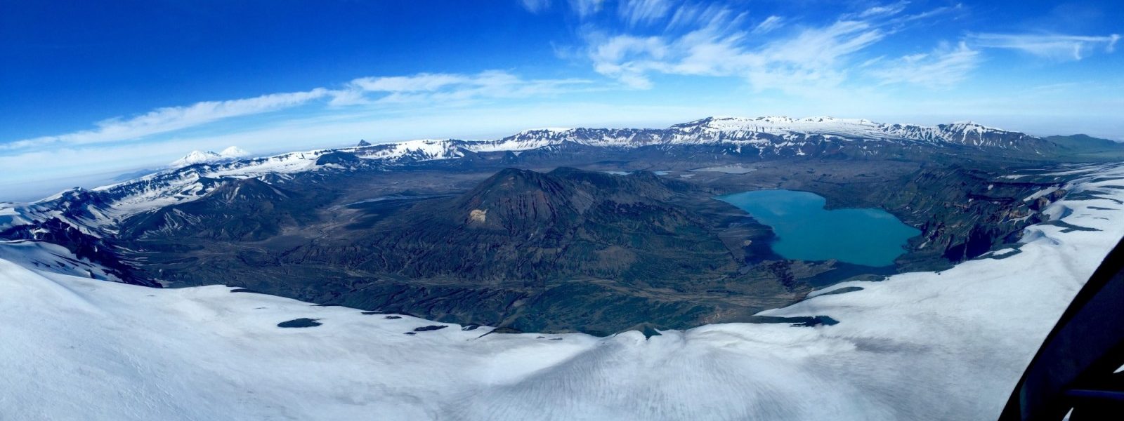
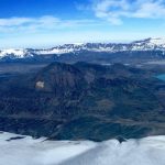
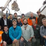
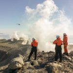
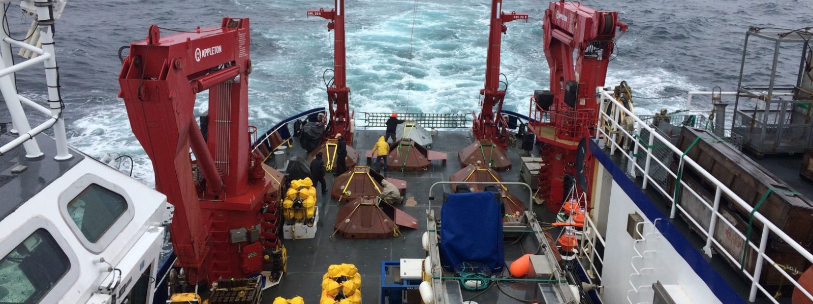
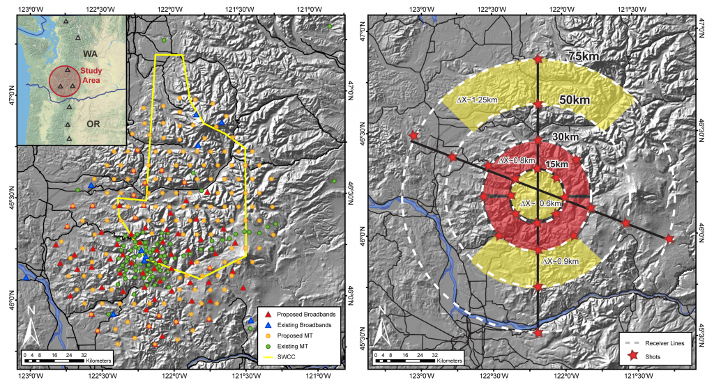
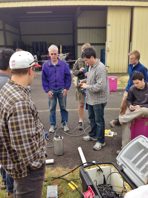
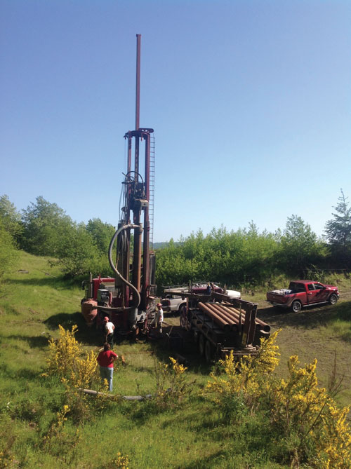
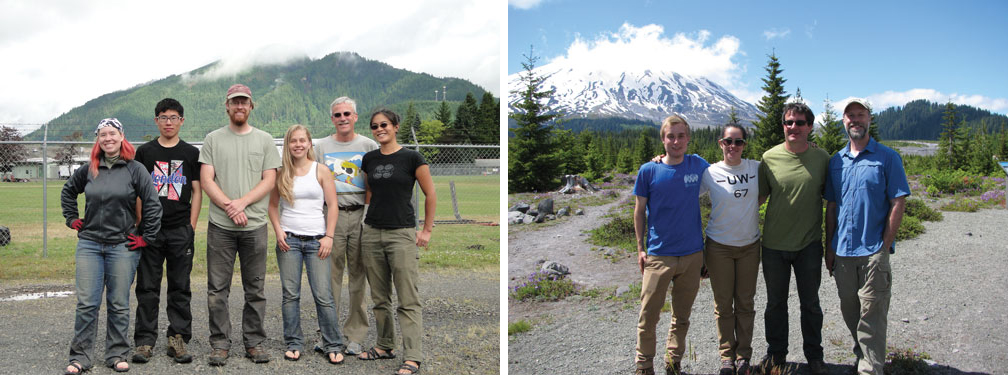
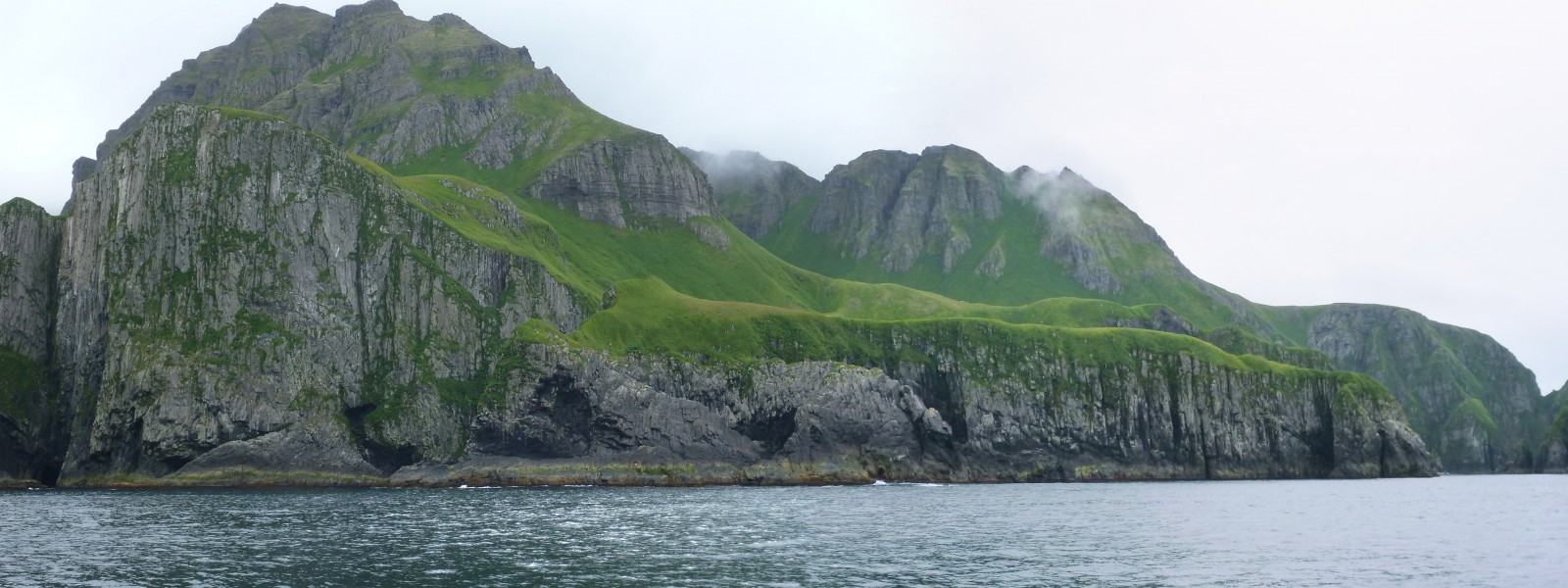
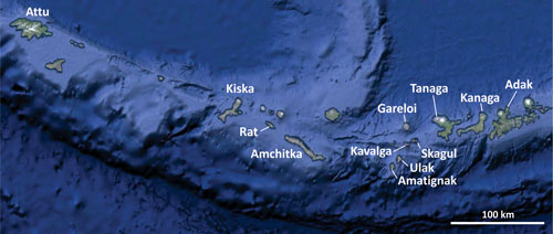
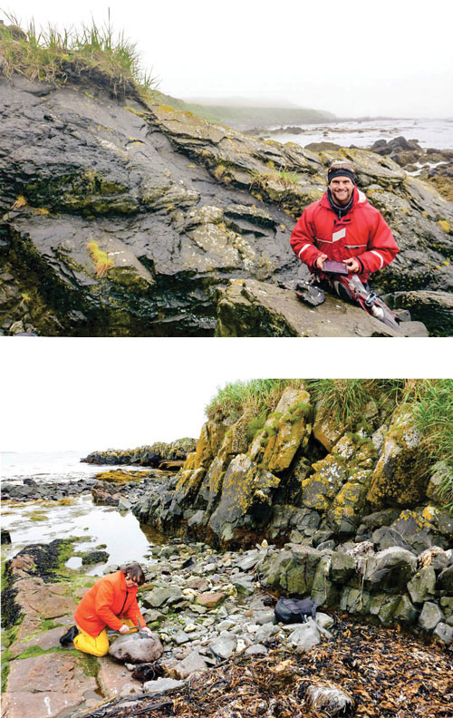
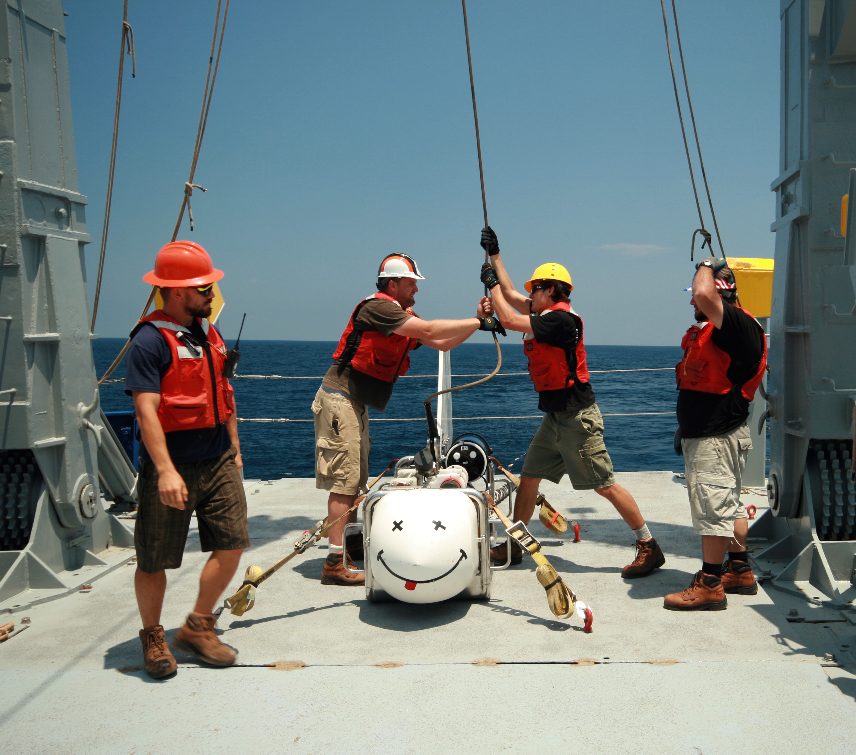
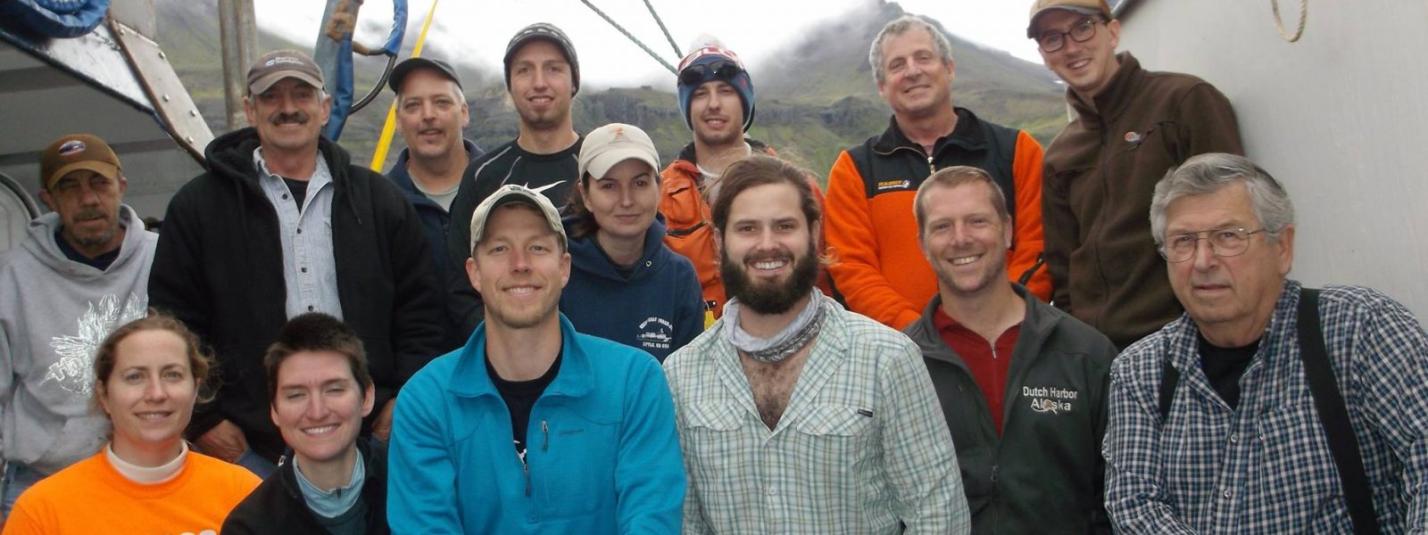
A NSF-funded group led by DTM seismologist Diana Roman headed to Alaska for three weeks,two of which were spent on the research vessel Maritime Maid, to collect seismic data in the Islands of the Four Mountains and tephra samples throughout the eastern Aleutians. The group included Roman and DTM postdoc Amanda Lough, as well as Dan Rasmussen, Alex Lloyd, and Terry Plank from Columbia University’s Lamont-Doherty Earth Observatory, Pete Stelling from Western Washington University, and John Power, John Lyons, Christoph Kern, and Cindy Werner from the U.S. Geological Survey.

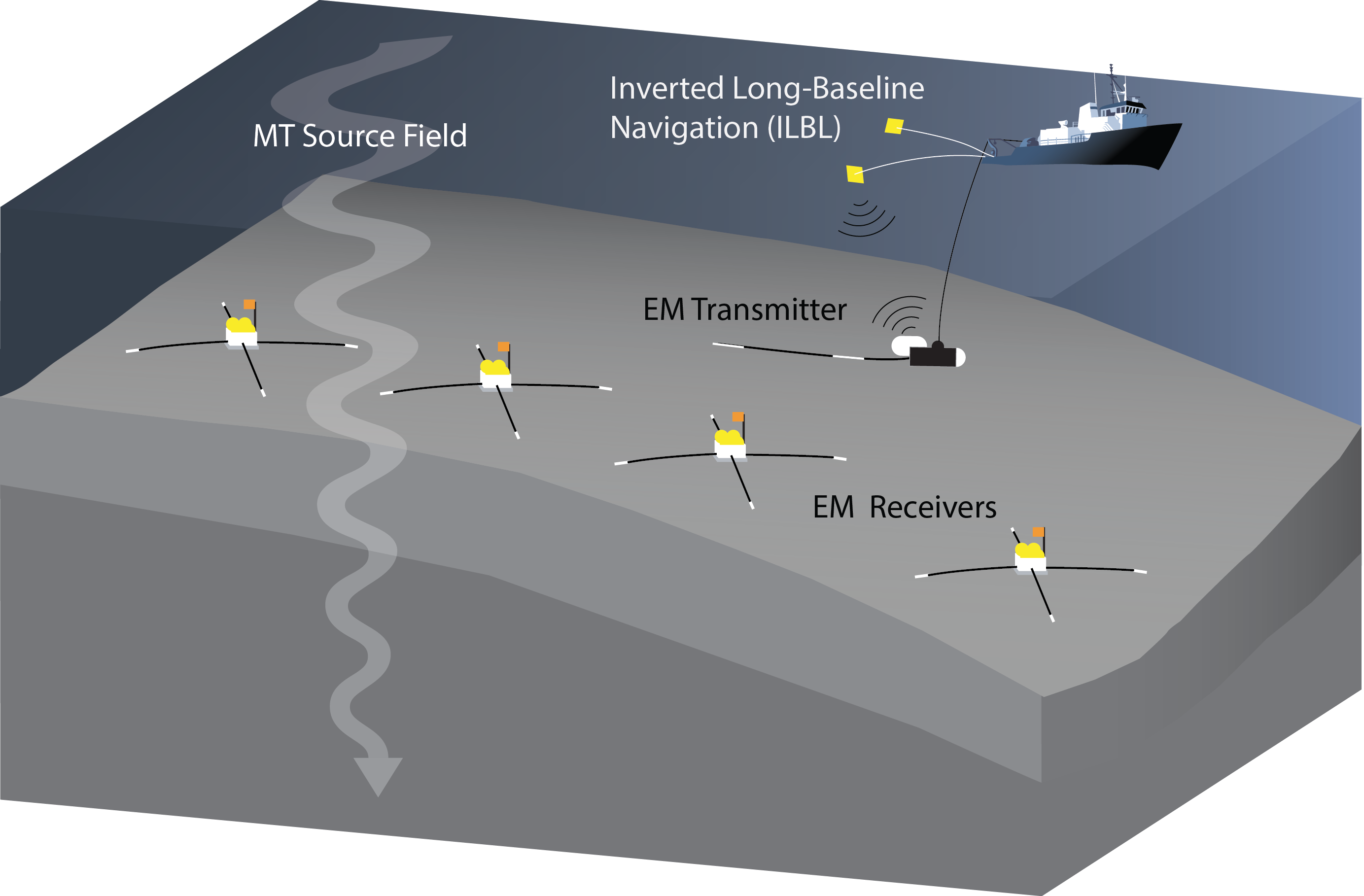
The goal of their work is to determine how the amount of water dissolved in magma affects where, and for how long, magma is stored in Earth’s crust. This information is critical for accurately
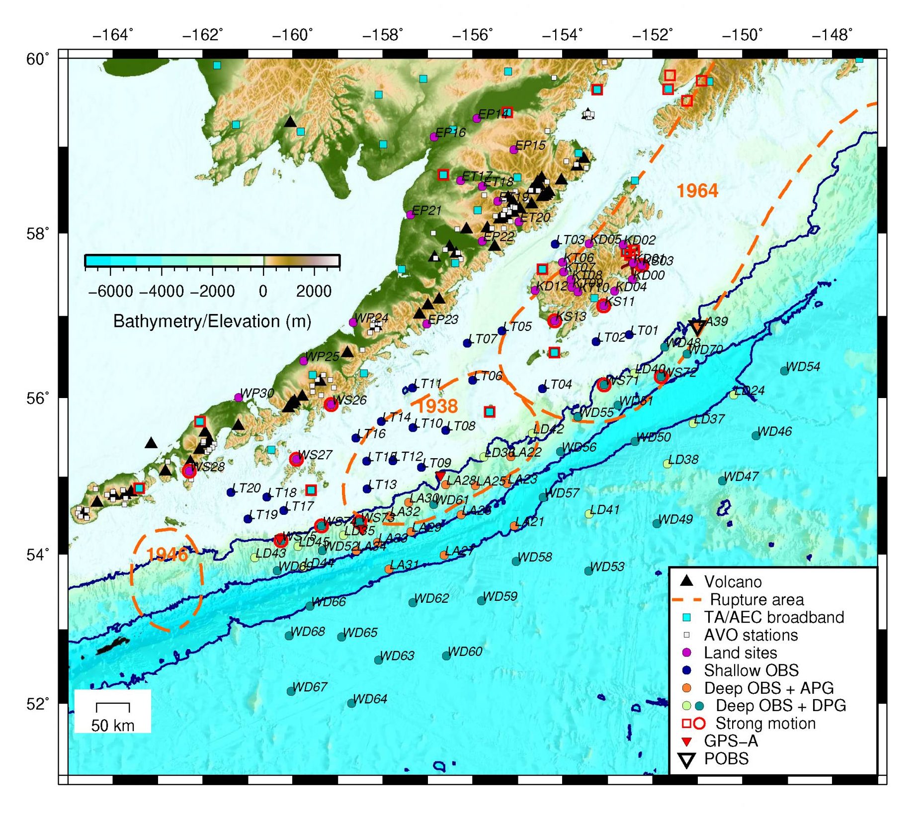
forecasting volcanic eruptions and understanding the large-scale processes that lead to volcanism in Earth’s subduction zones. The volcanoes targeted in this study have a wide range of magma water contents, magma storage depths, and depths of seismic activity, making them ideal candidates for this research.

Roman led another trip in the summer of 2016 to retrieve seismic equipment from the Islands of the Four Mountains. ■

“Report from the Field” was designed to inform the community of real-time, exciting GeoPRISMS -related research. Through this report, the authors expose the excitement, trials, and opportunities to conduct fieldwork, as well as the challenges they may have experienced by deploying research activities in unique geological settings. If you would like to contribute to this series and share your experience on the field, please contact the GeoPRISMS Office at info@geoprisms.nineplanetsllc.com. This opportunity is open to anyone engaged in GeoPRISMS research, from senior researchers to undergraduate students.
We hope to hear from you!

Reference information
Islands of Four Mountains to Unimak: From the slab to the surface
GeoPRISMS Newsletter, Issue No. 36, Spring 2016. Retrieved from http://geoprisms.nineplanetsllc.com

Magnetotelluric & seismic investigation of arc melt generation, delivery, and storage beneath Okmok volcano


Ninfa Bennington (U. Wisconsin-Madison), Kerry Key (Scripps Institution of Oceanography), and USGS Investigators Matthew Haney and Paul Bedrosian

Okmok Volcano - Umnak Island in the eastern Aleutian islands of Alaska
Fore more information about the project, videos, photos, updates, visit the blog

Okmok is one of the most active volcanoes in the Aleutian arc and hosts a 10 km diameter caldera. The subdued topography of Okmok, relative to other Aleutian volcanoes, improves access and permits dense sampling of the volcanic edifice. We have selected Okmok as the site of study for this project due to frequent volcanic activity and the presence of a crustal magma reservoir as inferred from previous seismic studies. At least two caldera forming eruptions are recognized and Okmok is believed to be representative of volcanoes both within the Aleutian arc and worldwide, where long periods of effusive eruptions are punctuated by much larger explosive caldera forming eruptions.

We are applying geophysical techniques to characterize the magmatic system beneath Okmok. During the summer of 2015, we collected onshore and offshore magnetotelluric (MT) data and installed a temporary year long seismic deployment. The seismic instruments will be retrieved in summer 2016. These new geophysical data will be used to test hypotheses regarding the role of slab fluids in arc melt generation, melt migration within the crust, and the crustal magmatic plumbing and storage system beneath Okmok Caldera.

Offshore MT Field Deployment

After numerous delays due to thick fog typical of the Aleutians, the entirety of the offshore MT crew arrived to Dutch Harbor, AK and was assembled on the R/V Thompson. On June 18, 2015, the team departed Dutch Harbor for their first offshore MT site. The offshore crew spent the day preparing receivers so that there were only a few remaining steps to complete before deploying them over the side of the ship. By June 20, all 54 MT receivers had been deployed well ahead of schedule.

With the MT deployment complete, the team collected multi-beam bathymetry data on the upper forearc slope south of Umnak Island using the ship’s EM302 multi-beam echo sounder. On top of mapping the bathymetry of the ocean floor, the intensity of these recordings can be used to help determine the nature of the seabed (e.g. sediments versus hard rock). On June 21, the offshore team transited back to Dutch Harbor via Umnak pass. This return route included spectacular views of Mount Makushin Volcano on Unalaska Island.

Onshore MT and Seismic Deployments

On June 23, having returning to Dutch Harbor from offshore MT work, co-PI Key and Scripps graduate student Georgiana Zelenak joined up with the rest of the onshore team (PI Bennington, UW-Madison post-doc Summer Ohlendorf, and USGS collaborators Matthew Haney and Paul Bedrosian) and departed for Umnak Island. The onshore work was based out of Bering Pacific Ranch at Fort Glenn, an abandoned WWII military base, with a helicopter transporting the seismic and MT teams and equipment during the 19 days of field operations.

After the team arrived at Fort Glenn, the camp house was set up and seismic and MT equipment were prepared for the start of field operations the following day. Seismic and MT field operations commenced on June 23 and extended until July 11. The seismic team installed thirteen temporary broadband seismometers both in and around the Okmok Caldera. In tandem with the Alaska Volcano Observatory’s twelve permanent seismic stations, there are now twelve seismic instruments within or at the rim of the caldera and 14 seismic instruments outside the caldera. The temporary array will record seismic data until its retrieval in summer 2016. Onshore magnetotelluric data were collected in a 3D array using a combination of long-period and wide-band MT systems, with 19 stations within the caldera and ten stations outside. Following the completion of onshore fieldwork, part of the onshore team (PI Bennington, Summer Ohlendorf, and USGS collaborators Matthew Haney and Paul Bedrosian) caught a charter flight back to Dutch Harbor. Co-PI Kerry Key and graduate student Georgie Zelenak hitched a more unconventional ride when the rescue boat from the RV Sikuliaq picked them up from Umnak Island.

Offshore MT Instrument Recovery

Following completion of onshore MT work, the offshore MT team made a six day cruise on the new R/V Sikuliaq to recover offshore MT instruments. Of the 54 offshore deployments, 53 instruments were successfully recovered while one instrument was lost in Umnak pass due to strong tidal currents in the shallow water. ■

“Report from the Field” was designed to inform the community of real-time, exciting GeoPRISMS -related research. Through this report, the authors expose the excitement, trials, and opportunities to conduct fieldwork, as well as the challenges they may have experienced by deploying research activities in unique geological settings. If you would like to contribute to this series and share your experience on the field, please contact the GeoPRISMS Office at info@geoprisms.nineplanetsllc.com. This opportunity is open to anyone engaged in GeoPRISMS research, from senior researchers to undergraduate students.
We hope to hear from you!

Reference information
Magnetotelluric & seismic investigation of arc melt generation, delivery, and storage beneath Okmok volcano
GeoPRISMS Newsletter, Issue No. 36, Spring 2016. Retrieved from http://geoprisms.nineplanetsllc.com

A Field Campaign to the Aleutians


Field work in the Aleutian Islands is complex, expensive, and thoroughly exciting. When the community suggested to NSF that we facilitate a collaborative field platform to get safely to and from the many islands of interest along the arc, we turned to our colleagues in the Division of Polar Programs (PLR). They helped us coordinate, along with the USGS and Alaska Volcano Observatory (AVO), a combined logistics platform of ship and helicopters that could support the science proposed by our eager PIs.

Planning began in the summer of 2014, as we looked at the proposals that had come into the GeoPRISMS deadline focused on work in Alaska and the Aleutians. What was funded from that round was a group of well-reviewed proposals that together we felt had a chance to make real progress on the goals laid out in the Science and Implementation Plan. We got to work with the PIs, the USGS & AVO, Polar Field Services (who would manage the logistics), and PLR to set up the work, get everyone permitted, and get our scientists in the field. We leveraged funds from a number of places to make this work. EAR and OCE, via the GeoPRISMS Program, funded the bulk of the platform. The Directorate for Geosciences (GEO) contributed funds as well. The GeoPRISMS project shared mobilization costs with a previously-funded Arctic Social Sciences project. The Polar Geospatial Center generated DEMs and maps to help researchers better target their time on these remote islands.

In the summer of 2015, three teams of academic researchers along with scientists from the USGS & AVO set off on unprecedented coordinated research in the Aleutian Islands. They shared ship and helicopter time aboard the Maritime Maid, a helicopter-capable research vessel that traveled along more than 800 miles of volcanic arc, from Dutch Harbor in the east to Buldir Island in the west, transporting scientists and equipment on and off the islands. The USGS, already involved in assisting our scientists with permitting and field expertise, also funded their own helicopter time to service monitoring stations on volcanoes, some of which hadn’t been visited in many years. The Deep Carbon Observatory, funded by the Sloan Foundation, provided additional support for a fourth team of researchers to occupy the remaining free berths on the Maritime Maid, maximizing the efficiency of the ship and the potential for real scientific progress.

Field work included rock and gas sampling from numerous volcanoes, as well as geophysical deployments (seismic and magnetotelluric) via this joint logistics platform and parallel-funded projects in the eastern part of the arc. The scientists involved were interested in a range of topics, including magma storage beneath the volcanoes, the chemistry and style of eruptions, and earthquake and tsunami hazards in the Pacific.

This multidisciplinary, multi-scale, collaborative work has already and will, in the future, yield remarkable results that help forward the goals laid out in the GeoPRISMS Science and Implementation Plan. The researchers returned home (mostly) unscathed and very scientifically successful, and both NSF and the USGS have praised the endeavor which uniquely coordinated resources to accomplish the goals of two federal agencies. The GeoPRISMS Program estimates that we saved nearly a million dollars by leveraging what we could, partnering with experts, and being strategic in our thinking, funding, and planning.

– Maurice Tivey
GeoPRISMS Program Manager, National Science Foundation

Magnetotelluric & seismic investigation of arc melt generation, delivery, and storage beneath Okmok volcano

Magnetotelluric & seismic investigation of arc melt generation, delivery, and storage beneath Okmok volcano

Ninfa Bennington (U. Wisconsin-Madison), Kerry Key (Scripps Institution of Oceanography), and USGS Investigators Matthew Haney and Paul Bedrosian Okmok is one of the most active volcanoes in the Aleutian arc and hosts a 10 km diameter caldera....
Islands of Four Mountains to Unimak: From the slab to the surface

Islands of Four Mountains to Unimak: From the slab to the surface

Report retrieved from the website of the Department of Terrestrial Magnetism Carnegie Institution of Washington and the Facebook page of the field mission (IFM-Unimak 2015: From the Slab to the Surface) Scientists have a relatively good understanding...
Investigating older rocks in the oceanic Aleutian volcanic arc east of Adak

Investigating older rocks in the oceanic Aleutian volcanic arc east of Adak

Peter Kelemen (Columbia University, LDEO) on behalf of Merry Yue Cai (Columbia University, LDEO), Emily H.G. Cooperdock (UT Austin), Steve Goldstein (Columbia University, LDEO), Matt Rioux (UC Santa Barbara), and Gene Yogodzinski (University of South...
Seeking the origins of continents in the western Aleutian island arc

Seeking the origins of continents in the western Aleutian island arc

Elizabeth Cottrell (Smithsonian Institution), Katherine A. Kelley (University of Rhode Island), Michelle Coombs (USGS Alaska Volcano Observatory), Elizabeth Grant (University of Washington), Mattia Pistone (Smithsonian Institution), and Katherine Sheppard...

AACSE:  The Alaska Amphibious Community Seismic Experiment


North America’s largest recorded earthquakes and largest documented volcanic eruptions both take place in southwest Alaska. A major shoreline-crossing community seismic experiment commenced in 2018, focused on the Alaska Peninsula subduction zone. Alaska is a GeoPRISMS primary site and EarthScope target. The deployment is augmented by deployment of EarthScope Transportable Array (TA) seismic stations, earthquake and volcanic monitoring networks, and the development of a large pool of ocean bottom seismographs (OBSs). Together, these resource provide a unique opportunity to advance understanding of Alaska and subduction processes generally.

The Alaska Amphibious Community Seismic Experiment (AACSE) collects seismic data remotely onshore and offshore, all of which have been freely released to the community. The array includes 75  broadband OBSs and 30 land broadband sensors, recording for 15 months beginning May-June 2018. The array covers a broad area that spans the incoming plate, the megathrust and volcanic arc to the distal backarc, and includes a dense transect in the Kodiak/Katmai region. When integrated with the TA, the array extends 1500 km from incoming plate to the Arctic coast and spans 700 km along strike. The OBSs include 20 shielded sensors for deployment in shallow water. Many OBSs include absolute pressure gauges to capture possible slow slip events, while five OBSs and six land sites will include accelerometers to record large local earthquakes without clipping.

A map of the deployment plan (PDF, last update March 10, 2020) and a detailed deployment plan can be found below. The project is intended to help grow the seismological community, and included opportunities to sail on OBS cruises and short courses for undergraduates.  Feel free to contact members of the PI team for more information.

Deployment and DataPI teamLinks & DocumentsWebinarEarly Career and Education Program

Important note: LDEO OBS station locations incorrect in channel metadata

Prior to late June, 2020, station locations were incorrectly reported in some metadata for LDEO OBS sites (station codes LA##, LD##, and LT##). Specifically, metadata requested from the IRIS DMC at the level of “channel” reported latitude, longitude, and elevation from planning documents, and not from final surveyed OBS locations, while metadata requested at the level of “station” correctly reported final OBS locations. Users should compare station location information for all data downloaded prior to late June, 2020 to correct locations stored in station-level metadata or to correct final locations reported in the table (.txt or .xls) to ensure that correct station locations were used. New metadata were submitted for LDEO OBS sites on June 26, 2020, and were available shortly after this date.

Seismicity Catalog

In an alternative format, the full catalog is available from within the ANSS Comprehensive Earthquake Catalog (ComCat), searching by setting the Catalog option to Aacse

Cruise reports

MGDS is the primary repository for cruise reports. Please find below links to PDF report for each cruise and their MGDS webpage.

Data Availability

OBSIC has released horizontal-component seismometer orientations for AACSE OBSs. That table, along with some clock drift corrections and other reports, are distributed by the IRIS Data Services.

Final station locations based on OBS acoustic surveys or GPS position onshore are available from the IRIS DMC’s Station metadata, or on this table (.txt or .xls).

All broadband seismometer data are now available from the IRIS Data Center under network code XO, and the nodal data are available under network code 8J.

Marine geophysical data are available or being made available through the Marine Geoscience Data System.

The AACSE PI Team at the Portland (ME) OBS Workshop in September 2017. From left to right, top to bottom: Lindsay Worthington, Susan Schwartz, Anne Sheehan, Spahr Webb, Emily Roland, Donna Shillington, Aubreya Adams, Doug Wiens, and Geoff Abers.

PI team for the Alaska Amphibious Community Experiment

Geoff Abers (Cornell University, abers at cornell.edu)
Douglas Wiens (Washington University in St Louis, doug at wustl.edu)
Susan Schwartz (UC Santa Cruz, syschwar at ucsc.edu)
Emily C. Roland (Western Washington University, emily.roland at wwu.edu)
Anne Sheehan (University of Colorado Boulder, anne.sheehan at colorado.edu)
Aubreya Adams (Colgate University, aadams at colgate.edu)
Donna Shillington (Northern Arizona University, Donna.Shillington at nau.edu)
Spahr Webb (LDEO, Columbia University, scw at ldeo.columbia.edu)
Peter Haeussler (USGS, pheuslr at usgs.gov)
Lindsay Worthington (University of New Mexico, lworthington at unm.edu)

Other project leads

Patrick Shore (WUSTL – field support)
Anne Bécel (LDEO – active-source leg)
Grace Barcheck (Cornell – data assessment)
Natalia Ruppert (UAF – catalog production)
John Collins (WHOI – OBSIC)
Jim Gaherty (LDEO/NAU – OBSIP)

Learn more about the AACSE:


A webinar (April 25, 2016) introduced the community to the exciting scientific opportunities that this DCL offers and to outline general strategies for achieving them. Watch the record of the webinar below.

Presenters: Susan Schwartz, Geoff Abers, Emily Roland, Rob Evans, Doug Wiens, Jeff Freymueller

The AACSE Community

As a community experiment, the AACSE project was intended to build capacity and help grow the seismological community. The project included multiple opportunities for both early and mid- career researchers, students and community members to get involved in the scientific planning and data acquisition. The PI team included scientists at all career stages, including three pre-tenure investigators who were involved in all stages of the project from proposal writing to logistics planning to data preparation and gained experience leading onshore and offshore data acquisition legs.

Apply-to-Sail

The AACSE Apply-to-Sail program was open to interested scientists at all career stages as a way to broaden and diversify the user-base of ocean bottom seismometer data, offer training in marine geophysical data processing and to develop sea-going experience. Opportunities were advertised via GeoPRISMS and other community listservs, individual PI Twitter handles, and word-of-mouth. Over the course of four offshore OBS operations cruises in 2018-2019 aboard the R/V Sikuliaq and R/V Langseth as well as an active-source acquisition cruise aboard R/V Langseth in 2019, more than 25 Apply-to-Sail participants sailed with the AACSE. These included 20 graduate students and postdoctoral researchers, 3 mid-career scientists new to OBS data acquisition, 3 undergraduate students and two K-12 teachers from Alaska.

“For the past 3 years, I’ve been looking at OBS data off the east coast of New Zealand’s North Island, and I always wondered about the logistics behind ‘my’ dataset of earthquakes. It turns out that deploying ocean bottom seismometers is a huge task that includes multiple people. This experience exceeded all my expectations. I imagined a boring and repetitive process, but every single station has its own challenges: the bathymetry indicating a rough or steep relief so we have to move somewhere close by with a more flat and soft bathymetry, be sure the temperature sensors are the ideal for specific depths, fill the sheets with station information and log it in our physical and digital forms, and a large etcetera. After this experience, I really value all the effort that the science crew did for the deployment and recovery of the data that I am currently working on.”

-Jefferson Yarce, University of Colorado graduate student (now at University of Michigan), Apply-to-Sail 2018 Leg 2

“The Apply to Sail program for the AACSE was my first opportunity to participate in broadband OBS research at sea. As an early career scientist, I believe the experience was formative – it helped develop my understanding of the planning and execution of field operations for OBS experiments, introduced me to the essential roles of technicians and other experts, and allowed me to interact with students from a range of backgrounds as a peer-mentor at sea. I hope to see similar opportunities continue in the future.”

-Helen Janiszewski, University of Hawaii Asst Professor, Apply-to-Sail 2019 Leg 1

Undergraduate Short Course

To highlight career and research opportunities in geophysics and tectonics to the next generation of scientists, the AACSE team hosted a short course on seismology and Alaskan tectonics during the summer of 2019. The short course was advertised to a broad range of professional and social platforms, with a strong emphasis on recruiting students from minority serving institutions and institutions lacking a geophysics program. Six students were selected from a national pool of 53 applicants, and joined members of the AACSE team on Kodiak Island. This short course included classroom-based work about how to access and process seismic data, a field trip to important geologic and tectonic sites around Kodiak Island, and field work, during which students assisted with the recovery of 398 nodal seismometers. As a capstone project, the undergraduate student participants created a storymap, outlining the goals of the AACSE, and their own roles within the project (accessible with an ArcGIS account).

I had such an incredible experience with AACSE. I don’t think I realized it at the time, but AACSE really influenced my academic course. I used to study geology region by region or terrane by terrane. AACSE helped me view the world as an interconnected system. It really opened my eyes to the incredible volume of data that some earth scientists work with and different methods of identifying patterns within the data. … [Working in the field] taught me about keeping explicit, easy to understand notes; the importance of checking every serial number; and having a good attitude in the field. I hadn’t even given a thought about grad school until [organizers] asked if I had any plans.  -Cora Van Hazinga

Participating in the AACSE project on Kodiak island was an incredible experience.  I learned so much about seismology and tectonics from the short course, and it was so valuable to participate in active research and work with the research team to contribute to the project. -Emma Devon

iMUSH: Imaging Magma Under St. Helens


Carl Ulberg (University of Washington) and members of the iMUSH field team

The imaging Magma Under St. Helens (iMUSH) experiment is a collaborative research project involving several institutions with an aim to illuminate the magmatic system beneath Mount St. Helens, WA, from the slab to the surface. A variety of geophysical imaging techniques (magnetotelluric, active-source, and passive-source seismology) are being used in conjunction with geochemical and petrologic data to image and interpret the crust and upper mantle in the greater Mount St. Helens (MSH) area. All components of the project were underway during the 2014 field season, deploying instruments and collecting data. The active source experiment successfully set off 23 shots, recording data at about 6000 sites in late July and early August. Magnetotelluric measurements were made at 40 sites during the summer of 2014 and many rocks were collected and analyzed. The passive source seismic deployment occurred between June 16 and July 2, and involved installing 70 broadband seismometers in a ~50 km radius around MSH. The following sections detail the passive seismic deployment.

Figure 1. Proposed project map showing deployment locations of passive source seismic imaging and magnetotelluric survey (left) and active source tomography (right) in the greater Mount St. Helens area. For the active part (right), black lines are refraction profiles, each with 8 shots (red stars) and 1000 Texans. Colored areas are areal areas, each containing 1600 Texans.

June 16-June 22: Kelso, Organizing

18 people descended on an airport hangar in Kelso, WA, to begin the passive deployment. After a couple of days training on the instruments and installation procedures, buying materials and getting them ready, we headed out to begin the installations. We started out in two large groups to learn the ropes, then began to split into teams of two to three to install further sites.

Figure 2. The participants practicing seismic station setup in Kelso, WA. Photo credit: Seth Moran

Figure 2. The participants practicing seismic station setup in Kelso, WA. Photo credit: Seth Moran

A Day in the Life (by Steve Malone)

After a late night the evening before with the PIs (Principle Investigators) “strategizing” about what should next be done, it is an early morning departure. After a half hour drive one team realizes they don’t have the maps for where they are going and must return to the motel to pick them up. Another team has a flat tire on some very rough roads and must return on the spare to get it fixed…a good thing since later in the day they have another flat (different tire) so really needed that spare. Using a combination of written instructions, road maps, Forest Service maps, private timber company maps, a laptop computer with mapping software, a compass and a GPS the team finds its way to its assigned installation site which has been investigated and permitted sometime in the last couple of years. Now it is time to really get to work.

Equipment is hauled from the truck several hundred meters to the actual site, in multiple trips. Discussions, opinions and arguments issue between the two PIs in this team over exactly where the best place for the vault should be. It must be away from tall trees, in ground that can be dug but as close to bedrock as the site provides. In the meantime the hole is dug by hand by Alicia, who just graduated with a PhD and has forgotten that she should leave the digging to current grad students and participate in the PI discussions.

The actual sensor is very sensitive and must be handled with care even when its moving parts are locked for transport. Once installed on the small concrete pier in the bottom of the hole and cables attached it can be unlocked. At this point the sensor is very vulnerable to damage if moved.

In the meantime another team is working on other parts of the station installation. Many sites will be powered by solar panels. Because of the elevation and winter weather they must be installed on a mast to get them above the likely snow depth, sometimes as much as four meters deep in late winter. The mast consists of a wood post buried up to a meter with a sectional pipe bolted to it.
Once all of the heavy work is done it is time to make all the connections and test the system. A rat’s nest of wires and cables in the equipment box connects the various components. The seismometer cable comes in through a PVC pipe and power cable is protected from animals with a wire mesh screen. A seismometer control box allows for testing, unlocking and centering the seismometer even without a datalogger. The datalogger gets timing information from a specialized GPS antenna. A regular iPod with special software and cable is used to configure, initialize and test the datalogger. In one case the team forgot the iPod in the equipment box and had to drive all the way back to the site the next day to retrieve it.

Near the end, with only back filling and covering the vault and cleaning up left to do the site is a mess of tools, equipment boxes, shipping containers and water jugs. Once all of this is hauled back to the truck the site should be relatively inconspicuous.

Other Distractions

Initial sites were on the west side of MSH in a lot of timber land and we quickly found our tires weren’t up to the task. We got over ten flats split between six vehicles and thankfully no one ever got stuck, although there were at least two cases of a full flat plus another slow leak where the vehicle was able to make it back to town in time.

The World Cup was happening at the same time so some people used creative means to catch a game, although for the most part we were resigned to learn the results when we returned at night (those of us who cared, that is). Turned out sitting in a tire store waiting for a flat to be fixed was a good way to spend the morning. One team had the luck of a wet mix of concrete, which of course called for eating lunch in town (somewhere with a TV!) waiting for it to dry. Or getting a site where there was still radio reception- sitting in the car for 15 minutes to listen to the US fall to Belgium while your partner digs a hole in the blazing heat isn’t so bad, is it?

June 22-June 29: Split up- Trout Lake vs. Randle

After a week based out of the relatively civilized Kelso, WA, the group split into two smaller teams to venture east into the boonies. So the race began between Team Randle and Team Trout Lake.
In Randle, many of the sites were on Forest Service land, with much longer drive times. We began with eight people and dwindled down to five over the next week as other commitments took people away. These were long days with a lot of driving. We used slow-drying cement (the only kind available) the first day, so that delayed things a little bit, since it required returning several days later to finish the installation. Thankfully we had no flats. We were staying in a combination motel/bar/restaurant, and it was the only place we ate dinner for almost a week. It had some variety at least, and a warped pool table, jukebox, and karaoke. Internet service was limited so we had to learn to enjoy each others company instead.

Compared to Randle, Trout Lake initially sounded like a breeze. Great progress was made every day, there were two (!) places to eat at night, and teddy bears on the beds. Not everything was fun and games, however…

We have had a few field adventures, fortunately none involving flats. An iMUSH rig was high-centered on a snow drift for 15 minutes on our first day, on a road which turned out to be closed (no sign) due to snow. Fortunately another vehicle came up the road, even more fortunately it had a tow strap and was able to pull the iMUSH rig back to terra firma. Unfortunately we will not be able to reach that site until we get a few good warm days to finally melt off the snow. Another adventure involved installing a site on a steep slope with a thin soil veneer on top of bedrock that defeated all attempts at whacking it with a breaker bar. The site was installed, but the crew is less than confident about its ability to withstand snow creep (particularly the solar panel mount).Seth Moran, USGS-CVO

This site wins the prize for the worst site ever. During the siting visit a year ago Seth badly sprained his ankle. The road in had awful berms and potholes and crazy trees. The slash was crazy deep and slippery. And yet, Ben managed to haul about 160 lbs. of material through it. What a trooper.
One of the nuts on the solar panel mount was double threaded, so Tim and Roger had to saw it off. We also forgot to undo the solar panel cable before erecting the mast, so Tim got up on Ben’s shoulders to reach it. Dinner in Hood River tonight. We earned it. Whoot!Alicia Hotovec-Ellis, UW post-doc

The heat was unforgiving. It was even harder to bear when that overloaded SUV decided to fight back. The odds were against them when she blew a tire on that old dusty road. This wasn’t the first hardship they encountered, but it came at the worst time. They couldn’t chance being stranded since their comrades were hours away. The only option was to see if that old four wheeler could be put back together. The help they needed was back in town at an old service station, so the two travelers turned tail and ran. Once that old hunk of junk was fixed up, they decided to give it one more go. Although their hopes were high, their original plan was abandoned. They decided to head to the longest and most arduous site, to deploy one of the few remaining seismometers. The two weren’t out of the woods yet. They went on a few unexpected detours and were devoured by godless horse flies. After their long day was done, they headed back to that little town shadowed by the mountain.They grabbed a fulfilling meal and drank a nice strong brew…They were victorious.Gina Belair, UC-Berkeley undergrad and IRIS intern

June 29-July 2: Finishing up, Kelso

After a week further afield, the remaining participants returned to Kelso to finish up the installs on the west side of the volcano. By this time we were all seasoned pros. Combine that with fewer sites and fewer people to keep track of, and we were able to make quick work of the remaining sites and return home to celebrate the Fourth of July, until some of us returned a couple weeks later to service the instruments before the active seismic experiment began shooting.

July 15-August 5, 2014: Active Seismic Experiment

Drilling a shothole

Drilling a shothole

The iMUSH active seismic experiment was fielded from instrument centers established in the gymnasiums of public schools in the towns of Castle Rock, Woodland, and Carson, Washington. A group of 55 volunteers and four PASSCAL field technicians deployed about 2500 Texan recorders in two deployments. A dozen UNM volunteers and Nodal Seismic personnel fielded the Nodal Seismic recorders. Over 1100 instruments were hiked into the Mount St. Helens National Monument. UTEP personnel from the National Seismic Source Facility oversaw drilling and loading the 23 shotholes, and detonating the explosions. The field operations were preceded by twelve weeks of surveying and permitting. The experiment extended across the Gifford Pinchot National Forest and lands belonging to four timber companies and the State of Washington, requiring permits from fifteen public and private organizations. In addition to excellent recordings of the shots, the iMUSH active source instruments recorded dozens of local earthquakes.

Spring-Fall, 2014: Magnetotelluric Deployment

The iMUSH magnetotelluric (MT) deployments were staged from Oregon State University, in Corvallis, OR, with a forward operating base in Portland, OR. A total of 40 MT stations were completed in 2014, 97 additional stations were permitted, and 13 remain to be permitted in 2015. MT field crew participants included a USGS team led by Jarod Peacock and Lyndsay Ball, who did the major 2014 push, and an OSU team led by Myle McDonald, who installed iMUSH sites in the Fall of 2014 until the end of the field season. MT work is seasonal and is usually initiated when the ground is clear of snow and ends when snowfall becomes a significant operating concern. The 2014 field operations were limited by the number of instruments that operated with reliable firmware and the number of magnetic field seasons. The 2015 field season is about to get underway, with OSU taking up the initial installations, and USGS anticipated to resume operations later in the field season. For 2015 operations, the number of wideband MT instruments will increase from four to ten and two field crews will operate simultaneously for much of the field season.

Deploying Texans on foot around Mount St. Helens

Deploying Texans on foot around Mount St. Helens

More daily blog posts compiled by Steve Malone detailing all parts of the iMUSH experiment are on the website (imush.org). Participants in the passive seismic broadband deployment included Ken Creager, Shelley Chestler, Kelley Hall, Jiangang Han, Alicia Hotovec-Ellis, Mika Thompson, Carl Ulberg, Mark Welch (University of Washington); Geoff Abers, Zach Eilon (LDEO); Tim Clements (Cornell); Gina Belair (UC-Berkeley); Dylan Jamison (USGS-UW); Ben Alonzo, Roger Denlinger, Seth Moran (USGS-CVO); Eric Makarewicz, George Slad (PASSCAL Instrument Center). The active seismic experiment is led by Alan Levander (Rice University), the magnetotelluric component is led by Adam Schultz (Oregon State University) and Paul Bedrosian (USGS) and the petrologic studies are led by Olivier Bachmann (ETH Zurich), Tom Sisson (USGS) and Mike Clynne (USGS). iMUSH is funded by NSF-GeoPRISMS, NSF-Earthscope with substantial in-kind support from the USGS. Broadband seismometers and support was provided by IRIS-PASSCAL.

Newsletter_Spring2015_iMUSHgroupCreager

“Report from the Field” was designed to inform the community of real-time, exciting GeoPRISMS -related research. Through this report, the authors expose the excitement, trials, and opportunities to conduct fieldwork, as well as the challenges they may have experienced by deploying research activities in unique geological settings. If you would like to contribute to this series and share your experience on the field, please contact the GeoPRISMS Office at info@geoprisms.nineplanetsllc.com. This opportunity is open to anyone engaged in GeoPRISMS research, from senior researchers to undergraduate students.
We hope to hear from you!

Reference information
iMUSH: Imaging Magma Under St. Helens, Ulberg C. and members of the iMUSH Team

GeoPRISMS Newsletter, Issue No. 34, Spring 2015. Retrieved from http://geoprisms.nineplanetsllc.com

Evolution of the Chemically Diverse Aleutian Island Arc


Brian Jichaand Suzanne Kay2

1Department of Geoscience, University of Wisconsin-Madison, Madison, WI, 2Department of Earth and Atmospheric Sciences, Cornell University, Ithaca, NY

Figure 1. Google Earth image of western Aleutian arc showing islands studied as part of this project.

The Alaska-Aleutian Arc extends for more than 3500 km westward from central Alaska to the Kamchatka Peninsula. The timing of Aleutian Arc inception and subsequent compositional evolution through the initial stages of arc growth are poorly known. Early estimates of Aleutian Arc inception varied from 70 to 40 Ma (e.g., Grow and Atwater, 1970; Scholl et al., 1986), but were based on very little data. Determining precisely how and when the Aleutian Arc began to form was one of the initial goals of this project. By addressing a central question of the GeoPRISMS Program (What are the physical and chemical conditions that control the development of subduction zones, including subduction initiation and the evolution of mature arc systems?) we intended to help link subduction initiation in the Aleutians with similar tectonic events at subduction zones in the western Pacific.

We identified outcrops on several islands that appeared to have a high probability of providing new limits on the timing of arc inception. Specifically, we focused on mafic ‘basement’ rocks and intrusives that cut the mafic lavas on Amatignak, Ulak, and Amchitka Islands (Fig. 1). These islands were interpreted to host remnants of the very early growth of the Aleutian Arc prior to northward arc migration. We also aimed to acquire new samples of the Vega Bay formation on Kiska Island and investigate the Finger Bay Volcanics on Adak Island (Rubenstone, 1984; Kay and Kay, 1994) from the extensive sample suite in the collections at Cornell University.

Figure 2. Allen Schaen (top) and Suzanne Kay (bottom) collecting samples from Rat and Skagul Islands, respectively in 2013.

Figure 2. Allen Schaen (top) and Suzanne Kay (bottom) collecting samples from Rat and Skagul Islands, respectively in 2013.

Two reconnaissance field campaigns were conducted in the summer of 2012 and 2013 with the help of the U.S. Fish and Wildlife service vessel M/V Tiglax. In 2012, we (Jicha and Cornell Ph.D. student Ashley Tibbetts) spent two weeks in the central and western Aleutians sampling lavas from Adak, Kiska, Ulak, Amatignak, and Kagalaska islands. Initial 40Ar/39Ar incremental heating experiments and geochemical analyses revealed that most of the subaerial samples of the older portions of the central and western Aleutians are < 40 Ma and thus provide little information on subduction initiation. As a result, we refocused our priorities and aimed to constrain the along- and across-arc chemical evolution of the central and western Aleutians over the last 40 Myr of arc history (e.g., Kay and Kay, 1994). In August 2013, we (Jicha, Kay, UW-Madison M.S. student Allen Schaen) conducted another sampling campaign with an emphasis on two regions: a SW-NE trending transect from the southern (Amatignak and Ulak) and central (Kavalga, Ogliuga, and Skagul) Delarof Islands to the Pleistocene-Holocene volcanoes on Gareloi and Tanaga Islands, and the Rat Island to Attu island segment of the western Aleutians (Figs. 1, 2). The first transect is the focus of the Master thesis of UW-Madison student Allen Schaen, which aims to compare the temporal evolution of igneous and tectonic processes in the Delarofs with similar studies on the Adak Island to the east (e.g., Kay and Kay, 1994) and the Attu Island to the west (e.g., Yogodzinski et al. 1993). The thesis of Tibbetts focuses on the evolution of the Aleutian basement on the islands of Attu, Kiska and Rat.

Overall, we have conducted 40Ar/39Ar laser incremental heating experiments and major, trace-element, and Sr and Nd isotope analyses on more than 130 samples. A summary of the findings is provided here:

Twenty-two 40Ar/39Ar ages reveal that magmatism in the Delarof region spanned 37 million years and was coincident with two arc-wide magmatic flare ups in the late Eocene/early Oligocene and latest Miocene/Pliocene (e.g., Jicha et al., 2006). A significant transition in arc chemistry of the lavas in this region occurs in the Pleistocene where lavas from nearby volcanoes Gareloi and Tanaga exhibit higher sediment signatures (e.g., Th/La) and lower 143Nd/144Nd compared to older Delarof Islands closer to the trench. Similar findings from Eocene-Miocene lavas within the western Aleutians from Amchitka to Adak suggest that a sediment melt component was unavailable early in the development of the western Aleutian Arc, but has become more pronounced in the Quaternary.

As part of our attempt to understand the evolution of the Central Aleutian arc lower crust we have studied and dated gabbroic composition granulite xenoliths from the Cornell collection of ~200 samples from Kanaga Island. The mafic xenolith suite is composed of plagioclase-clinopyroxene ±orthopyroxene-titanomagnetite-bearing gabbroic xenoliths with rare olivine and adcumulate textures, pyroxene granulites with granoblastic textures, and deformed recrystallized mafic granulites. The variable textures, mineral chemistries and isotopic ratios of these xenoliths show they had experienced a complex history before being incorporated into their ~7 Ma Mg-rich basalt host lava. These mafic xenoliths, along with the ultramafic xenoliths, are interpreted as lower crustal cumulates of basaltic to mafic andesitic arc magmas (e.g., Kay et al., 2013). It is from a mafic two-pyroxene granulite xenolith that we have surprisingly obtained the oldest ages yet reported in the Aleutian arc. This age comes from extremely challenging 40Ar/39Ar incremental heating experiments on low K (~An68Or0.4 Ab31.6) plagioclase, which yield complicated spectra, but give a plateau age of 47.8±4.3 Ma. We interpret this age as a time of metamorphism and recrystallization of mafic arc cumulates by younger arc magmas intruding the existing arc crust.

Calc-alkaline I-type plutons, like those thought to be major crustal building blocks of continental margins are rare in oceanic island arcs, but are present in the pre-Pliocene record of the Aleutian arc (e.g., Kay et al., 1990). The oldest and most calc-alkaline of these is the ~10 km wide Hidden Bay pluton on Adak Island, which intrudes the early Tertiary Finger Bay Formation. Published K-Ar (Citron et al., 1980) and new 40Ar/39Ar and U-Pb zircon ages from 16 gabbro, porphyritic diorite, diorite, granodiorite, leucogranodiorite and aplite units show the pluton evolved from 34.6 to 30.9 Ma in a series of events during a waning magmatic phase. The similarity of chemical analyses of the isotropic gabbros with modern Aleutian high-Al basalts supports minimal evolution of the central Aleutian magmatic source since at least 34 Ma. Mineralogical, trace element, and isotopic evidence suggest the plutonic units largely evolved in the deep crust with final crystallization and segregation of aplites occurring at shallow levels. Overall, the diorites are cumulates, whereas the volumetrically dominant granodiorites (58-63% SiO2) along with the leucogranodiorites (67-70% SiO2) approach melt compositions. The presence of calc-alkaline plutons in the central Aleutian arc by 34 Ma requires stability of pargasitic hornblende, crustal thicknesses approaching those of the modern arc by 34 Ma (~37 km on Adak; Janiszewski et al., 2013), a parental magma similar to that from the present-day arc, and a contractional stress regime. Such a scenario requires a very rapid build-up of the Aleutian ridge in the Eocene.

Building on the model of Yogodzinski et al. (1993), we have also been investigating the early evolution of the western arc. Our new chemical and 40Ar/39Ar analyses show that both the host rock (40.3±0.1 Ma) and the gabbroic units (34.7 to 27.2 Ma) have depleted epsilon Nd values (+9-10.8) and Marianas-like trace element chemistry (e.g., depleted LREEs). These NE-striking units are bordered on the west by 35.6 to 28.8 Ma altered MORB-like pillow lavas, breccias and dikes. Still further west lies a band of MORB-like rhyolite-albite granites with one rhyolite giving a 40Ar/39Ar age of 16.2±0.1 Ma. Thus, our new data indicates the oldest units on Attu formed in a Marianas-like arc between 40 and 16 Ma. To our knowledge, similar magmatic rocks are virtually unknown east of Attu. In contrast, the youngest Attu volcanic rocks form an east-west trending band of 8-6 Ma calc-alkaline andesites with lower eNd (+7.5-9.0) that erupted as calc-alkaline volcanism was occurring all along the arc. Combining this change in the strike of magmatic centers on Attu with published paleomagnetic data from Kiska (Minyuk and Stone, 2009) suggests a ~40-50° clockwise rotation of the western Aleutians along with uplift on Attu after 16 Ma and before 8 Ma.

Our ongoing and future efforts for the samples collected in 2012 and 2013 coupled with the vast collection at Cornell University will be focused on quantifying subduction erosion and subsequent northward migration of the arc with time, and evaluating the evolution of the different parts of the central and western Aleutian arc in comparison to the Attu-Rat, Delarof, and Kanaga-Adak segments.

References
Citron, G.P., Kay, R.W., Kay, S.M., Snee, L., Sutter, J. (1980). Tectonic significance of early Oligocene plutonism on Adak Island, central Aleutian Islands, Alaska, Geology, 8, 375-379.
Grow, J.A., Atwater, T. (1970). Mid-Tertiary tectonic transition in the Aleutian arc, Geological Society of America Bulletin, 81, 3715-3722.
Janiszewski, H.A., Abers, G.A., Shillington, D.J., Calkins, J.A. (2013). Crustal structure along the Aleutian island arc: New insights from receiver functions constrained by active-source data, Geochem. Geophys. Geosys., 14(8), 2977–2992, doi:10.1002/ggge.20211.
Jicha, B.R., Scholl, D.W., Singer, B.S., Yogodzinski, G.M., Kay, S.M. (2006). Revised age of Aleutian Island Arc formation implies high rate of magma production, Geology, 34, 661-664.
Kay, S.M., Kay, R.W., Citron, G.P., Perfit, M. (1990). Calc-alkaline plutonism in the intra-oceanic Aleutian Arc, Alaska, In Kay, S. M. and Rapela, C.W. (eds.), Plutonism from Antarctica to Alaska, Geol. Soc. Spec. Pap., 241, 233-255.
Kay, S.M., Kay, R.W. (1994). Aleutian magmas in space and time, in Plafker, G., and Berg, H.C., eds., The Geology of Alaska: The Geology of North America, v. G-1: Boulder, Geological Society of America, p. 687-722.
Kay, S.M., Romick, J., Jicha, B.R., Kay, R.W. (2013). Mafic basement xenoliths from Kanaga Island and their implications for Aleutian arc initiation and evolution, Abstract for 2013 Fall Meeting, AGU, San Francisco, CA, V131-06.
Minyuk, P.S., Stone, D.B. (2009). Paleomagnetic determination of paleolatitude and rotation of Bering Island (Komandorsky Islands) Russia: comparison with rotations in the Aleutian Islands and Kamchatka, Stephan Mueller Spec. Publication Series, 4, 329–348.
Rubenstone, J.L. (1984). Geology and geochemistry of early Tertiary submarine volcanic rocks of the Aleutian Islands, and their bearing on the development of the Aleutian arc [Ph.D. Thesis]: Ithaca, New York, Cornell University, 350 p.
Scholl, D.W., Vallier, T.L., Stevenson, A.J. (1986). Terrane accretion, production, and continental growth: a perspective based on the origin and tectonic fate of the Aleutian-Bering Sea region, Geology, 14, 43-47.
Yogodzinski, G.M., Rubenstone, J.L., Kay, S.M., Kay, R.W. (1993). Magmatic and Tectonic Development of the Western Aleutians: An Oceanic Arc in a Strike-Slip Setting, J. Geophys. Res., 98, 11807-11834.
Reference information
Evolution of the Chemically Diverse Aleutian Island Arc, Jicha, B., Kay, S.

GeoPRISMS Newsletter, Issue No. 34, Spring 2015. Retrieved from http://geoprisms.nineplanetsllc.com

Report: South Island, New Zealand primary site coordination mini-workshop


AGU Fall Meeting 2014, San Francisco, USA

Workshop Conveners: Sean Gulick1, Mike Gurnis2, Ellen Syracuse3, Tim Stern4, Phaedra Upton5

1University of Texas; 2Caltech; 3Los Alamos National Laboratory; 4Victoria University of Wellington 5GNS Science, NZ

Attendees of the South Island Mini-Workshop on Sunday afternoon.

On Sunday December 14, 2014, from 1:30 to 5 pm, a diverse group of researchers met in the Grand Hyatt San Francisco before the AGU Fall Meeting to discuss coordination of work within the South Island, New Zealand GeoPRISMS primary site. The South Island of New Zealand offers extraordinary opportunities to address subduction cycles and dynamics science questions. Members of the community are gearing up for work in New Zealand and so the time was ripe to foster collaboration between US scientists and others internationally.

Following an introduction from the organizers, Sean Gulick (UT Austin) recapped the science priorities defined for Puysegur and Fiordland in the GeoPRISMS Implementation Plan. Sean described how the South Island of New Zealand offers a wealth of prospects for subduction zone research. The Puysegur Trench region – a juvenile subduction zone “caught in the act” of initiation – provides unique opportunities to investigate the geodynamics of this fundamental plate tectonic process. In Fiordland, tectonic motions have led to deep exhumation of a pristine Cretaceous arc section and offers a prime locale to investigate the root zones of an ancient arc at outcrop scale. Addressing questions on subduction initiation, exhumed terranes, and subduction thrust slip behavior in one region is an exciting opportunity and will require large geophysical field deployments, targeted geological fieldwork, sampling, geochemical analysis and geodynamic models.

The overview was followed by shorter talks describing specific targets or nascent efforts for larger activities. Joshua Schwartz (CS Northridge) described how an exhumed arc root exposed at Fiordland provides opportunities to address how volatiles, fluids, and melts are stored, transferred, and released through the subduction system. Sarah Penniston-Dorland (U Maryland) then described how Fiordland presented an outstanding locale for an ExTerra Field Institute in which a group of experienced scientists and students would spend several weeks in the field familiarizing newcomers to the area, collecting rock samples and making other detailed field observations. Jamie Howarth (GNS Science) discussed surface processes and the history of earthquakes from the sedimentary record. Jamie described his own work using sequences of turbidites to understand landslides and erosion in the Southern Alps and how the large magnitude earthquakes within Fiordland can be better understood through the study of turbidites.

Harm Van Avendonk (UT Austin) gave a talk on measuring crustal and fault structure across Puysegur with active source seismology. Harm described how the fundamental geophysical unknowns in Puysegur limit our understanding of subduction initiation. Through detailed models of seismic wave propagation through Puysegur, Harm showed how crustal structure, crustal thickness and dip of the nascent plate boundary could be determined with east-west active source seismic lines. Recent seismic work elsewhere showed that the necessary data could be acquired with an active source experiment. The field geophysical theme continued with a talk by Michal Kordy and Phil Wannamaker (U of Utah) on constraining mantle volatiles with an MT (magnetotellurics) experiment. They showed how major changes in electrical resistivity are likely associated with volatiles in the mantle and how a combined onshore and offshore MT experiment across Fiordland and Puysegur could constrain the volatile release during subduction initiation. Joann Stock (Caltech) made the case for magnetic measurements along Puysegur – the only subduction zone in which the kinematics of both over-riding and under thrusting plates are well known during the initiation phase.

Brian Jicha (U of Wisconsin) and Gene Yogodzinski (U of South Carolina) gave a talk on adakitic volcanism and subduction initiation at Solander Island. Solander is the only sampled volcanism along Puysegur and the andesites there are adakitic. Brian reviewed the other locations in which adakites are found and that melting of MORB eclogite in the subducting oceanic crust is one aspect of their formation. Most studies of subduction initiation have been made on western Pacific arcs and Puysegur provides an opportunity to study a nascent arc which has a different petrological expression. The case was made that there is a large area of submarine volcanism around Solander that has yet to be sampled and that the time is now ripe to do so.

Several talks explored work currently underway on the South Island that complements those planned for GeoPRISMS. Simon Lamb and Tim Stern (Victoria U of Wellington) gave a talk exploring the putative hyperextended margin of the conjugate to Campbell Plateau that might be the crust now below the central part of the Southern Alps. Martha Savage (Victoria U) gave an overview of several other South Island projects including seismic anisotropy over the extent of the island and drilling within the Alpine Fault.

The talks were followed by open discussion on both the science and logistics of the various plans presented. In terms of science returns, the participants discussed how the seismic experiments link the plate kinematics to the structure and evolving force balance. The MT experiment would map the first appearance of volatile release heralding the transformation of basalt to eclogite that could have provided a major jump in the force driving subduction initiation. Discussed at length was the question of optimizing the logistics of the passive MT and active seismic experiments while providing opportunities to sample volcanic rocks around Solander Island. The two geophysics experiments have different footprints: the seismic lines are more tightly aligned on the Puysegur margin while the MT experiment extends farther afield. The vessel that deploys or recovers the MT instruments might also be able to dredge for samples around Solander. The broader group discussed logistical aspects of holding an ExTerra Field Institute in the remote Fiordland location highlighting the advantages of coordination with any geophysical deployment. The group identified numerous opportunities and ways to coordinate activities through both NSF programs and international collaboration.

Go to the Mini-Workshop webpage

Reference information
South Island, New Zealand primary site coordination mini-workshop, Gulick, S., Gurnis, M., Syracuse, E., Stern, T., Upton, P.

GeoPRISMS Newsletter, Issue No. 34, Spring 2015. Retrieved from http://geoprisms.nineplanetsllc.com

Report: Workshop to cultivate and coordinate GeoPRISMS studies of the Hikurangi subduction margin


AGU Fall Meeting 2014, San Francisco, USA

Workshop Conveners: Laura Wallace1, Mike Underwood2, Samer Naif3, Bill Fry4, Stephen Bannister4, Nathan Bangs1

1UTIG, Austin; 2University of Missouri; 3Scripps Institution of Oceanography, UC San Diego; 4GNS Science, NZ

Mike Underwood, one of the conveners of the Hikurangi Mini-Workshop, leading discussion on Sunday morning

On Sunday, December 14, 2014, an enthusiastic group of more than 70 international researchers from a variety of disciplines met in San Francisco at AGU to discuss studies that should be proposed at the Hikurangi subduction margin (part of the New Zealand focus site) for the upcoming GeoPRISMS funding rounds. The meeting began with a brief overview of the GeoPRISMS program by Peter van Keken, which was followed by Mike Underwood’s review of the Hikurangi margin science priorities, which are based largely on discussions at the New Zealand Focus site workshop that was held in April 2013. The objective of the mini-workshop was to promote and coordinate new collaborations to fill critical gaps in the GeoPRISMS Implementation Plan. To that end, a series of short talks highlighted projects that are either ongoing, already proposed, or soon to be proposed. The last half of the meeting was focused on open discussion during which participants identified new research opportunities.

The community has already made major progress in advancing key science objectives identified for the Hikurangi margin. Demian Saffer overviewed the IODP drilling proposals to investigate shallow slow slip events (SSEs) at the northern Hikurangi margin; the proposal for riserless drilling has passed through panel reviews and now awaits scheduling by the JOIDES Resolution Facilities Board. A proposal for riser drilling also reviewed well and has been forwarded to the Chikyu Facilities Board. Already underway is the Hikurangi Ocean Bottom Investigation of Tremor and Slow Slip (HOBITSS) to investigate vertical deformation of the seafloor and seismicity related to the shallow SSEs, supported by funding from NSF, New Zealand, and Japanese sources. An NSF-funded heat-flow survey led by Rob Harris is scheduled for May/June 2015 to constrain the thermal regime of the subduction interface. Proposals have been submitted to NSF to (1) acquire 3-D seismic data of the shallow SSE source, (2) conduct onshore and offshore geophysical investigation of megathrust properties along-strike, and (3) to install long-term borehole observatories at the proposed IODP sites.

Numerous representatives from the New Zealand geoscience community introduced ongoing and planned geophysical, geological, and modeling initiatives that dovetail nicely with GeoPRISMS goals. In particular, there are a large number of seismological, electromagnetic (onshore), numerical modeling, and paleoseismological investigations conducted by New Zealand-based researchers. To leverage these existing and planned studies (and not duplicate efforts), it is particularly important for GeoPRISMS-funded investigators to collaborate with and communicate with their New Zealand-based counterparts. David Johnston of GNS Science informed participants about a New Zealand-based initiative called “East Coast Life at the Boundary (LAB)”, part of which is targeted at communication of research results on the Hikurangi margin to the general public and local policymakers. This offers an excellent opportunity for GeoPRISMS researchers at Hikurangi to work with the East Coast LAB to coordinate outreach activities in New Zealand. We also heard about ongoing and already funded efforts by Japanese and European researchers focused on the offshore Hikurangi margin over the next four years.

The last half of the mini workshop was dedicated to discussion of critical science gaps. The main discussion focused on:

  1. microseismicity, episodic slow slip, and tremor;
  2. the state of the incoming plate and the role of incoming sediment properties in subduction thrust behavior and margin evolution;
  3. past and present megathrust slip behavior and the physical controls on that behavior;
  4. fluid and volatile fluxes in the forearc.

From this discussion we identified some of the most critical studies that are needed to fill gaps. Paleoseismology studies will help resolve the past earthquake behavior of the subduction thrust and whether or not the modern-day geodetic locking pattern is static or varies with time. Increased efforts towards sampling and geochemical analysis of onshore and offshore fluid seeps will yield important insights into volatile cycling and hydrogeology above a shallow subduction thrust. A new idea was raised to use the seafloor drill rig MeBo for coring at numerous points on the Hikurangi Plateau (a Large Igneous Province) where the sedimentary cover is thin (<200 m). Such sampling would address the role of 3-D stratigraphic variability in modulating subduction-interface slip behavior. Controlled-source electromagnetic (CSEM) transects in the offshore forearc and incoming plate will evaluate the role of fluids in megathrust slip behavior and margin evolution. Seafloor (GPS-Acoustic) geodetic studies will help resolve the slip behavior of the shallow subduction thrust. Densification of onshore geodetic instrumentation, and addition of strain meters, tiltmeters, and borehole seismometers will lower the threshold of slow slip event detection, enabling higher-resolution investigation of SSEs and seismicity, and detection of smaller events. Modeling of Hikurangi SSEs assuming a rate-state friction framework, as well as other approaches, will help resolve the physical controls on the diversity of SSE behavior.
The conveners appreciate the participants’ contributions, and thank them for their help in achieving the goals of the mini-workshop.

Go to the Mini-Workshop webpage

Reference information
Workshop to cultivate and coordinate GeoPRISMS studies of the Hikurangi subduction margin, Wallace, L., Underwood, M., Naif, S., Fry, B., Bannister, S., Bangs, S.

GeoPRISMS Newsletter, Issue No. 34, Spring 2015. Retrieved from http://geoprisms.nineplanetsllc.com

Imaging the Nicaragua Subduction Zone with Marine Electromagnetic Methods


Samer Naif1, Kerry Key1, Steven Constable1, Rob L. Evans2
1SCRIPPS Institution of Oceanography, 2Woods Hole Oceanographic Institute

Modified from Naif, S., Key, K., Constable, S., Evans, R.L., 2013. Melt-rich channel observed at the lithosphere-asthenosphere boundary. Nature 495, 356-359.

In April and May 2010, we conducted the Serpentinite, Extension and Regional Porosity Experiment across the Nicaraguan Trench (SERPENT). During the 28 day cruise on the R/V Melville we collected seafloor electromagnetic data sensitive to electrical conductivity variations in the crust and mantle. Because electrical conductivity depends on pore fluid content, the data from SERPENT provide unique constraints on porosity across an active subduction zone. The entire SERPENT data set consists of 54 stations of marine magnetotelluric (MT) data and nearly 800 km of deep-towed controlled-source electromagnetic (CSEM) data. This is a huge milestone for marine electromagnetic (EM) studies as we collected significantly more seafloor MT stations than previous offshore surveys of subduction zones. Furthermore, our survey is the first to collect marine CSEM data at a subduction zone. The results showed here demonstrate the ability to image porosity and pore fluids in crustal bending faults and along the plate interface beneath the forearc using this technique.

SERPENT team members deploy the Scripps Undersea EM Source Instrument (SUESI), a deep-towed horizontal electric dipole transmitter used for the CSEM method. SUESI will only work if she is smiling.

SERPENT team members deploy the Scripps Undersea EM Source Instrument (SUESI), a deep-towed horizontal electric dipole transmitter used for the CSEM method. SUESI will only work if she is smiling.

Electrical conductivity is a material property that can vary by several orders of magnitude in geologic systems. While metallic ore bodies can be very conductive, the silicate rocks that dominate the crust and upper mantle are relatively poor conductors (<10-5 S/m). However, fluids such as seawater and basaltic melt are significantly more conductive (>10-1 S/m). Given this large contrast, even small amounts of conductive pore fluids in an otherwise resistive matrix can produce a notable increase in bulk electrical conductivity, making a suitable target for EM exploration.

Electrical and electromagnetic (EM) methods have been used for onshore prospecting for about a century. Their use offshore came later with pioneering efforts at the Scripps Institution of Oceanography, where an ocean-bottom EM recorder was developed in the 1960’s , followed by the development of a deep-towed EM transmitter system in the 1970’s and 1980’s to map the high resistivity of the oceanic lithosphere (Constable, 2013). While this early work was largely funded by the Office of Naval Research, the recognition that this technology could be used to map resistive hydrocarbon reservoirs on the continental shelves led to a significant influx of industry support starting around 2000, resulting in major strides in instrumentation design, numerical modeling algorithms, and data interpretation tools. In particular, industry support allowed Scripps to develop a fleet of 60 broadband ocean-bottom EM receivers and two deep-towed EM transmitter systems. We leveraged this equipment for the NSF-funded SERPENT project, resulting in the largest marine EM experiment at a subduction zone to date.

MT passive method utilizes a natural source field generated by the interaction of the solar wind with the geomagnetic field. This interaction leads to the formation of time varying ionospheric current systems that emanate plane EM waves diffusing down to the surface through the resistive atmosphere. As these EM fields diffuse into the solid Earth, they attenuate in response to the subsurface conductivity structure. By measuring both electric and magnetic fields on the seafloor for several days to weeks, the MT method can estimate frequency dependent impedances over several decades of frequency, which in turn can be inverted for conductivity structure. In marine environments, the highly conductive ocean attenuates the source energy at frequencies above about 0.1 Hz, reducing the sensitivity of marine MT to shallow structure and making it more suitable for recovering upper mantle conductivity structure. In order to better resolve structure in the upper 10 km, we can supplement the MT method with the CSEM method, which involves deep towing a transmitter that emits 300 amps of time varying current across a 250 m dipole antenna, giving EM responses in the 0.25 to 10 Hz band (Fig. 1).

Figure 1. Marine EM survey operations. Broadband EM receivers are deployed from the ship to record electric and magnetic fields generated by both active and passive sources. An EM transmitter, deep-towed behind the ship near the seafloor, emits the high-frequency active source energy. The transmitter position is acoustically navigated with an inverted long-baseline configuration. A large-scale survey spanning several hundred kms can be performed in a single month long cruise voyage.

Figure 1. Marine EM survey operations. Broadband EM receivers are deployed from the ship to record electric and magnetic fields generated by both active and passive sources. An EM transmitter, deep-towed behind the ship near the seafloor, emits the high-frequency active source energy. The transmitter position is acoustically navigated with an inverted long-baseline configuration. A large-scale survey spanning several hundred kms can be performed in a single month long cruise voyage.

The SERPENT survey was conducted along a 280-km transect crossing the Middle America Trench offshore Nicaragua (Fig. 2). Previous seismic imaging detected deep Moho-crossing bending faults that could provide pathways for water to serpentinize the uppermost mantle (Ranero et al., 2003). We collected marine MT and CSEM data in order to probe the subsurface electrical conductivity structure for anomalies associated with fluid-tectonic processes at the subduction front, such as plate hydration beneath the outer rise bending faults as well as diagenetic dehydration of the subducted sediments. Our goal was to quantify the lateral and depth variations of porosity in the incoming oceanic plate and the forearc margin so that we could infer fluid content and identify migration pathways and circulation patterns.

Figure 2. Map of the SERPENT survey transect. A total of 50 EM receivers were deployed across the Middle America Trench offshore Nicaragua, where the 24 Ma Cocos plate subducts beneath the Caribbean plate. Receiver locations spanned the abyssal plain, the visibly faulted outer rise, and the continental slope and shelf at 10 and 4 km spacing. A cluster of active forearc seeps are located adjacent to the survey transect (blue circles).

Figure 2. Map of the SERPENT survey transect. A total of 50 EM receivers were deployed across the Middle America Trench offshore Nicaragua, where the 24 Ma Cocos plate subducts beneath the Caribbean plate. Receiver locations spanned the abyssal plain, the visibly faulted outer rise, and the continental slope and shelf at 10 and 4 km spacing. A cluster of active forearc seeps are located adjacent to the survey transect (blue circles).

We specifically designed the survey transect to include data coverage over the Cocos plate abyssal plain, far enough seaward of the outer rise so we would image what was expected to be a simple one-dimensional conductivity structure of “normal” oceanic mantle. This measure was meant to serve as a background measurement of the oceanic lithosphere from which we could better quantify conductivity changes associated with faulting and hydration at the deformation front. With a stroke of luck, the MT data from the abyssal sites were far more valuable than we predicted, aiding our discovery of a surprising horizontally extensive high conductivity layer at depths of 45-70 km (Fig. 3). The observed layer led us to consider a fundamental question regarding plate tectonics that was unrelated to the originally proposed goals of the survey: what rheological mechanisms govern the lithosphere-asthenosphere boundary (LAB) allowing rigid tectonic plates to slide?

Figure 3. Non-linear 2D inversion of MT and CSEM data. Left: converged MT data inversion. The dashed black lines enclose the prominent low resistivity channel interpreted as partial melt at the LAB. Right: converged CSEM data inversion that shows decreasing resistivity beneath fault scarps at the outer rise and a low resistivity channel that follows the plate interface in the forearc margin, and which represent hydration and sediment subduction, respectively.

Figure 3. Non-linear 2D inversion of MT and CSEM data. Left: converged MT data inversion. The dashed black lines enclose the prominent low resistivity channel interpreted as partial melt at the LAB. Right: converged CSEM data inversion that shows decreasing resistivity beneath fault scarps at the outer rise and a low resistivity channel that follows the plate interface in the forearc margin, and which represent hydration and sediment subduction, respectively.

There are three competing hypotheses often invoked to explain the oceanic LAB that is prominent in seismic and EM observations: 1) a thermal boundary, 2) a hydration boundary, 3) a partial melt boundary (Fischer et al., 2010). From the existing laboratory studies of the electrical conductivity of expected mantle phases, the signature of our observed channel is too conductive to be explained with either temperature or hydrated olivine alone. Such high conductivity measurements require an interconnected network of 1-2% hydrated basaltic melt. Alternatively, a recent study suggests that 0.3-0.5% of highly enriched incipient melt is a more plausible interpretation (Sifré et al., 2014). In light of other recent results that infer or are compatible with partial melt at the LAB (Mierdel et al, 2007; Sakamaki et al., 2013; Yamamoto et al., 2014) it is tempting to conclude that partial melts are ubiquitous and the dominant cause of a rheologically weak asthenosphere. However, a number of competing interpretations derived from compelling observations continue to spark exciting debate regarding the origin of the asthenosphere (Karato, 2012; Beghein et al., 2014; and references therein).

While the MT results are enticing food for thought, we have yet to address our survey’s core objective, to investigate the hydration and dehydration of a subducting slab. This is where the potential of the CSEM method really shines. In the right panel of figure 3, we offer a glimpse of our 2D CSEM conductivity model, created by a non-linear two-dimensional inversion of the observed data (Naif et al., in review). This model depicts three important fluid-tectonic processes within the framework of a single coherent image:

At the outer rise, multiple sub-vertical conductive channels correlate with seafloor fault scarps that extend into the lower crust. This observation confirms previous conjecture that outer rise faults behave as porous permeable pathways for seawater to penetrate the plate and further suggests that significantly more crustal pore water is subducted than previously thought.

At the forearc, a thin conductive channel that persists along the plate-interface is caused by the complete subduction of porous sediments with the sinking oceanic plate. This observation suggests that a considerable amount of water is available to generate extreme pore pressures and is consistent with seismic observations and numerical models at the erosive Nicaraguan margin (Spinelli et al., 2006; Ranero et al., 2008; Saffer & Tobin, 2011).

Approximately 20 km into the margin, a prominent sub-vertical conductive channel propagates from the plate-interface into the overlying continental crust in the same region where numerous active seafloor seeps and mud mounds exist (Sahling et al., 2008). This is potentially the first observation to image the migration of subducted fluids to forearc vents.

The outcomes of the SERPENT survey we described above may signify a new era for marine EM exploration that is well suited for the study of fluid-tectonic processes. The interpretation of our conductivity models in terms of faulting and fluid processes builds upon an abundance of geophysical, geochemical, and geological research focused on the Nicaragua and Costa Rica region, testifying to the critical advantages that collaborative multidisciplinary efforts have to offer.

References
Beghein, C., Yuan, K., Schmerr, N., Xing, Z. (2014). Changes in seismic anisotropy shed light on the nature of the Gutenberg Discontinuity. Science, 343(6176), 1237–1240.
Constable, S. (2013). Review paper: Instrumentation for marine magnetotelluric and controlled source electromagnetic sounding. Geophys. Prospect., 61(s1), 505–532.
Fischer, K.M., Ford, H., Abt, D., Rychert, C.A. (2010). The lithosphere-asthenosphere boundary. Annu. Rev. Earth Planet. Sci., 38, 551–575.
Karato, S. (2012). On the origin of the asthenosphere. Earth Planet. Sci. Lett., 321, 95–103.
Mierdel, K., Keppler, H., Smyth, J.R., Langenhorst, F. (2007). Water solubility in aluminous orthopyroxene and the origin of Earth’s asthenosphere. Science, 315(5810), 364–368.
Ranero, C. R., Grevemeyer, I., Sahling, H., Barckhausen, U., Hensen, C., Wallmann, K., et al. (2008). Hydrogeological system of erosional convergent margins and its influence on tectonics and interplate seismogenesis. Geochem. Geophys. Geosys., 9(3).
Ranero, C.R., Phipps Morgan, J., McIntosh, K., Reichert, C. (2003). Bending-related faulting and mantle serpentinization at the Middle America trench. Nature, 425(6956), 367–373.
Saffer, D.M., Tobin, H.J. (2011). Hydrogeology and Mechanics of Subduction Zone Forearcs: Fluid Flow and Pore Pressure. Annu. Rev. Earth Planet. Sci., 39(1), 157–186.
Sahling, H., Masson, D.G., Ranero, C.R., Hühnerbach, V., Weinrebe, W., et al. (2008). Fluid seepage at the continental margin offshore Costa Rica and southern Nicaragua. Geochem. Geophys. Geosys., 9(5).
Sakamaki, T., Suzuki, A., Ohtani, E., Terasaki, H., Urakawa, S., Katayama, Y., et al. (2013). Ponded melt at the boundary between the lithosphere and asthenosphere. Nat. Geosci., 6(11), 1–4.
Sifré, D., Gardés, E., Massuyeau, M., Hashim, L., Hier-Majumder, S., Gaillard, F. (2014). Electrical conductivity during incipient melting in the oceanic low-velocity zone. Nature, 509(7498), 81–85.
Spinelli, G.A., Saffer, D.M., Underwood, M.B. (2006). Hydrogeologic responses to three-dimensional temperature variability, Costa Rica subduction margin. J. Geophys. Res., 111(B4).
Yamamoto, J., Korenaga, J., Hirano, N., Kagi, H. (2014). Melt-rich lithosphere-asthenosphere boundary inferred from petit-spot volcanoes. Geology, G35944.1.Benoit, M.H., Long, M.D. (2009). The TEENA experiment: a pilot project to study the structure and dynamics of the eastern US continental margin: AGU Fall Meeting Abstracts.

Reference information
Imaging the Nicaragua Subduction Zone with Marine Electromagnetic Methods, Naif, S., Key, K., Constable, S., Evans, R.L.
GeoPRISMS Newsletter, Issue No. 33, Fall 2014. Retrieved from http://geoprisms.nineplanetsllc.com

Cascadia Initiative Workshop Update


Portland, Oregon, October 15-16, 2010

Jeff McGuire1, Doug Toomey2, Chris Goldfinger3, Susan Schwartz4, Richard Allen5

1WHOI; 2University of Oregon; 3Oregon State University; 4UC Santa Cruz; 5UC Berkeley

PBO GPS stations upgraded as part of the Cascadia Initiative (black triangles) and broadband seismometers (circles) expected to operate in the Cascadia Region in various time windows between 2011 and 2015. For a detailed discussion of the different seismometer experiments (color-coded) and the schedule of their deployments, please see the full workshop report.

PBO GPS stations upgraded as part of the Cascadia Initiative (black triangles) and broadband seismometers (circles) expected to operate in the Cascadia Region in various time windows between 2011 and 2015. For a detailed discussion of the different seismometer experiments (color-coded) and the schedule of their deployments, please see the full workshop report.

As part of the 2009 Stimulus or ARRA (American Recovery and Reinvestment Act) spending, NSF’s Earth Sciences (EAR) and Ocean Sciences (OCE) divisions each received $5M in facility-related investment. The funds were targeted toward the creation of an Amphibious Array Facility (AAF) to support EarthScope and MARGINS science objectives. The initial emphasis and deployment site was onshore/offshore studies of the Cascadia margin, with an expectation that the facility would later move to other locations. Thus, the Cascadia Initiative (CI) is an onshore/offshore seismic and geodetic experiment that takes advantage of the Amphibious Array to study questions ranging from megathrust earthquakes, to volcanic arc structure, to the formation, deformation and hydration of the Juan De Fuca and Gorda pPlates. The Initiative was featured in Vice President Biden’s list of “100 Recovery Act Projects that are Changing America” under the heading “Research to Avert Disaster: Understanding Earthquakes in the Pacific Northwest – Oregon, Washington, Northern California”. In October 2010, we convened an open community workshop that produced a series of recommendations to maximize the scientific return of the CI as well asand to develop deployment plans for the offshore component of the experiment. We summarize some of the main points of the full workshop report here.

The science objectives of the CI are wide-ranging. The new instrumentation will enable: real-time, high-rate GPS data to be used both for studying large earthquakes in the region and potentially for real-time seismic and volcanic hazard mitigation; continued monitoring of non-volcanic tremor along the entire subduction zone; imaging of the physical properties of the (offshore) megathrust properties; and studies of the formation, evolution, deformation and hydration of the incoming Juan de Fuca and Gorda plates as it they moves from ridge to trench. This diverse set of objectives are all components of understanding the overall subduction zone system and require an array that provides high quality data that crosses the shoreline and encompasses relevant plate boundaries.

The ARRA funded upgrades to 232 Cascadia GPS stations that are part of the Plate Boundary Observatory, that are being carried out by UNAVCO (Figure 1). The improvements include switching from daily downloads to continuous, real-time streaming of data from daily downloads, and increasing the rate of sampling from 30-second to 1-second epochs. The majority of these upgrades have already been completed;, the project is on schedule and on budget., and the remainder of the PBO stations will be completed by summer of 2011.

The onshore seismic component of the AAF consists of 27 EarthScope/USArray/Transportable Array station sites that have been deployed to complement the existing distribution of broadband stations in Cascadia, (Figure 1). Where possible and appropriate, some of the 27 sites are reoccupying the original sites of the Transportable Array in the region. In other cases, new sites were have been identified to complement existing stations and/or when if the original site was is not available. All 27 sites have a broadband velocity sensor and a strong-motion accelerometer and the deployments were completed in the summer of 2010 (Figure 2). All are operational with data streaming in near-real time to the IRIS Data Management Center (DMC), and will operate until at least September 2013. The data are archived at the IRIS Data Management CenterDMC. Stations report their data under the TA network code, and use the standard TA station naming convention. In addition, the Virtual Network Definition (VND) capability at the DMC provides a simple means to access these data. The virtual network “_CASCADIA” will provide access to the 27 TA stations plus 47 other broadband stations in the area, while the “_CASCADIA-TA” VND provides access to the 27 TA Cascadia stations.

The CI funded the construction of a total of 60 Ocean Bottom Seismometers (OBSs) by the three Institutional Instrument Contributors (IICs) of the National Ocean Bottom Seismometer Instrumentation Pool (OBSIP). The IICS group at Lamont-Doherty Earth Observatory (LDEO) will build 30 OBSs, while the groups at the Scripps Institute of Oceanography (SIO) and the Woods Hole Oceanographic Institution (WHOI) will build 15 each. All 60 OBSs will be equipped with Nanometrics Trillium Compact seismometers. In addition to the seismometers, the SIO and WHOI OBSs will be equipped with Differential Pressure Gauges (DPGs) while the LDEO OBSs will carry Absolute Pressure Gauges (APGs). Twenty of the LDEO OBSs will be installed in trawl-resistant enclosures and will be available for deployments in water depths extending from the shelf down to 1,000 m. These 20 OBSs will be deployed via the ship’s wire and recovered using a Remotely-Operated Vehicle (ROV). These instruments will not be deployable in water depths greater than 1,000 m. The fifteen SIO OBSs will also be installed in trawl-resistant enclosures, and are deployable at depths extending from the shelf down to 6,000 m. The WHOI OBSs will not be deployable in depths shallower than 1000 m. All 60 instruments will be equipped with 12-month battery packs.

The OBSs will be utilized in four one-year long deployments. These experiments will provide an offshore extension of the EarthSscope Transportable Array (≈70 km spacing) as well as 3 dense experiments focused on either imaging various properties of the thrust interface and forearc or recording local seismicity (Figure 1). The OBS deployment geometry complements the cabled observatories of NEPTUNE Canada and the Regional Scale Nodes of the Ocean Observatory Initiative as well as funded, PI-driven OBS experiments designed to study deformation near the Blanco Transform and within the Gorda Plate. The proposed deployment plans are described in detail in the workshop report.

Figure 2. Installation of station N02D at Trinity Center in northern California in the fall of 2009

Figure 2. Installation of station N02D at Trinity Center in northern California in the fall of 2009

A team of PIs will lead expeditions to deploy and recover CI OBSs and to develop Education and Outreach modules. The team is being organized by Doug Toomey and includes Richard Allen, John Collins, Bob Dziak, Emilie Hooft, Dean Livelybrooks, Jeff McGuire, Susan Schwartz, Maya Tolstoy, Anne Trehu and William Wilcock. The PI team is knowledgeable about the science and operational objectives of the CI, includes individuals with chief scientist experience, as well as onessome who have not yet been to sea, and comprises representatives from both the EAR and OCE communities. It is anticipated that there will be berths for students, post-docs and other scientists to participate in either deployment or recovery legs, thus providing the seismological community with opportunities to gain valuable experience in planning and carrying out an OBS experiment. Funding and ship time for the deployments and recoveries of OBS will be supported primarily by the Ocean Sciences Division of NSF.

The CI has a finite duration with the intention that both the onshore and offshore components of the AAF will move to other locations following the completion of the CI. The community plan that resultinged from the October workshop requiresa four 4-years of onshore/offshore deployments in Cascadia, which will begin in the summer of 2011. The four4 one-year OBS deployments in the region would last until the summer/fall 2015 at which point the AAF could move to a new location, or could remain in Cascadia. The October workshop recommended that during the deploymentfour years, smaller workshops should be held to evaluate data quality, present results from initial analyses, and make adjustments to the deployment plan if necessary. A process is also needed to decide where the AAF should be deployed following the initial 4-year deployment in Cascadia. In the context of the ongoing EarthScope initiative, possible locations include the East Coast, the Gulf of Mexico, and Alaska. However, the AAF could also move to other locations, and could also or remain in Cascadia. A community workshop in 2014 was therefore proposed as a venue to decide on the next deployment of the AAF.

 Reference information
Cascadia Initiative Workshop Update, McGuire J. et al;

GeoPRISMS Newsletter, Issue No. 26, Spring 2011. Retrieved from http://geoprisms.nineplanetsllc.com