2012 Planning Workshop for the East African Rift System Primary Site


October 25-27, 2012
Morristown, New Jersey

AnnouncementAgenda - Presentation archiveStudent SymposiumWhite Papersmore infoOutcomes

The GeoPRISMS Steering and Oversight Committee is pleased to announce a workshop to develop a detailed science plan for the GeoPRISMS East African Rift System (EARS) Primary Site. The East African Rift System was chosen as a primary site for GeoPRISMS because it offers significant opportunities to study a wide range of questions outlined in the GeoPRISMS Science Plan for the Rift Initiation and Evolution (RIE) Initiative. More details about GeoPRISMS science objectives in the East African Rift can be found in the GeoPRISMS Science Plan and the Draft Implementation Plan; these documents will serve as the starting point for this workshop.

The main goals of the workshop are to clarify the community research objectives in the EARS, to discuss candidate “Discovery Corridors,” to identify opportunities for international partnerships, and to develop a detailed Implementation Plan for GeoPRISMS research, considering the available resources and infrastructure, to guide GeoPRISMS proposers and reviewers. The success of GeoPRISMS studies in the East African Rift also will depend on developing strong partnerships with international communities with similar research interests.

The program will include a number of overview presentations on the EARS, along with plenary and break-out discussions, culminating in decisions regarding science implementation in the East African Rift. White papers will be solicited in advance of the workshop to ensure community input.

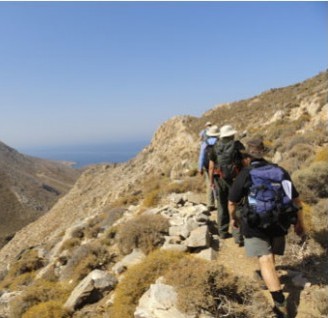
The meeting will take place in Morristown, NJ from October 25-27, with a graduate student symposium on Wednesday, October 24.

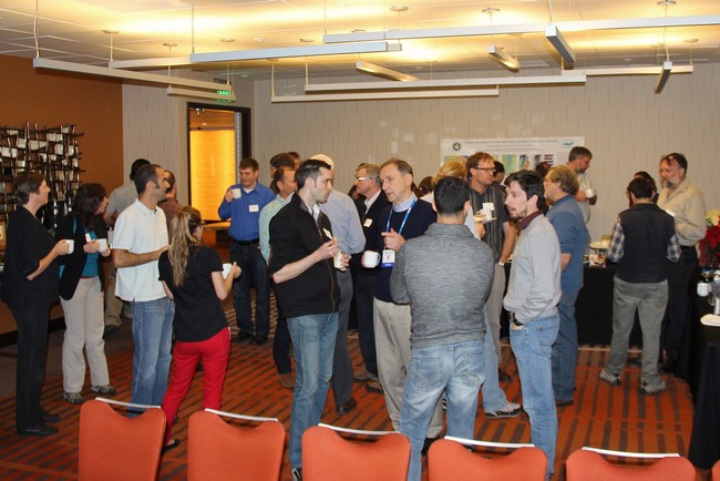
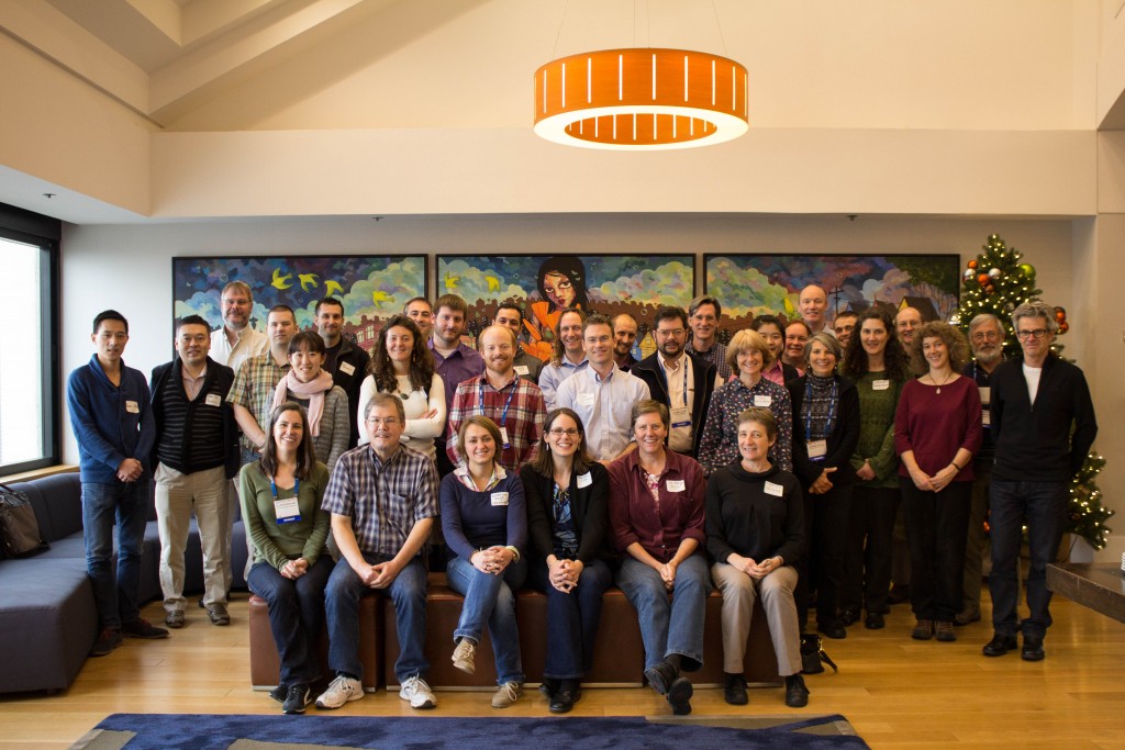
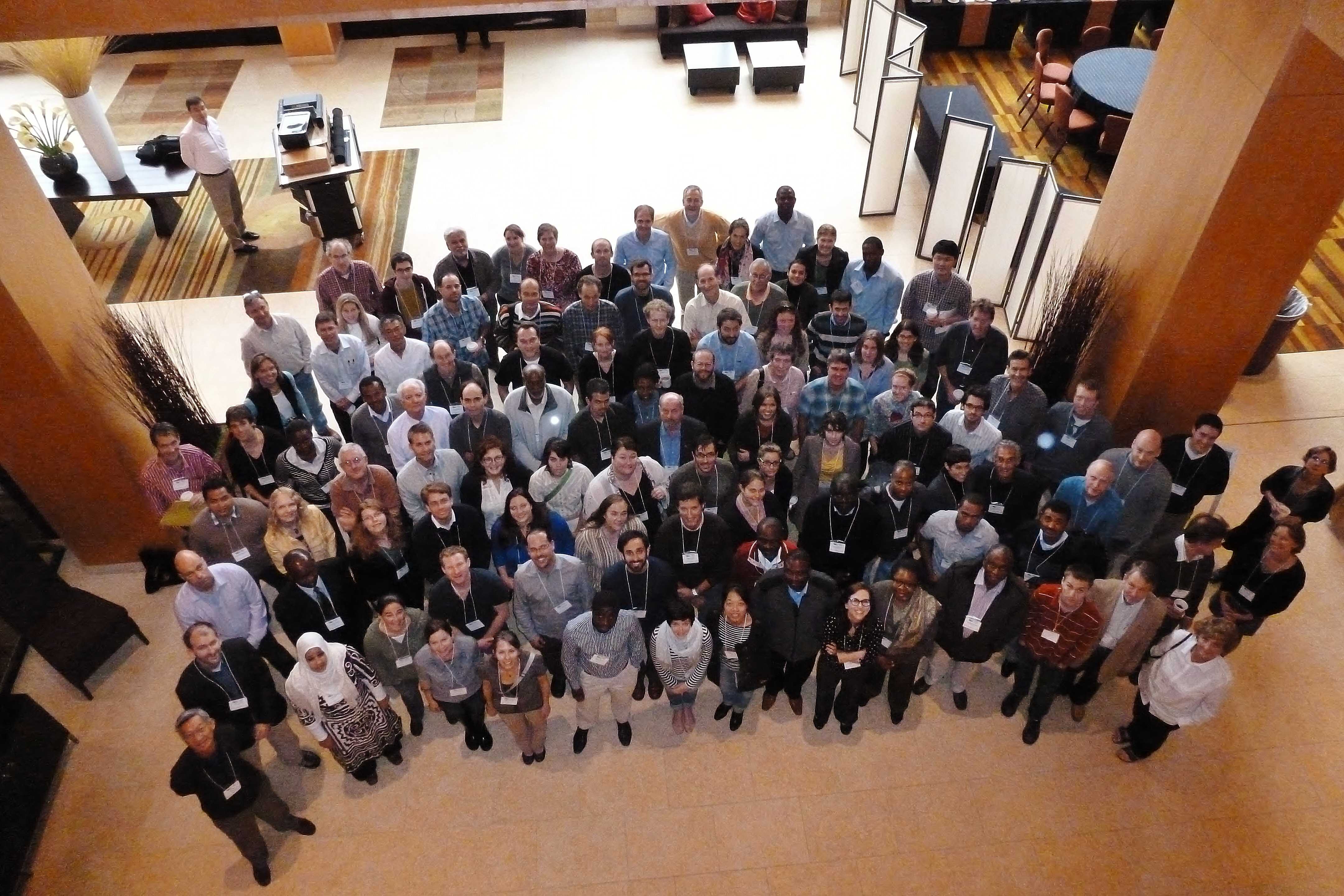
Researchers from all countries are encouraged to apply, independent of past involvement in GeoPRISMS. Post-docs, senior graduate students, and members of under-represented groups are especially encouraged to participate. Funding from NSF and other sources is expected to cover a significant fraction of travel and accommodation costs for ~80 participants with a diversity of interests, including limited funds for international attendees. Applications should include a brief statement of interest and anticipated contribution to the workshop and a short curriculum vitae.

Workshop Conveners:

Ramon Arrowsmith
Estella Atekwana
Maggie Benoit
Andrew Cohen
Rob Evans
Matthew Pritchard
Donna Shillington
Tyrone Rooney

Student Symposium | Wednesday, October 24

8:00 – 5:00 Graduate Student Symposium & Field Trip
5:30 Workshop Registration & Ice Breaker (with Cash Bar)
7:00 Graduate Student Dinner

Day 1 | Thursday, October 25

Moderators: Maggie Benoit, Tyrone Rooney
8:00 Opening remarks
· Welcome from NSF – B. Haq, J. Wade
· Introduction to GeoPRISMS – Julie Morgan
· Goals of meeting – Conveners

8:30 Introductory Talk: Overview of the EAR | Cindy Ebinger (U. Rochester)

9:00 Plenary Topic 1: How does the presence or absence of an upper-mantle plume influence extension?
a. Seismological imaging of plumes and associated magmatism in rifts |  12Mb Gabriel Mulibo and JP O’Donnell (Penn State U.)
b. Origin of magmas from geochemical perspective |  1MbTyrone Rooney (Michigan State)
c. Plume dynamics and surface uplift |  8Mb Sarah Stamps (Purdue U.)

9:45 Plenary Topic 2: How does the mechanical heterogeneity of continental lithosphere influence rift initiation, morphology, and evolution?
a. Mechanisms for thinning the lithosphere, including thermal/chemical erosion, and interaction with large scale lithospheric structures |  11Mb Ben Holtzman (LDEO)
b. Control of pre-existing structures on early rifting |  3MbAubreya Adams (Wash. U)
c. Geochemical heterogeneity of the lithosphere |  2Mb Wendy Nelson (U. Houston)

10:30 Coffee Break & Poster Session

Moderators: Matt Pritchard, Rob Evans
11:00 Plenary Topic 3: How is strain accommodated and partitioned throughout the lithosphere, and what are the controls on strain localization and migration?
a. Magmatism during rifting events |  1MbDavid Ferguson (LDEO)
b. Modeling and observations of faulting and magmatism during rifting |  2Mb Juliet Biggs (U. Bristol)
c. Active deformation processes |  1MbBecky Bendick (U. Montana)

11:45 Plenary Topic 4: What factors control the distribution and ponding of magmas and volatiles, and how are they related to extensional fault systems bounding the rift?
a. Geochemical studies of magmas and volatiles |  35MbTobias Fischer (U. New Mexico)
b. Geophysical imaging of magmas and fluids (MT, seismic) |  1Mb Derek Keir (Natl. Ocean. Centre, Southampton)
c. Shallow dynamics of magma chambers/dikes and eruptions |  1Mb Manahloh Bechalew (U. Rochester)

12:30 LUNCH

Moderators: Andrew Cohen, Estella Atekwana
1:45 Plenary Topic 5: How does rift topography, on either the continental- or basin-scale, influence regional climate, and what are the associated feedback processes?
a. Climate and tectonics and feedbacks |  3Mb Manfred Strecker (U. Potsdam)
b. Modeling perspective | Joellen Russell (U. Arizona)
c. Tectonics and sedimentation at basin scale |  24Mb Chris Scholz (Syracuse U.)

2:30 Pop-ups by Graduate Students

3:00 Introduction to BREAKOUT 1 – Prioritizing science objectives. Divide into groups based on science questions in the draft implementation plan. What are the highest-priority questions? What kinds of observations do we need to address them and what are the characteristics of places where they should be made? What kind of modeling/experimental work is needed?

3:15 Break & Poster Session

3:45 BREAKOUT 1 – Round 1

4:30 BREAKOUT 1 – Round 2

How does the presence or absence of an upper-mantle plume influence extension?
Leader: Rob Moucha
Scribe: Sara Mana

How does the mechanical heterogeneity of continental lithosphere influence rift initiation, morphology, and evolution?
Leader: Anne Egger
Scribe: Kate Selway

How is strain accommodated and partitioned throughout the lithosphere, and what are the controls on strain localization and migration?
Leader: Roger Buck
Scribe: Andrew Katunwehe

What factors control the distribution and ponding of magmas and volatiles, and how are they related to extensional fault systems bounding the rift?
Leader: Laurent Montesi
Scribe: Dorsey Wanless

How does rift topography, on either the continental- or basin-scale, influence regional climate, and what are the associated feedback processes?
Leader: Naomi Levin
Scribe: Gail Ashley

Moderators: Donna Shillington, Ramon Arrowsmith
5:30 Plenary Topic 6: Hazards and Resources in the EAR and Links to Rifting
a. Seismic hazard |  1MbAtaley Ayele (Addis Ababa U.)
b. Volcanic hazard |  3MbNicolas d’Oreye (Natl. Museum of Nat. Hist. Lux.) & Lukawa N’yombo (Goma Volcanic Observatory)
c. Oil/gas exploration |  14MbDozith Abeinomugisha (PEPD Uganda)

6:30 Adjourn for Day

7:00 Conference Dinner

8:00 Poster Session
He-Ne-Ar-CO2-N2 Isotope and Relative Abundance Characteristics of the East Africa Rift System (EARS) | icon-file 1.2Mb – David Hilton
Projects and Current Initiatives for Scientific Research and Hazard Assessment in the Albertine Rift | icon-file 2.7Mb – François Kervyn
Achieving Scientific Projects in Central Africa: Some Shared Experience |  3.6Mb – Nicolas D’Oreye
Volcano Monitoring in the Virunga Volcanic Province, DR Congo |   2.8 Mb – Nicolas D’Oreye
Distribution of Faults and Volcanic Centers in the Early Stages of Continental Breakup: Natron Basin, Tanzania |  285Kb – James Muirhead
Active Kinematics of Lithospheric Extension Along the East African Rift System |  610Kb – Robert Reilinger
Magma Sources Involved in the 2002 Nyiragongo Eruption, As inferred from an InSAR Analysis |  900Kb – Christelle Wauthier

8:00 GeoPRISMS Data Resources Mini-workshop |  1MbAndrew Goodwillie

Day 2 | Friday, October 26

Moderators: Rob Evans, Donna Shillington

8:00 Report from breakouts & plenary discussion

9:00 Plenary Topic 7: Synergies with other agencies / international projects

NSF/USAID PEER Program Annica Wayman (USAID) and DeAndra Beck (NSF)
Overview of recent and funded NSF programs |  1MbRob Evans (WHOI) and Donna Shillington (LDEO)
New NSF-IES (Integrated Earth Systems) and other programs |  1Mb Leonard Johnson and Jennifer Wade (NSF)
AfricaArray |  1Mb Andy Nyblade (Penn State U.)
Hominin Sites and Paleolakes |  1MbAndy Cohen (U. Arizona)
Lake Drilling Project |  2Mb Chris Scholz (Syracuse U.)
Afar consortium |  1Mb Kathy Whaler (Edinburgh)/Derek Keir (NOCS)
Summary of French programs |  1MbCecile Doubre (U. Strasbourg)
NASA |  1MbSimon Carn (Mich. Tech. U)
GEOBSNET |  1Mb François Kervyn (Royal Museum for Central Africa, Belgium)

10:30 Coffee Break & Poster Session

Moderators: Andrew Cohen, Rob Evans
11:00 Plenary Topic 8: African partnerships panel. (5 min presentations how to build successful, mutually beneficial collaborations in Africa, followed by plenary discussion

12:30 LUNCH

1:30 Quick Pop-Ups and Plenary Discussion

2:30 Introduction to BREAKOUT 2 – Implementation strategies. Divide into groups based on science questions in the draft implementation plan. In the context of high-priority science and critical observations/modeling from BREAKOUT 1, discuss implementation strategies for each question, including the best places in the EAR to implement science questions, opportunities to leverage other activities, and high-priority thematic studies.

2:45 BREAKOUT 2, Round 1

3:30 BREAKOUT 2, Round 2

How does the presence or absence of an upper-mantle plume influence extension?
Leader: Jim Gaherty
Scribe: Maryjo Brounce

How does the mechanical heterogeneity of continental lithosphere influence rift initiation, morphology, and evolution?
Leader: TBA
Scribe: Julie Elliot

How is strain accommodated and partitioned throughout the lithosphere, and what are the controls on strain localization and migration?
Leader: John Nabelek
Scribe: Erin DiMaggio

What factors control the distribution and ponding of magmas and volatiles, and how are they related to extensional fault systems bounding the rift?
Leader: Adam Soule
Scribe: Brandon Chiasera

How does rift topography, on either the continental- or basin-scale, influence regional climate, and what are the associated feedback processes?
Leader: Ramon Arrowsmith
Scribe: Amy Morrissey

4:15 Coffee Break

4:45 Reports from Breakout 2

5:30 Plenary Discussion

6:00 Adjourn for the Day

7:00 Dinner on your own

8:00 Poster Session

Day 3 | Saturday, October 27

8:00 Reports from Breakout 2

8:30 Plenary Discussion

9:00 Introduction to BREAKOUT 3 – Finalizing implementation plan. Divide into groups that represent the spectrum of science for the EAR. Discuss integrated strategies to accomplish the highest impact in the EAR, including the best locations for focused, multidisciplinary study, key observations, thematic studies and leveraging opportunities.

9:15 BREAKOUT 3

10:15 Graduate Student Perspective & Implementation Plan

10:45 Coffee Break and Poster Session

11:15 Reports from BREAKOUT 3 and final plenary discussion with decision making on areas for focused research and highest priority thematic studies.

11:45 Wrap-up discussion

12:00 Meeting Adjourns

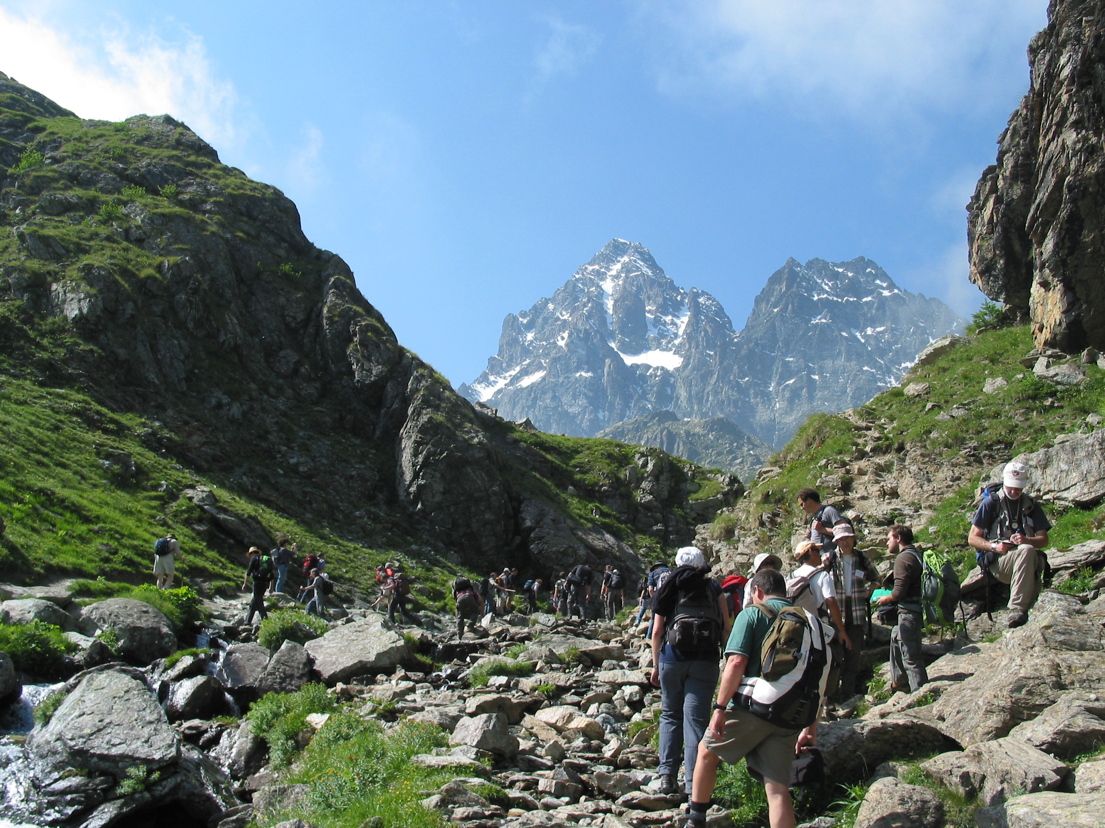
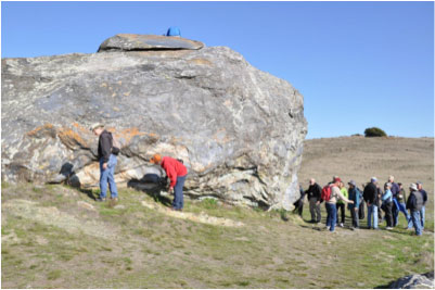
12:00-6:00 Post-Meeting Field Trip, (Lunch Provided – Register with GeoPRISMS office)

GeoPRISMS Student Symposium for the East Africa Primary Site

  Cotton Building Room 217, Victoria University, Wellington, NZ
Sunday, April 14, 2013

8:00 -9:00 AM Breakfast and Registration

9:00 – 10:30 AM Plenary Session:

Introductions
Overview of GeoPRISMS and EARS Planning Meeting – Maggie Benoit and Juli Morgan
Overview of EARS Geophysics – Donna Shillington
Overview of EARS Geochemistry – Tyrone Rooney
Overview of EARS Surface Processes – Ramon Arrowsmith

10:30 – 12:00 PM Student Posters and Presentations

12:00 – 5:30 PM Field Trip to Newark Basin led by Martha Withjack and Roy Schlische

7:00 PM Student Dinner

 icon-download Download the compiled white papers

Landscape and lakescape evolution: source-to-sink study of geomorphic, tectonic, climatic, andvegetation interactions in a tropical rift basin (Lake Malawi) | icon-file 300Kb – Arrowsmith et al.

The Lake Tanganyika Drilling Project: A potential ~10 Ma continuous record of integrated tectonicand climatic history for the western African rift |  200Kb – Cohen et al.

Studying early stage of rifting in Northern Tanzania |  700Kb – Doubré et al.

The GeoPRISMS Dataportal |  200Kb – Goodwillie

Active Kinematics of Lithospheric Extension Along the East African Rift |  6Mb – Reilinger et al.

Geochemical and petrographic approaches for the study of rifting in the EAR |  60Kb – Rooney et al.

SEGMeNT: An NSF-Continental Dynamics project to study the weakly extended Malawi (Nyasa) Rift |  7Mb – Shillington et al.

Geodetic Constraints of Rift Initiation across the Somalia-Lwandle Plate Boundary in Madagascar |  600Kb – Stamps et al.

An Investigation of Continental Rift-Parallel Deformation |  400Kb – Stamps et al.

Call for White Papers

GeoPRISMS has identified the East African Rift System (EARS) as a primary site of the Rift Initiation and Evolution (RIE) initiative. GeoPRISMS research spans the shoreline and, in doing so, provides an integrated framework for understanding the effects of inherited lithospheric weakness, magmatism, volatiles, climate, and sedimentation on rift initiation and evolution. The associated broader impacts of natural hazards and assessment of geological resources, including traditional and alternative sources of energy, are significant.

The October 2012 Planning Workshop for the EARS Primary Site has two main purposes. First, it will focus community effort and research approaches in the EARS, including prioritization of important GeoPRISMS RIE science targets. In particular, the GeoPRISMS RIE community will use the meeting to identify critical areas for focused research. Second, the workshop will establish research strategies that maximize synergies between GeoPRISMS and ongoing international efforts to address common research goals.

Scientists interested in participating in the development of the integrated science and implementation plan for EARS are invited to submit White Papers in advance of that workshop. The White Papers will play an important role in the workshop outcomes and design, including guiding breakout discussions and speakers at the workshop, and they are thus an important mechanism for community input. White Papers should propose specific science objectives, show suitability for addressing the research themes outlined in the GeoPRISMS Science Plans, and consider the relative merits of PI-driven versus “community” approaches to collecting necessary data sets. Example White Paper topics could include specific scientific questions and/or targets in the Eastern Africa Rift System, potential “Discovery Corridors” and justifications for them, possible community experiments (including joint international proposals), and implementation strategies for carrying out thematic studies.

White papers should be submitted to the GeoPRISMS Office by September 15, 2012. In preparation, White Paper authors should consult relevant parts of the GeoPRISMS Science Plan and the Draft Implementation Plan.

All White Papers will be made available to meeting participants and the community prior to the workshop.

Guidelines

White Papers submitted by proponent teams are preferred to ensure broader consensus, although individuals are also welcome to submit.
Graduate students and post-doctoral fellows are encouraged to participate in the process of assembling a white paper; similarly, PIs are encouraged to include students, post-docs, and young investigators in author teams.

Authors can contribute more than one white paper.

White Papers should be clear and succinct and are limited to 2 pages of text plus 1 page of figures and references.

White Papers can be submitted even if the authors are unable to attend the meeting.

White Papers that address the integration or complementarity of GeoPRISMS with ongoing international projects are particularly encouraged.

The conveners reserve the right to restrict dissemination of papers deemed to be too narrow in scope or not aimed at goals of integrating resources of the relevant programs.

Please provide the following header information on each paper:

– White Paper Title
– Authors and Affiliations
– Contact information
– Proposed sites and/or themes addressed
– Key types of existing or forthcoming data/infrastructure to build upon

Helpful Links

Final participant list (last update 10-18-12)
Post meeting field trip – Saturday October 27, 12:00-6:00PM (lunch provided)
Conference Hotel and Venue: Hyatt Morristown

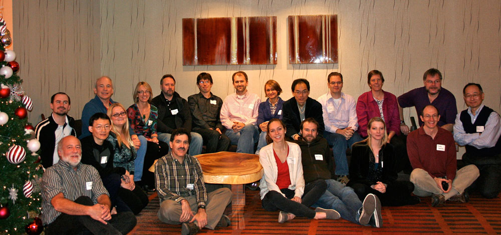
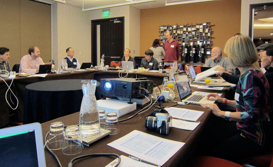
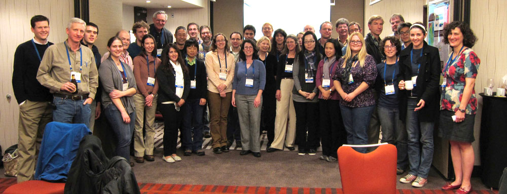
Meeting participants

The workshop conveners have provided the following synthesis of the outcomes of discussions that took place at the workshop, based on the informative talks and in-depth discussions that explored the full spectrum of scientific opportunities for GeoPRISMS in the EARS. Below, they offer a framework for the draft implementation plan, for your comment and feedback.

The initial model envisaged has a primary focus area within the EARS where significant interdisciplinary research could be linked to address the questions outlined in the science plan. Investigations in areas that complement work in the primary area and leverage previous and ongoing US and international projects are also integral to this model – we call these areas Collaborative Targets of Opportunity to emphasize that studies in these areas should focus on multi-disciplinary GeoPRISMS questions that cannot be answered in the primary focus area (as opposed to the wider range of projects that could be submitted for NSF Core funding or that might be supported by other NSF programs and initiatives). This initial model is a direct outcome of your meeting input, and we would greatly appreciate your feedback to help refine this draft plan.

Primary focus area: The Eastern Rift. The Eastern Branch of the EARS was identified in breakout groups and by the graduate students as a location where a focused inter-disciplinary effort could substantially impact our understanding of rift processes and effectively address the majority of the science questions that form the core of the science plan. This region would encompass the rift from the Tanzanian divergence in the south to Lake Turkana and southern Ethiopia to the north. Particular opportunities highlighted by discussion and relevant to the science plan include (but are not limited to) the role/origin of a plume in this part of this rift; the interaction of the rift and plume with major lithospheric structures; an active magmatic system; along-strike variations in the amount of cumulative extension and lithospheric thickness (from thin in the north to thick in the south); the preservation of a record of the interplay of climate and tectonics. The existing studies characterizing this region provide a rich framework upon which GeoPRISMS science will build.

Collaborative Targets of Opportunity:

Target 1: The Afar and Main Ethiopian Rift. This region is the focus of intense recent and ongoing international and US efforts in this part of the rift system. Further GeoPRISMS studies that could enhance our understanding of rifting processes include (but are not limited to) efforts that examine strain localization, and studies probing the origin and role of a plume in rifting.

Target 2: The Western Rift and SW branch. This site would provide the opportunity to examine the role of magmatism in rifting by comparing this less magmatic system with the highly magmatic Eastern Rift. It also contains the most weakly extended portions of the rift and thus can be used to tackle questions concerning incipient rifting. Finally, lakes along the Western Rift contain a rich record of tectonic and climatic events. New GeoPRISMS studies in this area can leverage recently funded NSF programs and other previous and ongoing tectonic and climate investigations.

Target 3: Synoptic investigations along the entire rift. As identified in many discussions at the workshop, there are questions in the science plan that are best addressed by examining the rift as a whole. These concern rift-wide variations in the origin and timing of volcanism, the strain field along and across the rift and large scale structure and dynamics underpinning the rift system. Thus, key components of the implementation plan should include broad and open data assimilation efforts, strategic infilling of climatic, geochemical, and geophysical observations, and modeling and experimental work, which would provide a framework for the focused investigations along the rift.

Feedback on this draft framework is welcome – please feel free to contact any of the conveners below with your input, and you can send your comments to info@geoprisms.nineplanetsllc.com. The next step in this process is to use this framework to write an implementation plan for GeoPRISMS science in the East Africa Rift based on the discussion and input received at the workshop. This process will involve soliciting more community feedback and NSF advice. We will circulate a draft version of the implementation plan to the community for further input.

In addition, we plan to reach out to more colleagues in Africa by summarizing the proposed implementation plan at the upcoming Colloquium of African Geology in January 2013.

 icon-chevron-right Photos from the workshop

2013 Planning Workshop for the New Zealand Primary Site

April 15-17, 2013
Te Papa Museum, Wellington, New Zealand

AnnouncementAgenda - Presentation archiveStudent SymposiumWhite Papersmore infoOutcomes

Many thanks again to all of you for participating in and contributing to a most informative and inspiring planning workshop for future GeoPRISMS and related research in New Zealand. The discussions point toward a clear plan forward, with strong motivations for focused community-based investigations of several key regions in and around New Zealand.

Announcement

The GeoPRISMS Steering and Oversight Committee is pleased to announce a workshop to develop a detailed implementation plan for the NSF GeoPRISMS New Zealand Primary Site. New Zealand was chosen as a primary site because all of the GeoPRISMS Subduction Cycles and Deformation (SCD) themes can be addressed particularly well at the Hikurangi/Kermadec and Fiordland subduction zones. The SCD themes include arc magmatism and volatile cycling, subduction initiation, subduction margin deformation processes (both seismic-cycle and longer timescales), and links between surface processes and subduction margin tectonics. In addition to serving as an excellent natural laboratory for modern subduction processes, New Zealand also offers opportunities to investigate an exhumed Paleozoic to Mesozoic subduction system.

The workshop is intended to clarify the main research objectives for the New Zealand primary site, and to develop an implementation plan and timeline to achieve these objectives considering available resources and infrastructure. More details about GeoPRISMS science objectives, can be found here, along with the initial Implementation Plan for the New Zealand primary site, which will serve as a starting point for this workshop.

The program will include a number of overview presentations on New Zealand and related subduction margins, existing scientific infrastructure within New Zealand (such as GeoNet), potential for multinational partnerships on New Zealand-based research, and break-out discussions that will lead to conclusive decisions about science implementation at the New Zealand primary site. White papers will be solicited in advance of the workshop to ensure community input.


Researchers from all countries with an interest in New Zealand subduction zone science are welcome to apply. Post-docs, senior graduate students, and members of under-represented groups are especially encouraged to apply. Funding from GeoPRISMS/NSF and the New Zealand Ministry for Business, Innovation, and Employment (MBIE) is expected to cover a significant fraction of travel and accommodation costs for ~50 participants traveling from outside of New Zealand. We also expect to support participation from a similar number of New Zealand-based scientists. Applications require a brief statement of interest and anticipated contribution to the workshop and a short C.V.

Note: April 2013 will be a busy time for meetings and workshops (EGU, SSA, Chikyu+10), thus interested participants should plan their travel and meeting schedules accordingly. The Seismological Society of America meeting is planned for April 17-19 in Salt Lake City. If participants plan to attend both SSA and the GeoPRISMS NZ workshop, the time difference makes it possible to depart New Zealand the evening of April 17th, and arrive in Salt Lake City by mid-day on April 17th. There are also daily direct flights from Auckland, New Zealand to Tokyo, convenient for participants who plan to attend both the GeoPRISMS NZ meeting and the Chikyu+10 meeting in Tokyo (April 21-23).

Workshop Conveners:

Susan Ellis, GNS Science – New Zealand
Adam Kent, Oregon State University
Nicola Litchfield, GNS Science – New Zealand
Kathleen Marsaglia, California State University at Northridge
Jeff Marshall, California State University at Pomona
Demian Saffer, Pennsylvania State University
Susan Schwartz, University of California, Santa Cruz
Laura Wallace, University of Texas, Austin
Richard Wysoczanski, NIWA – National Institute of Water and Atmospheric Research – New Zealand

Student Symposium | Sunday, April 14

6:30-8:30 pm Icebreaker and registration* at Foxglove Restaurant, Wellington waterfront

*Note that participants can also register at Te Papa during the days of the workshop. The registration desk at Te Papa will be open from 8:00 AM on April 15, and will be located in front of the Soundings Theatre or in the reception area of the Telstra Centre.

Day 1 | Monday, April 15

Moderators: Laura Wallace and Susan Ellis
8:30-8:40 Welcome from the conveners and housekeeping issues
8:40-8:50 Welcome from Prue Williams (the NZ Ministry for Business, Innovation and Employment)
8:55-9:10 introduction to the aims of the workshop and the GeoPRISMS Program | icon-file 1Mb –  Julia Morgan (GeoPRISMS Office) 

Talks introducing New Zealand’s subduction zones and the primary topics in subduction margin evolution and behavior
9:10-9:45 Overview of Zealandia and its subduction record since the Paleozoic |  12Mb – Nick Mortimer (GNS Science)

TOPIC 1: What are the geological, geochemical, and geophysical responses to subduction initiation and early arc evolution and how do they affect subduction zone formation?
9:45-10:10 Causes and consequences of subduction initiation |  2Mb – Mike Gurnis (Caltech)
10:10-10:35 The expression of subduction initiation in New Zealand |  12Mb – Rupert Sutherland (GNS Science)

10:35 Morning Tea. Posters will be available for viewing during all morning and afternoon teas and lunches. There will also be an extended afternoon tea on Day 3 for more poster viewing

Moderators: Adam Kent and Richard Wysoczanski
TOPIC 2: What are the pathways and sources of magmas and volatiles emerging in the arc and forearc, and how do these processes interact with upper plate extension?
11:05-11:30 Volatile fluxes at subduction zones, the model perspective |  4Mb – Brad Hacker (University of California-Santa Barbara)
11:30-11:55 Volatile fluxes and arc magmatism: The observational record and unresolved questions |  1Mb – Paul Wallace (University of Oregon)
11:55-12:20 The Kermadec Arc system: our understanding about the present and past |  3Mb – Christian Timm (GNS Science)
12:20-12:45 Taupo Zone volcanism, extension and large silicic eruptions |  6Mb – Colin Wilson (Victoria University of Wellington)

12:45 Lunch

Moderators: Kathleen Marsaglia and Demian Saffer
TOPIC 3: What controls subduction thrust fault slip behaviour and its spatial variability?
1:40-2:05 Global perspective on controls on megathrust slip behavior |  4Mb – Satoshi Ide (University of Tokyo)
2:05-2:30 Overview of Hikurangi margin subduction tectonics and megathrust slip behavior |  5Mb – Laura Wallace (University of Texas, Institute for Geophysics)

TOPIC 4: Feedbacks between climate, sedimentation, and forearc deformation
2:30-2:55 Global overview of interaction among subduction margin sedimentation, climate, eustasy, and forearm deformation |  7Mb – Mike Underwood (University of Missouri)
2:55-3:20 The passage of sediment from mountain source to ocean sink: Results from the MARGINS S2S Waipaoa sedimentary system, Hikurangi Margin |  5Mb – Alan Orpin (NIWA)
3:20-3:45 Offshore Hikurangi Margin: tectonic deformation – sedimentation – climate interactions |  8Mb – Phil Barnes (NIWA)

3:45 Afternoon tea

4:15 First breakout sessions, based around the 4 main topics. The goal for these breakouts will be to identify the most exciting science that can be done in NZ to help address each main Topic

TOPIC 1: What are the geological, geochemical, and geophysical responses to subduction initiation and early arc evolution and how do they affect subduction zone formation?
Breakout leaders: Mark Reagan (University of Iowa), Tim Stern (Victoria Univ. Wellington)
Scribes: Justin Ball (Univ. Colorado), Katrina Jacobs (VUW, Wellington)

TOPIC 2: What are the pathways and sources of magmas and volatiles emerging in the arc and forearc, and how do these processes interact with upper plate extension?
Breakout leaders: Ian Smith (University of Auckland), Kaj Hoernle (GEOMAR)
Scribes: Madison Myers (Univ. of Oregon), Melissa Rotella (VUW, Wellington)

TOPIC 3: What controls subduction thrust fault slip behaviour and its spatial variability?
Breakout leaders: Bill Fry (GNS Science), Kelin Wang (Canadian Geological Survey, PGC)
Scribes: Noel Bartlow (Stanford University), Dan Bassett (Oxford University)

TOPIC 4: Feedbacks between climate, sedimentation, and forearc deformation
Breakout leaders: Clark Alexander (Skidaway Inst. Oc.), Ingo Pecher (Univ. of Auckland)
Scribes: Corina Cerovski-Darriau (Univ. of Oregon), David Oakley (Penn State)

5:10 Switch up breakout sessions (people migrate to a different breakout session)

6:00 End of Day 1

Day 2 | Tuesday, April 16

Moderators: Susan Schwartz and Jim Gill

8:30 Introduction to Day 2

8:40 Report from Day 1 breakout leaders, plenary discussion on outcomes of breakouts

10:00 Morning Tea

Moderators: Nicola Litchfield and John Townend
Series of talks on existing scientific infrastructure and current initiatives in NZ subduction science, including emerging IODP projects
10:30-10:50 New Zealand GeoNet: Impacts on geological hazards monitoring and research in New Zealand |  2Mb – Ken Gledhill (GeoNet)
10:50-11:05 The NZ active faults data base and onshore active faulting studies at New Zealand’s subduction zones |  3Mb – Nicola Litchfield (GNS Science)
11:05-11:20 The SAHKE Project: Imaging the subduction plate boundary beneath Wellington |  2Mb – Stuart Henrys (GNS Science)
11:20-11:35 New Zealand marine geological and geophysical research capabilities and databases |  2Mb – Geoffroy Lamarche (NIWA)
11:35-12:00 Overview of current knowledge and initiatives on the Kermadec arc volcanoes, including emerging IODP opportunities there | Cornel De Ronde (GNS Science)
12:00-12:15 Using IODP drilling to unlock the secrets of slow slip events, the Hikurangi subduction margin |  1Mb – Demian Saffer (Penn State)
12:15-12:30 Proposed IODP drilling at the Lord Howe Rise to understand subduction initiation at the Tonga/Kermadec Trench |  3Mb – Rupert Sutherland (GNS Science)

12:30 Lunch

Moderators: Susan Ellis and Jeff Marshall
Series of talks on the role of subduction science in understanding seismic, tsunami, and volcanic hazards and risk in New Zealand
1:20-1:35 It’s Our Fault: A project to understand earthquake risk posed to the Wellington region |  5Mb –  Russ Van Dissen (GNS Science)
1:35-1:50 Developing an effective community response to the next Great East Coast Subduction Zone Earthquake and Tsunami |  2Mb – David Johnston (GNS Science, Massey University)
1:50-2:05 The integrated role of research and monitoring in the assessment of volcanic hazards and risk in New Zealand |  1Mb – Gill Jolly (GNS Science)

2:05-3:30 A series of short topical talks (~10 mins each + 2 minutes for questions/discussion).
Variable mantle and subduction components in the sources of Havre Trough back arc lavas |  22Mb – Erin Todd (USGS)
Tomographic imaging of the mantle wedge beneath the North Island and relationship to volcanic arc processes |  1Mb – Martin Reyners (GNS Science)
Magnetotelluric imaging studies of the Hikurangi margin–from arc to forear |  2Mb – Wiebke Heise (GNS Science)
Fluids as sentinels of deep crustal changes and history in the Hikurangi forear | Agnes Reyes (GNS Science)
Seismological studies of slow slip in New Zealand |  1Mb – Bill Fry (GNS Science)
Episodic tremor and slip at the Japan Trench before the 2011 Tohoku earthquake: Implications for understanding shallow megathrust processes at the NZ focus site |  2Mb – Yoshihiro Ito (Tohoku University)
Heat flow along the Hikurangi margin |  2Mb – Rob Harris (Oregon State University)

3:30 Afternoon Tea

4:00 Breakout sessions based on the four main geographic regions of NZ subduction: (1) Hikurangi Margin, (2) Fiordland, (3) Kermadec Arc/Havre Trough (+Colville Ridge, South Fiji Basin, across to Lord Howe Rise), and (4) Taupo Volcanic Zone. These breakouts are intended to develop and discuss the main science priorities in each of these geographic areas, and identify data needed to do the science. Synergies that exist across the four Topics (from Day 1) in each of these locations will also be discussed. Note, the conveners may change the organization and aims of Day 2 breakout sessions depending on the interests emerging from the Day 1 breakouts.

Location 1: Hikurangi Margin
Breakout leaders: Rob Harris (Oregon State University) and Stuart Henrys (GNS Science)
Scribes: Rachel Lauer (Penn. State), Jiao Ruohong (VUW, Wellington)

Location 2: Fiordland
Breakout leaders: Andy Tulloch (GNS Science) and Tracy Rushmer (Macquarie University)
Scribes: Besim Dragovic (Boston University), Samir Naif (UCSD-Scripps)

Location 3: Kermadec Arc/Havre Trough/South Fiji Basin/Lord Howe Rise
Breakout leaders: Fernando Martinez (Univ. Hawaii), Simon Turner (Macquarie University)
Scribes: Sophie Barton (NIWA/VUW), Erin Todd (USGS)

Location 4: Taupo Volcanic Zone
Breakout Leaders: Pilar Villamor (GNS Science), Kari Cooper (Univ. California-Davis)
Scribes: James Muirhead (Univ. of Idaho), Hannu Seebeck (VUW, Wellington)

5:00 Switch up breakout groups

6:00 End of Day 2

7:00 Conference dinner: Dockside Restaurant, Wellington waterfront

Day 3 | Wednesday, April 17

Moderators: Adam Kent and Rupert Sutherland

8:30 Introduction to Day 3

8:40 Report from Day 2 breakout leaders, plenary discussion on breakout outcomes

10:15 Morning Tea

Moderators: Nicola Litchfield and Clifford Thurber
Series of talks from international partners on scientific infrastructure (e.g., marine vessels, equipment) and potential funding resources for international collaborators to conduct subduction studies in New Zealand
10:45-11:05 Review of NSF programs, infrastructure for subduction studies | Bilal Haq (NSF)
11:05-11:20 Japanese perspective |  4Mb – Shuichi Kodaira (JAMSTEC)
11:20-11:35 German perspective |  3Mb – Achim Kopf (Univ. Bremen)
11:50-12:05 UK perspective |  1Mb – Lisa McNeill (Univ. of Southhampton)
11:35-11:50 Canadian perspective |  2Mb – Kelin Wang (Canadian Geological Survey, PGC)

12:05 Lunch

12:45 Breakouts by each of the scientific topics (from Day 1) to develop an implementation plan for collaborative, multinational subduction science in NZ for the next ten years. This breakout is intended to define the research that is best-suited for GeoPRISMS goals and resources, but is also intended to define a path forward for future NZ-led initiatives and those that international partners would like to contribute to and/or lead. Conveners may decide to modify the focus/organization of the breakouts depending on the outcomes from the previous days’ breakout discussions.

TOPIC 1: What are the geological, geochemical, and geophysical responses to subduction initiation and early arc evolution and how do they affect subduction zone formation?
Breakout leaders: Mike Gurnis (Caltech) and Jim Gill (Univ. California-Santa Cruz)
Scribes: Rob Holt (VUW, Wellington) and Sapthala Karalliyada (VUW, Wellington)

TOPIC 2: What are the pathways and sources of magmas and volatiles emerging in the arc and forearc, and how do these processes interact with upper plate extension?
Breakout leaders: David Hilton (UCSC-Scripps) and Ken Rubin (Univ. Hawaii)
Scribes: Simon Barker (VUW, Wellington) and Adrian Shelley (VUW, Wellington)

TOPIC 3: What controls subduction thrust fault slip behaviour and its spatial variability?
Breakout leaders: Harold Tobin (Univ. Wisconsin) and Harmony Colella (Miami Univ. Ohio)
Scribes: Pegah Faegh Lashgary (VUW, Wellington) and Erin Todd (Univ. Calif.-Santa Cruz)

TOPIC 4: Feedbacks between climate, sedimentation, and forearc deformation
Breakout leaders: Mike Underwood (Univ. Missouri) and Alan Orpin (NIWA)
Scribes: Calum Chamberlain (VUW, Wellington) and Laurel Childress (Northwestern Univ.)

1:45 Break for afternoon tea and extended poster session

2:45 Switch up breakout groups

Moderators: Demian Saffer, Laura Wallace, and Richard Wysoczanski
3:45 Reconvene for final decisions on implementation plan for NZ focus site

3:50 The student symposium participants will present their integrated perspective on the priorities and path forward

4:05 Implementation plan breakout summaries (~10-15 minutes for each breakout)

5:00 Plenary discussion of the overall implementation plan. Participants may be asked to decide/vote on the most suitable priorities for the GeoPRISMS implementation plan.

6:00 Wrap up and closure of meeting

GeoPRISMS Student Symposium for the New Zealand Primary Site
Cotton Building Room 217, Victoria University, Wellington, NZ
Sunday, April 14, 2013

8:00 AM Welcome and Symposium Objectives |  200Kb – Jeff Marshall (CSU Pomona)
8:10 AM Introduction to GeoPRISMS |  12Mb – Juli Morgan (Rice University, GeoPRISMS Chair)
8:30 AM The tectonic setting of New Zealand |  9Mb – Susan Ellis (GNS Science)
9:00 AM Subduction megathrust processes in New Zealand |  9Mb – Laura Wallace (University of Texas, Austin)
9:30 AM Arc volcanism in New Zealand |  19Mb – Graham Leonard (GNS Science)
10:00 AM New Zealand sedimentation & tectonics |  14Mb – Kathie Marsaglia (CSU Northridge)

10:30 AM Coffee Break

11:00 AM Student Poster Session with 2-3 min presentations at each poster

12:30 PM Pick-up Lunch, Get on bus for Field Trip

12:30-6:00 Wellington Fault Geologic Field Trip led by Nicola Litchfield (GNS Science) and Tim Little (Victoria University of Wellington)
The fieldtrip is intended to view the Wellington fault, a major active, right lateral strike slip fault that runs through downtown Wellington and continues northward along the length of the North Island. We will have fieldtrip stops to view the fault in Wellington, and will finish up at a prime location to see the Wellington fault in Upper Hutt. We will also discuss the effects that an 1855 Magnitude 8.2 rupture of another nearby strike-slip fault (the Wairarapa fault) had on the Wellington region.

6:30 PM Workshop Registration, Ice Breaker at Foxglove Restaurant

The follow-up Student Career Dinner will be held in Wellington Monday, April 15, 7pm at Osteria del Toro restaurant.

 icon-download Download the compiled white papers

Why do some subduction zones have M9 earthquakes and others less than M7.5? Composition and state variations on the subduction thrust | icon-file 400Kb – Roy Hyndman

Mission Immiscible or supercritical fluid? |  400Kb – Yoshihiko Tamura et al.

Heat Flow along the Hikurangi Margin |  1Mb – Robert Harris et al.

Fluid Redistribution Coupled to Deformation Around the NZ Plate Boundary |  400Kb – Richard Sibson et al.

GeoPRISMS Science Goals in the Havre Trough Back-Arc Basin |  500Kb – Fernando Martinez and Robert Dunn

Developing an effective community response to the next “Great East Coast Subduction Zone Earthquake and Tsunami” |  500Kb – David Johnston et al.

What should we look for at Hikurangi in light of our findings in the Japan Trench? |  100Kb – Virginia Toy et al.

The active margin carbon cycle |  200Kb – Laurel Childress and Neal Blair

Unlocking the Secrets of Slow Slip by Scientific Drilling at the Northern Hikurangi Subduction Margin, New Zealand |  300Kb – Laura Wallace et al.

Seafloor instability processes and products on the active Hikurangi margin |  300Kb – Joshu Mountjoy et al.

Geochemical Fluxes through the New Zealand Arc System |  300Kb – Stuart Simmons et al.

Seafloor and Subseafloor Monitoring of Slow Slip at the Northern Hikurangi Margin |  400Kb Laura Wallace et al.

Resolving Fundamental Questions of Subduction Initiation in New Zealand |  2Mb Mike Gurnis et al.

Testing induced vs spontaneous subduction initiation mechanisms in the SW Pacific |  200Kb – Nick Mortimer et al.

Imaging the Southern Hikurangi Margin locked subduction interface and upper plate by passive and active seismic and magnetotelluric arrays |  700Kb – Stuart Henrys et al.

GeoPRISMS Data Portal: New Zealand Primary Site |  2Mb – Andrew Goodwillie

Cambrian Rocks of the Takaka Terrane, the Foundation of Zealandia: A Complex Record of Subduction Initiation and Arc Development Exposed in the Nelson Area of the South Island |  300Kb – Kate Pound et al.

Constrains on the thermal history of crystal-rich magmas from crystal residence timescales |  200Kb – Adam Kent and Kari Cooper

Brothers submarine arc volcano: gateway to the sub-arc mantle |  200Kb – Cornel de Ronde et al.

Louisville seamount subduction: tracking mantle flow beneath the central Tonga-Kermadec arc |  700Kb – Christian Timm et al.

Characterization of structure and properties of the northern Hikurangi Margin using OBS seismology for studies of slow slip and along-strike variations in plate interface coupling |  400Kb – OBS working group

Subduction inputs of the Hikurangi Margin, New Zealand |  200Kb – Michael Underwood et al.

How do subduction zones end? |  300Kb – Simon Lamb et al.

Proposal to study subduction initiation in northern Zealandia |  200Kb Tim Stern and Rupert Sutherland

Linking fluid chemistry to mechanics and geophysical structure along the Hikurangi Margin |  300Kb – Susan Ellis et al.

Constraining melt transport, storage and chemical modification in monogenetic vents: focus on the Auckland Volcanic Field |  700Kb – John C. Lassiter et al.

Look before it leaps: the interplay of magmatism, tectonism and basement structural inheritance in a migrating rifting arc |  500Kb – Julie Rowland et al.

Integrating current research on subduction processes and records into learning and teaching: potential for GeoPRISMS knowledge transfer |  100Kb – Kate Pound et al.

Paleoseismology at the Hikurangi Margin |  200Kb – Jessica Pilarczyk et al.

Three-dimensional seismic imaging of slow slip zones along the northern Hikurangi Margin |  200Kb – Nathan Bangs et al.

Determining slip behavior in the near-trough region of the Hikurangi subduction zone with GPS-Acoustic seafloor geodesy |  300Kb – Kelin Wang et al.

Variations in remote triggering susceptibility along the Hikurangi margin and implications for the time-dependent strength of subduction zones |  300Kb – Nicholas J van der Elst et al.

Lateral Migration of Subduction Systems: Progression of the Hikurangi Margin Southwestward Through Increased Plate Coupling to Continuum Compression |  400Kb – Philip E. Wannamaker et al.

Geospatial variation in magmatic and volatile fluxes to the oceans and atmosphere from active subaerial/submarine volcanism in the New Zealand Primary Site |  400Kb – Ken Rubin et al.

Havre Trough and the “Rifting Phase” of Back-arc Basin Evolution |  10Mb Erin Todd et al.

Gas Hydrates in New Zealand |  200Kb – Ingo A. Pecher et al.

Exterra: Understanding Convergent Margin Processes Through Studies of Exhumed Terranes – GeoPRISMS New Zealand Focus Site |  300Kb – Besim Dragovic et al.

Interaction of subduction and rifting on the exhumed Cretaceous convergent margin arc of Zealandia |  200Kb – Andy Tulloch et al.

Call for White Papers

Scientists interested in participating in the development of the integrated science and implementation plan for New Zealand are invited to submit White Papers in advance of the workshop. The White Papers will play an important role in the workshop outcomes and design, including guiding breakout discussions and speakers at the workshop, and they are thus an important mechanism for community input.

White Papers should propose specific science objectives, show suitability for addressing the research themes outlined in the GeoPRISMS Science Plans, and consider the relative merits of PI-driven versus “community” approaches to collecting necessary data sets. Example White Paper topics could include specific scientific questions and/or targets in New Zealand, possible community experiments (including joint international proposals), and implementation strategies for carrying out thematic studies. White Paper authors should consult relevant parts of the GeoPRISMS Science Plan & Draft Implementation Plan

White papers should be submitted to the GeoPRISMS Office by March 15, 2013. All White Papers will be made available to meeting participants and the community prior to the workshop, and will be used in the implementation strategy decision-making process during the workshop.

Guidelines

MS Word Doc template – Please use this template for your white paper submission

White Papers submitted by proponent teams are preferred to ensure broader consensus, although individuals are also welcome to submit.

Graduate students and post-doctoral fellows are encouraged to participate in the process of assembling a white paper; similarly, PIs are encouraged to include students, post-docs, and young investigators in author teams.

Authors can contribute more than one white paper.

White Papers should be clear and succinct and are limited to 2 pages of text plus 1 page of figures and references.

White Papers can be submitted even if the authors are unable to attend the meeting.

White Papers that address the integration or complementarity of GeoPRISMS with ongoing international projects are particularly encouraged.

The conveners reserve the right to restrict dissemination of papers deemed to be too narrow in scope or not aimed at goals of integrating resources of the relevant programs.

Please provide the following header information on each paper (see Word Template):

White Paper Title
Authors and Affiliations
Contact information
Proposed sites and/or themes addressed
Key types of existing or forthcoming data/infrastructure to build upon

Final participant list (last update 4-8-13)
Participant lodging list (last update 4-9-13)
Conference hotel: Ibis Hotel, Wellington
Conference venue: Museum of New Zealand Te Papa Tongarewa
, Wellington

NZ Field Guides

This is a non-exhaustive list of relevant fieldtrips located in the North Island.

Information provided by Nicola Litchfield from previous fieldtrips

White Island Tour: Products and Processes of Recent Activity
The Geology of Mayor Island (Tuhua): a Brief Introduction
Coastal Hazards of the Bay of Plenty
An introduction to Sunny Matata and its great 18 May 2005 Debris Flows
Earthquakes and Eruptions at Okataina Volcanic Centre
Waipaoa Sedimentary Field Trip, Gisborne
Overview of Hikurangi Margin Slow Slip Event, Gisborne (2-days field trip)
Wellington Fault: Neotectonics and Earthquake Geology of the Wellington-Hutt Valley Segment
Hikurangi Margin Subduction Thrust Fieldtrip: Late Quaternary Upper Plate Deformation in the Southern Wairarapa Valley and Palliser Bay

P1090731

An implementation planning workshop was held for the New Zealand Primary Site in Wellington, New Zealand on 14-16 April, at Te Papa Museum. There were 170 participants from ten different countries, demonstrating the excellent opportunities for international collaboration at this primary site. The large number of participants and high-quality white papers submitted (38 white papers–more than for any of the other GeoPRISMS primary site workshops) reflected the high level of enthusiasm among both the US and international subduction zone community for future studies in New Zealand. The workshop consisted of a number of keynote and invited talks, and break-out sessions to discuss and prioritize the main scientific objectives and most suitable GeoPRISMS goals.

The major SCD topics addressed at the meeting included:

(1) What are the geological, geochemical and geophysical responses to subduction initiation and early arc evolution and how do they affect subduction zone formation?
(2) What are the pathways and sources of magmas and volatiles emerging in the arc and forearc, and how do these processes interact with upper plate extension?
(3) What controls subduction thrust fault slip behaviour and its spatial variability?
(4) What are the feedbacks between climate, sedimentation, and forearc deformation?

Workshop objectives were to refine these questions with reference to scientific opportunities in New Zealand, and to specify focus areas and implementation approaches to address them, to guide future research within GeoPRISMS and beyond.

Four geographic regions emerged as focus areas where several of these topics could be well addressed:

(1) The Puysegur Trench is arguably the best-expressed example on Earth of a subduction zone being “caught in the act” of initiating, providing a unique opportunity to define the geodynamic boundary conditions to test models for subduction intiation. Key questions include: How does the new slab first enter the mantle? What is the fluid expression and thermal structure of subduction initiation? Focused geophysical surveys can tackle fundamental questions about the onset of convergence and associated vertical motions, offshore thermal and crustal structure, newly developing arc volcanism, as well as the geometry of subduction initiation. These new datasets will be underpinned by the uniquely well-constrained plate kinematic history during subduction development, a complete Miocene rock uplift history onshore Fiordland, among others.

(2) The Hikurangi Subduction Margin offers an outstanding opportunity to address the controls on variability in megathrust slip behaviour, due to strong along-strike variations in interseismic coupling and slow slip event behavior observed there. Participants also recognized the outstanding opportunities to assess feedbacks between climate, sedimentation and forearc deformation, which can build upon previous MARGINS S2S studies in the Waipaoa catchment. Other questions to be addressed at Hikurangi include: How do topography, thermal structure, and material properties of incoming plate control fault zone structure, slip behavior, accretionary wedge evolution, and uplift and erosion of the forearc? What are the pathways and timescales of sediment input? What is the slip behavior and rheology of the near-trench portion of subduction fault? Discussions for future work emphasized integrated geophysical, geological, and geochemical studies of the onshore and offshore forearc and incoming plate to discern the major controls on variations in subduction interface behaviour and overall margin evolution. Moreover, a series of IODP proposals are currently in the system to investigate the mechanisms behind shallow slow slip event occurrence at North Hikurangi, and these provided an important focal point for discussions on future studies. Future studies at Hikurangi will leverage on existing datasets and scientific infrastructure such as a comprehensive geodetic and seismic network (www.geonet.org.nz), as well as significant ongoing and planned efforts by international partners in NZ, Japan, and Germany.

(3) The Taupo Volcanic Zone elicited significant excitement as the most productive rhyolitic system on Earth, which also coincides with an extensional fault system. Some of the major questions to be addressed there include: How does the mafic flux from the mantle translate to voluminous rhyolitic magma production? How does arc volcanism interact with upper plate extension? World-class datasets bearing on the distributions, age, geochemistry, physical volcanology and petrology of many rocks from the Taupo and adjacent arc volcanoes have already been acquired by New Zealand-based researchers. As a result substantial scope exists to supplement and synthesise these data and combine them with integrative geophysical and geochemical investigations. Moreover, comparison of the Kermadec Arc corridors with outcomes from the TVZ affords an opportunity to assess the influence of the continental/oceanic crust transition in the overlying plate on arc development, as well as changes in the nature of the subducting plate. An opportunity to link with the Hikurangi margin group also exists, and a targeted geochemical, geophysical, and geological corridor would enable assessment of controls on magmatism and volatile cycling for the entire subduction system, from the incoming plate and forearc through to the arc.

(4) The Kermadec Arc offers a prime setting for addressing questions relating to magmatic and volatile fluxes at a well-developed volcanic arc from the forearc through to the backarc. The Havre-Lau backarc system, which progresses from oceanic spreading in the north to rifting and disorganised spreading in the south, also offers insights into backarc extension dynamics and the reorientation of arc systems. The effect of Hikurangi Plateau subduction on the magmatic products of the arc is also a topic of interest, requiring some along-strike comparisons. Moreover, it was also recognized that an outstanding record of Eocene subduction initiation at the Tonga-Kermadec-Hikurangi Trenches exists in the region west of the Kermadec Trench. The Kermadec Arc working group recognized that a key initial part of the project will be to identify corridors across the arc in which to target their field programs. Targeted field programs would include shipboard geophysics (passive and active seismic, electromagnetic, among others), rock sampling for geochemistry, petrology, and chronology, and hydrothermal fluid sampling.
Results from an upcoming GeoMar/Sonne cruise in the Kermadec Arc will provide results to help define which corridor(s) to focus on. The marine-based science plan developed by the Kermadecs group would complement ongoing and planned efforts by New Zealand, Japanese and German colleagues, and these international collaborations will amplify outcomes of GeoPRISMS goals in the Kermadec Arc.

In addition to these geographically-focused efforts, there was strong support for continuing studies of Exhumed Terranes in New Zealand, which provide unique exposures of Mesozoic subduction in the Fiordland and Otago regions of the South Island, as well as parts of the eastern North Island. It was recognized that the only pristine Cretaceous arc section in the Circum-Pacific exists in Fiordland in the South Island, offering a prime locale to investigate the root zones of an ancient arc, at outcrop scale.

New Zealand offers major opportunities to leverage international collaborations, including those within the New Zealand-based geoscience community, and major ongoing and planned efforts by Japanese and European collaborators, among others. Although the science priorities identified are many and varied, we expect that most of these can be realistically accomplished due to the additional resources of the broader, international community that can be brought to bear on these topics.

We would like to thank the meeting attendees for their enthusiastic participation, which made the workshop a great success. We would also like to thank the speakers for stimulating and informative talks, and the breakout leaders for their key role in steering discussions. The white paper authors made major contributions by sharing their ideas for future work, which will also provide an important resource for development of the implementation plan in the coming months. The conveners were impressed by the enthusiastic participation of the graduate students and post-docs. On the final day, the students presented a well-organized implementation plan for the New Zealand focus site, which will help guide the final implementation plan. Finally, a successful workshop would not have been possible without financial support from NSF/GeoPRISMS, the New Zealand Ministry for Business, Innovation and Employment, the Consortium for Ocean Leadership, GNS Science, and the New Zealand Earthquake Commission.

A number of important tasks lie ahead. The conveners and breakout leaders will develop a draft implementation plan for the New Zealand Primary Site to be available for comment and input from participants by the end of June. At the end of July, the conveners will integrate the community input into the plan, and will release the final implementation plan by late summer. This comprehensive implementation plan will serve as a guide for NSF proposals submitted to next year’s NSF GeoPRISMS solicitation in July 2014. We also hope that the implementation plan will help to guide future international collaborative work at the New Zealand focus site.

Workshop Conveners (in alphabetical order):

Susan Ellis, GNS Science – New Zealand
Adam Kent, Oregon State University
Nicola Litchfield, GNS Science – New Zealand
Kathleen Marsaglia, California State University at Northridge
Jeff Marshall, Cal Poly Pomona
Demian Saffer, Pennsylvania State University
Susan Schwartz, University of California, Santa Cruz
Laura Wallace, University of Texas, Austin
Richard Wysoczanski, NIWA – New Zealand

 icon-chevron-right Photos from the workshop

Using Geoinformatics Resources to Explore the Generation of Convergent Margin Magmas


  Warfield Room, Grand Hyatt San Francisco
345 Stockton Street, San Francisco, CA

Wednesday December 4, 2011, 9:00 – 5:00 PM

Conveners: Robert Stern, Mark Feigenson, Kerstin Lehnert, Andrew Goodwillie, Peter Van Keken, Jun-Ichi Kimura, Brian Dreyer, Erika Jordan, Warren Lieu

AgendaMeeting objectivesMeeting report

Geochemical databases and how to access them – Kerstin Lehnert

Break

GeoMapApp (including depth from volcano to slab)- Andrew Goodwillie

Break

Central America and Izu-Bonin-Mariana Arc Geochemical Database – Erika Jordan

LUNCH

Intro to slab thermal structure – Peter van Keken

Break

Introduction to Arc Basalt Simulator 3.1 – Jun-Ichi Kimura

Break

ABS exercise

AGU_geoinformantics_fig_2011
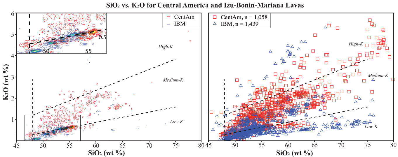
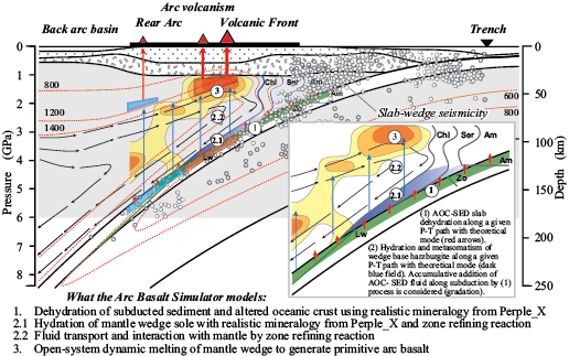
This short course is intended to help students, faculty, and researchers develop skills for mining data from EarthChem about the composition of arc lavas, visualize the location and important physical parameters of these volcanoes on GeoMapApp, and explore the petrogenesis of primitive lavas with a new Excel spreadsheet-based petrogenetic program “ABS 3” (Kimura et al., 2010). The course will comprise a variety of exercises and short lectures to explore and explain how these 3 software tools work together to address problems in convergent margin magma genesis. The course integrates use of geochemical databases, data visualization tools, and data analysis software with background knowledge about geoinformatics, relational databases, and data reporting. We will distribute ABS 3 spreadsheets and tutorials to participants before the workshop.

Participants should bring a laptop to the workshop.

Using Geoinformatics Resources to Explore the Generation of Convergent Margin Magmas
AGU Fall Meeting 2011, San Francisco, CA
R. Stern1, M. Feigenson2, K. Lehnert3, A. Goodwillie3, P. van Keken4, J. Kimura5, B. Dreyer6, E. Jordan1,  W. Lieu1

1University of Texas, Dallas; 2Rutgers University; 3Lamont-Doherty Earth Observatory; 4University of Michigan; 5IFREE, JAMSTEC; 6University of California, Santa Cruz

Twenty geoscientists attending Fall AGU forsook the chance to enjoy a beautiful Sunday in San Francisco on December 4, 2011, and chose instead to descend into the bowels of the Grand Hyatt for the chance to explore how geoinformatics can help geoscientists understand the composition and generation of convergent margin magmas. The all-day workshop was organized in support of the science goals of the GeoPRISMS Subduction Cycles and Deformation (SCD) Initiative. SCD aims to understand how subduction zones work, from cold, shallow regimes (accretionary prism, forearc crust, and the seismogenic zone) to deeper, hotter regions where fluids and melts from the subducted slab trigger melting in the convecting asthenosphere above it. SCD builds on and integrates the successes of the predecessor MARGINS Seismogenic Zone and Subduction Factory experiments, targeting the Aleutian and Cascade arcs as community-chosen focus sites. The techniques and insights developed from studies of these arcs can be applied globally, and we hope to attract more geoscientists to join the “subduction parade”. In our efforts to involve a more diverse group of geoscientists in this effort – from students to university professors to expert researchers – we need to develop better, more accessible tools for this community to use. The Geoinformatics workshop was an effort to attract new members of the GeoPRISMS SCD team and help prepare these geoscientists.

Figure 1, Dec. 2011 GeoPRISMS geoinformatics workshop participants. Front row (L to R): M. Feigenson, Warren Lieu, Erika Jordan, Peter Michael, Megan Derrico, Nick Deems, Sara Douglas, Andrew Goodwillie, Jun-ichi Kimura. Back row: Charles Bopp, Bob Stern, Kerstin Lehnert, Guillaume Girard, Tyrone Rooney, Katherina Vogt, Osamu Ishizuka, Brian Dreyer, Julia Morgan, Peter van Keken

Using Geoinformatics Resources to Explore the Generation of Convergent Margin Magmas | AGU 2011

These are lofty goals that can only be realized if interested geoscientists gather to explore effective tools and how they can be used. The most important community tools are databases, data visualizations, and data analysis software. Examples of each of these were highlighted in the workshop, as is clear from the agenda below (with pertinent links and other information). Each 50 minute long session encouraged questions and comments from workshop participants and was followed by a 10-minute break that allowed folks to stretch and refuel with plenty of food and beverages provided by GeoPRISMS.

  1. Geochemical databases and how to access them – Kerstin Lehnert (LDEO) explained how geochemical databases such as PetDB, Georoc, SedDB, and NAVDAT (all of which can be accessed via Earthchem) are increasingly important aspects of teaching and research (including GeoPRISMS SCD). Kerstin also explained how the new SESAR (System for Earth Sample Registration) can resolve problems of sample ambiguity (for example: how many samples have the same ID, e.g., how many “D1” samples are there in dredge collections around the world?) and data redundancy (for example: how many samples have been analyzed multiple times for different elements and isotopes, each reported with slightly different IDs that are entered separately into one or more databases?). Kerstin emphasized how important it was that samples studied as a result of GeoPRISMS SCD should each be registered for(International Geo Sample Number), a 9-digit alphanumeric code that uniquely identifies samples and provides information about where these can be found.
  2. Data Visualization Tool: GeoMapApp – GeoMapApp is an Earth science exploration and visualization application that is maintained and improved as part of the Marine Geoscience Data System at LDEO. There are several YouTube GeoMapApp multimedia tutorials that can be accessed. Of special interest to this workshop is the fact that GeoMapApp has a new feature that allows users to determine the depth of the subducted slab beneath a given arc volcano, and one tutorial shows how to do this, using the global compilations of Syracuse and Abers (2006).
  3. Central America and Izu-Bonin-Mariana arc geochemical databases – Erika Jordan and Warren Lieu (UT Dallas). CentAm and IBM were focus sites for the MARGINS Subduction Factory experiment and geochemical data for these from EarthChem have been compiled and are being filtered so that these can be made available as an Earthchem data library. Erika summarized the status of compilations for volcanic front lavas from these two focus sites, using graphs to show their geochemical similarities and differences. Once completed, these compilations will be available to anyone as a Geochemical Reference Library. One of the important issues related to such compilations is how to best show these data. There are hundreds to thousands of data points in these compilations, so individual points on graphs often lie on top of each other and it can be difficult to see underlying structure. Warren showed how large data sets can be contoured and it is clear that making such data visualization tools available will be key for exploiting large geochemical data sets.
  4. Thermal structure of subducted slabs – Modeling the thermal structure of subduction zones and using geochemical and geophysical data to test and refine these models is leading to some of the most rewarding collaborations between geodynamic modelers, geophysicists, and geochemists. After lunch, Peter van Keken (U. Michigan) presented some of the latest thinking about how lithosphere age and convergence rate control temperatures in subduction zones. It is the slightly (~1%) more dense nature of the ~100 km thick lithosphere relative to ambient mantle that makes plates subduct, but it is the thin veneer of subducted sediments and the upper, altered portion of the oceanic crust– typically only a few tenths of a percent of everything that is subducted – that controls the subduction zone incompatible element budget. We cannot understand the trace element and isotopic composition of arc lavas without understanding how sediments are cooked in the subduction zone kitchen. Subducted sediments lie athwart a very strong temperature gradient between hot convecting asthenosphere and cool conducting lithosphere, so it is not surprising that our thinking has fluctuated between a consensus that subducted sediments beneath the arc mostly are sufficiently cool that they only release hydrous fluids to the idea that they are mostly hot enough to melt. Thermal models for subducted sediments need to be tested and refined with geophysical and geochemical data and experiments.
  5. Introduction to Arc Basalt Simulator 3.1 – Jun-ichi Kimura (JAMSTEC/IFREE) presented the theoretical underpinnings of an evolving software package for understanding arc petrogenesis, called “Arc Basalt Simulator”, or “ABS”. ABS is a forward model designed to match the incompatible trace element and radiogenic isotopic composition of primitive (high Mg#) arc lava by inputting appropriate subducted sediment and altered oceanic crust compositions and compositions of unmodified mantle wedge, choosing an appropriate subduction zone thermal model (from Syracuse et al., 2010) and adjusting some other subduction zone parameters, such as where fluids or melts are extracted from the downgoing slab and the depth of mantle melting. ABS is an Excel-based spreadsheet that can be run on any PC or Mac, so all members of the GeoPRISMS SCD community can use it. A tutorial walks the new user through the various functions of ABS 3.1. The ABS spreadsheet and ABS tutorial can be downloaded from the Geochemical Resource Library. A recent paper (Kimura et al., 2010) uses ABS version 3.1 to investigate compositions of primitive magmas along the Izu arc, and a new version (ABS 4) is being developed by Dr. Kimura and colleagues.
  6. ABS exercise – Bob Stern (UTD) and Mark Feigenson (Rutgers) provided some practical experience with ABS3.1. Bob walked workshop participants through each of the ABS3.1 user-adjustable functions, then Mark showed the group how ABS 3.1 could be used to understand the composition of primitive Cerro Negro (Nicaragua) lavas.

There are some useful lessons to be learned for others considering proposing future workshops before or after national geoscientific meetings like AGU or GSA. It is important to start planning early so that possible participants have the workshop on their “radar screens” before they buy their air tickets for the meeting, and so these societies can include the workshops on meeting announcements. In addition, workshop conveners should make a strong push to advertise the workshop at least two months before the meeting, in order to maximize workshop attendance. The conveners would be happy to discuss other considerations with people thinking about proposing a GeoPRISMS workshop.

ExTerra at AGU 2011: Understanding Convergent Margin Processes Through Studies of Exhumed Terranes


  Warfield Room, Grand Hyatt San Francisco
345 Stockton Street, San Francisco, CA
Wednesday, December 7, 2011, 6:00 – 9:30 pm

Conveners: Maureen Feineman, Sarah Penniston-Dorland, Brian Savage

AgendaMeeting objectivesHandoutMeeting report

6:00-6:30 | Greeting, reception, and introduction – Juli Morgan, Maureen Feineman

6:30-7:00 | Keynote: Interdisciplinary study of exhumed subduction zones – Bradley  Hacker

7:00-7:30 | First Breakout: identify scientific objectives for ExTerra

7:30-7:45 | Focusing interdisciplinary study through sample and data management – Maureen Feineman

7:45-8:15 | Second Breakout: identify logistical and organizational needs

8:15-8:45 | Synthesis

This mini-workshop, to be held the evening of Wednesday, December 7, during the 2011 Fall Meeting of the American Geophysical Union in San Francisco, CA, aims to explore the interdisciplinary utility of studying exhumed terranes from extinct subduction zones. Exhumed terranes represent parts of the subduction zone that are not directly observable at currently active margins. By going to exhumed terranes, we are able to make direct measurements and observations that can be invaluable for ground-truthing seismic observations, thermal structure models, and interpretations of geochemical and petrological processes based on the eruptive products of active subduction zones. Due to the nature of the dynamic processes that bring exhumed terranes to the Earth’s surface, it is not possible to identify a single locality that represents the full range of subsurface regimes, including the subducted slab, the mantle wedge, the overlying arc crust, and exposed fault systems in the crust or accretionary prism. The goal of this workshop is twofold;
Identify what samples and data will be most useful to the diverse geophysical and geochemical subdisciplines involved in the study of active convergent margins, and
Determine how to best integrate studies of globally distributed exhumed terranes into a unified and directed body of research.
We will discuss in detail the benefits and burdens of sample archiving and data sharing. We encourage participation not only of those involved in the direct observation, sampling, and analysis of exhumed terranes, but also those who would make use of data gathered from these studies, including seismologists, modelers, and experimentalists.

What is ExTerra?

The NSF GeoPRISMS Subduction Cycles and Deformation SCD) Science Plan identified the study of exhumed terranes as an important component of subduction zone research. It remains to be determined how to best integrate the study of exhumed terranes and high pressure rocks into GeoPRISMS SCD. GeoPRISMS largely follows the very effective model used previously by MARGINS of building a research program around a few select focus sites at active subduction zones. This focused research has been a clear strength of the MARGINS program. Work at focus sites, however, may not be the best way to approach exhumed terranes and HP-UHP rocks. During active subduction, these features are buried deep beneath the surface. Of necessity, exhumation most often occurs during or following the death of a subduction zone. The nature of exhumation processes is such that entire subduction zones are rarely if ever exposed in a single location, requiring field work to be conducted at multiple locations, and most likely by multiple research groups using different techniques and approaches, before a comprehensive range of pressure and temperature conditions can be represented. Currently, the study of exhumed terranes is included in the GeoPRISMS implementation plan as a thematic approach. The goal of this meeting is to explore how we can best organize research on exhumed terranes and HP-UHP rocks under the umbrella of GeoPRISMS SCD such that we might accomplish more as a group than we could as individuals working independently.

Context

The GeoPRISMS SCD Implementation Plan identifies the following seven questions  to be addressed within the initiative. These should be a good place to start in terms of focusing our research within the context of the SCD initiative.

  1. What governs the size, location and frequency of great subduction zone earthquakes and how is this related to the spatial and temporal variation of slip behaviors observed along subduction faults?
  2. How does deformation across the subduction plate boundary evolve in space and time, through the seismic cycle and beyond?
  3. How do volatile release and transfer affect the rheology and dynamics of the plate interface, from the incoming plate and trench through to the arc and backarc?
  4. How are volatiles, fluids, and melts stored, transferred, and released through the subduction system?
  5. What are the geochemical products of subduction zones and how do these influence the formation of new continental crust?
  6. What are the physical and chemical conditions that control the initiation and development of subduction zones, including subduction initiation and the evolution of mature arc systems?
  7. What are the feedbacks between surface processes and subduction zone mechanics and dynamics?

Food for thought

The following objectives and scientific questions were identified during the GeoPRISMS SCD Implementation Meeting breakout session on Exhumed Terranes, which took place in parallel with the Focus Site breakout groups. We realized that there were a number of individuals at the meeting working in various disciplines whose work was not easily tied to a focus site in an active subduction zone. Those present fell into one or more of the four sub;fields of research, given below.

Four focus areas
  • Subducted slab: Includes HP and UHP rocks such as blueschists, eclogites, and metapelites
  • Mantle wedge: Includes serpentinites, ophiolites, and peridotites
  • Middle and lower arc crust: Includes granitoids and gabbros, migmatites, gneisses, amphibolites, and granulites
  • Exhumed fault systems: mostly accretionary prism ?)
What can studies of exhumed systems contribute to GeoPRISMS?
  • Organizes individual efforts into major interdisciplinary objectives: the whole is greater than the sum of the individuals
  • Integrating data from multiple sites allows coverage of a broad range of conditions not observable at a single site
  • Links experiments and seismic observation to physical reality: Adds components of space and time / Do the measurements scale up? grain scale to outcrop scale, outcrop scale to seismically resolvable features, days to millions of years
  • Enables coupled study of mechanical and chemical processes
  • Allows sample and data collection to be tuned to serve the needs of other groups geochemists helping seismologists, petrologists helping modelers, etc…)
Scientific Questions
  • What are the rates and fluxes associated with fluid and melt production as recorded by interaction with rocks?
  • What are the mass transfer processes important for global evolution models as well as concentration of ore metals societal relevance)?
  • How are tremor and slip recorded in the rock record? What are the geophysical properties of natural rocks velocity structure, anisotropy, fabrics) at a variety of scales?
  • How is magma formed and stored in the crust, and how does the crust evolve in response?
  • Data and sample management
  • Does it make sense to identify unofficial “focus sites” within the community?
  • Organize collaborative, multi;disciplinary field campaigns
  • “Require” voluntary registration of all samples with the System for Earth Sample Registration SESAR)
  • can be linked to ExTerra to make a searchable database of participating samples Interface with existing databases such as MetPetDB?
  • Should there be a physical component i.e., a sample repository) linked to the digital archive?
  • Alternatively, we can ask for a voluntary commitment to sample sharing within the community
Your mission:

We will split out twice into four breakout groups to facilitate inclusion of everyone in the discussion. Please be prepared to discuss the following issues. The ideas and feelings of the group with respect to these and any other issues/questions that arise will be assembled in a white paper to be submitted to GeoPRISMS.

First breakout – Scientific Objectives:
  • How is the study of exhumed terranes relevant and necessary to the objectives of the GeoPRISMS SCD initiative?
  • What critical scientific questions can we address using exhumed rocks/terranes?
  • How can field geologists interface productively with experimentalists, seismologists, and modelers?
Second breakout – Organizational aspects:
  • What data and meta;data do we need to collect and store?
  • How can we make data and samples accessible to all?
  • Is there a need for a physical, curated sample repository?
  • Should we identify key sites for collaborative field efforts? If so, which ones?
  • What other efforts e.g. workshops, fieldtrips) would facilitate collaboration?

ExTerra: Understanding Convergent Margin Processes Through Studies of Exhumed Terranes | AGU 2011

ExTerra: Understanding Convergent Margin Processes Through Studies of Exhumed Terranes

AGU Fall Meeting 2011, San Francisco

M. Feineman1, S. Penniston-Dorland2, B. Savage3

1Pennsylvania State University; 2University of Maryland; 3University of Rhode Island

On the evening of December 7, 2011, about 35 geoscientists convened in the ExTerra mini-workshop during the fall AGU Meeting to discuss how to integrate the study of exhumed rocks into the GeoPRISMS Subduction Cycles and Deformation (SCD) initiative (Figure 1). After introductory presentations by the convenors and keynote speaker Brad Hacker (University of California, Santa Barbara), workshop participants divided into four groups based on different types of exhumed terranes: subducted slab, mantle wedge, arc crust, and fault systems. The group discussion was divided into two areas: identification of scientific objectives and organizational strategies. Details of the outcomes from each discussion group are outlined at http://www.geoprisms.nineplanetsllc.com/scd/exterra.html. This is an ongoing discussion leading to a white paper contribution to the GeoPRISMS SCD Science Plan, and we invite all interested parties to participate!

What is ExTerra?

The NSF GeoPRISMS Science Plan for the SCD Initiative identified the study of exhumed terranes as an important component of subduction zone research. It remains to be determined how to best integrate the study of exhumed terranes and high pressure rocks into GeoPRISMS SCD. GeoPRISMS largely follows the very effective model used previously by MARGINS of building a research program around a few locations, referred to as primary sites, atactive subduction, these features are buried deep beneath the surface. Of necessity, exhumation most often occurs during or following the death of a subduction zone. The nature of exhumation processes is such that entire subduction zones are rarely if ever exposed in a single location, requiring fieldwork to be conducted at multiple locations, and most often by multiple research groups using different techniques and approaches, before a comprehensive range of pressure and temperature conditions can be represented. Currently, the study of exhumed terranes is included in the GeoPRISMS Implementation Plan as a thematic study. The goal of this mini-workshop and the resulting white paper is to explore how we can best organize research on exhumed terranes under the umbrella of GeoPRISMS SCD such that we might accomplish more as a group than we could as individuals working independently.

Figure 2. SOTA fieldtrip to see Cycladic subduction zone rocks on the island of Syros, Greece.

What can studies of exhumed systems contribute to GeoPRISMS?

The integration of studies of exhumed systems through GeoPRISMS can organize individual efforts towards major interdisciplinary objectives. Integration of data from multiple sites allows coverage of a broad range of conditions not observable at a single site. Studies of exhumed systems under the umbrella of GeoPRISMS have the potential to link experiments and seismic observation to physical reality, adding the components of space and time. Collaboration and communication between different communities represented within GeoPRISMS allow sample and data collection to be tuned to serve the needs of other groups (geochemists helping seismologists, petrologists helping modelers, etc.).

Target areas

Four target areas have been identified as significant to improving our understanding active subduction processes by the study of exhumed terranes: 1) subducted slab, including HP and UHP rocks such as blueschists, eclogites, and metapelites; 2) mantle wedge, including serpentinites, ophiolites, and peridotites; 3) middle and lower arc crust, including granitoids, gabbros, migmatites, gneisses, amphibolites, granulites; and 4) exhumed fault systems, including accretionary prisms.

Fostering Interdisciplinary Communication

Several different ideas have been suggested in order to facilitate communication among different geoscientists. One idea is to hold focused, interdisciplinary field trips in order to provide the opportunity for non-field geologists to observe exhumed rocks and create an environment for exchange of ideas between field geologists and non-field geologists. Another idea is to create a sample repository and associated database that will allow sample collectors to connect with those who have use for rock samples. For example, experimental petrologists can make use of a sample repository to find materials for their experiments.

Figure 4. AGU Fieldtrip to see subduction zone rocks of the Franciscan Complex, CA.

Challenges

We recognize that there are many challenges facing the integration of the study of exhumed terranes into GeoPRISMS. How do we open the dialog between petrologists, geophysicists, and modelers? How can studies of worldwide exhumed terranes be related to current GeoPRISMS focus sites? GeoPRISMS is a small program, and we will need to leverage with funds from outside sources.

Marine Geophysics in the Cascadia Primary Site


  Fillmore ABC, Grand Hyatt San Francisco
345 Stockton Street, San Francisco, CA

Sunday, December 2, 2012, 6:00 – 9:30 pm

Conveners: W.Steve Holbrook, Geoff Abers, Maya Tolstoy, Suzanne Carbotte, Anne Trehu, Harold Tobin, Doug Toomey, Katie Keranen, Paul Johnson

AgendaMeeting objectivesMeeting report

6:00-7:30 | Major projects

7:30-8:00 | Five-Minute Presentations

Contributions “from the floor” – maximum 5 minutes, one PPT slide

8:00-8:45 | Open Discussion

Possible Topics:
  • OBS array redeployment
  • Future MCS: 2D vs 3D
  • Wide-angle, active-source seismics (OBS, onshore-offshore)
  • Bathymetric grids
  • Data Sharing

8:45-9:30 | Posters

This mini-workshop will focus on marine and “amphibious” geophysical activities in the Cascadia Primary Site; mini-workshop objectives will be to review progress, coordinate activities, and plan future work in Cascadia, particularly in association with the recent acquisition of several major new large-scale geophysical data sets. This mini-workshop will leverage the current momentum from the present marine geophysical studies in Cascadia and provide the underlying context for the next decade of interdisciplinary studies of the area.

The Cascadia subduction margin has been designated as a Primary Site for the GeoPRISMS program, due largely to the seismic hazard posed to the U.S. Pacific Northwest by potential megathrust earthquakes on the subducting plate boundary. Although science planning has begun with several successful workshops (Cascadia Initiative, October 2010; GeoPRISMS, April 2012), PI- and community-driven projects are in a nascent state. The past year has been particularly active for offshore Cascadia margin studies. Four separately funded seismic studies were conducted:

  • The Cascadia Initiative OBS passive-source deployment,
  • Two active-source Langseth surveys (Ridge2Trench and COAST)
  • Onshore-offshore piggybacks to the two Langseth surveys.
The offshore part of the Cascadia Initiative Amphibious Array complements the onshore part that became operational earlier. In addition, the active-source surveys were complemented by onshore recording arrays in Oregon and Washington, capturing signals that sample the megathrust. Some of the data acquired are open-access (COAST, CI), while others are PI-specific. This intense activity attests to the wide community interest in pursuing GeoPRISMS goals on the Cascadia margin.This mini-workshop will:
  • Review Cascadia science goals in the context of recent progress and new data
  • Exchange information and preliminary results, both among current PI’s and more broadly to the community
  • Coordinate joint interpretation of diverse geophysical data
  • Publicize and encourage broad community use of open-access data sets
  • Stimulate discussions on future work and proposals

Marine Geophysics in the Cascadia Primary Site | AGU 2012

Marine Geophysics in the Cascadia Primary Site

Convened by: W.Steve Holbrook, Geoff Abers, Maya Tolstoy, Suzanne Carbotte, Anne Trehu, Harold Tobin, Doug Toomey, Katie Keranen, Paul Johnson

This mini-workshop, held on Sunday December 2, 2012, focused on recent marine and “amphibious” geophysical activities in the Cascadia Primary Site. Projects (and presentations) include:

  • Cascadia Initiative OBS Passive-Source Deployment & data (Doug Toomey & Spahr Webb)
  • COAST Open Access Marine Seismic Project (Steve Holbrook)
  • Ridge2Trench Marine Seismic Project (Suzanne Carbotte)
  • Onshore-offshore Integration of Seismic Data Sets (Geoff Abers)
  • Review of Legacy Seismic Data in Cascadia (Anne Trehu)
  • In addition, several contributions from the floor reviewd related projects, including
  • Models of subduction and continental accretion in Cascadia (Haiying Gao)
  • Cascadia forearc faults (Katie Keranen)
  • Review of magnetotelluric studies in Cascadia (Adam Schultz)
  • OOI geophysics (Will Wilcock)

The mini-workshop allowed the community to review progress, coordinate activities, and plan future work in Cascadia, leveraging the current momentum from the present marine geophysical studies in Cascadia, and providing the underlying context for the next decade of interdisciplinary studies of the area.

IODP Opportunities in GeoPRISMS Subduction Studies


  Fillmore ABC, Grand Hyatt San Francisco
345 Stockton Street, San Francisco, CA

Thursday, December 6, 2012, 6:00 – 9:30 pm


Conveners: Robert Stern, David Scholl, John Jaeger, Terry Plank

AgendaMeeting objectivesMeeting report
6:00 | IntroductionRobert Stern
6:05 | Using the drillship to determine subduction zone inputs Terry Plank
6:20 | Using the drilling ship to recover the long-term paleoseismic/tsunami history of giant Aleutian, Alaska, Cascadia,and New Zealand megathrust ruptures David Scholl
6:35 | Using the drillship to understand relationships between mountain building, climate, and sedimentation – John Jaeger
6:50 | Using the drillship to understand arc magmatic evolution through time by sampling the tephra record – Brian Jicha
7:05 | Using the drillship to understand the age and origin of the Aleutian Marginal Basin what this tells about the early history of the Aleutian ArcRobert Stern
7:20 | Hikurangi IODP proposalsLaura Wallace
7:50 | How to propose an IODP workshop – John Jaeger
8:00 | What should be done next? | Robert Stern
8:15 | Group Photo – Miniworkshop Adjourned
8:15 | Informal Gathering of Embryonic Proposal- Planning Groups (optional): Groups with potential common interests are encouraged to self-organize, collect e-mails, and start the dialogues needed to generate and submit an IODP workshop proposal.

Much of our understanding of convergent margin processes is the direct result of ocean drilling on downgoing and overriding plates around the world. The GeoPrisms Subduction Cycles and Deformation (SCD) initiative presents new opportunities to engage IODP in this effort, specifically to understand the Cascadia, Aleutians-Alaska and Hikurangi subduction primary sites. The Drillship JOIDES Resolution will operate under a regional operations model during the new IODP program, and its shiptrack beyond 2014 will depend upon proposal pressure. Thus, now is the time to consider how to best use IODP drilling to support GeoPRISMS SCD science objectives, and to engage younger geoscientists in this effort, including proposal writing.

This mini-workshop will explore how best to use IODP drilling to support GeoPRISMS Subduction Cycles and Deformation science objectives, and especially, how to make use of the DV JOIDES Resolution for studying the Cascadia, Aleutian and New Zealand primary sites. Topics will include summaries of recent expeditions, future drilling targets, proposal development including workshops, and engaging early career geoscientists in these efforts.

Leveraging IODP Scientific Drilling in Support of Subduction Cycles & Deformation Science Objectives

AGU Fall Meeting 2012, San Francisco, USA

Conveners: Robert Stern1, John Jaeger2, Brian Jicha3, Terry Plank4, Dave Scholl5, Gene Yogodzinski6

1University of  Texas, Dallas; 2University of Florida; 3University of Wisconsin; 4Lamont-Doherty Earth Observatory; 5U.S. Geological Survey; 6University of South Carolina

IODP Opportunities for SCD (Dec 6, 2012)

About 25 scientists attending Fall AGU meeting in San Francisco took a couple hours out of their busy schedules to participate in a Thursday evening mini-workshop at the Grand Hyatt about how to best use seafloor drilling to address GeoPRISMS Subduction Cycles and Deformation (SCD) science objectives. A new decade of scientific ocean drilling will occur when the new International Ocean Discovery Project (IODP) gets underway; this is planned for 2013-2023 (For more information about IODP and GeoPRISMS, look at the GeoPRISMS Fall 2012 Newsletter). The primary goal of the AGU mini-workshop was to stimulate interested geoscientists to consider how IODP drilling in the Aleutians, Cascadia, and Hikurangi margins can attack the seven “key questions” in the SCD Initiative draft Science Plan. The two-hour brainstorming session was fueled by hors d’oeuvres, a cash bar, and six brief (5 minute presentations plus 10 minutes discussion) talks.

Figure 1. General diagram showing tectonic locations being discussed for IODP drill sites in support of GeoPRISMS science objectives. Site 1: sediment and basement inputs to subduction factory and seismogenic zone, important for Cascadia, Aleutians, and Hikurangi. Site 2: Shallow drilling to understand slow slip events, suggested for Hikurangi margin. Site 3: forearc drilling to reconstruct megathrust events and mountain growth, suggested for Aleutian and Cascadia margin. Site 4: Volcanic history (via tephra) and early arc basement, suggested for Aleutian arc. Site 5: Aleutian Basin formation and evolution.

Terry Plank discussed how to use the drillship to determine subduction zone inputs. It is essential to sample the oceanic crust and sediments that are subducted at each margin, in order to understand how these inputs affect the mechanical properties of fault zone rocks, the generation of fluids in the subduction zone, and the formation of arc magmas (Fig. 1 site 1). Terry noted that for Cascadia there are already several sediment reference sites, and there are even sites in the northern Juan de Fuca plate where basement has been well-sampled and studied hydrologically. These materials need to be analyzed in order to establish the chemical composition of what is being fed into the Cascadia subduction zone. A major uncertainty is what is accreted in the fore-arc and what is swept down to ~100 km to feed the arc magmatic system. Understanding inputs to the Aleutian-Alaskan subduction factory is a bigger problem: this convergent margin is much longer than Cascadia (~3000 km vs. ~1000 km) and sedimentation on the downgoing plate changes along strike from thick, abyssal plain and trench-axis turbidite deposits in the east to thin pelagic sediments overlain by thinning trench-axis deposits in the west. For the eastern Aleutians, we have good but very incomplete DSDP sampling of the Zodiac Fan and more sediment coring in the Gulf of Alaska is expected from scheduled drilling. In contrast, not much is known about sediments on the downgoing plate feeding the intra-oceanic Aleutian arc, west of the Bering shelf break. Fracture zones (FZ) like the Amlia FZ provide additional complexity: these may mark unusual zones of thick sediments, altered oceanic crust, and serpentinized mantle. Can we recognize these inputs in the resultant arc magmas? The subducted oceanic crust appears to become ever more important to arc outputs toward the west, but less than 20 meter of basaltic basement have been recovered from the entire 3000 km Aleutian sector. We need to recover several hundred meters of oceanic crust, because we cannot constrain how much H2O and CO2 is carried down into the subduction zone unless we understand alteration of the subducting oceanic crust. For the Hikurangi margin, ODP Leg 181 sampled the upper sediments, but the lower km (related to Hikurangi Plateau volcanism) has not yet been sampled. Plans are underway, however, to drill a new section of sediment and basement input to the Hikurangi margin (see below).

Dave Scholl outlined how we could obtain a long-term history of major Aleutian seismogenic zone earthquakes by drilling into the forearc to core the deposits of landslides and turbidites that shallow earthquakes create (Fig. 1 site 3). There are two challenges here: to distinguish seismogenic deposits from those produced by other causes, such as non-seismic forearc slope collapse; and how to date these deposits – once identified – with the precision needed at the scale of the seismic cycle? It was also noted that we have a better understanding of the Cascadia seismogenic record than we know the Alaskan record, in spite of the fact that major (M>8 to 9.2) earthquakes (eight have occurred since 1899) are more frequent along the Alaskan-Aleutian margin.

John Jaeger continued on the theme of how we could interpret tectonic history from studying deep sediment cores (Figure 1, site 3). He outlined how these sedimentary records could illuminate linkages between uplift and deformation on the one hand and climate-mediated erosion of growing mountains on the other hand. He further noted how these could combine to create a high sedimentary flux that can turn off forearc deformation.
Brian Jicha explored how the drillship could be used to understand the early Aleutian subduction zone development, and how the arc magmatic system has since evolved (Figure 1, site 4). Aleutian arc subduction is thought to have begun in Eocene time – perhaps along an E-W trending fracture zone – capturing part of the Mesozoic Kula or Resurrection plates to form the Aleutian Basin (see below). We should be able to find a suitable place in the Aleutian forearc where a continuous tephra record – the products of Aleutian and Alaskan explosive eruptions – is preserved. The tephra record – which has wind-direction and compositional bias – could be supplemented by volcaniclastic sediments, which is less compositionally biased but which would preserve the magmatic record of a few upslope volcanoes. Drilling through sedimentary cover to sample forearc basement should recover magmatic products accompanying formation of the Aleutian subduction zone. It is possible that the Aleutian Basin formed by Paleogene backarc spreading, instead of being trapped Pacific/Kula/Resurrection plate. Recovery and study of Aleutian Basin crust would be a primary constraint on timing and nature of Aleutian arc subduction initiation.

Bob Stern outlined using the drillship to understand the age and origin of the Aleutian Basin, and use this information to constrain interpretations of surrounding regions (Fig. 1 site 5), such as the early history of the Aleutian Arc as well as the thermal history of the Aleutian Basin and basement-rock beveled Beringian Shelf. The issue is that there is a lot of sediment in the Aleutian Basin (km’s), but there might be regions where the sedimentary section is thinner. By drilling to basement though 1.5 km of sediments, we should recover a complete high-latitude record of Cenozoic climate history as well as direct age of Aleutian Basin crust.
After these five samplers, we heard briefly about more advanced plans for drilling in the Hikurangi SCD focus site to understand slow slip events (Figure 1, site 2) from Laura Wallace. Hikurangi slow slip events are unusually shallow and may propagate all the way to regions near the trench that are accessible to drilling. Drilling may thus give us direct access to sampling rocks and fluids formed in association with slow-slip events. A riserless drilling proposal currently in the review and ranking process has a coring transect from the subducting plate (inputs) across the overriding plate above the SSE source. There is an input site planned: 1 km of sediments followed by ~200 m penetration into basement. The input site will provide protoliths of the fault zone rock at depth in the slow slip event source area. A proposal to drill a ~5 km riser hole will be submitted in April 2013. Hikurangi drilling will collect samples related to the former MARGINS “Source to Sink” site in the nearby Waipaoa catchment.

We were also told about an interesting Brothers volcano (Kermadec Arc) IODP pre-proposal in the works, and a full IODP proposal to drill at the Lord Howe Rise and New Caledonia Basin to look at the consequences of subduction initiation along the Tonga/Kermadec/Hikurangi subduction system. These two proposals are likely to be submitted in April 2013.

Following these presentations, the floor was open to other inputs. Gene Yogodzinski led the group in broad discussions, from Cascadia sediment input, the need for coring into oceanic basement at all sites, the importance of water-rich saponite in oceanic crust, the importance of studying input material to understanding the rheology of the plate interfaces, to the opportunity presented by drilling into the Amlia fracture zone because of unusual sediments and ocean crust alteration, to the importance of biogenic silica as a fluid source, to further discussion of the significance of the tephra record, to engineering considerations for drilling in the Aleutian Trench, to the Cascadia fore-arc slope basins being obvious targets for sampling the paleoseismic record.

After the open discussion, John Jaeger outlined how to propose an IODP workshop, which is useful for moving from broad ideas to specific drilling proposals. Since the workshop, we have learned that guidelines for preliminary proposals are being revised and will be in place for the Oct. 1, 2013 deadline. Some groups interested in similar drilling objectives gathered to begin planning.

ExTerra at Goldschmidt 2013 Workshop


  University of Florence, Italy
2013 Goldschmidt Conference

August 24-25, 2013, 8:00 am – 12:00 pm

Conveners: Maureen Feineman, Sarah Penniston-Dorland

AgendaAnnouncementMeeting report

Day one

Morning | The subducted slab
Welcome and introduction to the workshop
Keynotes + Discussion
  • The growth of garnet and the chronology of slab dehydration – Ethan Baxter
  • The importance of hybrid rocks for transient trace-element and volatile storage at the slab-mantle interface – Horst Marschall
  • Into the subduction plate interface? – Philippe Agard

1-minute briefs on posters

Lunch with focus area groups (slab, mantle, and arc crust)

Afternoon | The mantle wedge
Keynotes + Discussion
  • Field observations and thoughts about carbon transfer from metasediments into the mantle wedge in oceanic subduction zone – Peter Kelemen
  • Geochemical signature of a serpentinized mantle wedge – Jaime Barnes
  • Seismic signatures of a hydrated mantle wedge from antigorite crystal preferred orientation (CPO) – Sarah Brownlee
  • Mantle wedge oxygen fugacity – Katie Kelley
1-minute briefs on posters

The arc crust

Keynotes + Discussion

  • Hot lower arc crust at the surface – A review of some of the most important exhumed crystal sections and xenolith localities from the Americas – Mihai Ducea
  • Magmatic connections: The interplay of magmatic systems with their crustal containers – Josef Dufek
  • The formation of continental crust in arcs: The seismological perspective – Oliver Jagoutz
1-minute briefs on posters
Late afternoon/early evening
Poster session
Dinner meetings with focus area groups (slab, mantle, and crust)

Day two

Morning
Welcome and discussion of the future ExTerra
Sample and data management
Field trip proposals
Breakout sessions by topic
Breakout groups report back to full group

Lunch

Afternoon
General discussion and wrap-up

The goal of ExTerra 2013: Understanding Subduction through Studies of Exhumed Terranes is to organize disparate studies of subduction-related metamorphic and igneous rocks around a common set of scientific targets, and using centralized tools, in order to move the discipline forward more efficiently as a community. In order to accomplish this goal, we will gather the communities of researchers investigating three categories of exhumed rocks from subduction zones:

1) high-pressure rocks of the subducted slab,
2) middle and lower arc crust, and
3) the mantle wedge.

The ExTerra 2013 workshop will be held starting in the morning of Saturday, August 24, lasting through the middle of Sunday, August 25, during the two days prior to the 2013 Goldschmidt Conference in Florence, Italy. It will be held in classrooms on the campus of the University of Florence. The program will include scientific presentations (talks and posters) on current research in exhumed terranes, an update on database and archiving progress, and will identify localities and organizers for field forums to be held over the next few years.

ExTerra: Understanding Subduction Through Studies of Exhumed Terranes (Florence, Italy, August 24-25, 2013)

Understanding Subduction through the Study of Exhumed Terranes

August 24-25, Florence, Italy

M. Feineman1 & S. Penniston-Dorland2

1Pennsylvania State University;  2University of Maryland

On August 24-25, 2013, geoscientists met in Florence, Italy for the ExTerra 2013 workshop prior to the Goldschmidt conference. In all, there were 33 participants from 9 countries, including 11 students, 2 post-docs, and 5 early-career faculty. Workshop participants divided into three groups based on different types of exhumed terranes: subducted slab, mantle wedge, and arc crust. The groups were tasked with refining the key scientific questions previously identified in the ExTerra White Paper (2012) and discussing future directions for ExTerra.

What is ExTerra?

ExTerra is a group of individuals interested in studying exhumed rocks of ancient subduction zones in order to understand the processes that operate deep within subduction zones. Our ongoing mission is to explore how we can best organize research on exhumed terranes such that we might accomplish more as a group than we can as individuals working independently. Three target areas have been identified as significant to improving our understanding active subduction processes by the study of exhumed terranes:

  1. Subducted slab, including HP and UHP rocks such as blueschists, eclogites, and metapelites;
  2. Mantle wedge, including serpentinites, ophiolites, and peridotites; and
  3. Middle and lower arc crust, including granitoids, gabbros, migmatites, gneisses, amphibolites, granulites.

Figure 2. ExTerra 2013 workshop participants learn about US examples of exhumed arc crust sections from Mihai Ducea.

Workshop summary

Day 1: Science Questions

The first day consisted of a full day of scientific presentations with ten keynote talks followed by an evening poster session. The talks were chosen to emphasize cutting-edge research on the processes and materials found deep within subduction zones and ultimately exhumed at the Earth’s surface, and to stimulate discussion of the Big Science Questions that can be addressed using rocks from exhumed terranes. The keynote speakers and topics are listed in the table below.

Day 2: Planning for the Future

The second day was focused on the future of ExTerra and included presentations on potential field institute localities and a discussion of sample and data management led by Kerstin Lehnert, Director of Integrated Earth Data Applications (IEDA). The workshop participants then separated into breakout groups by target area to refine the key scientific questions identified in the first ExTerra white paper (2012), and to discuss future directions for ExTerra, including potential field institute localities.

Table 1. List of speakers and presentations
Speaker Institution Talk Title
Subducted Slab
Ethan Baxter Boston University The growth of garnet and the chronology of slab dehydration
Philippe Agard UPMC (Paris VI) Into the subduction plate interface?
Horst Marschall WHOI The importance of hybrid rocks for transient trace-element and volatile storage at the slab-mantle interface
Mantle Wedge
Peter Kelemen LDEO – Columbia Field observations and thoughts about carbon transfer from metasediments into the mantle wedge in oceanic subduction zones
Jaime Barnes UT, Austin Geochemical signature of a serpentinized mantle wedge
Katherine Kelley URI – GSO Mantle wedge oxygen fugacity
Sarah Brownlee Wayne State University Seismic signatures of a hydrated mantle wedge from antigorite crystal preferred orientation (CPO)
Arc Crust
Mihai Ducea Univ. of Arizona A review of some of the most important exhumed crustal sections and xenolith localities from the Americas
Josef Dufek Georgia Tech Magmatic connections: The interplay of magmatic systems with their crustal containers
Olivier Jagoutz MIT The formation of continental crust: the seismological perspective

Big Science Questions

Workshop participants continued to explore and refine the Big Science Questions regarding subduction zones that can be addressed through the study of exhumed high- and ultrahigh-pressure rocks and terranes. A few of the many emergent and re-emergent themes include:

  • What are the timescales of fluid release and transport in the slab and mantle?
  • What is the physical nature of the slab-mantle boundary?
  • What is the relative importance of mechanical vs. chemical mixing across the slab interface?
  • How are volatiles (including CO2, H2O, and O2) stored and transported in the mantle?
  • What is the extent of mass exchange between arc magmas and arc crust?
  • Is the erupted component at volcanic arcs representative of the stored plutonic component in the middle-to-lower arc crust?
  • How different is the bulk composition of continental vs. oceanic arc crust?
  • How can we best relate observables from exhumed rocks to seismic observations and geodynamic models?

ExTerra Field Institutes

One proposed extension of ExTerra in the coming years is a series of field institutes that would gather groups of researchers (~20 participants) at a few world-class exhumed subduction localities with the purpose of exploring some of the key scientific questions identified in the ExTerra white papers. The field institutes would focus on targeted sample collection, supported by careful sample registration and data management. Institutes might also include field techniques such as LiDAR, handheld XRF, and in situ measurement of physical properties. After an initial time period (~18 months) during which samples would be preferentially accessible to field institute participants for analysis, all samples would be made publicly available for research purposes following a model similar to that employed by the Ocean Drilling Program. Proposed sites for future field institutes include Santa Catalina Island, CA; Santa Lucia Mountains, CA; Fiordlands, New Zealand; Sierra Valle Fertil, Argentina; and Monviso, Italian Alps.

Workshop on Field Logistics for GeoPRISMS Research in the Aleutian Arc


  Fillmore ABC, Grand Hyatt San Francisco
345 Stockton Street, San Francisco, CA

Sunday, December 8, 2013, 12:40 – 6:00 pm

Conveners: Peter Kelemen, Geoff Abers, Jeff Freymueller, P. Haeussler, W.Steve Holbrook, Brian Jicha, John Power, Gene Yogodzinski

AgendaMeeting objectivesMeeting report

12:40 1:00 | GeoPRISMS Science Plan: focus on the Aleutians – Julia Morgan
1:00 – 1:10 |   Sites for seismometer deployment: passive sourceGeoff Abers
1:10 – 1:20Sites for sampling lavas for geochemistryGene Yogodzinski
1:20 – 1:30 | Sites for sampling magmatic volatiles – Terry Plank
1:30 – 1:40 | Sites for sampling plutons for geochemistry – Peter Kelemen
1:40 – 1:50 | Sites for seismometer deployment: active source – Steve Holbrook
1:50 – 2:00 | Sites for measuring ongoing deformation – Jeff Freymueller

2-2:10 BREAK

2:10-2:20 | Sites for sampling for geochronology – Brian Jicha
2:20-2:30Sites for investigating tectonic historyDave Scholl
2:30-2:40 | German-Russian-American collaborative cruises – Kaj Hoernle
2:40-2:50 | Alaska Volcano Observatory, operations & synergy – John Power
2:50-2:00 | EarthScope/Plate Boundary Observatory logistics – Max Enders
3:00- 3:10 | Experience with Aleutian logistics & options for the future – Jeff Freymueller

3:10-3:30 BREAK

3:30-4:30 | Community input & discussion: Where do you want to go?

4:30-4:50 BREAK

4:50-5:10 | Updated, straw person plan for shared logistics – John Power

5:10-5:50 | Discussion

5:50-6 | Wrap up, plans for continuing input – Julia Morgan

Workshop participants will address coordination of resources for fieldwork in the Aleutian arc. We will assess available resources and community interest in proposed, shared field support for NSF GeoPRISMS supported research in the Aleutian arc.

As one important part of the mix, NSF is considering chartering a ship and an associated helicopter, which would leave Anchorage for the western Aleutians, in a 40 to 60 day round trip, in the summers of 2015 and/or 2016.

Investigators would board and disembark as needed, in ports such as Sand Point, Cold Bay, Dutch Harbor, Adak Island, and perhaps other ports, and would use the ship and helicopter to access field sites along the Aleutians.

We will also consider the role of the NSF Amphibious Array of ocean bottom seismometers, the IRIS deployment of seismometers in the Transportable Array in Alaska, the Alaska Volcano Observatory in their ongoing volcano monitoring efforts, NOAA Ocean Exploration, and other interested organizations whose resources and goals offer potential synergy with GeoPRISMS research in the Aleutian arc.

The motivation for this workshop is to reduce the logistical cost per project in the Aleutians while maximizing the number of field projects that can be supported. In particular, we hope that sharing resources will provide access to investigators who otherwise might not participate in Aleutian research, in order to ensure the maximum scientific return on this unprecedented opportunity to study a uniquely important part of the global subduction system.

Central goals of the workshop will include:
  1. Assessing community interest in one or more shared logistical platforms
  2. Assessing logistical requirements
  3. Exploring partnerships with other organizations and groups
  4. Discussing funding options with NSF personnel

The choice of venue was made to reduce travel costs for participants already planning to attend the Fall AGU Meeting 2013. There will be no registration fee. GeoPRISMS will cover the cost of meeting facilities and refreshments for the workshop, but not travel. There will be a limited number of participants. Ideally, the maximum number will be attained, but not exceeded.

Workshop on Field Logistics for GeoPRISMS in the Aleutian Arc

AGU Fall Meeting 2013, San Francisco, USA

Conveners: Peter Kelemen1, Geoff Abers1, Jeff Freymueller2, Paul Haeussler3, Steve Holbrook4, Brian Jicha5, John Power3, Gene Yogodzinski6

1LDEO; 2University of Alaska, Fairbanks; 3USGS; 4University of Wyoming; 5University of Wisconsin; 6University of South Carolina

A Mini-Workshop, with support from GeoPRISMS, was organized to explore options for shared logistical support for NSF funded research in the Aleutian volcanic arc, which is part of the GeoPRISMS Alaska Focus Area. The goal is to reduce the logistical costs per project in order to enable a larger group of investigators to benefit from the opportunity that the GeoPRISMS focus is intended to foster. The workshop was held in the Fillmore ABC meeting rooms, in the Grand Hyatt San Francisco Hotel on Sunday, December 8, 2013 from 12:40 to 6:00 PM.

Despite inclement weather across North America, which prevented some registrants from attending, there were more than 90 participants from more than 60 universities and research organizations, mostly in the US.

 icon-chevron-right Sharing Resources for Aleutian Arc Research | Eos, Vol. 95, No.11, 18 March 2014

Kermadec Arc – Havre Trough Planning Mini-Workshop


 icon-map-marker Fillmore ABC, Grand Hyatt San Francisco
345 Stockton Street, San Francisco, CA

Sunday, December 8, 2013, 8:00 am – 12:00 pm

Conveners: Adam Kent, Mark Reagan, Laurent Montesi, Kaj Hoernle

AgendaMeeting objectivesMeeting report

8.00 | Introductory Remarks and logistics – Adam Kent
8.10 | Introduction to the GeoPRISMS programPeter van Keken
8.20 | GeoPRISMS NSF plans and opportunities – Jenn Wade
8.30 | Keynote: KAHT system introductionIan Smith

Ongoing projects

9.00 | Japanese ROV Plans – Yoshi Tamura
9.15German PlansKaj Hoernle
9.30 | New Zealand Plans – Adam Kent
9.45 | Australian Plans – Richard Arculus
10.00 | Break + Posters

Opportunities
10.30 | Subduction fluxes – Erin Todd/ Jim Gill
10.45 | Subduction Initiation: lessons from the IBMMark Reagan
11.00 | Pop up talks

11.45 | Discussion: Priorities

The Kermadec Arc and Havre Trough (KAHT) represent a classic intraoceanic arc – back-arc system. The KAHT extends north from the Taupo Volcanic Zone of New Zealand to the Tonga-Lau subduction system. With a well-defined arc front, remnant arcs (the Colville and Kermadec Ridges), and a back arc > 100 km wide, the KAHT system is a prime setting for investigating arc processes from subduction initiation, through arc splitting, to backarc formation, including tectonic and mass transfer processes.

Recently, the KAHT has become the focus of international research into intraoceanic arc systems, and it is part of the New Zealand GeoPRISMS focus site. A number of groups are already working in the system, including GeoPRISMS researchers and a significant number of other international groups (Germany, Japan, New Zealand, Australia). The goal of the workshop is to share details about science plans and existing results, and to coordinate future activities to maximize the synergy between different expeditions and research programs. Researchers with existing or planned future programs in this region are encouraged to attend the workshop.

Kermadec Arc-Havre Trough Planning Mini-Workshop

AGU Fall Meeting 2013, San Francisco, USA

Conveners: Adam Kent1, Mark Reagan2, Laurent Montési3, Kaj Hoernle4

1Oregon State University; 2University of Iowa; 3University of Maryland; 4GEOMAR, Germany

On Sunday December 8, 2013 a diverse group of international researchers gathered at the Grand Hyatt, San Francisco for a GeoPRISMS-sponsored Mini-Workshop aimed at advancing collaborative science within the Kermadec-Havre Trough system (KAHT), part of the SCD New Zealand Focus Site. This followed from the successful New Zealand Planning Workshop held in Wellington in April 2013. The primary goal of this Mini-Workshop was to bring representatives of international groups together to discuss recent results, review ongoing science plans, and to identify area for future work under the aegis of GeoPRISMS.

Kermadec Arc-Havre Trough Planning Mini-workshop (8am-12 pm, December 8, 2013)

Kermadec Arc-Havre Trough Planning Mini-workshop (8am-12 pm, December 8, 2013)

Following an introduction from the organizers and short presentations by NSF and GeoPRISMS representatives, a keynote presentation by Ian Smith, University of Auckland, provided background on the KAHT system as a classic intra-oceanic arc, and emphasized some of the key science opportunities such as progressive changes in convergence rate and continental contributions along strike from North to South, the significant proportion of felsic rocks that are present, and the possibility for studies of arc initiation in older preserved arc remnants.

These opportunities were also discussed and expanded on by reports from a number of international groups that are either already working in the region or that have well advanced plans. Most of these groups are actively seeking collaborators, reinforcing the potential of the KAHT system for driving multidisciplinary collaborative research. Kaj Hoernle (GEOMAR, Germany) discussed results for upcoming cruises aimed at understanding the inception and evolution of the Vitiaz Arc that was subsequently split into the Tonga-Kermadec and Lau-Colville Ridges. These ridges offer important targets for understanding the timing of initiation and evolution of the KAHT system – particularly in comparison with recent results from the Izu-Bonin-Mariana Arc (IBM) to the North. This point was also emphasized by Mark Reagan (U. of Iowa), who summarized advances in understanding of arc initiation in the IBM – and there may be close parallels between the KAHT and IBM. Yoshi Tamura (JAMSTEC) outlined ambitious plans for ROV studies of arc initiation, origin of basalts, caldera volcanism, and hydrothermal fluids associated with submarine volcanism within the KAHT. This proposed project would be conducted by a Japanese-led team of international researchers. Adam Kent (Oregon State U.) presented results provided by Richard Wysoczanski (NIWA, New Zealand) of sampling cruises to a number of submarine KAHT volcanoes as well as a number of regional and focused geophysical surveys. Many of these data sets will provide valuable for future selection of targets for detailed study. Erin Todd (USGS) discussed trace element and isotopic variations in dredged lavas from the Havre Trough – focusing on the interplay between tectonic and magmatic processes. Erin emphasized the importance of the KAHT for resolving the effects of melting styles, tectonic settings, and mantle thermal conditions on magma production during the rifting phase of backarc basin evolution.

These presentations were followed by a number of “pop up” talks – short presentations detailing other opportunities presented by KAHT research. These included Fernando Martinez (U. of Hawaii) discussing the large difference in spreading rates between the Lau Basin and Havre Trough. Samer Naif (Scripps Institution of Oceanography) described the potential for use of marine EM techniques and Dan Bassett (U. of Oxford) discussed the interplay between structure, mechanics, and seismicity. Jessica Warren (Stanford) detailed a global data base of abyssal and forearc peridotite compositions and Ken Rubin (U. of Hawaii) and Osama Ishizuka (GSJ/AIST) showed results from recent cruises to the northern Lau and the Tonga Trench respectively, that provided additional information on the range of mantle compositions and magmatic processes in the Kermadec-Tonga system.

The final part of the workshop was spent discussing future plans for KAHT research, with a consensus that the system offers many exciting new opportunities for international collaborative research.

Mini-Workshop for the South Island, New Zealand Primary Site coordination


   icon-map-marker Grand Hyatt San Francisco 
345 Stockton Street, San Francisco, CA
Union Square Room – 36th Floor

Sunday December 14, 2014, 1:30 – 5pm

Conveners: Mike Gurnis, Sean Gulick, Ellen Syracuse, Tim Stern, Phaedra Upton

 icon-file-text-o Participant list

AgendaMeeting objectivesMeeting report

Introduction

1:30 |  Introductory remarks and logistics – Michael Gurnis
1:50 | Recap of science priorities defined for Puysegur and Fiordland in the GeoPRISMS implementation plan – Sean Gulick

2:10-3:00 | Ongoing and already proposed projects – Chair: Tim Stern

2. Surface processes and the history of earthquakes from the sedimentary record in Fiordland – Jamie Howarth
7. Exploring the hyperextended margin of the Campbell Plateau – Simon Lamb & Tim Stern
8. On going work – Martha Savage
9. Investigating Exhumed Lower Arc Crust in Fiordland | Joshua Schwartz

3:00-3:15 | Short break

3:15-4:15 | Discussion and breakout

Discussion will focus on studies that are needed to fill existing science/dataset gaps in the implementation plan. Discussion will also include leveraging existing datasets, and on linking in with other planned/proposed studies. Coordinating logistics, such as taking advantage of ships that will be in the area, should also be discussed. Participants are welcome to come with a few slides if appropriate—please let us know in advance if you plan to bring slides, so we can be sure to fit this in.

4:15-5:00 | Develop a short listing that prioritizes the science gaps that need to be filled

The South Island of New Zealand offers a wealth of prospects for subduction zone research. The Puysegur Trench region — a juvenile subduction zone “caught in the act” of initiation — provides unique opportunities to investigate the geodynamics of the process. In Fiordland tectonic motions have led to deep exhumation of the only pristine Cretaceous arc section in the circum-Pacific and offers a prime locale to investigate the root zones of an ancient arc at outcrop scale. Excellent opportunities exist in both regions to address fault slip and its spatial variability. Addressing questions on subduction initiation, exhumed terranes, and subduction thrust slip behavior in one region is an exciting opportunity, and will require large geophysical field deployments, targeted geological fieldwork, sampling, geochemical analysis, multi- scale geodynamic models, and integration of diverse data types. Solving the questions may require ocean drilling and sampling through IODP. The South Island mini-workshop will focus on: 1. Brief reviews and discussion of latest work on GeoPRISMS science questions within Puysegur and Fiordland; 2. Presentation of specific plans on a wide range of studies (including geological sampling, passive and active geophysical experiments, and IODP drilling); 3. Review and discuss the capabilities of facilities from the US, NZ and other countries and how they could be used to address plans; and 4. Make plans for science collaboration. Researchers in any geoscience field are invited to participate in the workshop, including those who have not worked in the region previously.

South Island, New Zealand primary site coordination mini-workshop

AGU Fall Meeting 2014, San Francisco, USA

Conveners: Sean Gulick1, Mike Gurnis2, Ellen Syracuse3, Tim Stern4, Phaedra Upton5

1University of Texas; 2Caltech; 3Los Alamos National Laboratory; 4Victoria University of Wellington 5GNS Science, NZ

On Sunday December 14, 2014, from 1:30 to 5 pm, a diverse group of researchers met in the Grand Hyatt San Francisco before the AGU Fall Meeting to discuss coordination of work within the South Island, New Zealand GeoPRISMS primary site. The South Island of New Zealand offers extraordinary opportunities to address subduction cycles and dynamics science questions. Members of the community are gearing up for work in New Zealand and so the time was ripe to foster collaboration between US scientists and others internationally.

South Island, New Zealand primary site coordination mini-workshop (1:30pm-5 pm, December 14, 2014)

Following an introduction from the organizers, Sean Gulick (UT Austin) recapped the science priorities defined for Puysegur and Fiordland in the GeoPRISMS Implementation Plan. Sean described how the South Island of New Zealand offers a wealth of prospects for subduction zone research. The Puysegur Trench region – a juvenile subduction zone “caught in the act” of initiation – provides unique opportunities to investigate the geodynamics of this fundamental plate tectonic process. In Fiordland, tectonic motions have led to deep exhumation of a pristine Cretaceous arc section and offers a prime locale to investigate the root zones of an ancient arc at outcrop scale. Addressing questions on subduction initiation, exhumed terranes, and subduction thrust slip behavior in one region is an exciting opportunity and will require large geophysical field deployments, targeted geological fieldwork, sampling, geochemical analysis and geodynamic models.

The overview was followed by shorter talks describing specific targets or nascent efforts for larger activities. Joshua Schwartz (CS Northridge) described how an exhumed arc root exposed at Fiordland provides opportunities to address how volatiles, fluids, and melts are stored, transferred, and released through the subduction system. Sarah Penniston-Dorland (U Maryland) then described how Fiordland presented an outstanding locale for an ExTerra Field Institute in which a group of experienced scientists and students would spend several weeks in the field familiarizing newcomers to the area, collecting rock samples and making other detailed field observations. Jamie Howarth (GNS Science) discussed surface processes and the history of earthquakes from the sedimentary record. Jamie described his own work using sequences of turbidites to understand landslides and erosion in the Southern Alps and how the large magnitude earthquakes within Fiordland can be better understood through the study of turbidites.

Harm Van Avendonk (UT Austin) gave a talk on measuring crustal and fault structure across Puysegur with active source seismology. Harm described how the fundamental geophysical unknowns in Puysegur limit our understanding of subduction initiation. Through detailed models of seismic wave propagation through Puysegur, Harm showed how crustal structure, crustal thickness and dip of the nascent plate boundary could be determined with east-west active source seismic lines. Recent seismic work elsewhere showed that the necessary data could be acquired with an active source experiment. The field geophysical theme continued with a talk by Michal Kordy and Phil Wannamaker (U of Utah) on constraining mantle volatiles with an MT (magnetotellurics) experiment. They showed how major changes in electrical resistivity are likely associated with volatiles in the mantle and how a combined onshore and offshore MT experiment across Fiordland and Puysegur could constrain the volatile release during subduction initiation. Joann Stock (Caltech) made the case for magnetic measurements along Puysegur – the only subduction zone in which the kinematics of both over-riding and under thrusting plates are well known during the initiation phase.

Brian Jicha (U of Wisconsin) and Gene Yogodzinski (U of South Carolina) gave a talk on adakitic volcanism and subduction initiation at Solander Island. Solander is the only sampled volcanism along Puysegur and the andesites there are adakitic. Brian reviewed the other locations in which adakites are found and that melting of MORB eclogite in the subducting oceanic crust is one aspect of their formation. Most studies of subduction initiation have been made on western Pacific arcs and Puysegur provides an opportunity to study a nascent arc which has a different petrological expression. The case was made that there is a large area of submarine volcanism around Solander that has yet to be sampled and that the time is now ripe to do so.

Several talks explored work currently underway on the South Island that complements those planned for GeoPRISMS. Simon Lamb and Tim Stern (Victoria U of Wellington) gave a talk exploring the putative hyperextended margin of the conjugate to Campbell Plateau that might be the crust now below the central part of the Southern Alps. Martha Savage (Victoria U) gave an overview of several other South Island projects including seismic anisotropy over the extent of the island and drilling within the Alpine Fault.

The talks were followed by open discussion on both the science and logistics of the various plans presented. In terms of science returns, the participants discussed how the seismic experiments link the plate kinematics to the structure and evolving force balance. The MT experiment would map the first appearance of volatile release heralding the transformation of basalt to eclogite that could have provided a major jump in the force driving subduction initiation. Discussed at length was the question of optimizing the logistics of the passive MT and active seismic experiments while providing opportunities to sample volcanic rocks around Solander Island. The two geophysics experiments have different footprints: the seismic lines are more tightly aligned on the Puysegur margin while the MT experiment extends farther afield. The vessel that deploys or recovers the MT instruments might also be able to dredge for samples around Solander. The broader group discussed logistical aspects of holding an ExTerra Field Institute in the remote Fiordland location highlighting the advantages of coordination with any geophysical deployment. The group identified numerous opportunities and ways to coordinate activities through both NSF programs and international collaboration.